New Orleans East Land Bridge Study LPV 111 to Chef Menteur, Chef - - PowerPoint PPT Presentation

new orleans east land bridge study lpv 111 to chef
SMART_READER_LITE
LIVE PREVIEW

New Orleans East Land Bridge Study LPV 111 to Chef Menteur, Chef - - PowerPoint PPT Presentation

Feasibility study by Ben C. Gerwick, Inc. New Orleans East Land Bridge Study LPV 111 to Chef Menteur, Chef Menteur to Rigolets Presentation to the SLFPA.E by Dale E. Berner, PhD PE and Jean O. Toilliez, PhD, PE THURSDAY, DECEMBER 20, 2012 1


slide-1
SLIDE 1

THURSDAY, DECEMBER 20, 2012 EAST LAND BRIDGE

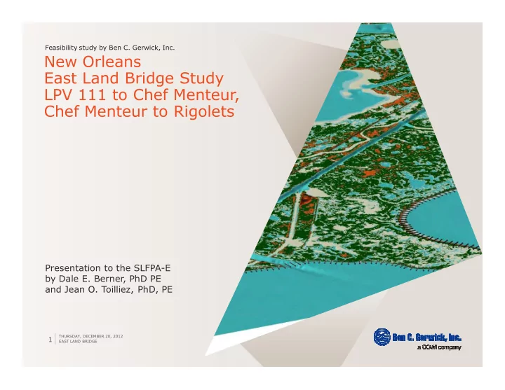
1 Feasibility study by Ben C. Gerwick, Inc.

New Orleans East Land Bridge Study LPV 111 to Chef Menteur, Chef Menteur to Rigolets

Presentation to the SLFPA.E by Dale E. Berner, PhD PE and Jean O. Toilliez, PhD, PE

slide-2
SLIDE 2

› Existing Studies

› Published research and body of results available

› Background information and key vulnerable locations

› Met ocean assessment and coastal state of the art

› Plan formulation

› Definition of goals, constraints, performance criteria and screening

› Preliminary levee design parameters

› Rationale for numerical model tests

› Hydrodynamic model test results

› Definition of test cases, goals of the modeling efforts

› Proposed plan and analysis

› Proposition for immediate implementation and concept design, draft cost analysis

› Conclusions and recommendations

› Action plan, recommendations for immediate implementations and future efforts

Outline

THURSDAY, DECEMBER 20, 2012 EAST LAND BRIDGE

2 East Land Bridge feasibility study

slide-3
SLIDE 3

THURSDAY, DECEMBER 20, 2012 EAST LAND BRIDGE

3 East Land Bridge feasibility study

Chapter 2 Existing studies

slide-4
SLIDE 4

› Louisiana Draft Master Plan (2007 and 2012)

› General framework; use it to define objectives and constraints for plan formulation

› UNO Report on Hydrodynamic Modeling of the Tidal Prism in the Pontchartrain Basin

› Optimal pass opening widths study using FVCOM model › Recommend wide openings at both passes to minimize disruption on tidal hydrodynamics (tidal prism and hydro.period)

› Louisiana Coastal Protection and Restoration (LACPR) Final Technical Report

› Very large database available directly applicable to current study, with information on:

› Storm surge › Present day/future condition hazard › Future projects › Large collection of case studies directly connected to the East Land Bridge

› Major basis for future work; this study to draw on these results

› Framework for Environmental Assessment of Alternative Flood Control Structures on Chef Menteur and Rigolets Passes

› Rigorous assessment of pass impact on ecosystem; framework for future installations

› NRC Review of the LACPR Technical Report › Others: see report for complete list of references

Background References

THURSDAY, DECEMBER 20, 2012 EAST LAND BRIDGE

4 Existing studies

slide-5
SLIDE 5

ELB as Critical Feature and Location for Future Flood Protection System

THURSDAY, DECEMBER 20, 2012 EAST LAND BRIDGE

5

› Land bridges

› "

  • "

› ELB as Strategic Location for Flood Defense System

› Several alignment directly on ELB path

› CPRA (2007) states:

› "

  • "

LACPR Technical Report // CPRA

slide-6
SLIDE 6

THURSDAY, DECEMBER 20, 2012 EAST LAND BRIDGE

6

› In LACPR Technical Report

› Two solutions were envisaged for the partial or complete hydraulic closure of Lake Pontchartrain. › Both solutions dismissed based on cursory review of engineering feasibility issues

› This report to investigate this matter in greater depth and scope

› Barriers and levees considered along US 90 alignment in LACPR against various design storm surge cases

› Use this information when devising additional cases to evaluate

Levee at ELB – Overtopping vs. Non.overtopping and Consequences

LACPR Technical Report

  • !

" ! 100.YRP 25 12.5 400.YRP 32 12.5 1000.YRP 36 12.5

Added value: design basis for flood control system to be investigated in this study

slide-7
SLIDE 7

Present Day and Estimated Future Condition Storm Surge Hazard at ELB

THURSDAY, DECEMBER 20, 2012 EAST LAND BRIDGE

7

› In LACPR Technical Report

› Include high estimates for future sea. level rise conditions › Estimates provide a good reference for the existing flood risk in the South Lake Pontchartrain region, in the absence of a flood control system › Return periods: 100, 400 and 1000. YRP

› Double check with most recently (1984) FEMA FIRM stating 18ft. NGVD29 storm surge elevation

LACPR Technical Report // FEMA

#$% & %' (!

  • %!

100.YRP 14.6 17.9 400.YRP 17.8 21.5 1000.YRP 19.4 23.8

Added value: design basis for flood control system to be investigated in this study

slide-8
SLIDE 8

THURSDAY, DECEMBER 20, 2012 EAST LAND BRIDGE

8

› Alternative EA

› Full closure at US.90 with presence of closed flood control structures at the Chef Menteur and Rigolets passes. The levee is non.overtopping, with a design crest elevation of 27ft. This option is the most effective at reducing storm surge near Slidell.

› Alternative EB

› Same as EA but with an overtopping levee, with top crest elevation of 12.5ft. Again, the two passes at ELB Are in a closed position.

› Alternative EC

› This alternative is identical to EB, however in this case the two passes are in an open position (i.e. no flood control structures).

Structures at ELB: Existing Results

LACPR Technical Report

slide-9
SLIDE 9

THURSDAY, DECEMBER 20, 2012 EAST LAND BRIDGE

9

Effect of Structures: Value of High.Crested Levee System

LACPR Technical Report

  • Alt. EA
  • Alt. EB
  • Alt. EC
slide-10
SLIDE 10

THURSDAY, DECEMBER 20, 2012 EAST LAND BRIDGE

10

Effect of Alternatives on MEOW and MWLD at Key Locations at and Near ELB

LACPR Technical Report

MEOW (left) and MWLD (right) bar charts show the impact of hard overtopping and non.overtopping structures at different sites near the ELB for various alternatives. The massively non.overtopping flood control structure (Alt. EA) diverts some amount of storm surge toward neighboring areas, in exchange for a large reduction in storm surge near Slidell, LA. Undeniable value of high.crested levee system to reduce storm surge )*+%%%+*+,

slide-11
SLIDE 11

THURSDAY, DECEMBER 20, 2012 EAST LAND BRIDGE

11 East Land Bridge feasibility study

Chapter 3 Background information

slide-12
SLIDE 12

Timeline for study: 2060 NOAA DEM

THURSDAY, DECEMBER 20, 2012 EAST LAND BRIDGE

12

Critical location: direct line of defense against storm surge Regional influence: St. Tammany, Orleans, St. Bernard parishes and State of Mississippi

slide-13
SLIDE 13

THURSDAY, DECEMBER 20, 2012 EAST LAND BRIDGE

13

Federal Levee Lake Pontchartrain and Vicinity (LPV) 111 to Rigolets Pass. As delineated in the project, the area of considered here covers approximately 40 square miles.

slide-14
SLIDE 14

THURSDAY, DECEMBER 20, 2012 EAST LAND BRIDGE

14

&- .#&! .#&! /.#&! .#&! Maximum water level 10 11.6 12.7 15.4 Minimum water level .1.8 .2.0 .2.1 .2.3 "%$% .#&$*! .#&$*! /.#&$*! .#&$*! Bay Waveland, MS 74 77 79 82 Shell Beach, LA 82 88 94 107 "011 "%$* 12 ** &3&% 73145 15 m 6.5 m (21 ft) 12.50 s 73143 20 m 7.3 m (24 ft) 12.50 s 73142 20 m 8.0 m (26 ft) 12.50 s 73141 21 m 8.8 m (29 ft) 12.50 s

Large waves near Chandeleur Islands capable

  • f entering into

Lake Borgne and vicinity Estimated wind speeds: exposed location Subject to frequent, severe flooding Source: Shell Beach, LA

slide-15
SLIDE 15

THURSDAY, DECEMBER 20, 2012 EAST LAND BRIDGE

15

Local wave climate

LACPR Technical Report

STWAVE maximum wave height spatial distribution for 150 storms evaluated for the 2007 (current) conditions near the ELB, per (USACE 2009) 6.8 ft significant wave height expected near ELB Degraded Chandeleur Islands still provide significant reduction in wave height (breaking/friction) Evidence of value of marhsland in wave attenuation

slide-16
SLIDE 16

THURSDAY, DECEMBER 20, 2012 EAST LAND BRIDGE

16

Sea.level Rise

LACPR Technical Report // IPCC // State guidance (Calif.) // Vermeer and Rahmstorf

4 15#+'%( Low.lying shoreline protection where primary purpose is to slow down erosion/shoreline retreat where failure would be local and limited in severity. 0.47m or 1.55ft (calculated from the mid.range VR, akin to a 50% confidence level) Critical feature (e.g. levee or floodwall) destined to protect public and private properties and where failure would be catastrophic. 0.7m or 2.3ft (upper limit of VR results, akin to a 90% confidence level)

slide-17
SLIDE 17

THURSDAY, DECEMBER 20, 2012 EAST LAND BRIDGE

17

Impact of Static Relative Sea Level Rise on ELB

The majority of the ELB terrain, as delineated in this study, lies between 0 and 1ft. A rise in the mean sea level would have significant consequences on the ELB A relative area analysis reveals that only 13.7% of the ELB lies above 3ft

slide-18
SLIDE 18

THURSDAY, DECEMBER 20, 2012 EAST LAND BRIDGE

18

Residual dry land at ELB assuming a +1ft RSLR Residual dry land at ELB assuming a +3ft RSLR Note US 90 and CSX railroad as assets RSLR includes SLR and subsidence

slide-19
SLIDE 19

› A location

› Large waves › Low.lying land, subject to frequent flooding (temporary) and inundation (permanent) even relatively small permanent variations in the relative MSL. › Combined action of waves in conjunction with an appreciable rise in sea level could further accelerate marshland degradation and coastline recess.

› 6* relevant objectives

› If global accelerating trends in SLR continue complete disappearance of the ELB becomes a plausible scenario. › Mitigation and resiliency plan to strike a balance between shoreline preservation and flood risk reduction

› 5 pre.existing assets

› Here, it is the well.consolidated railroad that traces across the ELB and along GIWW, standing at over 6ft (1.83m) on average

Summary Met.ocean Assessment and Relative Sea.level Rise

THURSDAY, DECEMBER 20, 2012 EAST LAND BRIDGE

19 Statistical analyses // Buoy data // NOAA.NGDC

slide-20
SLIDE 20

Historical and Projected Shoreline Change

› Potential loss of an additional 5,200 square miles (13,468 square kilometers)

  • f Louisiana coastal area by 2100

assuming a 3.ft (0.9.m) RSLR over that period. › Non.conservative estimate of RSLR › Historical loss of approximately 2,400 square miles of Louisiana coastal lands since that time › Reference: Blum, Michael D., and Harry

  • H. Roberts. 2009. “Drowning of the

Mississippi Delta Due to Insufficient Sediment Supply and Global Sea. level Rise.” 2 (7) (June): 488–491. doi:10.1038/ngeo553.

Blum and Roberts

THURSDAY, DECEMBER 20, 2012

20

EAST LAND BRIDGE

slide-21
SLIDE 21

THURSDAY, DECEMBER 20, 2012 EAST LAND BRIDGE

21

Photographic Evidence

Coastal degradation

5 7% * Petites Coquilles Visible signs of shoreline erosion

  • n the South side
  • f US.90

East of Unknown Pass New interior water bodies have replaced elevated vegetative cover. Alligator Bend, interior area Larger water bodies in lieu of vegetative cover.

Comparison of ELB aerial photographs, spanning approximately 30 years (1980.2011). Note that useful comparative visual data covering the West end of the ELB is not

  • available. Source: Google Earth compiled from USGS and NOAA data.
slide-22
SLIDE 22

THURSDAY, DECEMBER 20, 2012 EAST LAND BRIDGE

22

Shoreline Movement Rate

Penland et al. Location of shore.normal transects for Lake Borgne. From (Penland et al. 2002) Measured trends in shoreline rates for transects 27.38, as per . Bars indicate historical trends, as recorded between 1850 to 1995. Curves represent more recent trends.

Reference: Penland, S., A. Beall, D. Britsch, and S.J.

  • Williams. 2002.

!". New Orleans, LA: U.S. Geological

  • Survey. http://coastal.er.usgs.gov/pontchartrain/.
slide-23
SLIDE 23

THURSDAY, DECEMBER 20, 2012 EAST LAND BRIDGE

23 › Data provided by USGS reveals that at the ELB, the historical average shoreline movement rate is 5.7ft/year, with accelerating trends recorded in more recent epochs › Between 1930 and 1995, the rate is approximately 9.4ft/year › Slows down to 7.2ft/year when measured between 1960 to 1995: restoration projects › While no data exists for the region of the ELB located at the Lake Pontchartrain side › Assume from satellite imagery that this area is less likely to undergo coastal recess rates as severe as those recorded on Lake Borgne side › Prone to severe retreat

› Alligator Bend has the fastest recorded rate of erosion with over 12ft per year; › Justifies the on.going shoreline protection efforts

slide-24
SLIDE 24

THURSDAY, DECEMBER 20, 2012 EAST LAND BRIDGE

24

Design Subsidence Rate

LACPR // USGS // Design values

5 6 * 1%+'(! [m] [m] Low Average High Chef Menteur, LA 229904 3329253 0.15 (0.49) 0.35 (1.15) 0.6 (1.97) Michoud, LA 217710 3325564 0.35 (1.15) 0.75 (2.46) 1.2 (3.94) 5 1%

  • 8+!

1% + '(! 1% / +'(! ELB 3.0 0.15 (0.50) 0.30 (1.0)

LAPCR: 2.0 mm/year regional rate; or 0.3ft in 50 years. USGS: 3.0 mm/year local subsidence rate; or 0.5ft in 50 years. Design subsidence rate

slide-25
SLIDE 25

THURSDAY, DECEMBER 20, 2012 EAST LAND BRIDGE

25

Key Vulnerable Locations within the ELB Project Area

Anticipating changes and implementing solutions

Key vulnerable locations within the ELB area: for marsh degradation; % for observed shoreline retreat. In general, the ELB exhibits more vulnerable spots on the Lake Borgne (surge side) region than on the Lake Pontchartrain (protected side) region, with coastal erosion visible from satellite data near the Petites Coquilles area.

slide-26
SLIDE 26

THURSDAY, DECEMBER 20, 2012 EAST LAND BRIDGE

26

On.going projects

  • 4$%

&$ 5 1$ PO.22

  • Dec. 2001

Shoreline protection against wave action on marsh Bayou Chevée area NRCS (federal) and LACPR (state) PO.34

  • Sep. 2012 (anticipated)

Shoreline protection and marsh restoration South.west bend

  • f ELB

USACE (federal) and LACPR (state)

Nearby projects that directly affect the ELB restoration and protection efforts can be found from the Louisiana Coastal Wetlands Conservation and Restoration Task Force database. Most notably, the Bayou Chevée Shoreline Protection (PO.22) and the Alligator Bend Marsh Restoration and Shoreline Protection (PO.34) projects are the immediate vicinity

  • f the ELB
slide-27
SLIDE 27

THURSDAY, DECEMBER 20, 2012 EAST LAND BRIDGE

27 East Land Bridge feasibility study

Chapter 4 Plan Formulation

slide-28
SLIDE 28

THURSDAY, DECEMBER 20, 2012 EAST LAND BRIDGE

28 Risk reduction and shoreline stabilization

Plan Formulation

Risk framework: USACE ER 1105.2.100 (USACE 2000)

› 7-/: To reduce flood risk at the LPB by placing a physical flood barrier against storm surge. › 7-: To preserve the integrity and encourage efforts to expand and strengthen the shoreline at the ELB.

slide-29
SLIDE 29

THURSDAY, DECEMBER 20, 2012 EAST LAND BRIDGE

29

› constraints

› Do not contradict or otherwise negatively interfere with Master Plan requirements and guidelines. › Do not jeopardize existing or future flood reduction system near study area.

› constraints

› Further loss of existing marshes, tidal flats in the study area and reduction in the quality of existing marshes. › Negative impact on salinity, tidal fluxes and sediment quality within the study area. › Negative impacts to native species; reduction of total habitat value. › Negative impacts to existing infrastructure function within the study area. › Features that reduce or limit future ability to adapt to increased flood risk doe to changing climatic conditions in excess of those considered during the evaluation period.

Constraints

Plan Formulation

slide-30
SLIDE 30

THURSDAY, DECEMBER 20, 2012 EAST LAND BRIDGE

30

› Completeness

› Completeness is a determination whether or not the measure includes all elements necessary to achieve the objectives of the plan. It indicates the inter.dependence of the outputs of the plan upon those of other plans.

› Effectiveness

› Weighs the ability of a given measure to achieve the planning objectives. Those that do not contribute, in an unambiguous manner, to achieving these objectives, will be dropped altogether.

› Efficiency

› Efficiency measures cost effectiveness and is expressed in estimating the net impact to be obtained from the measure. Benefits can be both monetary and non.monetary. Measure with a very high cost and little or no foreseeable benefits will not be retained; measures that provide moderate benefits but outstanding value per dollar spent will be considered.

› Acceptability

› Acceptability is all.encompassing metric that seeks to define whether the measure or plan is sound technically, environmentally, economically and socially. Unpractical or downright unfeasible plans and measures will be dropped altogether.

Planning Criteria

Plan Formulation

slide-31
SLIDE 31

THURSDAY, DECEMBER 20, 2012 EAST LAND BRIDGE

31

Multiple Lines of Defense Principle

Measure selection

Barrier Island Marsh Restoration Rock Dike Augmented Armored Berm Elevated and Augmented Highway Earthen Levee, Floodwalls and Flood Gates

Limit realm of potential measures to well.defined and recognized framework

Lopez, J., and M. Davis. #$ # %&%' ( !) ! & . New Orleans, LA: Lake Pontchartrain Basin Foundation, April 2011. Lopez, J., N. Snider, C. Dufrechou, M. Hester, and

  • P. Keddy. %(

&*' + &&% ,--.( /012. New Orleans, LA: Lake Pontchartrain Basin Foundation, 2009.

slide-32
SLIDE 32

THURSDAY, DECEMBER 20, 2012 EAST LAND BRIDGE

32

90% )* 1* $ 6%**2+ 5

  • Summarized

net benefit for flood reduction Potential for regional.scale surge reduction. Promotion of low.energy climate. Increases natural wildlife habitat. May reduce incoming wave energy during storm surge Limit coastline recess and provides benefits for marsh restoration projects. Strengthens ELB's role as flood defense line by maintaining current marsh area. Leverages US90 alignment and provides direct protection against moderate storm surge with limited impact on local system Physical, high. crested line of defense against moderate to severe storm surge Enhanced potency of flood risk reduction system with ability to hydraulically lock LP Positive acceptability factors

  • Planning opportunity to

define new protection status to large areas; enlargement

  • f natural habitats and

wildlife refuge. Remote location and low social impact.

  • Provides long.term

benefits with low disruption to existing landscape.

  • Expands natural

habitat and promotes favorable environmental conditions.

  • Opportunity to use

as building block for replanting and restoration efforts.

  • Inert building

material. Reduced footprint Opportunities for including small.scale restoration projects along US 90 alignment.

  • Located in mostly uninhabited areas
  • Ample opportunities for mitigating

ecological impact during/after construction.

  • Earthen levees may be used as support

blocks for replanting/marsh revitalization efforts.

  • Recreational value: structures may be

integrated into state park or recreation areas with bike/walk paths, beaches, etc.

  • ● Project brings focus to restoration and

revaluation of nearby natural landscape Negative acceptability factors

  • Large.scale disruption of

existing landscape.

  • Limited ability to provide

direct, measurable reduction in storm surge in densely populated areas.

  • May be overwhelmed by

change in sea.level.

  • Short.term

environmental disruption during marsh nourishment phase.

  • Sediment for

restoration subject to limited quantity and availability.

  • Non.native

building material and potential disruption to natural habitat.

  • Construction may

be conducted in sensitive areas.

  • Elevated structure

would require upgrades to existing infra.structures that would affect local ecosystem.

  • Right.of.way

issues; inhabited areas may be left unprotected

  • Large.scale project significantly alters

landscape and local ecosystem.

  • Heavy pre.construction soil preparation;

construction may incur environmental impact; mitigating measures should be enforced.

  • Hydrodynamic consequences of repeated

and/or prolonged pass closures

Measuring acceptability

slide-33
SLIDE 33

THURSDAY, DECEMBER 20, 2012 EAST LAND BRIDGE

33

7- :3%$ 4 / Background study Literature/Data collection $10,000

  • Hydrodynamics

Grid generation, model setup, model calibration, simulations $40,000 ; Salinity Model setup, calibration and simulations $10,000

  • Flushing time

Calculation of Lagrangian currents $5,000 Temperature Model setup, simulations $10,000

  • Dissolved oxygen

Determination of dominant bio.chemical processes and corresponding parameters, model setup and simulations $10,000 < Nutrient supply Determination of dominant bio.chemical processes and corresponding parameters, model setup and simulations $10,000 1=9:7:5'%( $95,000

  • Geomorphology

Determination of bottom sediment properties and sediment intake, model setup and simulations $10,000 > Other water quality parameters Additional modeling efforts for specific parameters $5k to 10k :7:5'%( $115,000 ?$$+@+-@%A+B/

Supplemental Environmental Impact Study

Post.feasibility study: establish performance of gates

Determine the fate of water quality during closures spanning from one week to a month Estimate the time needed for the local ecosystem to recover from the closure and restore itself to pre.closure conditions after the lake is re.connected to Lake Borgne Performance of non. traditional/composite gate structures aimed at minimizing hydrologic disruption

slide-34
SLIDE 34

THURSDAY, DECEMBER 20, 2012 EAST LAND BRIDGE

34

Measure Screening and Discussion

Performance criteria

) &- %%% #% 1 1 2 Levee

  • Yes

Selected for next screening round Armored berm

  • Yes

Selected for next screening round Augmented berm

  • No

This measure was eliminated from further consideration because of potential cost and acceptability issues. The measure would necessarily interfere

  • n existing infrastructure (Alligator

Bend) Barrier Island

  • No

This measure does not properly address storm surge reduction and is incomplete: the concept spans outside the realm of authority of the SLFPA.E. Elevated highway

  • No

This measure leaves out a large area of ELB vulnerable to shoreline erosion and marshland loss. Alignment does not line up with interests of stakeholders. Objective 1 To reduce flood risk at the LPB by placing a physical flood barrier against storm surge. Objective 2 To preserve the integrity and encourage efforts to expand and strengthen the shoreline at the ELB.

slide-35
SLIDE 35

THURSDAY, DECEMBER 20, 2012 EAST LAND BRIDGE

35

Discussion and Path Forward

› Armored berm

› Shoreline/foreshore protection alone is limited › Small.scale protection measures can only limit dame sustained from minor events.

› Very potent flood risk reduction measure

› No direct answer to shoreline stabilization › Cost and real estate constraints

› Trade.off conceded

› Higher level of flood protection at the expense of a more focused foreshore and shoreline stabilization project (FSSP). › Trade.off is modulated favorably by the presence of on.going foreshore stabilization (Alligator Bend Marsh Restoration and Shoreline Protection) › CLEAR assessment strongly indicates that these efforts should have tangible impact on the marshland. Consequently, the armored berm option is given a lower priority.

Plan formulation: conclusion

&+

  • $

1

High.crested levee Feasibility study and conceptual design of high.crested levee protection at ELB.

2

FSSP evaluation and monitoring program Track success through quantifiable metrics such as a regrowth index, organic top.layer measurements; aerial photo and on.site collection campaign.

3

Complement/augment existing FSSP with ad.hoc measures wherever required. Conditioned to efficacy of high.crested levee in limiting storm surge, augment and/or complement existing FSSP at critical areas where shoreline stabilization is critical and participates in improving the efficacy of the flood control system.

slide-36
SLIDE 36

THURSDAY, DECEMBER 20, 2012 EAST LAND BRIDGE

36 East Land Bridge feasibility study

Chapter 6 Hydrodynamic Modeling

slide-37
SLIDE 37

THURSDAY, DECEMBER 20, 2012 EAST LAND BRIDGE

37

Hydrodynamic Evaluation & General Objectives

ADCIRC/SWAN modeling

7-

  • To assess the effect of subsidence

and marshland within the project area and their impact on hurricane storm surge hazard;

7-9

  • To assess the effects of gates at

Chef Menteur and Rigolets passes

7-4

  • To assess the impact of a new

structure on the time and spatial redistribution of storm surge near the ELB. Define case studies

slide-38
SLIDE 38

THURSDAY, DECEMBER 20, 2012 EAST LAND BRIDGE

38

4 1

  • !

' %( #15#! '%+ %% ( "** '( ! $$C

  • **

! Overtopping barrier.weir considered for testing in the LACPR (shown for reference; see Section 2.2.6) 12.5 100.YRP level 18 2.6 6 22 400.YRP level 21.5 2.6 8 26 Non.overtopping barrier considered for testing in the LACPR (shown for reference; see Section 2.2.6) 100.YRP level 25 400.YRP level 32

Levee Design Parameters

Numerical investigation: preliminary design parameters to be tested for efficacy

Project alignment for tentative levee concept (orange line). The proposed path follows a simpler alignment than a similar alignment considered in the LACPR Technical Report. Establishment of crest elevation for levees based on storm surge elevation assessment from LACPR Technical Report. Future conditions for surge elevations are those reported for the Or.leans area, and correspond to Future Case 2, featuring a more conservative SLR projection. Case studies to integrate a high.crested levee, with a crest elevation of 22 ft.NAVD88

slide-39
SLIDE 39

Computational Setup

THURSDAY, DECEMBER 20, 2012 EAST LAND BRIDGE

39 ADCIRC/SWAN modeling

› General

› 40 simulations › 100. and 400.year storm surge, focused on ELB using the coupled ADCIRC and SWAN modeling systems › All runs include 2.8 ft. RSLR

› Meshes

› Five sets of mesh structures › 300 x 600 ft. mesh size at ELB › Less than 300 ft. at channels and

  • penings

› Future Slidell levee implemented › Runs executed on super computer; no instabilities detected

› Modular value: may be tuned to support detailed environmental studies

slide-40
SLIDE 40

THURSDAY, DECEMBER 20, 2012 EAST LAND BRIDGE

40 ADCIRC/SWAN modeling

Storm Selection

ADCIRC/SWAN modeling

› Storms

› Select storms from recently completed FEMA FIS and LACPR studies › Each show distinct features, including max wind speed, forward speed and minimum pressure › Selected based on ability to replicate statistical surge level within the ELB area › Not necessarily valid outside of that area

slide-41
SLIDE 41

THURSDAY, DECEMBER 20, 2012 EAST LAND BRIDGE

41 › BASE CASE › FWOA.ELB.intact

› Future without Action (FWOA) scenario › ELB remains intact and vegetated.

› Basis for comparison with most scenarios

› SCENARIO 1

› FWOA.ELB.degraded

› where the ELB has been allowed to erode and disappear.

› Estimate the role of the ELB topography and vegetation in suppressing storm surge in Lake Pontchartrain.

› SCENARIO 2

› Levee.Gate.Closed.ELB.intact

› Proposed levee across the ELB with no openings at the Chef Menteur and Rigolets passes. › Hydraulically isolates Lake Pontchartrain from Lake Borne and the Gulf of Mexico.

› Approximate the redistribution of storm surge at nearby locations

› SCENARIO 3

› Levee.Gate.Open.ELB.intact aka "Open.pass.intact"

› Openings at the Chef Menteur and Rigolets passes.

› Estimate the change in surge response within Pontchartrain and at nearby locations including the Mississippi coast.

› SCENARIO 4

› Levee.Gate.Open.ELB.degraded aka "Open.pass.degraded"

› Open gates and anticipates a degraded ELB

› Measure the impact of coastline degradation on the storm surge time/space distribution in Lake Pontchartrain and vicinity.

Test Cases

ADCIRC/SWAN modeling

slide-42
SLIDE 42

THURSDAY, DECEMBER 20, 2012 EAST LAND BRIDGE

42

Degradation Scenario

SCENARIO 1 vs. BASE CASE

Coastline recess rate Adopt “road maintained” scenario so that the highways are assumed to be maintained at current elevation (through mitigating measures) Anticipated profile evaluation Evaluate impact of degradation on efficacy

  • f ELB as line of defense, with and

without flood control system Smart shift of ELB terrain along delineated area: focused assessment

slide-43
SLIDE 43

THURSDAY, DECEMBER 20, 2012 EAST LAND BRIDGE

43

ELB Degradation and Storm Surge

SCENARIO 1 vs. BASE CASE

› Test case measures impact of fate of ELB on storm surge distribution

› New water depth approx. 2.5 ft. › Use degradation approximation as described earlier

› Results show that, regionally, the influence of the land bridge is small but measurable › However, numerical simulations do underscore significant negative consequences for New Orleans metro area if ELB is degraded

› +2.3 ft. increase in surge for the 400.year case

› Highlight the very intertwined and interdependent nature of the system

  • f flood protection in that area
slide-44
SLIDE 44

THURSDAY, DECEMBER 20, 2012 EAST LAND BRIDGE

44

Efficacy of gates at passes

SCENARIO 2 vs. BASE CASE

› Dramatic reduction in surge levels at Lake Pontchartrain: up to 3.5ft for 100 and 400.year level › Hydraulic cost:

› 3.4 ft. increase in surge at IHNC › 1.2 ft. over large expanses extending well over MS and Caernarvon › Note: for the areas away from ELB, the responses tend to be storm dependent and do not represent 100 and 400.year surge elevations well

› Results show trade off between large reduction in flood risk for LP and hydraulic burden for LB areas, and beyond.

slide-45
SLIDE 45

THURSDAY, DECEMBER 20, 2012 EAST LAND BRIDGE

45

Open.pass Flood Protection System

SCENARIO 3 vs. BASE CASE

› Limited efficacy in reducing storm surge levels, when compared to closed.gate counterpart › 1.2 ft. reduction in storm surge elevation in Lake Pontchartrain › Cost for adjacent areas

› 0.2 ft. increase near GIWW/IHNC floodwall complex

› Narrow foot print

› 100.year storm: No influence on the Mississippi coast › 400.year storm: Minor to no influence on MS coast

› Best protection system with minimal impacts on the Mississippi coast

slide-46
SLIDE 46

THURSDAY, DECEMBER 20, 2012 EAST LAND BRIDGE

46

Degradation and flood protection system efficacy

SCENARIO 4 vs. SCENARIO 3

› Open gate only › Test case shows difference between Open.gate intact and open.gate degraded › Increase of hydraulic connectivity thus reduced surge level in front of defense line: 0.5 ft. › Conversely increased surge level at Lake Pontchartrain: 0.5 ft.

slide-47
SLIDE 47

THURSDAY, DECEMBER 20, 2012 EAST LAND BRIDGE

47

Impact of RSLR

ADCIRC/SWAN modeling

› Not formally evaluated but results can be inferred › Increased storm surge level

› Reduce bottom roughness, varies bottom geometry

› For larger values, RSLR:

› Influences storm flux, rather than storm parameters › Would contribute to more expansive flooding area › Reduce influence of ELB as line of defense

slide-48
SLIDE 48

THURSDAY, DECEMBER 20, 2012 EAST LAND BRIDGE

48

Wave Climate

ADCIRC/SWAN modeling

› Refined analysis focused on ELB › Use SCENARIO 3 as base case for wave climate › In general:

› Levee has minimal impact on wave climate outside of Lake Pontchartrain › Reduces wave penetration in the lake › Fetch.limited conditions

› Significant wave heights in front of levee

› 100.year conditions: 6 ft. on average › 400.year conditions: 8 ft. on average

› Relatively unchanged design conditions › Large waves present; potentially larger if ELB is further degraded

slide-49
SLIDE 49

THURSDAY, DECEMBER 20, 2012 EAST LAND BRIDGE

49

Open.pass & Current Velocities

ADCIRC/SWAN modeling

› Potentially very large currents developing due to strong hydrostatic gradient › Recorded velocities up to 30.40 ft/s in some instances › Will require robust scour control measures › However

› Results to be interpreted cautiously due to inherent limitations of model (2D) › Refined study needed

› Trade.off

› Reduced foot print › More transparent design implies higher flux and larger current in constricted area

slide-50
SLIDE 50

THURSDAY, DECEMBER 20, 2012 EAST LAND BRIDGE

50 East Land Bridge feasibility study

Chapter 7 Recommendations

slide-51
SLIDE 51

Path Forward

THURSDAY, DECEMBER 20, 2012 EAST LAND BRIDGE

51 Recommendations

› 1$/: *% without gates*

› Adaptive design for a high.crested levee at the ELB › ELB as another line of defense and integral component of a multi.layered complex › Provides supplemental surge reduction for already existing projects, such as PCCP

› 1$: 11&$.

› Track success through quantifiable metrics such as a regrowth index, organic top. layer measurements; aerial photo and on.site collection campaign. › Focus on the on.going Alligator Bend restoration project.

› 1$;: 4$8C11& with ad.hoc measures wherever required.

› Additional efforts conditioned to efficacy of high.crested levee in limiting storm surge › Augment and/or complement existing FSSP at critical areas where shoreline stabilization is critical and participates in improving the efficacy of the flood control system.

› * Discussed thereafter

slide-52
SLIDE 52

THURSDAY, DECEMBER 20, 2012 EAST LAND BRIDGE

52

High.crested Levee & 100.Year Level of Protection: an Adaptive Approach

STEP 1

Timeline for adaptive construction sequence, starting with the construction of a base design. Base design Bring protection to the 100.year level within a 20.year horizon. A final upgrade, scheduled to be completed 30 to 50 years from present day, is aimed at bringing the level of protection to the 400.year level by means of a hard structure (I, L or T.wall or batter.pile). 100.YRP levee 400.YRP levee Detailed assessment of settlement needed 2.3 ft. settlement over 50 years anticipated for rock wall by Geoengineering

slide-53
SLIDE 53

THURSDAY, DECEMBER 20, 2012 EAST LAND BRIDGE

53

slide-54
SLIDE 54

Special Provisions for Current Velocity at Pass Openings

THURSDAY, DECEMBER 20, 2012 EAST LAND BRIDGE

54 STEP 1

› The hydrodynamic study reveals that current velocities of on the

  • rder of 30.40 ft/s may develop at

deepest sections of passes during

  • 100. and 400.year storms

› Design basis

› Hydraulic Design Criteria Handbook

  • USACE. 1987. 3+

%. US Army Corps of Engineers. › USACE. 2009. % !(/ %!(2 #(. New Orleans, LA: US Army Corps of Engineers. New Orleans District Mississippi Valley Division. › Temple, W.H. & &(". State of Louisiana Department of Transportation and Development (LADOTD), 2006.

slide-55
SLIDE 55

THURSDAY, DECEMBER 20, 2012 EAST LAND BRIDGE

55 ACU or heavy riprap Heavy overtopping and complete submergence Conservative design, robust structure capable of withstanding the most critical situations

slide-56
SLIDE 56

› Preliminary cost estimates reveal that

› Bulk of the cost incurred from material hauling › 100.YRP levee and 50.YRP levee similar in cost › $1Bn approximately

› May not be able to achieve full base width of 50.YRP levee in one step

› Multiple steps necessary

› Crest heightening › Base widening

› Power of a flexible, adaptive design

› Gate options not included in cost estimate

› Too many variables › Must involve USACE to determine best route forward › Environmental mitigation necessary, pending refined assessment

› Flap gates › Adaptive crest height › Semi.transparent structures (Jarlan.type, slits, etc.)

Cost Estimates

THURSDAY, DECEMBER 20, 2012 EAST LAND BRIDGE

56 Recommendations

slide-57
SLIDE 57

› FSSP monitoring program. › Primary objectives

› Track the efficacy of all on.going FSSPs near the ELB through quantifiable metrics › Special attention should be given to Alligator Bend restoration project, which covers a large expanse of the ELB shoreline and may serve as a bellwether for future FSSP implementations near the ELB. › Learn and optimize the efficacy of tentative future projects.

› Implementation

› On.site monitoring programs › Other agencies and institutions to collect, organize and analyze data.

FSSP Monitoring Program

THURSDAY, DECEMBER 20, 2012 EAST LAND BRIDGE

57 STEP 2

slide-58
SLIDE 58

Supplemental FSSP

THURSDAY, DECEMBER 20, 2012 EAST LAND BRIDGE

58

› Locally mitigate shoreline retreat due to environmental pressure from storm surge and waves action › Be capable of withstanding complete submergence, without incurring significant damage › Mostly near passes and on Lake Borgne side › Area near Lake St. Catherine sheltered from most damaging effects › Additional efforts, beyond the scope

  • f this work, may be performed to

determine the value of such FSSB

  • n factors that extend past the strict

realm of flood protection

STEP 3

slide-59
SLIDE 59

Concept berm

THURSDAY, DECEMBER 20, 2012 EAST LAND BRIDGE

59

› Schematic of armored berm concept featuring a quarry run rock core, toe on both sides and a launch apron, intended to provide adaptability in the face of an evolving flood side shoreline. › A 2.05 ft RSLR estimate was calculated from the "mid.range" scenario, as explained in Section 3.5.6, to which the design subsidence value of 0.5 ft, was added › Expect 2.3 ft. settlement for type of structure (see Geoengineering rock wall)

STEP 3

slide-60
SLIDE 60

Summary

THURSDAY, DECEMBER 20, 2012 EAST LAND BRIDGE

60

› The ELB as a critical component of a multi.tiered flood protection system › Comprehensive assessment of existing assets, projects and anticipated changes

› Serious platform for high.grade levee system › Promising restoration projects are anticipated to deliver

› Impact of high.crested system exists but is manageable

› Several ways to mitigate

› Recommended immediate action

› No.gate levee, adaptive steps leading to 100.YRP level of protection within 20.30 years › FSSP monitoring program

Conclusion

slide-61
SLIDE 61

THURSDAY, DECEMBER 20, 2012 EAST LAND BRIDGE

61

Openings

Conclusion

› Examine a combination of floodgate/flood.barrier

› Cost efficient › Compliant design: bottom.hinged gate leaves could be designed to be

  • vertopped as a variable crest height

gate in order to limit the effect of increasing storm surge › Minimize disruption of the existing tidal prism passing through the Rigolets.

› Evaluate usefulness of gate at Chef Menteur

› If warranted by navigational and environmental needs. › Rigolets are #1.priority pass

› Refine the design of the recommended earthen levee

› Interface with the possible new surge gates/barriers across The Rigolets and Chef Menteur.

slide-62
SLIDE 62

THURSDAY, DECEMBER 20, 2012 EAST LAND BRIDGE

62