monmouth county bridge s 17 on county route 10 west front
play

Monmouth County Bridge S-17 On County Route 10, West Front Street - PowerPoint PPT Presentation

Monmouth County Bridge S-17 On County Route 10, West Front Street over the Swimming River In the Township of Middletown and the Borough of Red Bank Monmouth County, New Jersey Public Information Center #4 & 5 June 17, 2008 (Middletown)


  1. Monmouth County Bridge S-17 On County Route 10, West Front Street over the Swimming River In the Township of Middletown and the Borough of Red Bank Monmouth County, New Jersey Public Information Center #4 & 5 June 17, 2008 (Middletown) June 19, 2008 (Red Bank) Previous Meetings: Middletown: June 23, 2004 February 27, 2006 Red Bank: June 29, 2004

  2. Project Location Map Scoping Study for Improvements Monmouth County Bridge S-17 Township of Middletown & Borough of Red Bank Monmouth County, New Jersey JUNE 2008 (not to scale)

  3. PROJECT SCOPING PROCESS

  4. Project Need Statement The statement of project need can be stated as follows: 
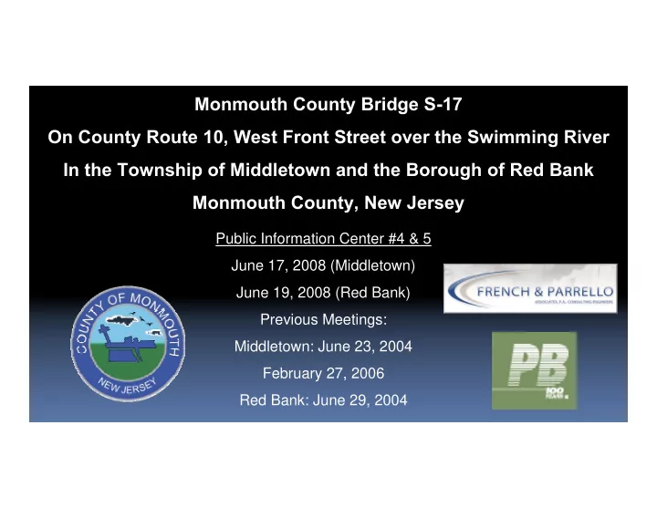
Monmouth County in conjunction with the North Jersey Transportation Planning Authority and New Jersey Department of Transportation are looking for feasible alternatives for improvements to Monmouth County Bridge S ‐ 17 and its roadway approaches. The SI&A Sheet dated July 11, 2000 indicates a structural sufficiency rating of 7.0 out of a possible 100. Since the sufficiency rating is extremely low, the bridge is classified as structurally deficient and is eligible for the NJDOT “select list”. This list identifies the most deficient bridges in the state. Also, since the sufficiency rating is below 50, the bridge is eligible for federal funding for replacement. Due to the low appraisal item ratings, the bridge is also considered functionally obsolete with inadequate deck geometry. Monmouth County Bridge S ‐ 17 carries West Front Street (C.R. 10) over the Swimming River. This roadway is a primary connector from Downtown Red Bank to points west with an ADT of 21,321 vehicles and over 1200 vehicles during peak hours. The roadway network and traffic signals in the surrounding area are currently operating at or near capacity, which places an onus on traffic maintenance. The approach roadway has geometric deficiencies with limited sight distance for driveway operations. The project goal is to provide a solution that will improve the structural deficiencies, traffic operations, and safety to the traveling public and minimize impacts to the environment, as well as the surrounding community.

  5. PROJECT CONSTRAINTS Photo No. 1 Aerial Photo of project site (looking east) EXISTING CONDTIONS

  6. PROJECT CONSTRAINTS Photo No. 2 Aerial Photo of project site (looking west) EXISTING CONDTIONS

  7. Bridge Statistics/History � Existing bridge was constructed in 1921 to replace an existing structure � The overall structure measures 339’-4” from abutment face to abutment face. � The bridge roadway width was 21.7’ originally and widened to 24’ as part of the temporary deck replacement. � A walkway is attached to the north side of bridge. � The substructure consists of seven (7) concrete, pile-supported piers with the end concrete piers identified as the east and west abutments. A major two million dollar substructure repair contract issued by the County in 1992 removed the old stone (circa 1921) and concrete (circa 1950) approach walls and installed steel sheet piling to support the approach roadway embankment. This contract also included roadway approach work and concrete repairs to the piers. � A 1.1 million dollar emergency deck replacement was performed in 2004. The existing steel girder bridge was demolished and replaced with a temporary prefabricated modular steel truss.

  8. Bridge Condition SI&A Sheet dated July 11,2000 (prior to deck replacement) This form indicates a structural sufficiency rating of 7.0 out of a possible 100. Since the sufficiency rating is extremely low, the bridge is classified as structurally deficient and is eligible for the NJDOT “select list”. This list identifies the most deficient bridges in the state. Also, since the sufficiency rating is below 50, the bridge is eligible for federal funding for replacement. Due to the low appraisal item ratings, the bridge is also considered functionally obsolete. Historic Significance Monmouth County Bridge S-17 was determined not eligible for listing on the National Register of Historical Places in the 1994 A.G. Lichtenstein & Associates’ New Jersey Historic Bridge Survey. The New Jersey State Historic Preservation Officer (SPHO) concurred with the findings.

  9. Superstructure Inspection Report & Priority I Repair Memorandum (November 2001) (Prior to deck replacement.) Indicated the bridge as in critical condition mainly due to advanced deterioration of the steel superstructure components. A priority repair memorandum was issued on November 19, 2001, subsequent to the bridge inspection in November, 2001. The memorandum addressed the most significant deficiencies, including failure of the open grid deck and piggyback stringers at the east abutment, and areas of 100% section loss on numerous floor beams, several stringers, and laterals. As a result, the County immediately retained the services of a consulting engineer and contractor to replace the severely deteriorated bridge in the winter of 2004, requiring the closure of West Front Street for two months. Substructure An underwater inspection performed for the 2001 Inspection Report indicated exposure of some pier footings and undermining of two piers. A Stage 1 scour evaluation previously determined that the bridge had a low potential for scour (Priority 3) and is not considered scour critical (Coding Item #113 on the SI&A Sheet).

  10. New Superstructure • Consists of six (6) 55’ prefabricated steel Acrow panel truss units. • Rehabilitation of the existing steel girders would have cost approximately the same amount as Acrow Panel truss rehabilitation. • Benefit is the County now owns the trusses for future re-use upon replacement of existing bridge. • The geometric inadequacies on the bridge that existed before the Acrow bridge was installed are still present – the Acrow bridge, although slightly wider than the original (deck width from 21 feet to 24 feet) does not meet geometric standard (30’). The SI&A Form for the present bridge will still define the bridge as “Functionally Obsolete” due to substandard geometry. • The replacement trusses could not be widened to meet standard geometric widths due to limitations of the existing superstructure. • The Acrow Panel bridge has a service life of 25+ years depending on environmental exposures and use.

  11. HISTORIC MAP & PROJECT PHOTOS Existing Conditions & Alternative Analysis Report Township of Middletown & Borough of Red Bank Monmouth County, New Jersey

  12. PROJECT PHOTOS Recently Constructed Acrow Panel Superstructure Township of Middletown & Borough of Red Bank Monmouth County, New Jersey

  13. PROJECT PHOTOS South Side of Bridge (prior to Superstructure Replacement in 2004) Note: Boating, Fishing and Crabbing Activities Township of Middletown & Borough of Red Bank Monmouth County, New Jersey

  14. PROJECT PHOTOS Sea-Land Marina at the Southeast Corner of the Bridge Approach Roadway Note: Existing utility poles, boat slips, newly constructed approach roadway steel sheeting bulkhead, and closeness of properties to West Front Street. Township of Middletown & Borough of Red Bank Monmouth County, New Jersey

  15. PROJECT PHOTOS River Plaza Marina West of Hubbard Avenue next to Chris Deli Township of Middletown & Borough of Red Bank Monmouth County, New Jersey

  16. PROJECT PHOTOS Navigational channel markers South of bridge. Township of Middletown & Borough of Red Bank Monmouth County, New Jersey

  17. PROJECT PHOTOS NJ Transit trestle northeast of the bridge. Township of Middletown & Borough of Red Bank Monmouth County, New Jersey

  18. PROJECT PHOTOS Looking west, north side, Monmouth County Bridge S-17. Scheme A will construct a new bridge at this location. Township of Middletown & Borough of Red Bank Monmouth County, New Jersey

  19. PROJECT PHOTOS Wetlands at the northwest corner of the bridge approach roadway. Note: Existing house on Hubbard Avenue. Township of Middletown & Borough of Red Bank Monmouth County, New Jersey

  20. PROJECT PHOTOS Wetlands at the southwest corner of the bridge approach roadway. Note: Existing utility poles and lighting adjacent to steel sheeting. Township of Middletown & Borough of Red Bank Monmouth County, New Jersey

  21. PROJECT PHOTOS Looking east from Sea Land Marina. Traffic Operations. Township of Middletown & Borough of Red Bank Monmouth County, New Jersey

  22. PROJECT PHOTOS Looking west towards Hubbard Avenue intersection. Township of Middletown & Borough of Red Bank Monmouth County, New Jersey

  23. PROJECT PHOTOS Looking west toward Hubbard Avenue. Note: Retaining wall and residential house on right. Township of Middletown & Borough of Red Bank Monmouth County, New Jersey

  24. PROJECT PHOTOS Looking west along West Front Street. Note: Shed on right. Township of Middletown & Borough of Red Bank Monmouth County, New Jersey

  25. PROJECT PHOTOS Looking west at New Jersey Transit Bridge. Note: Opening between pier and retaining wall. Township of Middletown & Borough of Red Bank Monmouth County, New Jersey

  26. PROJECT PHOTOS West Front Street east approach. Note: 10”-11” vertical clearance at railroad bridge/geometrics. Township of Middletown & Borough of Red Bank Monmouth County, New Jersey

Download Presentation
Download Policy: The content available on the website is offered to you 'AS IS' for your personal information and use only. It cannot be commercialized, licensed, or distributed on other websites without prior consent from the author. To download a presentation, simply click this link. If you encounter any difficulties during the download process, it's possible that the publisher has removed the file from their server.

Recommend


More recommend