Meeting No. 3 Meeting No. 3 Typical Elements Typical Elements - - - - PDF document

meeting no 3 meeting no 3 typical elements typical
SMART_READER_LITE
LIVE PREVIEW

Meeting No. 3 Meeting No. 3 Typical Elements Typical Elements - - - - PDF document

Stormwater Committee (SWC) Meeting No. 3 Typical Elements - Level of Service January 19 2010 Meeting No. 3 Meeting No. 3 Typical Elements Typical Elements - - Level of Service Level of Service Agenda Agenda Meeting 2 Summary: Regulations


slide-1
SLIDE 1

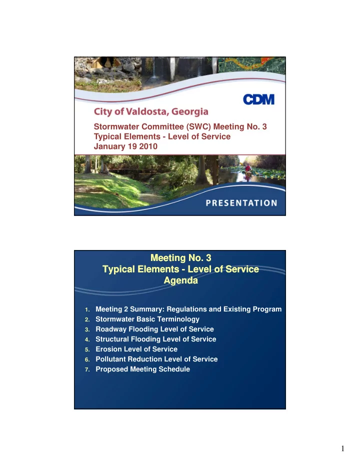
1 Stormwater Committee (SWC) Meeting No. 3 Typical Elements - Level of Service January 19 2010

Meeting No. 3 Meeting No. 3 Typical Elements Typical Elements -

  • Level of Service

Level of Service Agenda Agenda

1.

Meeting 2 Summary: Regulations and Existing Program

2.

Stormwater Basic Terminology

3.

Roadway Flooding Level of Service

4.

Structural Flooding Level of Service

5.

Erosion Level of Service

6.

Pollutant Reduction Level of Service

7.

Proposed Meeting Schedule

slide-2
SLIDE 2

2

Meeting No. 2 Summary Meeting No. 2 Summary Regulations and Existing Program Regulations and Existing Program

1.

Stormwater Related Regulations

  • GA EPD, USACOE, FEMA, GSWCC

2.

City Stormwater Functions

Engineering Department Utilities Department

3.

Quantity/Quality Level of Service

Public Works Department Planning and Zoning

Stormwater Stormwater Engineering Basics Engineering Basics and and Standard Terminology Standard Terminology

slide-3
SLIDE 3

3

Rainfall Records are the basis for the Rainfall Records are the basis for the analysis analysis

Rainfall events are recorded with rainfall gages Rainfall events are recorded with rainfall gages Data are compiled for many years Statistical Analysis determine

the frequency (how often), intensity, and duration of storms throughout the g period of record

Rainfall Rainfall Statistics Statistics

The Georgia

Stormwater Manual compiled statistics for the entire state.

slide-4
SLIDE 4

4

Intensity Duration Frequency Analysis Intensity Duration Frequency Analysis

DESIGN STORM DEPTHS (inches)

Recurrence Interval 1 year 2 year 5 year 10 year 25 year 50 year 100 year Annual Percent Chance

100% 50% 20% 10% 4% 2% 1%

1 Hour

1.85 2.09 2.49 2.78 3.21 3.55 3.88

6 Hour

2.76 3.24 4.08 4.68 5.46 6.00 6.66

12 Hour

3.00 3.84 4.80 5.52 6.48 7.2 8.04

24 Hour

3.60 4.32 5.52 6.48 7.68 8.4 9.12 Source: Georgia Stormwater Management Manual

Field explorations provide insights Field explorations provide insights regarding key watershed parameters regarding key watershed parameters

Imperviousness Imperviousness Soil Infiltration Capacity Topographic Relief Existing Infrastructure

slide-5
SLIDE 5

5

Channels, Bridges, Culverts and Pipes Channels, Bridges, Culverts and Pipes are surveyed and documented are surveyed and documented

Conveyance

Hightower Creek Hightower Creek

Conveyance Current Condition Roughness Assessment Erosion and Sedimentation

Baytree Baytree Road Road

Engineers evaluate the watershed and Engineers evaluate the watershed and channels to determine flood stages channels to determine flood stages associated with design storms associated with design storms

Rainfall Rainfall Stream Stage

slide-6
SLIDE 6

6

The Final Result is a table that shows The Final Result is a table that shows the expected flood stages at specific the expected flood stages at specific locations within the City locations within the City

Roadway Roadway Node Road Name Road Classification Invert Elevation (ft - NAVD) 1.2 - inch Storm 5 - Year Storm 10 - Year Storm 25 - Year Storm 100 - Year Storm

OM60250 184.2 187.3 187.4 188.1 188.9 OM60260S N Ashley Street Arterial Road 192.7 186.0 191.1 192.1 193.3 193.7 OM60265S 185.6 191.1 192.1 193.3 193.7 OM60270 188.1 191.5 192.3 193.4 193.9 OM60280S Lee Street Local Road 193.3 188.1 192.4 193.2 194.2 194.6

One Mile Branch y Crown Elevation (ft- NAVD)

Collector Road OM60290 188.6 192.9 193.5 194.4 194.8 OM60300S Vallotton Drive Local Road 193.3 188.6 193.1 193.7 194.7 195.3 OM60320 191.1 194.9 195.4 196.2 196.9 OM60330 196.1 198.8 199.5 200.3 201.1

Draft Results from Current Ongoing Master Plan Update

The Engineer Model also predicts the The Engineer Model also predicts the peak velocities in different sections of peak velocities in different sections of the stream the stream

ONE MILE BRANCH

Vallotton Drive Park Avenue Lee Street Ashley Street

slide-7
SLIDE 7

7

The final objective of the engineering The final objective of the engineering analysis is to determine the following analysis is to determine the following

Problem areas within the watershed Critical storms that flood roads Sections of the streams with erosive velocities Provide estimates of design parameters for

future projects

Determine the benefits/impacts of project

implementation

The Parameters set in the Level of Service The Parameters set in the Level of Service will provide a City wide metric to rank will provide a City wide metric to rank upcoming upcoming Stormwater Stormwater Construction Construction Projects Projects

Quantity Levels of Service Benefits Quality Levels of Service Benefits Preference for Joint use facilities Construction and Maintenance Costs

slide-8
SLIDE 8

8

Selected Level of Service translates Selected Level of Service translates into construction and O/M costs into construction and O/M costs Stormwater Stormwater Level of Service Level of Service

slide-9
SLIDE 9

9

Roadway Level of Service Roadway Level of Service

Determination of frequency (how often) and Determination of frequency (how often) and

severity (how deep) flood levels that are acceptable to the community

Roadway GA DOT Level of Service Roadway GA DOT Level of Service

The Georgia The Georgia

Department of Transportation (DOT) has set standards for their infrastructure

Example: A road

p with an Average Daily Traffic (ADT)

  • f 300 should be

designed 2 feet above the 10 year storm

slide-10
SLIDE 10

10

CDM has developed criteria specific to CDM has developed criteria specific to

  • ther locations to determine whether
  • ther locations to determine whether
  • r not a road is passable
  • r not a road is passable

Not Passable Passable Non Passable

Roadway Levels of Service Examples Roadway Levels of Service Examples

East Point GA East Point, GA

All roads shall be passable for the 25 yr/24

hour storm based. A determination is made based on flow depth and velocity

Tallahassee, FL

All roads shall be passable for the 25 yr/24 hr

t storm

Robinson Bayou, FL

Three different levels of service

based on 10, 25 and 100 yr storms

slide-11
SLIDE 11

11

Roadway Levels of Service Examples Roadway Levels of Service Examples

Jacksonville FL Jacksonville, FL

Arterial Roads

– 9 inches for 100 yr storm

Local Roads

– 3 inches for the 5 year storm Charlotte, NC

C a otte, C

Local Roads: 25 yr storm Arterial Roads: 50 yr storm If tributary area is greater than 1 sq-mi, 100 yr +

1 ft freebord criteria

Currently in Valdosta roadways are Currently in Valdosta roadways are classified based on traffic intensity classified based on traffic intensity

Arterial Roads Arterial Roads Local Roads Draft Consideration: Cross Drain Culverts

shall be designed to provide at least 1.5 ft of freeboard between the 100 year ponding and the centerline of the road (LDR 332-22-e)

slide-12
SLIDE 12

12

Roadway Level of Service Roadway Level of Service

Arterial Road Arterial Road Flood Frequency Local Road Flood Frequency

slide-13
SLIDE 13

13

Home / Structural Flood Level Home / Structural Flood Level

  • f Service
  • f Service

Structural Flood Level of Service Structural Flood Level of Service

Determination of frequency (how often) and Determination of frequency (how often) and

severity (how deep) of structural flooding (buildings, homes) standards

MeadowBrook MeadowBrook Dr Dr

slide-14
SLIDE 14

14

Critical Infrastructure should be Critical Infrastructure should be

  • perational during severe storms
  • perational during severe storms

Fire stations Hospitals Sewage pump Fire stations, Hospitals, Sewage pump

stations are some examples of critical infrastructure

In some instances the only solution is to flood

proof these structures to ensure they are

  • perational during severe floods

Withlacoochee WWTP Withlacoochee WWTP Sewage Pump Station Sewage Pump Station

Structural Flood Levels of Service Structural Flood Levels of Service Examples Examples

East Point GA East Point, GA

No structures should be flooded for the 100

year storm

Tallahassee, FL

None

Robinson Bayou, FL

Three different levels

were set for the 10, 25, and 100 year storms

slide-15
SLIDE 15

15

Structural Flood Levels of Service Structural Flood Levels of Service Examples Examples

Jacksonville FL Jacksonville, FL

No structures should be flooded for the 100 year

storm

Charlotte, NC

No structures should be flooded for the 100 year

storm

FEMA R l ti

FEMA Regulations

No new development is

allowed in the floodplain

If there is encroachment in the floodplain it is

required to raise the structures and compensate for storage

Structural Level of Service Structural Level of Service

Home Flood Frequency

slide-16
SLIDE 16

16

Erosion Level of Service Erosion Level of Service

Determination of the peak velocity that the Determination of the peak velocity that the

City wants to maintain in natural channels

High velocities are associated with loss of

stream bank, trees, and threat to properties

Lamar Street Bank Stabilization Lamar Street Bank Stabilization Sugar Creek Sugar Creek

Erosion Level of Service Examples Erosion Level of Service Examples

East Point GA East Point, GA

None

Tallahassee, FL

None

Jacksonville, FL

Existing Channels: 3 feet per second for the Existing Channels: 3 feet per second for the

2.3 year storm

New Designed Channels: 2 feet per second for

the 2.3 year storm

Charlotte, NC

14 fps for rip rap sections

slide-17
SLIDE 17

17

Valdosta Erosion Level of Service Valdosta Erosion Level of Service

25 yr storm peak velocities compared to channel 25 yr storm peak velocities compared to channel

lining (LDR 322-22-f-6)

Erosion Level of Service Erosion Level of Service

Stream Peak V l it Velocity

slide-18
SLIDE 18

18

Water Quality Level of Service Water Quality Level of Service

City has already a reduction goal of 98% for City has already a reduction goal of 98% for

bacteria in Two Mile Branch

Upcoming EPD regulations may enforce

bacteria and nutrient total maximum daily loads (TMDL)

MeadowBrook MeadowBrook Dr Dr

Quality Level of Service (LOS) Quality Level of Service (LOS)

Pollutant Reduction Reduction

slide-19
SLIDE 19

19

The City of Valdosta has the ability to The City of Valdosta has the ability to determine its level of service and determine its level of service and support the ranking of upcoming support the ranking of upcoming construction projects construction projects Quantity Level of Service (LOS) Quantity Level of Service (LOS) Home Flood Frequency Arterial Road Flood Frequency Local Road Flood Frequency

slide-20
SLIDE 20

20

Quality Level of Service (LOS) Quality Level of Service (LOS)

Stream Peak Stream Peak Velocity Pollutant Reduction

Meeting No. 3 Meeting No. 3 Typical Elements Typical Elements -

  • Level of Service

Level of Service Summary Summary

1.

Stormwater Basic Terminology

2.

Roadway Flooding Level of Service

3.

Structural Flooding Level of Service

4.

Erosion Level of Service

5.

Pollutant Reduction Level of Service

slide-21
SLIDE 21

21

Stormwater Stormwater Committee (SWC) Committee (SWC) Meeting Dates Meeting Dates

Nov 17 2009 – Introduction Dec 1 2009 – Regulations and Existing Program Jan 19 2010 – Typical Elements - Levels of

Service (LOS)

Feb 23 2010 – Special Considerations and LOS

Discussion Discussion

Mar 23 2010 – Recommendations to Council Apr 20 2010 – Extra Meeting (if necessary) April 2010 – Final Recommendations to Council