
SLIDE 1
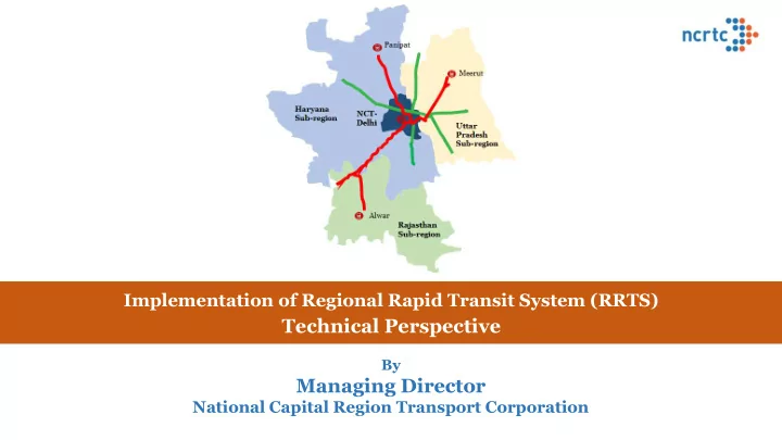
Implementation of Regional Rapid Transit System (RRTS)
Technical Perspective
By
Managing Director
National Capital Region Transport Corporation
Managing Director National Capital Region Transport Corporation - - PowerPoint PPT Presentation
Implementation of Regional Rapid Transit System (RRTS) Technical Perspective By Managing Director National Capital Region Transport Corporation Agenda of todays webinar Construction of project of this size and technical complexity is a
Implementation of Regional Rapid Transit System (RRTS)
Technical Perspective
By
Managing Director
National Capital Region Transport Corporation
Construction of project of this size and technical complexity is a challenging – first initiative of its kind in India with design speed of 180 kmph – design parameters different from Metro systems
Civil structures
from Metro – due to higher speed
luggage racks & high speed
Track structure
ballastless tracks for high speed to be used
Over Head Electrification
System for design speed of 180 kmph first time in India
Signalling
time in India - interoperability of corridors - seamless movement
Rolling Stock
rolling stock with high speed, high capacity
Operation of Metro services
Meerut - first time in India
Key identified Challenges
Technological Challenges
Multi-state Implementation
delay in approvals will have significant bearing on schedule
Stakeholder Challenges
Consequences of rapid urbanization in Delhi & NCR
– lack of integration - Multiple interchanges
pollution
Transport in the region*
(highest among top 50 cities with million plus population)
1: World Bank data 2: Report No. 92, EPCA, Oct. 2018
Population trend of mega cities in World1
Inadequate regional mobility – constraining economic growth
10 15 20 25 30 35 40 2005 2014 2030 Population in Millions
Tokyo Delhi Shanghai Beijing New York
* Delhi-SNB & Delhi-Meerut Road Corridor
Better Connectivity triggers Urban Development
Night Imagery- NCR
Regional Express Rail
257 stations 587 kms
Metro
384 stops 216.5 kms
Tramway
148 stations 95 kms
Buses
12,500 stops 347 lines
Network of Networks- Paris Metropolitan Region
(Co-existence of transit systems and express road networks)
Paris CBD
Regional Express Rails connect sub-urban centers to multi-modal grid of Paris CBD Connecting multiple modes transportation network of Paris CBD area to sub-urban modes through RER
~100 kms
Sub-urban Nodes
Regional rails can transform economies & lives of people enabling inter-connected clusters to develop as a vibrant, dynamic whole, greater than sum of its parts
Functional Plan on Transport for NCR-2032 - eight (8) Corridors of RRTS
Force having representation of GOI and NCR States –
✓ Delhi-Ghaziabad-Meerut (Sanctioned by
GoI – 07.03.2019) – in implementation phase
✓ Delhi-Gurugram-Alwar ✓ Delhi-Panipat
Parameters Delhi – Meerut Delhi – Panipat Delhi – Alwar Total Length (km) 82.15 103 164 Estimated travel time (min) 60 70 100
24 12 19 Total Cost (INR Cr.) 30,274 29,389 50,000+* ~ 350 kms 600 coaches 6 Depot. ~ 2 mn daily ridership INR 1+ Lakh Crore
*approximation based on cost of Delhi-SNB and SNB-Sotanala costs
1.City-center to city-center, high-speed dedicated rail connectivity
every 5-10 kms – 24 stations
modes of transport
37% to 63% – 100,000 vehicles off the road
Not merely connecting two cities but serving 82 km of urban strip
Corridor Length: 82.15 km
Elevated Underground
Design speed of 180 kmph (Delhi to Meerut in 60-65 min) Train every ~5-10 min. & serving traffic nodes every 5-10 kms Universal Access + Safety – Platform Screen Doors Reduced Land use for high throughput Commuter friendly information system Weather proof – rains, fog High capacity, comfortable journey, airline seating
RRTS – Rail based high speed, high capacity, comfortable and safe commuter service connecting regional nodes. It will help in reducing Road Congestion, Energy Consumption and Pollution
Interoperable Corridors & Multimodal Integration
RRTS trains will travel at 3 times the average speed of Metro
Multiple corridors are chosen, approx. cost is worked out and traffic survey is carried
Best route is selected based on the parameters of above study Various possible alignments are marked Cost, time required for construction, requirement of land acquisition, ratio of Elevated/ Underground are important criteria in working out most suitable option Even during construction phase minor alignment adjustments become very important because of site constraints or change in planning of other stake holders
E
Anand Vihar Ramp New Ashok Nagar Sahibabad Ramp
Pink line (Majlis park-Shiv Vihar) & Blue line (Vaishali- Dwarka Sec.21), Railway station and Bus stand
Towards Meerut
Sarai Kale Khan
Multi Modal Integration at Anand Vihar
DMRC LINE 4 DMRC LINE 7
```PLAZA Integration with UPSRTC
FROM SKK UPSRTC BUS STAND
Chaudhary Charan Singh Marg Ghazipur Drain
➢Preliminary Alignment of RRTS corridor fixed on Google earth map keeping in view proposed station locations, land availability, obligatory points, construction technology, multimodal integration etc. ➢Before commencement of construction, Topographical survey required to prepare base map for: ▪ Fine tuning/ geometric design of alignment as per design speed etc for marking same on ground ▪ Determining quantities for earthwork in embankment, cutting etc for cost estimation etc ▪ Exact location of obligatory points such as existing tunnels, bridges, rivers, flyovers, buildings etc for final alignment design ▪ Determining locations of various utilities such as electric lines, sewer lines, water lines etc to plan their shifting etc ▪ Working out exact quantities of land requirement ➢ Accuracy level of Toposurvey depends on type of construction. For railway lines, high grade accuracy level required (1 in 50,000)
using DGPS adopting basic principle of surveying from “whole to part”
interval) and Tertiary Control Points (at about 5 km interval )
surveyed to Control Points in the survey area by closed traverse as per required accuracy level (6√K mm)
Traversing by Total Station from one control point to another control point as per required accuracy level (1 in 50,000)
such as road, railway line, bridge, culvert, buildings, trees, sewer lines, drains, river etc., in the survey area with the Total station
PCPs
Points by DGPS Survey in the survey area
high resolution camera (4K) and Flight Planning according to area required to covered
and minimum 60 % side overlap (side)
flying in the intended area from local Authorities/DGCA
by flying drone over the intended area
Aerial Photographs) from Camera/Drone to Computer
appropriate photogrammetry software such as Pix4D, Autodesk ReCap etc. to create
sheets prepared by tracing the ground features in the CAD software.
the ground between successive pixel centers in an image). Accuracy of about 5-10 cm achieved
Orthophoto (from software) Toposheet prepared by tracing
Base Google image in Google Earth Software
RRTS Alignment
Topographical Sheet prepared from Ortho Map Geo referenced Ortho Map in Google Earth Software
RRTS Alignment
➢ Pros
conventional survey instruments
5 km
➢ Cons
survey instruments
during surveying
prepare drawings using appropriate software
➢ Pros
➢ Cons
permission to fly
processing Aerial Photogrammetry Total Station
Planned in Four Phases:
Elevated/ Underground Section Length (Km) Interval of Boreholes Depth of Boreholes Elevated IDPL Complex to Dharuhera 36 100 m
50%)
Dharuhera to SNB 35 Underground SKK-IDPL complex 23 50 m
Rajiv Chowk to Panchgaon 13
Testing
▪ Standard Penetration Tests (SPT) with Auto-trip hammers ▪ Collection of Disturbed and UDS Samples for suitable lab testing such as Grain size analysis, Atterberg’s limits, Direct Shear Test, Triaxial tests etc. ▪ Other field tests viz. Permeability, cross-hole seismic test, pressure meter test, plate load test ▪ Laboratory Test on Soil and Rock Samples by NABL accredited Laboratory ▪ Chemical Test on soil and Water sample ▪ Geotechnical Report including Geological Logs, field and lab test results and recommendations
Economical positioning
Continuously Operating Reference stations is a network
allows users to access long-range high-accuracy Network RTK corrections
Network Design Considerations:
stns in 82 km Delhi-Meerut corridor.
covered by atleast 3 and preferably 5 stations.
distances.
consistent.
Network Processing Facility Master Reference Station Auxiliary Reference Station B Auxiliary Reference Station C Auxiliary Reference Station D Auxiliary Reference Station A
1. 2. 3. 4. 5.
Rover User
Data Centre RTK Photogrammetry RTK Lidar RTK Precision Survey Engineering/Mapping Precise Under-Ground Asset Mapping Track Measurement and Monitoring System
Project planning & monitoring
Building Information Modelling (BIM)
UAV (Drone) Videography
Geospatial Information System
Common Data Environment
Collaborative design using BIM: ‘single source of truth’ Virtual Reality Studio
CORS
Operating Reference Stations for Surveying
beginning of a rail based project with the approval of Ministry of Railways to serves as co-coordination tool for all the disciplines.
which vehicle can move from the nominal centre line of track. It includes all the tolerances related to Vehicle and Track and quasi static movements.
which no fix structure should penetrate. It includes safety margins and additional clearances required on curves etc.
Ballast less Track was selected in preference to ballasted track Considerations:
Diameter)
Germany since 1972 by DB)
used in Germany since 2006 in the present form)
OBB in 1989)
Japan in 1975, similar approach ahs been followed by Taiwan, China)
Switzerland in 1989)
BLT was to be selected as per system requirements
300Kmph
per team against approx. 1.2 Km per month per team with conventional metro track
Cast-in-Situ type BLT system, because
during factory production of the slab
aerodynamics in tunnels become increasingly important.
has been achieved in other projects in India – for RRTS it would be 160 kmph
simulation analysis for aerodynamics and ventilation is being carried out
used for Tunnels of RRTS
Tunnel Diameter has an exponential implication on the cost of tunnel construction The tunnel dia for RRTS was
the centre of tunnel
Diameter 6.5m (Internal clear dia) which includes 200mm construction tolerances
important parameter in design. These forces depends on natural frequency and deformations of the structure
also become necessary
with ballast less track
and planning
Segmental Box Girder preferred
high speed operation
its higher weight
traffic block
to 55 ton
cables.
because of Railway/road bellow
preference to conventional truss
Steel Requirement is HIGH
is more than 3.5 m/s2.
selected for economy, Aesthetics- Better Dynamic Performance
Detailed dynamic analysis has been done for speed upto 236 kmpH Dynamic Augmentation :
subject to minimum value as per Bridge Rules.
Analysis of standard box girder using Midas Software
As per UIC 776-3R
12,0 58,0 26.5
RSI Model in LUSAS for viaduct (Stage-1)
Bearings
Spherical Bearing Elastomeric Bearings Pot PTFE Bearings Spherical Bearings preferred over Elastomeric:
case of CWR track, and has huge hidden cost
plastic hinge performance and ease
(IS 1893-3)
resist Torsional forces
6m to 20 m
Concept
Real pic at site Drawing
CAGE FABRICATED IN JIG
and station Conducting the Pile Test
before awarding the main contract by using independent contractor
faster testing
saves time
friction and end bearing of the pile with help of graphical iteration given in Annexure A of code IS 2911 (Part 4):2013
Yamuna Crossing
General industry Practice NCRTC
General practice : Safe and Ultimate load assuming water table at ground (not likely to happen) Safe and Ultimate load based
ground (optimization of foundation) Test load is restricted to 2.5- time safe load based on above condition. (Failure load is generally not achieved). Test load 3-time safe load(approach to find actual failure load). Accordingly size of foundation can be optimized. IRC criteria is followed for safe horizontal capacity Railway codes and guidelines are being followed to restrict deflection in order to control vibrations under high speed
heavy loads form the train and structures
Piling work in progress in priority section
maintained.
has been developed in the casting yard with all require instruments
PERMIABILITY TEST OF CONCRETE AT CASTING YARD QUALITY LAB AUTOMATED BATCHING PLANT INSTALLED AT CASTING YARD
Jigs has been prepared for accurate Cage Fabrication
NCR Transport Corporation, 7/6, Siri Fort Institutional area, August Kranti Marg, New Delhi 110049 Website ncrtc.in