
SLIDE 1
Main Points
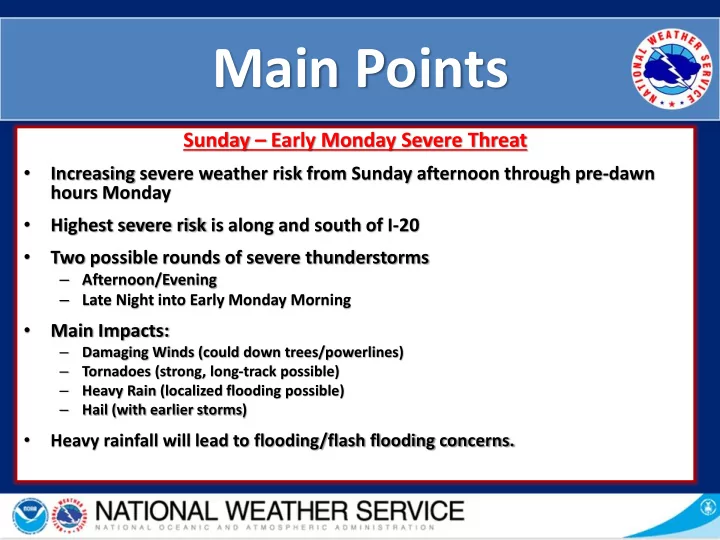
Sunday – Early Monday Severe Threat
- Increasing severe weather risk from Sunday afternoon through pre-dawn
hours Monday
- Highest severe risk is along and south of I-20
- Two possible rounds of severe thunderstorms
– Afternoon/Evening – Late Night into Early Monday Morning
- Main Impacts:
– Damaging Winds (could down trees/powerlines) – Tornadoes (strong, long-track possible) – Heavy Rain (localized flooding possible) – Hail (with earlier storms)
- Heavy rainfall will lead to flooding/flash flooding concerns.