link spokane
play

Link Spokane: Integrating Transportation & Utility Infrastructure - PowerPoint PPT Presentation

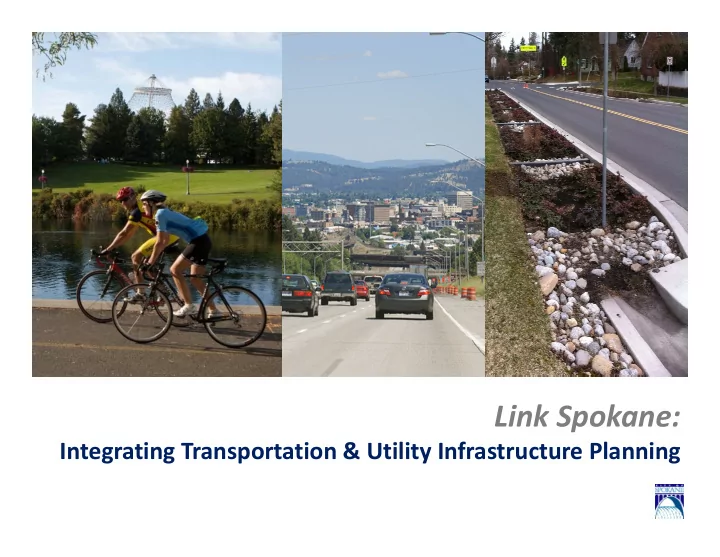
Link Spokane: Integrating Transportation & Utility Infrastructure Planning Introductions Who are you? Infrastructure interests in Spokane Hopes for best process/outcome Welcome & Background Changing circumstances Limited


  1. Link Spokane: Integrating Transportation & Utility Infrastructure Planning

  2. Introductions • Who are you? • Infrastructure interests in Spokane • Hopes for best process/outcome

  3. Welcome & Background • Changing circumstances – Limited resources and the need for integration. • Current Plan’s last major revision – 2001

  4. What is Link Spokane? • Preparing Spokane for the next 20 years – what does the city value, what does it invest in? • Update of the Transportation Chapter of the Spokane Comprehensive Plan including portions of the Capital Facilities Chapter. • Address the current and future needs of all modes of transportation (including cars, freight, transit, pedestrians and bicyclists) while meeting the needs of the city’s current and future land uses • Designed to be fully integrated with other City investments in utilities and infrastructure

  5. What Have We Done • Pedestrian Master Plan

  6. What Have We Done • Updated Project Selection Matrix Provide Transportation Access to Daily Needs and Regional Promote Economic Respect Natural and Neighborhood Maximize Public Benefits and Fiscal Responsibility with Enhance Public Health and Safety Choices Destinations Opportunity Assets Integration 110 Development Total Score Network Neighborhoo Regional Disadvantage Freight/ Neighborho Ped Plan CSO Maint and Leveraged Project Project Person Score Score & Score Air Water Score Vehicle Bike Ped Score Water Score Paving area (curb Estimated Cost Year Council Connectivit d Accessibilit d Goods od/District Priority Integratio Facility Financing Name Location Capacity Redevelopme Quality Quality Safety Safety Safety Integration to curb, sq yd) (per sq yard) Const District y Accessibility y Accessibility movement Impact Area n Condition (excludes levy) nt Potential Five Mile intersecti ## Connects 2 1 ‐ 2 bike improve Strong to ## destinations ## 0 ## ## 50% ‐ 75% built out ‐ 0 Neutral 0 #N/A Rd. on modes none none T4 Neutral Neutral ## Medium lane s sw ## None None None >75% funded Lincoln ‐ add bike 1 ‐ 2 lanes, ## ## destinations ## 0 ## ## 0 0 #N/A Rowan Driscoll to sidewalk, Connects 1 in project bike improve paving Maple ‐ Ash pathway mode limits none none T4 Built out for zoning Neutral Neutral Neutral ## None lane s sw ## None None None >75% funded Wellesle Haven to ## ## ## ## ## ## 0 0 #N/A y Freya add bike destination d lane, TJ lanes, s near greenw ## Connects 1 ## 0 2 ## ## 0 0 #N/A Meenach NW Blvd. to sidewalk, project ay, improve paving river pathway mode none limits 25% ‐ 34% T2 50% ‐ 75% built out ‐ Neutral Neutral Neutral ## None controll s sw ## None None None >75% funded In Ped sw Riverside Bernard to 5k ‐ 10k Connects 1 downtown 0 bike 2 2 4 score 1 ‐ 5 1 5 32.91% + 5 7 T4 2 adjacent 5 7 No chang 2 Neutral 2 Not in plan 0 3 None 3 Priority 5 ramps or 2 5 Medium 3 1850 ‐ 1930 5 PCI 40 ‐ 60 3 grant eligible 1 6 32.0 8933 $ 982,630 2 Avenue Division ADT mode core lane Zone repair Division to 10k ‐ 20k In Ped sw downtown 2 Project <50% funded Sprague Hamilton ADT + 4 None 0 4 score 1 ‐ 5 1 5 32.91% + 5 7 T4 2 adjacent 5 7 No chang 2 Neutral 5 6 None 0 none 0 Priority 5 ramps or 2 4 Medium 3 1850 ‐ 1930 5 PCI 40 ‐ 60 3 4 8 35.3 24128 $ 2,654,080 ? core listed in plan (any source) overpass HPTN Zone repair 1 ‐ 2 Hayford 48th to 5k ‐ 10k Connects 1 0 bike 2 2 4 none 0 destination 2 0% ‐ 6.92% 0 1 T3 3 None 0 3 No chang 2 Neutral 2 Not in plan 0 3 None 3 none 0 none 0 2 None 0 1975 ‐ 1994 2 PCI 0 ‐ 20 5 grant eligible 1 4 16.5 $ ‐ 2 Road McFarlane ADT mode lane s near Lindeke sw Sunset Blvd Connects 1 0 signing, Street ‐ < 5k ADT 1 2 3 score 1 ‐ 5 1 none 0 6.93% ‐ 11.43% 1 1 T5 1 None 0 1 No chang 2 Neutral 2 Not in plan 0 3 None 2 none 0 ramps or 2 2 None 0 1931 ‐ 1955 4 PCI 20 ‐ 40 4 limited 0 4 14.0 15534 $ 1,708,740 2 to 195 mode marking 16th repair 1 ‐ 2 New or In Ped sw 4th Sunset to 5k ‐ 10k 0 signing, 2 None 0 2 score 1 ‐ 5 1 destination 2 32.91% + 5 5 T5 1 None 0 1 No chang 2 updated 5 Not in plan 0 5 None 2 Priority 5 ramps or 2 5 High 5 1850 ‐ 1930 5 PCI 20 ‐ 40 4 grant eligible 1 8 25.0 5715 $ 628,650 2 Avenue Maple ADT marking s near facilities Zone repair New or In Ped sw 4th Jefferson downtown 0 bike < 5k ADT 1 None 0 1 score 1 ‐ 5 1 5 19.37% ‐ 26.4% 3 6 T5 1 adjacent 5 6 No chang 2 updated 5 Not in plan 0 5 None 3 Priority 5 ramps or 2 5 Medium 3 1850 ‐ 1930 5 PCI 40 ‐ 60 3 grant eligible 1 6 28.7 $ ‐ 2 Avenue to Division core lane facilities Zone repair

  7. What Have We Done

  8. What is Link Spokane? • Vision, Goals, and Priorities • Infrastructure Integration • Transportation ‐ Land Use Connection

  9. Transportation – Land Use Connection

  10. Transportation – Land Use Connection

  11. Transportation – Land Use Connection

  12. What is Link Spokane?

  13. Integrated Infrastructure Opportunities • Spokane incorporated in 1881 – Infrastructure nearing the end of its life – Streets, Water, Sewer, Sewer Overflow – Inadequate services hindering redevelopment

  14. Integrated Infrastructure • Predicted ‐ Fewer Transportation Capital Dollars – Leverage Stormwater Runoff Spending – Leverage Combined Sewer Overflow Spending – Many (newer) Uses of Right ‐ of ‐ Way

  15. How are Street Projects Funded? • The City has historically relied on the General Fund to help pay for maintenance of roads and Federal or State competitive grants for capital projects. • Over the last 10 years several new funding sources have been developed: – 2004 : $117 million 10 ‐ Year Street Bond (passed by 61.3% of City voters). Completed in 2015. – 2008 : A Transportation Impact Fee Ordinance adopted by City Council requiring developers to help pay City costs to provide public services to new development. – 2010 : Transportation Benefit District with $20 vehicle License Tab Fee created by City Council for residential streets. – 2014 : 20 ‐ year Arterial Street Levy (passed by 78% of City voters) (maintenance & repair funding). – 2014 : Utility Lease Payments – 2015 : Stormwater Green Bonds ‐ $200M

  16. It’s All About Integration! • Integrated Streets consider: – Pavement condition – Multi ‐ modal transportation components—bike lanes, pedestrian improvements, mass transit – Storm water management – Public & private utility infrastructure – Economic Development opportunities 3-Dimensional View of • Comes together in Comp Plan Streets update: Link Spokane

  17. 10 ‐ Year Street Bond Program + Gap Projects + Additional Work

  18. Integrated Plan Objectives Environmentally & Financially Responsible • Cleaner River faster. – Prioritize work that has a greater impact on pollutants. • Implement cost ‐ effective & innovative technologies. – Add “green” technologies. – Right ‐ size existing projects. • Holistic integration with other critical infrastructure. – Solve multiple problems. – Better streets, new water mains, better parks…

  19. Infrastructure Planning Context CONSISTENCY FROM STATE TO LOCAL GROWTH MANAGEMENT ACT CAPITAL CAPITAL COMPREHENSIVE IMPROVEMENT VISION FACILITIES PLAN PROGRAM PLAN IMPLEMENTATION • NEIGHBORHOOD • POLICIES • PRIORITIZATION • POLICIES • GOALS PLANS • GOALS CRITERIA • GOALS • OBJECTIVES • STRATEGIC • OBJECTIV • PROJECTS • OBJECTIVES • PROJECTS PLANS ES • BUDGET • BUDGET • ACTION PLANS • SCHEDULE • SERVICE AREA PLANNING 20 YEAR PLAN 20 YEAR PLAN 5-6 YEAR PLAN UPDATED UPDATED UPDATED EVERY 8 YEARS 20-50 YEAR EVERY 7-10 EVERY YEAR PLANS YEARS CONSISTENCY FROM VISION TO IMPLEMENTATION

  20. Infrastructure Planning CONSISTENCY FROM STATE TO CAN WE DELIVER LOCAL INFRASTRUCTURE IN A MORE INTEGRATED MANNER? GROWTH MANAGEMENT ACT CAPITAL CAPITAL IMPROVEMENT VISION FACILITIES PROGRAM COMPREHENSIVE PLAN PLAN • NEIGHBORHOOD PLANS IMPLEMENTATION • PRIORITIZATION • POLICIES • GOALS • STRATEGIC CRITERIA • GOALS • OBJECTIVES PLANS • PROJECTS • OBJECTIVES • PROJECTS • ACTION PLANS • BUDGET • BUDGET • WATER SERVICE • SCHEDULE AREA PLANNING 20 YEAR PLAN 5-6 YEAR PLAN UPDATED 20-50 YEAR 20 YEAR PLAN UPDATED EVERY 7-10 PLANS UPDATED EVERY YEAR YEARS EVERY 5 YEARS CONSISTENCY FROM VISION TO IMPLEMENTATION

Download Presentation
Download Policy: The content available on the website is offered to you 'AS IS' for your personal information and use only. It cannot be commercialized, licensed, or distributed on other websites without prior consent from the author. To download a presentation, simply click this link. If you encounter any difficulties during the download process, it's possible that the publisher has removed the file from their server.

Recommend


More recommend