
SLIDE 1
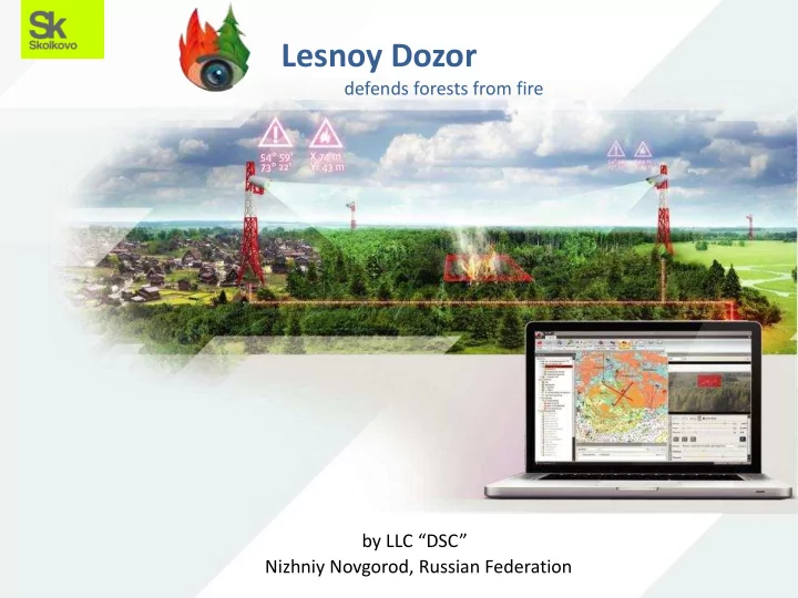
by LLC “DSC” Nizhniy Novgorod, Russian Federation
Lesnoy Dozor
defends forests from fire
Lesnoy Dozor defends forests from fire by LLC DSC Nizhniy Novgorod, - - PowerPoint PPT Presentation
Lesnoy Dozor defends forests from fire by LLC DSC Nizhniy Novgorod, Russian Federation 2010 2010 was a disaster 2 More than 4000 people in Russia lost their homes. Fire destroyed an area of 1.2 million acres. The mortality caused by
by LLC “DSC” Nizhniy Novgorod, Russian Federation
defends forests from fire
2
3
More than 4000 people in Russia lost their homes. Fire destroyed an area of 1.2 million acres. The mortality caused by heart and lungs diseases in 2010 has doubled.
4
The territory around our hometown Nizhny Novgorod was worst affected. And we offered something to solve the problem of early forest fire detection.
5
6
We came up with an idea: to develop a smoke detection algorithm;
7
which would analyze video stream from the network of variety PTZ ip video cameras and infrared sensors;
8
which could be inexpensively installed on existing infrastructure – widely spread nowadays cell phone towers.
9
We had a clear vision how to develop the way of calculating fire coordinates, using digital terrain model and computer vision technology.
10
How to calculate cameras positioning for optimum coverage on certain terrain, certain number of towers for certain region and its climate conditions.
11
12
13
Benefits:
PC
continuous statistics collecting)
14
15
There is a fundamental principle beyond all the functionality: In most cases there is no need to watch all the cameras, they follow their routes by themselves, analyzing forest areas frame by frame, searching for smoke. The user`s duty is validating automatically generated PDOs – Potentially Dangerous Objects. Filtering them.
16
New PDOs appears in the list. User validates PDO by pressing one of those buttons. Here we can see what was the reason for an alarm. Playback control.
17
This principle allows to control up to 30 cameras by single one operator. Monitoring of the same area in a traditional way would require 30 foresters. It is not difficult to calculate how much money would be spent from salary budget to afford 30 foresters.
18
19
status bar user ID tree of
GIS data
main menu
tech support
20
21
PDO Analysis Window
22
Fire Analysis Window
23
View Routes Window Panorama Timeline for chosen orientation Routes
24
Live View Window
Pan Auxiliary functions Tilt Zoom
25
Plotting coordinates PDOs, both manually or automatically generated, appears with calculated coordinates and with a marker on a map.
26
Plotting coordinates If you can see smoke from two cameras, coordinates could be calculated with even more precision.
27
Data integration
Loading on the fly assets:
28
Data integration
Loading on the fly assets:
29
Data integration
Loading on the fly assets:
30
Data integration
Loading on the fly assets:
31
Loading on the fly assets:
weather maps (beta)
Data integration
32
Diagnostics and Statistics Window Cameras, routes, users, servers diagnostics and statistics can be easily exported.
33
Statistics that could be exported in details:
34
More than 300 cameras in the system and
35
36
The easiest way. Low one-off costs if existing towers are using. Human factor – hard to stay concentrated for long time. Needs a lot
big areas. Good for monitoring distant areas. Good fire coordinates precision. Good for monitoring distant areas, that can`t be reached the other way.
used continuously. Takes long time to educate pilots. Data updates rarely (several times a day). Fire must be big enough to be detected. Unable to monitor areas under clouds.
Traditional Aircraft Satellite
37
Lesnoy Dozor
Automatic monitoring. Real-time data streaming. Up to 30 cameras per one operator. Coordinates calculation. A lot cheaper than aircraft monitoring. Third-party sources data integration, including satellite, weather, etc. Unlimited number of users and control centers. Needs electricity and internet connection on towers. Less precise coordinates calculation than an aircraft gives.
38
One-off (launch) costs:
Operating costs (monthly):
To calculate the costs or get more information, please contact us by phone: +7 (831) 411 55 97 or e-mail: info@lesdozor.ru
39
Under control: 318 sensors 1. the Altay Territory 2. the Vladimir Region (NP Meschera) 3. the Vologda Region 4. the Voronezh Region 5. the Irkutsk Region 6. the Kaliningrad Region 7. the Kaluga Region 8. the Kemerovo Region 9. the Kostroma Region
http://www.lesdozor.ru/en
40
Limited Liability Company DSC was founded in the city of Nizhny Novgorod in 2008. The company is a resident of Skolkovo Innovation Centre and IT-park Ankudinovka. The team develop, sell and implement the early warning system for forest fires Lesnoy Dozor (“Forest/Wood Watch” – transl.).
Ivan Shishalov – Managing Director and the architect of the project. Graduated Lobachevsky State University of Nizhny Novgorod with honors. Gained professional experience in Intel, Wireless Net Lab and Video City. Underwent a training in Intel Labs Berkeley. A patent holder for 4 inventions and an author of more than 20 scientific publications. Yaroslav Solovyov – Technical Director. Graduated Lobachevsky State University of Nizhny Novgorod (Radiophysical Department). Obtained experience in Encotes, Video City and Tele-M as Developer and then as Project Manager. Andrey Filimonov – Director of Software Engineering. PhD in the field
associate at Lobachevsky National Research University
Nizhny
companies Teleca and Telma more than 8 years as Developer, SW engineer and Senior Project Manager
http://www.lesdozor.ru/en
Dmitry Bulgatov
– Commercial Director. Has working experience on managing positions in companies: PepsiCo, Mobile TeleSystems, A’Lemar, NCC, SMARTS. More than 8 years in telecomminication business.
Contact information Limited liability company “DSC” 14 Cherepichniy village, Nizhny Novgorod, 603141, Russia Telephone/fax +7 (831) 411-55-97 Web www.lesdozor.ru/en E-mail info@lesdozor.ru CEO Ivan Shishalov shishalov@lesdozor.ru Director of Software Engineering Andrey Filimonov filimonov@lesdozor.ru Technical Director Yaroslav Solovyov solovyov@lesdozor.ru Commercial Director Dmitry Bulgatov bulgatov@lesdozor.ru
protects forest from fires