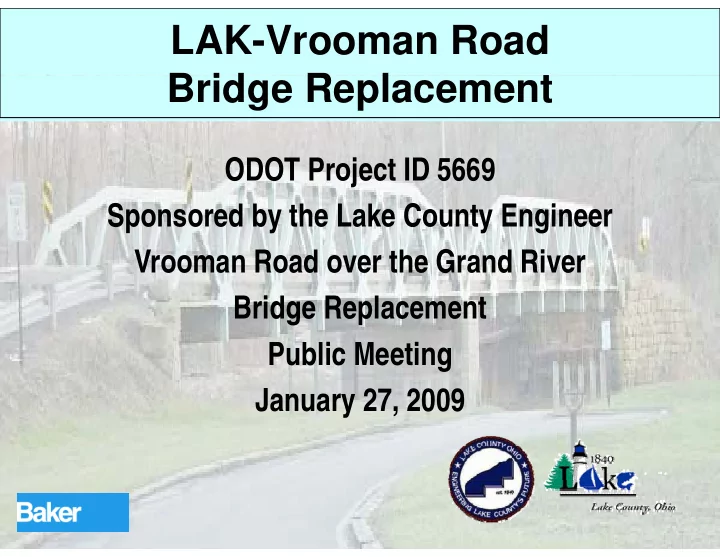
SLIDE 1
LAK-Vrooman Road B id R l t Bridge Replacement
ODOT Project ID 5669 Sponsored by the Lake County Engineer Sponsored by the Lake County Engineer Vrooman Road over the Grand River Bridge Replacement P bli M ti Public Meeting January 27, 2009 y ,
SLIDE 2
Welcome! Thank you for your attendance. Thank you for your attendance. Please take your time viewing this ease a e you e e g s presentation and visiting the various information stations located various information stations located throughout the Community Center. The Project Team members are h t ti here to answer questions you may have regarding the project. g g p j
SLIDE 3 Goals of Today’s Meeting
- Disseminate information
- Answer your questions
- Answer your questions
- Solicit your input
y p
SLIDE 4 Presentation Outline
- Project History
- Purpose and Need
Purpose and Need
T ffi
- Traffic
- 2004 Bridge Replacement Study
g p y
- What about Alternative C?
- Current Project Status
- Current Project Status
- What’s next?
SLIDE 5
Project History
The Lake County Engineer’s Office in conjunction with ODOT and the j Project Stakeholders have initiated preliminary engineering and p y g g environmental studies to identify the “Preferred” replacement alternative p for the structurally deficient and functionally obsolete Vrooman Road functionally obsolete Vrooman Road Bridge over the Grand River
SLIDE 6 Project History
- Current steel bridge erected in 1952
f d ti f th
- n masonry foundations from the
previous bridge built in 1879
- Bridge replacement study initiated
Bridge replacement study initiated and completed in early 1960’s, delayed because of lack of funding delayed because of lack of funding C f
- Complete replacement plans finalized
in mid 1990’s, but delayed because
SLIDE 7 Project History
- A new bridge replacement study was
commissioned in 2004 because the commissioned in 2004 because the existing bridge has continued to deteriorate deteriorate
- 2004 replacement study ended in
2005 with submission of the Planning 2005 with submission of the Planning Study
SLIDE 8 Project History
- The revised Planning Study was
approved by ODOT in 2008 approved by ODOT in 2008 C t Eff t (2008)
– Build on and supplement Planning St d l t d i 2005 Study completed in 2005 – Perform additional Environmental Studies and Investigations Studies and Investigations – Complete Preliminary Engineering studies and report studies and report – Identify “Preferred Alternative”
SLIDE 9
Purpose and Need
The purpose of this project is to replace the structurally-deficient and p y functionally obsolete bridge that regularly closes during flood events g y g with a facility that meets current design standards and improves g p existing geometrics correcting existing roadway deficiencies, while existing roadway deficiencies, while providing a safe, efficient route.
SLIDE 10 Project Limits
- Southern terminus is generally I-90
– Intersection of Vrooman Road and I-90 ramps p
- Northern terminus is generally SR 84
- Northern terminus is generally SR-84
– Intersection of Madison Avenue and SR-84 for Alternative A – Intersection of Lane Road and SR-84 for Alternative B
SLIDE 11 Project Limits
- Overall project can be divided into
two discrete segments:
– “Southern Reach” Southern Reach – “Valley Crossing”
C t i t l t d ff t i
- Current environmental study effort is
looking at both the “Southern Reach” and “Valley Crossing”
- Current engineering study effort is
- Current engineering study effort is
focused on the “Valley Crossing”
SLIDE 12 Project Limits
- “Southern Reach” (Both Alternatives)
Segment length approximately 4 400 – Segment length approximately 4,400 feet F I 90 th t j t th f – From I-90 ramps, north to just south of last curve on southern escarpment – From Osborne property at intersection
- f Vrooman Road and I-90 ramps, to
Ash-Sanford and Siders properties on Vrooman Road
SLIDE 13 Project Limits
- “Valley Crossing” (Alternative A)
Segment length approximately 2 900 – Segment length approximately 2,900 feet F j t th f l t – From just south of last curve on southern escarpment, north to the SR- 84 d M di A i t ti 84 and Madison Avenue intersection – From Ash-Sanford and Siders properties on Vrooman Road to Northeast Auto Service on SR-84
SLIDE 14 Project Limits
- “Valley Crossing” (Alternative B)
Segment length approximately 3 200 – Segment length approximately 3,200 feet F j t th f l t – From just south of last curve on southern escarpment, north to the SR- 84 d L R d i t ti 84 and Lane Road intersection – From Ash-Sanford and Siders properties on Vrooman Road to Perry Cemetery on SR-84
SLIDE 15 Traffic
- This area of Lake County is
considered a part of the Lake County Urbanized Area
- Vrooman Road is classified as an
Urban Collector/Arterial by NOACA Urban Collector/Arterial by NOACA and ODOT
- Both NOACA and ODOT project
modest growth for the area based on modest growth for the area based on current land use
SLIDE 16 Traffic
Vrooman Road Vrooman Road
SLIDE 17
Traffic
Lake County Urbanized Area
Vrooman Road
SLIDE 18 Traffic
- Charged with using ODOT Office of
Technical Services (OTS) Certified Technical Services (OTS) Certified Traffic
Present Day ADT Approximately 5200 – Present Day ADT Approximately 5200 VPD – Opening Year (2012) ADT Opening Year (2012) ADT approximately 5,200 VPD per ODOT OTS, 5,700 VPD per Planning Study d l model – Design Year (2032) ADT approximately 5 900 VPD per ODOT OTS 6 600 VPD 5,900 VPD per ODOT OTS, 6,600 VPD per Planning Study model
SLIDE 19 Traffic
- Current NOACA Traffic Model for
project used in planning study has different traffic volume projections p j
– Assumes that 75% of SR-528 Truck traffic may use Vrooman Road traffic may use Vrooman Road – This represents approximately 480 trucks in Opening Year (2012) trucks in Opening Year (2012) – This represents approximately 710 t k i D i Y (2032) trucks in Design Year (2032)
SLIDE 20 Traffic
- NOACA Traffic Model considers
current traffic composition and volume, and existing land use , g
- Both current traffic projections
indicate that no more than two lanes
- f roadway are required to support
the projected traffic volumes the projected traffic volumes
SLIDE 21 2004 Bridge Replacement Study
Study Focus
Public Involvement
– Stakeholder Committee Meetings Public Meetings – Public Meetings
P li i E i t l S i
- Preliminary Environmental Screening
and Evaluation
SLIDE 22 2004 Bridge Replacement Study
Study Focus
- Develop Conceptual Alternatives
Develop Conceptual Alternatives C l t Pl i St d
– Goal was to identify “Preferred Alternative” through environmental and engineering studies combined with Public and Stakeholder Committee Public and Stakeholder Committee Meetings
SLIDE 23 2004 Bridge Replacement Study
Conceptual Alternatives
- Ten Preliminary Conceptual
Alt ti i i ll id tifi d Alternatives were originally identified in a February, 2004 Stakeholder Committee Meeting Committee Meeting
- Five Conceptual Alternatives were
recommended for further id ti th h J 2004 consideration through June, 2004 Stakeholder Committee Meetings
SLIDE 24 2004 Bridge Replacement Study
Conceptual Alternatives
- The five Conceptual Alternatives
t d t th G l P bli were presented to the General Public in a Public Meeting held on July 7, 2004 2004 St k h ld C itt ti
- Stakeholder Committee meetings
were held in July, 2004 and February 2005 to review the study and public 2005 to review the study and public input
SLIDE 25 2004 Bridge Replacement Study
Conceptual Alternatives
- Alt A – High-Level bridge to Madison
Avenue
- Alt B – High Level bridge to Lane
Road Road
- Alt C – Low Level crossing on
existing alignment existing alignment
- Alt D – Replace bridge in current
location
SLIDE 26 2004 Bridge Replacement Study
Preferred Alternative
- Alternative B was identified as the
- Alternative B was identified as the
“Preferred Alternative” in a February, 2005 Stakeholder Committee Meeting Thi l i d t d i
- This conclusion was documented in
the December 2005 Planning Study
SLIDE 27 2004 Bridge Replacement Study
Planning Study Revisions
- Subsequent ODOT review indicated
th t dditi l i t l d that additional environmental and engineering studies were necessary to show relative impacts of both to show relative impacts of both Alternative A and Alternative B
- Revisions were made to the Planning
St d i J 2007 d M Study in January, 2007 and May, 2008
SLIDE 28 2004 Bridge Replacement Study
Alternative A (Madison Avenue) (Madison Avenue)
Satisfies Purpose and Need
valley crossing to valley crossing to Madison Avenue / SR – 84 intersection
geometry
Improved horizontal and vertical geometry
shoulders shoulders
SLIDE 29 2004 Bridge Replacement Study Alternative A (Madison Avenue) ( )
- Park land involvement
- Wetland involvement
- Cultural Resources involvement
- Right Of Way impacts at SR-84
Right Of Way impacts at SR-84
- May require acquisition of condominiums
at Madison Avenue intersection at Madison Avenue intersection
SLIDE 30 2004 Bridge Replacement Study
Alternative B (Lane Road) Road)
- Satisfies Purpose and
- Satisfies Purpose and
Need
valley crossing to Lane Road / SR – 84 intersection
geometry
- Improved horizontal and
- Improved horizontal and
vertical geometry
h ld shoulders
SLIDE 31 2004 Bridge Replacement Study
Alternative B (Lane Road)
Park land involvement
C lt l R i l t
- Cultural Resources involvement
- Minimal negative ROW impacts at SR-84
- ROW may be required for River Road
relocation
SLIDE 32 What about Alternative C?
Alternative C (Low- Le el Crossing) Level Crossing)
Purpose and Need 1200’ t 1500’ l l
- 1200’ to 1500’ long, low-
level valley crossing to Madison Avenue / SR – 84 intersection
t geometry
shoulders shoulders
SLIDE 33 What about Alternative C?
- Alternative C (“Low-Level Crossing”)
was eliminated from further consideration during a February, g y, 2005 Stakeholder Committee Meeting Meeting
- Reasons for elimination are
documented in Planning Study documented in Planning Study
SLIDE 34 What about Alternative C?
- Although this alternative was favored
by some, its drawbacks and actual impacts were not fully communicated p y to the Stakeholders and General Public Public
- Briefly, Alternative C did not satisfy
primary elements of the project primary elements of the project Purpose and Need
SLIDE 35 What about Alternative C?
- What were the reasons for
li i ti ? elimination?
– Proposed horizontal curves at both ends
- f bridge do not satisfy design criteria
g y g – Proposed grades at both ends of bridge are still steep, replicating current poor p p g p configuration – Profile creates a low spot over the p Grand River, posing a difficult problem for handling surface runoff
SLIDE 36 What about Alternative C?
- What were the reasons for
elimination? elimination?
C bi ti f d d – Combination of curves, grade and profile would perpetuate the current poor roadway geometry inherent traffic poor roadway geometry, inherent traffic safety issues and maintenance concerns – Reconfiguring the Vrooman Road, SR- 84 and Madison Avenue intersection to satisfy design criteria would require satisfy design criteria would require demolishing six condominium units
SLIDE 37 What about Alternative C?
- What were the reasons for
li i ti ? elimination?
– A new retaining wall would be necessary on the north end to allow the dditi f t l t SR 84 addition of a turn lane at SR-84 – Access to Mason’s Landing Park would be eliminated requiring extensive be eliminated requiring extensive remediation efforts – Environmental impacts to the Grand Environmental impacts to the Grand River would be similar in scope and magnitude to those of Alternatives A d B and B
SLIDE 38 What about Alternative C?
- What were the reasons for
elimination? elimination?
S l R d ld i – Seeley Road would require reconstruction Although total cost could be somewhat – Although total cost could be somewhat lower, the difference in total cost would not be as substantial as many perceive y p – Federal funds cannot be used on a project with substandard design f t h f ibl lt ti features when feasible alternatives meeting design criteria exist
SLIDE 39 Current Project Status
Phase I Environmental Site Assessment – Phase I Environmental Site Assessment – Phase I History/Architecture Survey – Phase I Archaeological Survey – Level I Ecological Survey g y – Farmland Survey Socio Economics – Socio-Economics – Noise Analysis
SLIDE 40 Current Project Status
– Provide Project Status to Individuals Provide Project Status to Individuals, the General Public, and Stakeholders Solicit Input from Individuals the – Solicit Input from Individuals, the General Public, and Stakeholders A ti f I di id l th – Answer questions from Individuals, the General Public, and Stakeholders – Public Meetings
- January 27, 2009 (Today)
- TBD (Spring or Summer 2009)
SLIDE 41 Current Project Status
– 2008 Stakeholder Meetings 2008 Stakeholder Meetings
- Leroy Township
- Perry Township
- Perry Township
- Lake Metroparks
- Ohio Department of Natural Resources
- Ohio Department of Natural Resources
- Riverside Local School District
- Nursery Growers of Lake County Ohio
- Nursery Growers of Lake County Ohio
- NOACA – Bike Advisory Committee
SLIDE 42 Current Project Status
Refine Conceptual Corridors identified – Refine Conceptual Corridors identified in 2005 Planning Study D l P li i li t – Develop Preliminary alignments – Develop Preliminary Profiles – Preliminary Bridge Layout
SLIDE 43 What’s Next
- Complete current stage of Environmental
Analysis (in progress) Analysis (in progress) C l t P li i E i i t di
- Complete Preliminary Engineering studies
and report (in progress)
- Present findings to Stakeholders
- Present findings to the Public
g
- Identify the “Preferred Alternative”
Identify the Preferred Alternative
SLIDE 44 Questions?
- Please feel free to ask the Project
Team Members any questions you Team Members any questions you may have regarding the project
- Reference materials are available for
review at the display stations during this public meeting this public meeting
SLIDE 45 Please Provide your Input
- Please complete and drop off the
- Please complete and drop off the
provided questionnaires
SLIDE 46 Project Team
- Lake County Engineer’s Office
James R Gills P E P S County Engineer – James R. Gills, P.E., P.S. County Engineer (440) 350-2770 james.gills@lakecountyohio.gov Al L E l P E P S P j t M – Alan L. Exley, P.E., P.S. Project Manager (440) 350-2770 alan.exley@lakecountyohio.gov
– Lawrence P. Ciborek, P.E. Project Manager (216) 776-6601 lciborek@mbakercorp.com @ p – Christopher B. Owen, MSHP NEPA Lead (216) 776-6630 cowen@mbakercorp com cowen@mbakercorp.com
SLIDE 47 Project Stakeholders
Stakeholder Organization
Rita McMahon City of Painseville Michael Armstrong FHWA Lee Melius Grand River Partners Chad Knisley Grand River Partners Chad Knisley Grand River Partners Daniel P. Troy Lake County Commissioners Raymond E. Sines Lake County Commissioners Robert E Aufuldish Lake County Commissioners Robert E. Aufuldish Lake County Commissioners David Gilmer Lake County Development Council Larry Greene Lake County EMA Bruce Landeg Lake County Engineers Office g y g Alan L. Exley Lake County Engineers Office James R. Gills Lake County Engineers Office Darrell C. Webster Lake County Planning Commission Dan Tasman Lake County Planning Commission Allen Weaver Lake County Port Authority William E. Crosier Lake County Sheriff's Office
SLIDE 48 Project Stakeholders
Stakeholder Organization
Dan Donaldson Lake County Soil & Water Conservation District Charles Kenzig Lake Metro Parks David Noble Lake Metro Parks Steve Madewell Lake Metro Parks Vince Urbanski Lake Metro Parks Raymond Jurkowski LAKETRAN F k H ff L R T hi Fi D t t Frank Huffman LeRoy Township Fire Department Chuck Klco LeRoy Township Trustees Linda Burhenne LeRoy Township Trustees Richard VanPelt LeRoy Township Trustees Richard VanPelt LeRoy Township Trustees Don Crellin LeRoy Township Zoning Commission Larry Advey Madison Township Sally Hanley NOACA Sally Hanley NOACA Ron Eckner NOACA Mark Gilson Nursery Growers
SLIDE 49 Project Stakeholders
Stakeholder Organization
Steve Roloson ODNR Kevin Kayle ODNR Bonnie Teeuwen ODOT District 12 Dale Schiavoni ODOT District 12 Dale Schiavoni ODOT District 12 Mark Carpenter ODOT District 12 Tom Sorge ODOT District 12 Gary Benesh ODOT District 12 Gary Benesh ODOT District 12 George Soos ODOT District 12 Andrea Stevenson ODOT -Office of Environmental Services Paul Graham ODOT -Office of Environmental Services William Cody ODOT -Office of Environmental Services Jim Gates ODOT -Office of Environmental Services Jason Watkins ODOT -Office of Environmental Services Susan Gasbarro ODOT -Office of Environmental Services Don Rostofer ODOT -Office of Environmental Services Chris Staron ODOT -Office of Environmental Services
SLIDE 50 Project Stakeholders
Stakeholder Organization
Joe Moravec Ohio Central Basin Steelheaders Mark Mlachak Painesville Fire Department Linda Reed Painseville Area Chamber of Commerce Lee R. Bodnar Painseville Township James McDonald Perry Fire Department Walter Siegel Perry Township N L St l P T hi T t Nancy L. Steele Perry Township Trustees Phillip S. Haskell Perry Township Trustees Rick C. Amos Perry Township Trustees Laurence Logan Perry Village Laurence Logan Perry Village Cindy Girdler Perry-Madison Chamber of Commerce Ted Davis Riverside Local Schools James Kalis Riverside Local Schools James Kalis Riverside Local Schools Ann M. DiDonato The Illuminating Company
SLIDE 51
Thank You! Thank you for your time and attention! Thank you for your time and attention!