Kern ern Grou roundwater Auth thor orit ity GSP Framework W k - - PowerPoint PPT Presentation

kern ern grou roundwater auth thor orit
SMART_READER_LITE
LIVE PREVIEW

Kern ern Grou roundwater Auth thor orit ity GSP Framework W k - - PowerPoint PPT Presentation

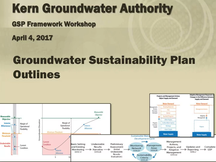
Kern ern Grou roundwater Auth thor orit ity GSP Framework W k Worksh shop Apri ril 4 4, , 2017 Groundwater Sustainability Plan Outlines Overview Analysis Approach GSP Sections Overview Umbrella/Chapter GSP Outline


slide-1
SLIDE 1

Kern ern Grou roundwater Auth thor

  • rit

ity

GSP Framework W k Worksh shop Apri ril 4 4, , 2017

Groundwater Sustainability Plan Outlines

slide-2
SLIDE 2

Overview

  • Analysis Approach
  • GSP Sections Overview
  • Umbrella/Chapter GSP Outline

Comparison Overview

  • GSP Development Process
  • Basin Settings
  • Next Steps
slide-3
SLIDE 3

Analysis Approach

  • Approved regulations
  • Excel version
  • Diagram Development
  • Detailed Outlines
  • Chapter and Umbrella

Outlines

slide-4
SLIDE 4

GSP Sections

  • Introduction
  • Basin Setting
  • Sustainability Goal
  • Monitoring Networks
  • Minimum Thresholds, Measurable

Objectives, and Interim Milestones

  • Water Supply Accounting
  • Projects, Management Actions, Adaptive

Management

  • GSP Reporting
slide-5
SLIDE 5

GSP Section: I ntroduction

  • GSP implementation costs
  • GSP funding plan
  • Description of plan area

– 8 maps – Document surface conditions

  • General plans summary
  • ID and describe GSP effects on parties in basin
  • Outreach/stakeholder communication

compilation

slide-6
SLIDE 6

GSP Section: Basin Setting

  • Data management system
  • Hydrogeologic conceptual model

– Principal aquifers and aquitards

  • Parameters and boundaries/extents

– 6 more maps, cross sections, basin boundaries

  • Groundwater conditions

– Contour maps – Change in storage – Hydrographs – Seawater intrusion maps/xsection – More maps (WQ, subsidence, SW systems, ecosystems) – Timing and quantity of stream depletions

slide-7
SLIDE 7

GSP Section: Basin Setting

  • Water budget

– 20 years historical

  • ET data (satellite)
  • Pumping data (estimated)
  • SW components

– Sustainable yield – Change in storage – Numerical model

  • Data projections (SW supply, land use, etc)
  • Forecast climate change?
  • Calibration
  • SW/GW interaction
  • 50 years projected
slide-8
SLIDE 8

GSP Section: Basin Setting

  • Existing monitoring

– Programs – Data collection – Suitability for SGMA – Levels, WQ, subsidence – Into DMS

  • Management areas

– Begin to ID

slide-9
SLIDE 9

GSP Section: Undesirable Results

  • Undesirable result narrative

– Programmatic language – Stakeholder outreach

  • Agencies
  • Public
  • Landowners

– Stakeholder education – Evaluation of occurrence – Evaluation of affect on beneficial uses

slide-10
SLIDE 10

GSP Section: Monitoring Networks

  • Develop representative monitoring

– Justification

  • Monitor for each aquifer in basin:

– Spatial density, frequency, maps, protocols

  • Data gaps and plan to fill
  • Summaries
  • Data management
slide-11
SLIDE 11

GSP Section: Thresholds

Example Diagram

slide-12
SLIDE 12

GSP Section: Thresholds

  • Representative monitoring (again)
  • Methodology for thresholds
  • Measurable objectives, minimum thresholds,

and interim milestones that cover

  • Graphs with thresholds for each key

monitoring point

  • Maps and tables
slide-13
SLIDE 13

GSP Section: Water Supply Accounting

  • Water accounting framework

– Development – Updates – Accounting

  • By agency and/or by landowner
  • Allocation strategy

– How the sustainable yield ‘pie’ is divvied up

slide-14
SLIDE 14

GSP Chapter:

Projects, Management Actions, and Adaptive Management

slide-15
SLIDE 15

GSP Section:

Projects, Management Actions and Adaptive Management

  • Management program

– Document development of projects – Analyze affect of projects/MAs/AMAs

  • Projects
  • Management actions
  • Adaptive management

– Quantifiable trigger points

slide-16
SLIDE 16

GSP Section:

Projects, Management Actions and Adaptive Management

  • Document for each project, MA, or AMA

– Outreach – Permitting – Benefits explanation – Source of water if used – Legal authority – Costs and funding – Addressing uncertainty – CEQA considerations

slide-17
SLIDE 17

GSP Section: Reporting

  • ID annual report content
  • ID 5 year evaluation content
  • Develop plan to prepare reports
  • Data management plan
  • Monitoring network updates
  • GW model updates?
slide-18
SLIDE 18

Umbrella/ Chapter Outlines

slide-19
SLIDE 19

Umbrella/ Chapter Outlines

  • Regional Scale

– Basinwide – KGA Area

  • Summaries
  • Guidance

Umbrella Chapter

  • Chapter Scale

– District / GSA

  • Local Detail
slide-20
SLIDE 20

Umbrella/ Chapter Outlines

  • Introduction

– KGA Info – Plan Area

  • Basin Setting

– HCM – GW Conditions – Water Budget – Regional Existing Monitoring – Management Areas – Allocations

Umbrella Chapter

  • Introduction

– Chapter Agency Info – Plan Area

  • Basin Setting

– Reference to Umbrella

  • Local refinement as needed

– Local Existing Monitoring – Local Management Areas – Local Allocation

Detail Refinement

Basin Setting

slide-21
SLIDE 21

Umbrella/ Chapter Outlines

  • Sustainability Goal

and Undesirable Results

– Goal – UR Narrative – Summary of Preliminary Evaluations

Umbrella Chapter

  • Sustainability Goal

and Undesirable Results

– Preliminary Evaluation

Guidance Detail

Undesirable Results

slide-22
SLIDE 22

Umbrella/ Chapter Outlines

– Objectives and Rationales – Standards and Protocols – Frequency / Density – Data Gaps

Umbrella Chapter

– Levels/Storage/Subs/ WQ/Seawater/SW- GW – Representative Monitoring – Monitoring Sites and Details (Grid)

Guidance Detail

Monitoring Networks

slide-23
SLIDE 23

Umbrella/ Chapter Outlines

  • General Guidance

and Limitations

  • Summary of Chapters
  • Review of Effects

between MAs Umbrella Chapter

  • Set for

Levels/Storage/Subs/WQ /Seawater/SW-GW

  • Representative

Thresholds

  • Consider Effects

between MAs Minimum Thresholds, Measurable Objectives, and Interim Milestones

Guidance and Summary Detail

slide-24
SLIDE 24

Umbrella/ Chapter Outlines

  • General Guidance and

Limitations

  • Summary of Chapters
  • How Actions achieve

Sustainability in Basin

  • Regional Actions

Umbrella Chapter

  • Detailed Description for

each

  • Project
  • Management Action
  • Adaptive Management

– How Actions achieve sustainability in Chapter

Guidance and Summary Detail

Projects, Management Actions, and Adaptive Management

slide-25
SLIDE 25

GSP Development Process

Need to know first Then Basin-Wide

slide-26
SLIDE 26

Basin Settings

slide-27
SLIDE 27

Basin Settings

  • Hydrogeologic Conceptual Model

– Describes physical framework that groundwater moves within

  • Geologic Formations
  • Barriers to Flow
  • Aquifer parameters
slide-28
SLIDE 28

Basin Settings

  • Groundwater Conditions

– Describes/shows how water moves within the framework

  • GW elevation,
  • GW flow directions,
  • GW gradients,
  • GW changes over time
  • GWQ/Salinity
  • Connection to SW
slide-29
SLIDE 29

Basin Settings

  • Water Budget

– Describes/shows the amounts of water

  • SW
  • GW
  • Precipitation
  • Extraction
  • Uses
  • ET
  • Historic/Current/Future
slide-30
SLIDE 30

Basin Settings

Basin Settings Hydrogeologic Conceptual Model Groundwater Conditions Water Budget Historic and Current Water Budget Numeric Model Forecast Water Budget SW/GW Interaction Underflows

slide-31
SLIDE 31

Basin Settings Process

  • Collect best data
  • Build database of data (DMS)
  • Hydrogeologic Conceptual Model
  • GW Data/trends (Conditions)
  • Create generalized Water Budget

(20 years historic/current)

  • Add Data to C2VSIM GW Model
  • Recalibrate? (unclear) then use to

– Underflows – SW/GW Interaction – Forecast Water Budget

  • Use model outputs to complete

Water Budget

Used to populate and calibrate model

slide-32
SLIDE 32

Next Steps

  • Late April / Early May workshops

for other GSP sections

  • Comments