
SLIDE 1
I-15 Gore Hill to Emerson Junction
Corridor Planning Study
Informational Meeting No. 1
1
10-29-2014
I-15 Gore Hill to Emerson Junction Corridor Planning Study - - PowerPoint PPT Presentation
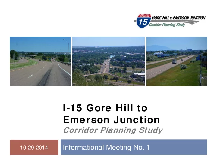
1 I-15 Gore Hill to Emerson Junction Corridor Planning Study Informational Meeting No. 1 10-29-2014 Welcome and Introductions 2 Introductions Partners MDT FHWA City of Great Falls Cascade County Consultant team
1
10-29-2014
Introductions Partners
MDT FHWA City of Great Falls Cascade County
Consultant team
2
3
Title VI considerations What is a corridor planning study? Study area boundary Study schedule Study background Transportation system Environmental setting Conclusion and next steps
4
5
Corridor planning studies:
Are a “high level scan” Define transportation issues/areas of concern Consider social, economic, and environmental effects at an
Identify cost-effective and feasible strategies Provide a level of analysis that can support informed and
Provide opportunities for early and continuous involvement
6
A corridor planning study is not:
An environmental compliance document A preliminary or final design project A construction or maintenance project A right-of-way acquisition project
7
Engage constituents early and often! Identify potential impacts and constraints Identify needs and objectives Identify short-range and long-range improvements Develop planning level cost estimates Develop information and data to be forwarded into
Interstate 15
South of Gore Hill North of Emerson
Interstate 315 10th Avenue South
West of Missouri
9
I-15 RP 276.8 I-15 RP 284.3 10th Ave S. RP 95
10
We are here
Two informational
October 29, 2014 Spring, 2015 Outreach to interested
Study newsletters Website
http://mdt.mt.gov/pubinvolve/i15
Other as needed
11
Great Falls Air National
Malmstrom Air Force
Great Falls International
Great Falls Policy
Great Falls
Great Falls Northern
Others as Requested
12
Review past, current, and
Great Falls Area Long Range
Cascade County Growth Policy
City of Great Falls Growth
Great Falls International Airport
Great Falls Transit
13
14
Emerson Junction to Manchester
Major rehabilitation of I-15 beginning at RP
Bridge Preservation, Great Falls IM
Bridge deck preservation on I-15 and I-315 at RP
Interstate 15
65 mph speed limit 4 interchanges
Interstate 315
55 - 45 mph speed
1 interchange Ends at Fox Farm Rd
10th Ave S
West of Missouri River 45 mph speed limit
16
Land Use
Private and public Mix of urban and rural
Railroad
Interstate crosses
Airport
Great Falls
Accessed primarily by
17
18 Location Feature Crossed Year Built Width (ft) Length (ft) Structure Condition Deck Condition I-15 RP 279.35 (NB) Sun River 1966 28(a) 485 Good Good RP 279.35 (SB) Sun River 1966 28(a) 485 Good Good RP 279.47 (NB) 5th Ave SW 1967 37(a) 125 Good Good RP 279.47 (SB) 5th Ave SW 1967 37(a) 125 Good Good RP 281.91 (NB) Vaughn Rd / BNSF RR 1967 28(a) 354 Good Fair-1 RP 281.91 (SB) Vaughn Rd / BNSF RR 1967 28(a) 359 Good Fair-1 RP 283.6 Access Rd 1960 126 18 Good Good I-315 RP 0.01 I-15 1967 45 294 Good Fair-1 RP 0.34 (EB) 14th St SW 1967 36(a) 150 Good Fair-2 RP 0.34 (WB) 14th St SW 1967 45 145 Good Fair-1 RP 0.34 (EB Off) 14th St SW 1997 23 136 Good Good RP 1.06 (EB) BNSF RR 1946 45 178 Good Fair-2 RP 1.06 (WB) BNSF RR 1967 37(a) 208 Good Fair-2 RP 1.06 (WB Off) BNSF RR 1996 23 186 Good Good Central Ave RP 0.16 (EB) BNSF RR 1967 27 551 Good Fair-1 RP 0.16 (WB) BNSF RR 1967 27 551 Good Fair-1 10th Ave S RP 94.61 (EB) Missouri River 1983 40 2122 Good Fair-1 RP 94.61 (WB) Missouri River 1951 28 2093 Good Good Source: MDT Bridge Management System, 2014
(a) Width less than 38 feet on the Interstate System
19
6,370 14,670 10,550 5,950 9,090 15,140 24,680
20
29,800 12,514 7,746 6,530 4,555 6,640 8,360
21 Location 2013 AADT 1994-2013 2000-2013 2007-2013 I-15 S of Gore Hill 6,370 1.4% 0.4% 0.1% I-15 N of Gore Hill 14,670 1.6% 1.3%
I-15 N of 10th Ave 10,550 1.5% 1.3% 0.3% I-15 N of Central Ave 5,950 1.2% 0.5%
I-15 N of Emerson 9,090 0.9% 0.1%
I-315 W of 14th St SW 15,140
(a) (a)
0.8% I-315 W of Fox Farm 24,680 4.2% 1.8% 0.1% 31st St SW S of Interchange 8,360 5.6% 4.7%
Airport Dr N of Interchange 3,640
0.7% 2.3% 10th Ave S Warden Bridge 29,800 1.5% 1.5% 0.4% Central Ave E of Interchange 12,514 0.0% 0.5% 3.0% Central Ave W of Interchange 7,746 0.6% 1.5% 4.4% Vaughn Rd E of Interchange 6,530 0.0%
1.5% Vaughn Rd W of Interchange 4,555 0.4% 0.7% 7.4% Source: MDT Data and Statistics Bureau, Traffic Data Collection Section, 2014
(a) Data unavailable
22 Location 2013 AADT Traffic Model Projected AAGR (a) 2035 Projected AADT I-15 S of Gore Hill 6,370 0.9% 7,681 I-15 N of Gore Hill 14,670 1.9% 22,358 I-15 N of 10th Ave 10,550 2.1% 16,693 I-15 N of Central Ave 5,950 0.6% 6,804 I-15 N of Emerson 9,090 0.9% 10,998 I-315 W of 14th St SW 15,140 0.8% 17,979 I-315 W of Fox Farm 24,680 0.7% 28,546 31st St SW S of Interchange 8,360 2.3% 13,678 Airport Dr N of Interchange 3,640 4.6% 9,887 10th Ave S Warden Bridge 29,800 0.7% 34,630 Central Ave E of Interchange 12,514 2.4% 21,270 Central Ave W of Interchange 7,746 0.1% 7,974 Vaughn Rd E of Interchange 6,530 1.4% 8,835 Vaughn Rd W of Interchange 4,555 1.1% 5,762
(a) Average Annual Growth Rates calculated from traffic model developed for Great Falls Area LRTP
23
Mainline traffic meets LOS
One vertical grade does not
Two horizontal curves do not
Radius Two vertical curves do not
Curvature Stopping sight distance
Interchange traffic meets LOS
performance standards
7 of 8 on-ramps do not appear to
meet current standards
Acceleration length
3 of 7 off-ramps do not appear to
meet current standards
Deceleration length
Spacing between 10th Ave S and
14th St SW does not appear to meet current interchange spacing standards
24
Six intersections do not
currently meet LOS performance standards
One additional projected to not
meet standards for traffic
Three intersections do not
appear to meet current standards
Queue length Turn-bay length
25
5 years of data 525 total reported
Four fatalities Eight crashes produced
incapacitating injuries
53% multi-vehicle crashes 14% involved alcohol and/or
drugs
Most common types were
rear-end and fixed object
26
28
Aggressive Driving
29
14th St Exit – RV
30
14th St Entrance – Difficulty Merging
31
14th St On Ramp – No Available Gap
Land Ownership Soil Resources and
Geologic Resources Water Resources Wetlands Floodplains and
Hazardous Substances Air Quality Noise Visual Resources Biological Resources Vegetation Cultural and
Social
33
Based on Natural
Prime if irrigated farmlands
are found between RP 278.8-279.0 and 280.5- 284.3
Farmlands of statewide
importance are found between RP 266.8-278.0, 279.5-280.5, and 282.5- 284.3
34
Numerous drainage
Bridge across Sun
Steel drainage culvert
Wetlands - delineated
35
Avoid adverse
36
Landscape
Visual Integrity Scenic Integrity Landscape visibility
37
Fish and Wildlife Vegetation
38
Canada Lynx
Threatened
Red Knot
Proposed
Wolverine*
Proposed
Sprague’s Pipit
Candidate
Whitebark Pine
Candidate No record of any
No species of concern
39
Cascade County Study Area
(a)Montana Natural Heritage Program - Natural
Heritage Map Viewer (report generated May 15, 2014) *No longer proposed for listing
Missouri and Sun
Common fish species
Brown trout Longnose sucker Longnose dace Stonecat Walleye White sucker
40
41
Parks
Westside Viaduct
West Hill Park
Historic
Missouri River
At least 33 historic
Bridges
Bridges with narrow widths
Mainline Interstate
Existing geometrics
Interchanges
Ramp length
Spacing
Intersections
Traffic operation
Queue lengths
Safety
Four fatal, eight incapacitating injury
Fix object collision trend
Physical Environment
Farmlands
Water resources
Parks & historic properties
Biological Environment
Threatened and endangered species
43
44
Continue study coordination and outreach Finalize Environmental Scan Finalize Existing and Projected Conditions
Continue analysis of transportation needs Identify potential improvement options Draft corridor study report
45
Questions, answers and/or
Study website:
http://www.mdt.mt.gov/pubinvolve/i15
Study newsletters: Study Contact
Corrina Collins MT Department of Transportation 2701 Prospect Avenue Helena, Montana 59620-1001 P.O. Box 201001 (406) 444-9131 ccollins@mt.gov