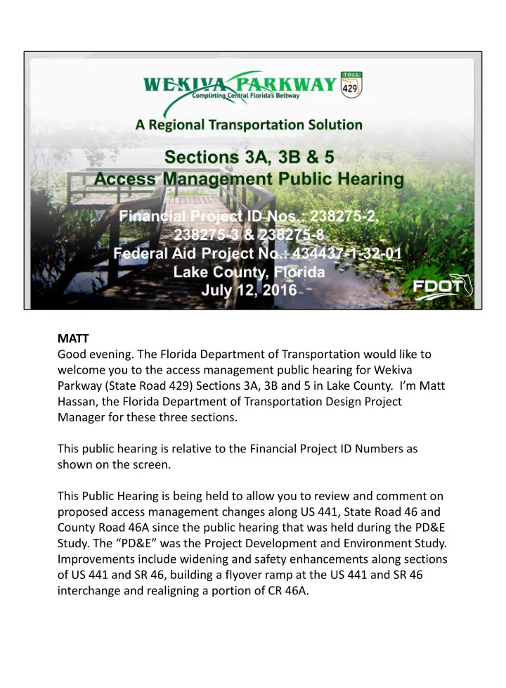
SLIDE 1 MATT Good evening. The Florida Department of Transportation would like to welcome you to the access management public hearing for Wekiva Parkway (State Road 429) Sections 3A, 3B and 5 in Lake County. I’m Matt Hassan, the Florida Department of Transportation Design Project Manager for these three sections. This public hearing is relative to the Financial Project ID Numbers as shown on the screen. This Public Hearing is being held to allow you to review and comment on proposed access management changes along US 441, State Road 46 and County Road 46A since the public hearing that was held during the PD&E
- Study. The “PD&E” was the Project Development and Environment Study.
Improvements include widening and safety enhancements along sections
- f US 441 and SR 46, building a flyover ramp at the US 441 and SR 46
interchange and realigning a portion of CR 46A.
1
SLIDE 2
MATT This hearing is being held to allow persons the opportunity to express their views related to the proposed access management changes on Wekiva Parkway Sections 3A, 3B and 5. The purpose of this public hearing is to share information with the general public about the proposed improvements. This public hearing also serves as an official forum to give you the opportunity to express your opinions and concerns about this project. At the end of this presentation there will be a brief break; and then attendees will have an opportunity to make a verbal public statement about the project. Please feel free to look at the display boards and ask questions or discuss the project with FDOT staff and other members of the project team during the break or after the presentation.
2
SLIDE 3 MATT This hearing presentation will include:
- Introductions of the project team and any attending elected and appointed
- fficials, and agency representatives,
- An overview of the project,
- A description of the proposed improvements for the three sections, and
- The project schedule
This hearing is being recorded by a Court Reporter. All oral proceedings will be included in the Public Hearing Transcript and will become part of the project’s
Please hold all questions until the public testimony period at the end. Be sure to fill out a speaker card. We will not be able to answer questions during the hearing. We will respond to all questions and comments in writing after the 10-day comment period. At the conclusion of the presentation, there will be a 10-minute break. During the break, you may request a speaker card or discuss the project with members of the project team. After the break, attendees who completed a speaker’s card will be given an opportunity to speak into a microphone to provide their testimonies regarding the project. Speaker cards are available at the sign-in table or will be distributed to additional attendees who wish to make a verbal statement.
3
SLIDE 4 MATT I would like to introduce members of the project teams
- Section 3A Consultant Project Manager – Frank Caruso with
Lochrane Engineering
- Section 3B Consultant Project Manager – Rick Rocktoff with Moffatt
& Nichol
- Section 5 Consultant Deputy Project Manager Rodger Schmidt with
CDM Smith
- Public Involvement Coordinator Mary Brooks, with QCA
- And there’s also a Court Reporter here from Milestone Reporting
At this time, we would like to recognize the following federal, state, county, or city officials who have signed in this evening.
- (Note: PIO staff will have provided the officials’ sign-in sheet for
reference prior to starting the presentation). Are there any other officials or agency representatives who would like to be recognized? If so, please stand and introduce yourself. ]
4
SLIDE 5
MARY
The Florida Department of Transportation complies with various non- discrimination laws and regulations, including Title VI of the Civil Rights Act of 1964. This hearing is being conducted without regard to race, color, national origin, age, sex, religion, disability or family status. Persons wishing to express their concerns relative to FDOT compliance with Title VI may do so by contacting the Department personnel shown here. Inquiries or complaints will be handled according to FDOT procedure and in a prompt and courteous manner.
5
SLIDE 6
MARY The Florida Department of Transportation is conducting this public hearing concerning the proposed median modifications and roadway improvements to Wekiva Parkway Sections 3A, 3B & 5 … in the City of Mount Dora and unincorporated Lake County, Florida … in compliance with Chapter 335; Section 199, Chapter 339; Section 155; and Chapter 120.525 Florida Statutes. This hearing is being held to afford persons the opportunity to express their views relative to the proposed roadway and access management changes.
6
SLIDE 7
MARY: This public hearing was advertised as follows: Display ads ran in the Orlando Sentinel Lake County Edition on June 26 and July 3, and in the Leesburg Daily Commercial on June 27 and July 5. An ad was published in the Florida Administrative Register on June 13. Notification letters were emailed to local officials and agencies on May 27. Letters were mailed to property owners within 500 feet of the project right of way on June 2. Notices were hand-delivered to businesses located directly along the project corridor on July 8. Notice also was posted on the FDOT public meeting website at www.dot.state.fl.us … at www.wekivaparkway.com …. And at www.cflroads.com
7
SLIDE 8
MARY So we’d like to give a brief project overview before getting into the section details.
8
SLIDE 9 MARY The Wekiva Parkway will complete Central Florida’s beltway, while helping to reduce congestion and enhance safety on other state and local
- roads. The parkway is one of three legacy projects currently underway in
the region, the others being SunRail and I-4 Ultimate. The Wekiva Parkway will provide travel alternatives in the short term, and mobility
- ptions for future generations to come.
9
SLIDE 10 MARY: The $1.6 Billion Wekiva Parkway – a new 25-mile toll road – being developed by the Florida Department of Transportation and the Central Florida Expressway Authority. The Florida’s Turnpike Enterprise will collect the tolls on the FDOT sections. The parkway will include a number of non-toll road improvements:
- Widening about 7 miles of SR 46
- Rebuilding the US 441/SR 46 interchange in Mount Dora
- Moving part of CR 46A out of the Seminole State Forest so
wildlife can move safely between habitats
- And building parallel, non-tolled service roads for local travel
The Department also will be including a multi-use trail along much
- f its portion of the parkway.
The parkway is expected to help spur significant economic development, including creating nearly 36,000 jobs, both directly and indirectly, during design and construction.
10
SLIDE 11
MARY: The Wekiva Parkway represents a unique transportation solution that also helps to protect wildlife and other natural resources in the Wekiva River Basin. The agencies have diligently adhered to the 2004 Wekiva Parkway and Protection Act, … including buying 3,400 acres of land for conservation and planning four substantial wildlife bridges. The parkway will have a minimal number of interchanges. The idea is to reduce the amount of related development in this environmentally sensitive area.
11
SLIDE 12
MARY: The Florida Department of Transportation is developing a trail that will parallel about 10 miles of the Wekiva Parkway. Here you can see a cross section or “sliced” view of the bridge. The trail is being designed concurrently with the parkway on sections 5, 6 and 7A. The Department in 2017 is scheduled to begin building a trail that will roughly parallel Sections 4A and 4B, which opened on January 20, 2016. Once complete the parkway trail will connect to future extensions of the West Orange and Seminole Wekiva trails, as well as connect to the new Lake-Wekiva trail planned by Lake County.
12
SLIDE 13
MARY: The Wekiva Parkway is the first expressway in Central Florida to feature All Electronic Tolling. There are no toll plazas – you do not need CASH on the parkway. Both FDOT and CFX are accommodating those who do not have a transponder. All Electronic Tolling – or AET: Enhances safety by eliminating the weaving between different lanes at toll plazas. It also maximizes convenience: Customers pay their tolls at safe highway and ramp speeds, without having to slow down or stop. You can find out more about all electronic tolling on the wekivaparkway.com website.
13
SLIDE 14 MARY: As shown here, the Wekiva Parkway consists of 14 project sections. The sections are split between CFX - shown in purple - and the FDOT – shown in green - for design, construction, operation and maintenance. This map – and all of the exhibits in tonight’s presentation - can be found
- n the www.wekivaparkway.com website.
The map on the home page is interactive – click on the section flag to get more information about the location of greatest interest. You can see here the year in which each section is scheduled to be open to traffic.
14
SLIDE 15 MARY: To learn more about the overall project, log onto www.wekivaparkway.com. You can find the maps in this presentation and
- ther helpful information on the project website.
You’re also welcome to contact me as the Public Involvement Coordinator as noted here. And you can follow the Wekiva Parkway on Facebook and twitter for real- time updates.
15
SLIDE 16
MARY: The focus of tonight’s meeting is to review the latest access management changes for Wekiva Parkway Sections 3A, 3B and 5. We want to take a few moments to explain what access management is, and how it affects your travel along state roads and to adjacent properties.
16
SLIDE 17
MARY: Access Management is the planning and control of the location, spacing, design and operation of driveways, median openings and street connections to a roadway. Access Management designates where and how vehicles enter and exit a roadway, helps protect public investment in roadways and improves public safety by preserving mobility, reducing delays and minimizing crashes.
17
SLIDE 18 MARY: By following access management principles we can:
- Limit the number of conflict points on a roadway,
- Separate the conflict points,
- Reduce or remove the number of vehicles that turn or cross the lanes
- f traffic,
- Remove excessive vehicle stacking from the lanes of traffic,
- Improve safety, and
- Improve roadway capacity.
18
SLIDE 19 MARY: Conflict points are locations along a roadway where the paths of two vehicles can legally
- cross. Each conflict point is a location that has the potential for a crash.
A goal of this project is to improve safety on SR 46, US 441 and CR 46A. One way to achieve this goal is to limit the number of conflict points by constructing directional median openings. The graphic on the left shows a full median opening, with 18 potential conflict points. The graphic on the right shows a single, directional median opening. Some locations may have bi-directional median openings, where vehicles on the through road can turn left from either direction, but vehicles from a driveway or cross street cannot turn left. This will restrict the number of lanes vehicles can cross. That in turn will eliminate conflict points, increase safety along the roadway, and reduce traffic delays.
19
SLIDE 20
MARY: The location of median openings, and the type of opening, are based on roadway classifications and minimum separation or spacing standards. The standards used by the Florida Department of Transportation provide the optimal balance between access and mobility. This graphic shows the allowed movement in green … and the prohibited movement in red. U-turns are often much safer than direct left turns, especially on high volume, high speed, or congested roadways. They have also been shown to reduce the potential for accidents. Research on the safety of U-turns indicates that crashes causing injuries or fatalities are reduced by 27% and total crash rates are reduced by 18% through encouraging right turns followed by U-turns, compared to direct left turns. Without access management, businesses can be hurt by congested, high collision roadways near their entrance. In Central and South Florida, studies have shown that the majority of corridor business operators saw an increase or no change in their customer traffic. 20
SLIDE 21
MARY: The Department’s Access Management standards are intended to provide the optimal balance between access and mobility. By improving access management, this will likely have a positive impact on safety by reducing the number of conflict points. This reduces the number of crashes and injuries, … helps to improve traffic flow, … and ultimately shortens travel times within the project corridor.
21
SLIDE 22
MARY: For more information on access management visit www.dot.state.fl.us. Type Access Management in the search box at the upper right hand corner of the site home page. Scroll down the page to the Access Management Brochure. Click on the text link or headline to download the brochure.
22
SLIDE 23
MARY So let’s look at the proposed improvements, starting with Section 3A. Consultant Design Project Manager Frank Caruso will now provide some information on this section.
23
SLIDE 24
FRANK Sections 3A and 3B are non-tolled improvements that include widening portions of US 441 and State Road 46 to six lanes. On the left is the typical section for US 441, with the right of way varying in width from a minimum of 200 feet. There will be five-foot sidewalks, curb and gutters and a shoulder “slash /” bike lane. There will be six, 12- foot lanes and a 17-foot median on US 441. On the right the typical section for SR 46 shows the right of way varying, with a minimum width of 180 feet. There will be five-foot sidewalks, curb and gutter and a seven-foot bike lane. There will be six, 11-foot lanes and a 20-foot median on SR 46. Design on these two sections is at 100 percent. Right of way acquisition is underway. These two sections will be built at the same time. The Department is scheduled to bid out the work next year in April, with contractor selection scheduled for June. Work is to start in the fall of 2017.
24
SLIDE 25 FRANK Section 3A will run along SR 46 from east of Vista View Lane (just off the left side of the map) to just east of Round Lake Road (toward the right of the map). This section involves widening to six lanes, and adding bike lanes, sidewalks and medians to enhance safety. This project includes building a closed drainage system with curb and
- gutter. In coordination with the Central Florida Expressway Authority
(CFX), runoff from Section 3A will flow to a joint-use pond on CFX’s adjacent Section 2C. You can see the joint use pond – which will be “curvilinear” or naturally shaped, and landscaped – on the right of this
- map. By using this joint pond, the Department was able to avoid taking a
family well digging business and a number of residences. We also will be widening Round Lake Road at the SR 46 intersection, and upgrading the traffic signal in this location.
25
SLIDE 26 FRANK: This slide shows three views of Section 3A with regard to the access
- management. The top photo shows the existing two-lane segment of roadway.
(CLICK highlight OFF) (CLICK 2nd highlight ON) The middle image shows the access management that was proposed at the public hearing for the Project Development and Environment – or PD&E – Study. (CLICK highlight OFF) (DOUBLE CLICK 3rd highlight ON) The third image is the current access management plan. There are no access management changes on this section between what was proposed during the PD&E Study, and what is currently proposed in the Section 3A design. The different types of median openings planned, and their locations, also are shown here: FULL at Buttercup and Norton Lanes, DIRECTIONAL at approximately station 115 And a BI-DIRECTIONAL opening at Suneagle Drive.
26
SLIDE 27
FRANK Now we will review the project details and access management plan for Section 3B. Consultant Design Project Manager Rick Rocktoff will speak about this section.
27
SLIDE 28 RICK The top image here shows the limits of Section 3B along US 441: from south of Robie Avenue on the south end, to north of Natoma Boulevard on the north
- end. The bottom image shows the profile, or changes in the ground level along
this stretch. This section includes an at-grade, signalized intersection at US 441 and SR 46. A flyover bridge will provide free-flowing movement from southbound US 441 to eastbound SR 46 heading toward the parkway. In the lower left corner is the City Water Treatment Plant; the access here will be moved from SR 46 to US 441. There is also a Joint Use Pond on the water treatment plant site to be shared by the City and the Department. There has been extensive community coordination on the design of this
- intersection. The goal of this concept is to minimize the profile of this
intersection to fit the small town feel of the City of Mount Dora. As a result, the flyover ramp will be only about five feet higher than the current US 441
- verpass. Also US 441 will be below existing ground level in this location.
28
SLIDE 29 RICK This slide shows three views of US 441 on Section 3B with regard to the access
- management. (CLICK highlight ON)
The top photo shows the existing four-lane segment of roadway. (CLICK 1st highlight OFF) (CLICK 2nd highlight ON) The middle image shows the access management that was proposed at the public hearing for the PD&E Study. Please note the limits along US 441 for this project have been extended on both ends since the study. (CLICK 2nd highlight OFF) (CLICK 3rd highlight ON) The bottom image is the current access management plan for US 441. The current design includes the following changes: The existing full median opening has been modified to provide direct access to the Summerbrooke community. The full opening has been divided into two bi- directional openings, with one at the Summerbrooke entrance. The other directional opening at station 474 will allow northbound U-turns. The different types of median openings and their locations are shown here.
29
SLIDE 30
RICK Likewise, here we see the limits for Section 3B along SR 46 up top, from west of US 441 to east of Vista View Lane. Along the bottom of this image you can see the changes in the ground level as you go east along SR 46. Again, SR 46 will be widened to six lanes and will include bike lanes, sidewalks and safety medians. During construction, the plans call for using the existing ramp alignments and temporary pavement to maintain traffic while the existing US 441 bridges and embankment are removed. The Department also is planning aesthetic treatments for the retaining walls, landscaping and other features on this section.
30
SLIDE 31
RICK This slide shows three views of State Road 46 on Section 3B with regard to the access management. (CLICK top highlight ON) The top photo shows the existing two-lane segment of roadway. (CLICK highlight OFF) (CLICK 2nd highlight ON) The middle image shows the access management that was proposed at the public hearing for the PD&E Study. (CLICK highlight OFF) (CLICK 3rd highlight ON) The third image is the current access management plan for SR 46. The current design follows the same access management proposed during the PD&E Study along SR 46. The different types of median openings and their locations are shown here.
31
SLIDE 32
RICK Now we’ll look at the details for Section 5. Consultant Deputy Design Project Manager Rodger Schmidt will bring you up to speed on that section.
32
SLIDE 33
RODGER Section 5 involves realigning part of CR 46A out of the state forest, to reduce collisions between vehicles and wildlife. Construction on Section 5 is currently slated to take place from 2017- 2019. The light blue areas are planned wet retention ponds. The brown areas represent dry retention ponds, which will be dry except after a heavy rainfall. The new alignment will be depressed – or below ground – where it comes closest to the Red Tail community. We will show more details on this in just a moment. A multi-use trail (shown in orange) will be built along the south end of this section. You can also see a trailhead planned by others. The trail will connect to the west with the planned Lake-Wekiva trail … and will continue along the parkway to the east on Sections 6 and part of Section 7A.
33
SLIDE 34 RODGER This typical section shows the realignment of CR 46A will initially be a two-lane, non-tolled connector road. Current traffic projections show the ultimate widening to four lanes will not be needed for more than 20 years under existing conditions. Where the new road comes closest to the Red Tail community, it will be depressed or lowered, to reduce visibility and noise. A vegetative buffer
- f at least 50 feet will be maintained along the outside of the
community’s property line. The initial two lanes will be built farthest from the neighborhood. Lake County will take over operation and maintenance of this realigned section of CR 46A once complete.
34
SLIDE 35
RODGER This typical section shows the south end of Section 5 in the area of Camp Challenge Road. Only two of the ultimate four lanes will be built initially in this area as well. The new, initially two-laned road will be located south of the existing SR 46 (to be renamed Sorrento Avenue). Current traffic projections show it will be more than 20 years before widening to four lanes will be needed. You can also see the multi-use path planned in this area.
35
SLIDE 36
RODGER The top image here shows the existing conditions on this part of CR 46A and within the project area. (CLICK 1st highlight ON). There have been changes in the access management proposed since the PD&E Study. (CLICK 1st highlight OFF). The middle image shows the access management proposed during the PD&E Study. (CLICK 2nd highlight ON). The PD&E Study called for four lanes along this section. There were directional median openings at Sahara Court and Droty Spring Road on the north end of the section. The study alignment of CR 46A also created a T-intersection at SR 46 (which is to be renamed Sorrento Avenue as part of this project). (CLICK 2nd highlight OFF). (CLICK 3rd highlight ON). The bottom image shows the current design. This design features only building the initial two lanes, which will provide full access at Droty Spring Road and Sahara Court on the north end. On the south end, CR 46A will now connect directly to the Section 4B interchange, with SR 46 tee-ing into CR 46A at a new traffic signal.
36
SLIDE 37
MARY Now we’ll update you on the overall project schedule, followed by the schedule for the sections we’re focusing on tonight.
37
SLIDE 38
MARY Here we have the latest overall project schedule, with the red line showing you where we are in this process. Design (shown in orange) is finished for all sections – except for Section 7B in Seminole County. Right of Way acquisition – shown in blue – is under way on the FDOT sections, and should roughly be done by late 2017. The green bars represent construction – with all of the sections scheduled to be open to traffic by late 2021.
38
SLIDE 39
MARY Here’s a breakout of the schedule for Sections 3A, 3B and 5. All of the sections have wrapped up design and are in right of way acquisition. Construction will begin next year on all three of these sections. As noted, Sections 3A and 3B will be built as one project.
39
SLIDE 40 MARY Thank you for taking the time to attend this public hearing. This concludes the project information portion. We will soon start the public testimony period, where you will be able to provide verbal comments. Please be sure to fill out a speaker card if you plan to give public
- testimony. (HOLD UP a speaker card)
There are other ways that you can participate besides giving public
- testimony. You can provide verbal comments to the court reporter.
Comment forms are available at the sign-in table. You can fill out a comment form and drop it in the comments box.
40
SLIDE 41 MARY If you would prefer, you can mail your comment form as shown here and
You also can email your comments to info@wekivaparkway.com Or go to the CFL Roads website at www.cflroads.com and use the “Submit Comments and Questions” link on the project webpage. All comments that are received by Tuesday, July 26, 2016, will become part of the public record for this hearing.
41
SLIDE 42 MARY There will now be a 10-minute break. Please feel free to review the display boards and talk to members of the project team about your questions or
- concerns. You may also speak to the Court Reporter if you would like to make a
public statement without having to speak in front of the whole group. If you wish to make a formal verbal public statement or ask a question for the public record, you will need a speaker card. (HOLD UP a speaker card) Speaker cards are available at the sign-in desk, or you may remain seated, raise your hand, and we will bring you one. Please fill out one of the speaker cards with your name and contact
- information. Names will be called in the order in which the cards are received.
When your name is called, stand up and we will bring you the microphone to provide oral comments. You will be given up to two minutes to speak. Your verbal statements will become part of the official record. All comments received, whether written or verbal, will become part of the
The time is now (state the time) ____ p.m. At this time, we’re going to take a 10-minute break and collect the speaker request cards. The formal statement period will begin after the break.
42
SLIDE 43
43
SLIDE 44
MARY: I would now like to reconvene the public hearing and continue with public testimony. If you are holding a completed speaker card, please give it to a team representative wearing a name tag. If you have not received a speaker request card and wish to speak, please raise your hand so you can receive a card to fill out. Please remember that written statements and exhibits may be presented in lieu of, or in addition to, oral statements. All written material received at this public hearing or postmarked no later than ten (10 ) days following the date of this public hearing, will become a part of the public record for the hearing. Contact information is provided on the comment form. We will not be able to answer questions during the hearing. All questions or comments will be responded to individually in writing at the end of the formal 10-day comment period. We ask that you limit your formal statements to two minutes per person. The two-minute speaker limit may not be extended with unused time from other speakers. If you would like to record a longer comment orally, the court reporter is available to record your comments after this comment period. MATT: We will now call upon those who have turned in speaker’s cards. When your name is called, please stand and we will bring you a microphone so the court reporter will be able to get a complete record of your comments. When you provide testimony, please first state your name and address. If you represent an organization, municipality or other public body, please provide that information as well. (Call on names.)
44
SLIDE 45 MATT (After you have gone through all of the speaker cards:) Does anyone else desire to speak? If you have completed a speaker’s card, please repeat your name and address. If not, state your name and address and complete a speaker’s card after you give your statement for the public record. The verbatim transcript of the hearing’s oral proceedings, together with all written material received as part of the hearing record and all studies, displays and informational material provided at the hearing will be made a part of the project decision-making process. All aforementioned materials will be available at the District Office for public review upon
- request. All of the public hearing materials also will be posted on the
www.wekivaparkway.com website within seven days of the hearing.
45
SLIDE 46
MATT Thank you for attending this public hearing. We appreciate your interest and for providing your input into this project. It is now (state the time). I hereby officially close the public hearing for the Wekiva Parkway Sections 3A, 3B & 5. The record of this hearing will remain open to receive written comments until Tuesday, July 26, 2016. We will respond to all questions and comments in writing after the comment period. Thank you again and have a good evening.
46