GOES-16 Product Quality and Distribution Matthew Seybold, - - PowerPoint PPT Presentation

goes 16 product quality and distribution
SMART_READER_LITE
LIVE PREVIEW

GOES-16 Product Quality and Distribution Matthew Seybold, - - PowerPoint PPT Presentation

GOES-16 Product Quality and Distribution Matthew Seybold, Upper-level vortices over NE U.S. http://rammb.cira.colostate.edu/ramsdis/online/loop_of_the_day/ GOES-R Data Operations Manager and Team Lead NOAA Satellite Conference for Product


slide-1
SLIDE 1

Upper-level vortices over NE U.S.

http://rammb.cira.colostate.edu/ramsdis/online/loop_of_the_day/

Matthew Seybold,

GOES-R Data Operations Manager and Team Lead for Product Readiness & Operations (PRO)

GOES-16 Product Quality and Distribution

NOAA Satellite Conference July, 2017 - New York, NY

slide-2
SLIDE 2

L1b Science Product Validation Status

ABI L1b Product Beta Provisional Full Radiances 2/28/17 6/1/17 6/5/18 GLM L2 Product Lightning:Events, Groups, Flashes 7/5/17 11/1/17 6/5/18 SEISS L1b Products Energetic Heavy Ions 2/10/17 11/1/17 6/1/18 Magnetospheric e-/p+: Low Energy 2/10/17 11/1/17 6/1/18 Magnetospheric e-/p+: High Energy 2/10/17 11/1/17 6/1/18 Solar & Galactic Protons 2/10/17 11/1/17 6/1/18 EXIS L1b Product Solar Flux: EUV 3/23/17 11/2/17 6/1/18 Solar Flux: X-ray Irradiance 3/23/17 11/2/17 6/1/18 SUVI L1b Product Solar EUV Imagery 4/19/17 11/2/17 6/1/18 MAG L1b Product Geomagnetic Field 5/25/17 11/2/17 10/9/18 Full Maturity Beta Maturity Not Validated Provisional Maturity Validation Maturity Levels: 2

slide-3
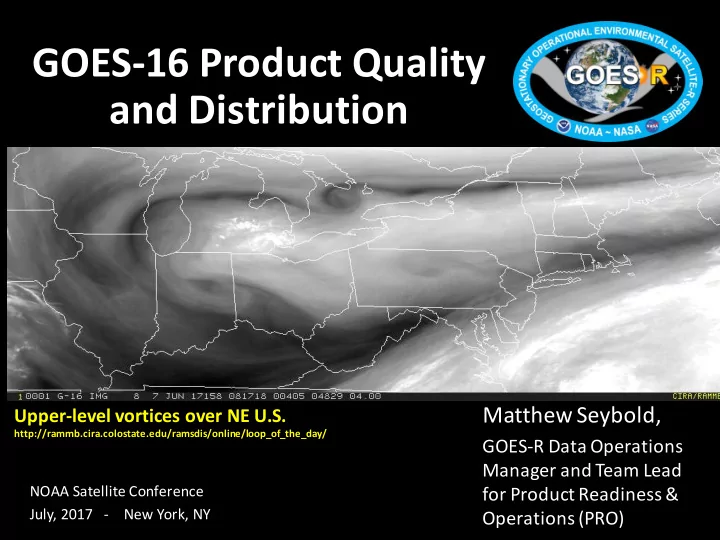
SLIDE 3

L2+ Science Product Validation Status

Full Maturity Beta Maturity Not Validated Provisional Maturity Validation Maturity Levels: ABI L2+ Products Beta Prov Full ABI L2+ Products Beta Prov Full Cloud and Moisture Imagery (CMI) and Sectorized CMI (KPP)

2/28/17 6/1/17 9/3/18

Downward S/W Radiation: Surface

6/23/17 3/16/18 9/3/18

Aerosol Detection (Smoke & Dust)

5/24/17 1/26/18 9/3/18

Fire/Hot Spot Characterization

5/24/17 1/26/18 9/3/18

Aerosol Optical Depth (AOD)

5/24/17 1/26/18 9/3/18

Hurricane Intensity Estimation

9/8/17 12/1/17 9/3/18

Clear Sky Mask

4/19/17 12/1/17 9/3/18

Land Surface Temperature

5/24/17 1/26/18 9/3/18

Cloud Optical Depth

6/8/17 2/23/18 9/3/18

Legacy Vertical Moisture Profile

5/16/17 12/22/17 9/3/18

Cloud Particle Size Distribution

6/8/17 2/23/18 9/3/18

Legacy Vertical Temperature Profile

5/16/17 12/22/17 9/3/18

Cloud Top Height

5/16/17 12/22/17 9/3/18

Rainfall Rate/QPE

8/1/17 TBD 9/3/18

Cloud Top Phase

5/16/17 12/22/17 9/3/18

Reflected S/W Radiation: TOA

6/23/17 3/16/18 9/3/18

Cloud Top Pressure

5/16/17 12/22/17 9/3/18

Sea Surface Temperature

6/14/17 1/26/18 9/3/18

Cloud Top Temperature

5/16/17 12/22/17 9/3/18

Snow Cover

12/30/17* 3/30/18* 9/3/18*

Derived Motion Winds

6/8/17 2/23/18 9/3/18

Total Precipitable Water

5/16/17 12/22/17 9/3/18

Derived Stability Indices

5/16/17 12/22/17 9/3/18

Volcanic Ash: Detection and Height

8/1/17 2/23/18 9/3/18

*Snow Cover has a waiver. It is dependent upon a non-baseline Albedo Product which is in development.

3

slide-4
SLIDE 4

Outline

  • Product Validation Maturity Process
  • Current GOES-16 Data Caveats
  • Product Distribution

4

slide-5
SLIDE 5

Product Validation Maturity Levels Are Determined in “PS-PVR” Reviews

5

  • A Peer Stakeholder - Product Validation Review (PS-PVR) appraises the status of

product quality with respect to GOES-R Program definitions.

  • Outcomes of PS-PVRs:
  • 1. Declares products have achieved a product maturity level (Beta, Prov., Full)
  • 2. Provides guidance on work expected to achieve the next maturity level
  • 3. Plans release of data through product distribution outlets

Instrument Vendor Analysis (L1b) CWG / AWG Analysis Declaration Of Product Maturity Level Product Feedback Forums (ABI L2+, including CMI, GLM L2+) PS-PVR

slide-6
SLIDE 6

Product Maturity Levels

6

What do the three Product Maturity Levels mean? Beta: The product is made available to users to gain familiarity with data formats and parameters. The product has been minimally validated and may still contain significant errors. Provisional: Product analyses are sufficient to communicate product performance to users including documentation of known issues. The product performance has been demonstrated through a large, but still (seasonally or otherwise) limited, number of independent measurements. The analysis is sufficient for limited qualitative determinations of product fitness-for-purpose, and the product is potentially ready for testing operational use. Full: Product is operational. All known product anomalies are resolved and/or documented and shared with the user community.

slide-7
SLIDE 7

Data Caveats - ABI L1b Radiances

Caveats that have been identified and are under analysis. Solutions are in development and testing: 1. Navigation may have errors up to 4 km. 2. Band-to-band co-registration errors may be up to 8 km. Larger errors occur between bands from the three groups of bands (1-6, 7-11, and 12-16 – they are in three different focal plane assemblies [FPA]). 3. Frame-to-frame registration may be unstable, causing features to “jump” in animation. 4. Image striping may occur across all 16 bands. 5. Band 2 radiances are about 7% brighter than comparable polar satellite observations. 6. The infrared (IR) radiance measurements for ABI Scan Mode 3 CONUS and MESO

  • bservations demonstrate an artificial periodicity of 15 minutes. The amplitude is

uniformly small in terms of radiance but can exceed 1 K in terms of brightness temperature for cold scenes. This effect may be larger during some times of day as well as some bands. 7. Stray light exists for Visible and Near IR (VNIR) bands approximately one hour before and after satellite local midnight during the eclipse season before the vernal (spring) equinox and after the autumnal (fall) equinox, and may exist in other days of the year. Total duration of impact is approximately twenty days twice per year. Band 7 experiences residual stray light effects during the same time frames. 8. The VNIR band radiometric calibration may cause frequent but minor discontinuities in radiance values following each solar calibration.

7

slide-8
SLIDE 8

Data Caveats - ABI L2 Cloud & Moisture Imagery

All radiance caveats noted on the prior slide are also valid for CMI. The following also apply for CMI: 1. The maximum reflectance value is currently capped at 1.0 which causes dark patches within high reflectance scenes. 2. There may be artificially cold pixels surrounding hot spots. 3. The multiband files do not have the correct downscaling method listed in the metadata. 4. The kappa0 value reported in the product is inconsistent with the correct kappa0 value applied to the reflectance factors. 5. There are inconsistent data quality flag (DQF) values for off-Earth pixels. 6. On occasion, the start time of a single band file is different from the other bands by 0.1 seconds.

8

slide-9
SLIDE 9

Access Points to GOES-16 Data

9

Direct Readout (requires receiving system) GRB

GOES Rebroadcast (L1b)

HRIT/EMWIN

High Rate Information Transmission/Emergency Managers Weather Information Network (select ABI L2 CMI)

GNC-A

GEONETCast-Americas (select ABI L2 CMI and other ABI L2

  • nce Provisional)

Terrestrial Access (L1b & L2+) PDA

Product Distribution & Access System

  • Operational real-time user subscriptions

CLASS

Comprehensive Large Array-data Stewardship System

  • Request and setup access
slide-10
SLIDE 10

GOES-16 Data in HRIT/EMWIN

Cloud and Moisture Imagery (CMI) Full Disk Imagery

  • 1. Band 2 (0.64um) with 2 km resolution
  • 2. Band 7 (3.9um) with 2 km resolution
  • 3. Band 8 (6.2um) with 2 km resolution
  • 4. Band 9 (6.9um) with 2 km resolution
  • 5. Band 13 (10.3um) with 2 km resolution
  • 6. Band 14 (11.2um) with 2 km resolution
  • 7. Band 15 (12.3um) with 2 km resolution

Plus - Mesoscale for Bands 2,7,8 The frequency is 1694.1 MHz. The data rate is 400 Kbps.

10

slide-11
SLIDE 11

GOES-16 Data in GEONETCast-Americas

Cloud and Moisture Imagery (CMI)

  • 1. Band 2 (0.64um) with 1 km resolution
  • 2. Band 7 (3.9um) with 2 km resolution
  • 3. Band 8 (6.2um) with 2 km resolution
  • 4. Band 9 (6.9um) with 2 km resolution
  • 5. Band 13 (10.3um) with 2 km resolution
  • 6. Band 14 (11.2um) with 2 km resolution
  • 7. Band 15 (12.3um) with 2 km resolution
  • 12 megabit per second broadcast is in place
  • 19 (Non-CMI) ABI L2 products will be added once Provisional
  • Catalog: www.geonetcastamericas.noaa.gov/pubs/section-1/GEONETCast-Americas%20Product%20Catalog%20-%20V20152110.pdf

11

slide-12
SLIDE 12

GOES-R Program Status Review 12 July 7, 2017

Ice in Hudson Bay Impressive resolution even at high latitudes

http://rammb.cira.colostate.edu/ramsdis/online/loop_of_the_day/

slide-13
SLIDE 13

Points of Contact

Matthew.Seybold@noaa.gov GOES-R User Services: Kathryn.Mozer@noaa.gov GOES-16 ABI L2+ Products: Wayne.MacKenzie@noaa.gov Distribution GOES Rebroadcast (GRB): James.McNitt@noaa.gov HRIT/EMWIN: Seth.Clevenstine@noaa.gov GNC-A: Hongming.Qi@noaa.gov GOES-16 data in PDA: Donna.McNamara@noaa.gov GOES-16 data in CLASS: Elizabeth.Kline@noaa.gov GOES-16 Data Caveats: https://www.ncdc.noaa.gov/data- access/satellite-data/goes-r-series-satellites

13