GIPPSLAND ENVIRONMENT GROUP Inc Presentation to Stockman Base Metals - - PDF document

gippsland environment group inc
SMART_READER_LITE
LIVE PREVIEW

GIPPSLAND ENVIRONMENT GROUP Inc Presentation to Stockman Base Metals - - PDF document

GIPPSLAND ENVIRONMENT GROUP Inc Presentation to Stockman Base Metals Project EES Panel Hearing 27 th June 2014 (Part A) 1 Introduction This presentation to the Stockman Project EES Hearing is made on behalf of Gippsland Environment Group Inc


slide-1
SLIDE 1

1

GIPPSLAND ENVIRONMENT GROUP Inc

Presentation to Stockman Base Metals Project EES Panel Hearing 27th June 2014 (Part A)

slide-2
SLIDE 2

2

Introduction This presentation to the Stockman Project EES Hearing is made on behalf of Gippsland Environment Group Inc (GEG) a small community environment group based in Bairnsdale. GEG Inc was incorporated in January 2005 and has approximately 25 members. GEG does not support the development of the Stockman Base Metals Project as outlined in the Environmental Effects Statement (EES) currently before the Panel. In particular, the proposed expansion of the existing tailings dam will pose a severe long-term risk of catastrophic environmental disaster to the Tambo River ecosystem all the way to the Ramsar listed Gippsland Lakes with serious economic and social consequences to the downstream and Gippsland Lakes communities and must not be allowed to proceed. There is no way that the community can be confident that a/the dam wall will not fail at some time in the future, or b/ that 2 metres of water (required to prevent oxidation of the toxic tailings) will be maintained over the tailings for the next thousands of years. To put the Tambo River and valley communities in that level of danger is simply

  • unconscionable. GEG considers that the site of the original Benambra mine works and

tailings dam requires further remediation to avoid ongoing acid seepage and heavy metal contamination of the local environment and downstream river system. Development and expansion of operations at the site by the Stockman project is not the solution to lingering problems at the site, and in fact will increase the risk of environmental catastrophe exponentially. * Expert Witness for GEG Mr Andrew Helps (Hg Recoveries) on 25th June, addressed issues of the long term survivability of tailings dams, the downstream impacts of loss of tailings dam structural integrity and the recent track record of permit condition enforcement by Victorian regulatory agencies. Mr Ian Magee will present further matters in Part B of the GEG general presentation to the Panel on 30th June * Part A - Key concerns: In this section of the presentation GEG will focus on the following key concerns:  Impact of the project on biodiversity  Limited or inadequate baseline data  Inadequate management by regulatory authorities at Benambra mine site  The Victorian Government must remediate the current environmental problems at the site not approve an expanded operation with potential to cause an even greater environmental liability.  Inadequate Community Consultation

slide-3
SLIDE 3

3

Location The Stockman project is located approximately 20km east of Benambra in State Forest at the junction of three bioregions: East Gippsland Uplands, Victorian Alps and Highlands Northern Fall. Tambo River The headwaters of the Tambo River including its tributary Straight Creek flow through the

  • site. A twenty kilometre section of the Tambo River flowing through the project site is a

Streamside Reserve – Natural Features Zone identified by the LCC. The upper reaches of the Tambo River 25kms downstream are a declared water supply catchment accessed by local farmers and provides the town water supply of Swift’s Creek. Native vegetation significance at project site The Stockman Project site is in an area of high biodiversity. In relation to native flora this was initially identified in the late 1980’s during the EES process for the original Benambra Mine Project. The 1987 EES Vegetation Report by Carr et al reported that: An unusually large number of significant species (9.8% of the total flora) were found in the study area. This is a direct function of the high species richness of the study area with its wide range of vegetation communities. The diversity of the vegetation communities is the result of heterogeneous environments provided by strong gradients in altitude, rainfall and soil-water relations as well as varied geology and a dissected

  • topography. (Carr et al 1987: 4.29)

Carr et al (1987: Table 3) identified that compared to vegetation surveys undertaken in nearby areas of comparable size in the Tambo River and adjoining catchments the study area had the highest number of native flora species, highest number of significant species and highest percentage of significant species. The project area was also notable for the numerous orchid1 species occurring there. A total

  • f 43 orchid species and one hybrid were recorded during the 1986 surveys. According to

Carr et al this was an exceptionally large number of orchid species, represented 44.7% of all Alpine orchid species. Carr et al emphasized the significant species richness of orchid flora in the project area and also noted the extremely small and localised natures of the populations found of many species. (1987:4.30).

Impact of the proposal on biodiversity

 Destruction of Rare Montane Swamp Complex Community Background The key native vegetation issue at this site right from the time of the original Benambra mine EES process in 1987-88 was the protection or destruction of the unique montane swamp complex community that had been identified in the headwaters of the upper Tambo River. Significance During the approval process for the development of the original Benambra Mine project in the late 1980’s the project design went through a number of variations after the initial exhibition of the EES in November 1987. In 1988 Macquarie Resources modified the design

1 All orchid species are now protected under the Victorian Flora and Fauna Guarantee Act 1988

slide-4
SLIDE 4

4

  • f its Benambra project but was not required to re-exhibit an EES. The Benambra Project

Modified Project Description proposed to re-locate the site of tailings dam from Souter’s block on private land west of the Tambo River to the site now known as T1 on Straight Creek a tributary on the headwaters of the Tambo River. Further vegetation surveys were carried

  • ut by Carr and McMahon (May 1988) at this site in 23-25 March 1988. Their report

identified that the proposed tailings dam would destroy the largest known example (21 ha) of a rare montane swamp complex community. However, the Carr and McMahon vegetation report (May 1988) for the modified project was not made public until just prior to the EES Hearing in mid-June 1988 (even though it was supposed to be available by April 1988). Only then was it disclosed that the project would result in the loss of a plant community of state [and now national] significance, too late for anyone to comment on it in an EES submission. The Panel Report of the Benambra Project EES Hearing noted that the Modified Project Description “gave the reader the impression that no significant areas would be affected”, (Ministry for Planning and Environment, Sept 1988:72). The Flora and Fauna Guarantee (FFG) Act 1988 had by then been passed but had not been

  • proclaimed. In their submission to the Benambra Project EES the then Department of

Conservation Forests and Lands argued that the montane swamp at the T1 proposed tailings dam site should be protected and noted that had the Act been proclaimed the flora community would be most likely eligible for listing.(quoted in Ministry for Planning and Environment, Sept 1988:53). In 1989 the montane swamp complex was nominated for listing under the Victorian FFG Act. According to the FFG Scientific Advisory Committee2, this was the second nomination to be made out of all the nominations made under the Act to date and the first flora (or fauna) community to be nominated. This flora community has therefore been recognised as of major botanical significance for more than 25 years. Carr and McMahon’s 1988 surveys identified (May 1988: 4.3-4.8) that the montane swamp complex community at the T1 tailings dam site consisted of three scarce sub-communities, which they identified as Montane Swamp Complex Community 1.0 sub-community 1.1, 1.2 & 1.3. In relation to sub-community 1.2 the authors noted (p4.6) that the sub-community had very distinctive vegetation that they had not seen before in the region nor reported in the

  • literature. The “exceptional development of Baeckea utilis” was also regarded as significant.

In relation to sub-community 1.3 they reported that “vegetation of this type has not been reported elsewhere.” (We note that the proposed Dinner Plain offset site does contain Baeckea utilis, among other species) In addition Carr and McMahon reported that nine of the ten significant plant species identified in the study area occurred in the Montane Swamp Complex Community (1988:4.14; Table 4.2), including Montane grass-trigger plant, Kiandra blue-tongue greenhood, Lanky goodenia and rare tea tress species Leptospermum sp. aff juniperinum . However, in December 1988, against the advice of her departmental head and leading botanists, the Minister for Conservation, Forests and Lands, Mrs Kay Setches, approved

2 20 June 2014 Email advice from Martin O’Brien, Executive Officer Flora and Fauna Guarantee Scientific

Advisory Committee.

slide-5
SLIDE 5

5

Maquarie Resources to use the montane swamp complex as a tailings dam. (The Age, 18 Jan 1989) Before mining operations began further investigations into the extent of the montane swamp community were undertaken by Gill Earl. In 1990 Earl investigated four small catchments of the upper Tambo River containing montane swamp vegetation. Her analysis found that the T1 tailings dam site montane swamp complex community was distinguished by 15 characteristic species not shared by other montane swamp sites, indicating a specialised environment (Earl 1990:2). Earl concluded that retention of the T1 site was “integral to the conservation of the Montane Swamp Complex, a botanically significant variant of Montane Swamp vegetation.” (Earl 1990:5) In 1991 the montane swamp complex community was listed under the FFG Act (and in 2009 under the national EPBC Act). The FFG Final Recommendation for listing the Montane Swamp Complex Community (SAC 1991) stated that the largest known example of the vegetation community was the 21 hectare site threatened by the construction of the mine tailings dam and that this site represented 47% of the total area of the community in Victoria. The Final Recommendation also stated that “no similar community had been discovered” and that the proposed tailings dam site was “possibly a distinct sub-community which could be eligible for listing in its own right.” In 1992 Denehurst Pty Ltd began mining operations at the Wilga mine and construction of the tailings dam resulted in the destruction of 19ha of the 21 ha site. (Taranto et al 2004:7) At Victorian State Government level the process of protection has been ineffectual. As mentioned above the ecological community was listed under the FFG Act in 1991 but it wasn’t until 2008 that a draft Action Statement (required by the Act) was circulated for public comment. To date the Action Statement has still not been finalised almost 25 years after the ecological community was listed for protection. In addition despite the fact that the montane swamp complex has been identified and researched by the department’s own employees in the upper Tambo River for more than 20 years, DEPI mapping does not currently identify the ecological community as present. The Montane Swamp Complex community draft FFG Action Statement identified various threats to the survival of the community including changes to groundwater quantity. Water seepage from the west side of the spillway may have been caused by construction of the spillway in 2006 “intersecting the water-table causing water to flow into the spillway, instead

  • f moving through the soil profile beneath the swamp vegetation and into Straight Creek.”

Consequent gradual drying out of the soil would result in changes to the species composition in the montane swamp. The draft Action Statement identifies that the cause of the spillway water seepage3 should be determined and if linked to the groundwater supply needs to be rectified. Instead now the Stockman project proposes to destroy another 0.36 ha of the remaining 2ha

  • f this unique montane swamp community in the expansion of the tailings dam. This is still a

significant area of the most diverse and structurally complex montane swamp complex

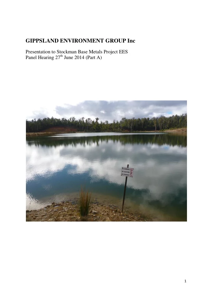
3 See attached photos “Tailings dam spillway seepage #1, & #2”

slide-6
SLIDE 6

6

community known to exist and should be protected. The site is still botanically very important (Cousins 1994:1). Montane swamp offset proposal GEG is opposed to the Stockman Project’s Dinner Plain off-set proposal for the loss of the montane swamp complex on a number of grounds. In 2009 the montane swamp complex ecological community was listed under the national EPBC Act as Alpine Sphagnum Bogs and Associated Fens ecological community. The EPBC Act Conservation Advice for the listing states4 “Ensure that any development or maintenance activities in areas where the Alpine Sphagnum Bogs and Associated Fens ecological community is known to occur do not result in adverse impacts.” The EPBC Act requires that conservation advices be considered when making decisions about approvals. Drowning an area of the ecological community under tailings dam is obviously an adverse impact and completely inconsistent with the Conservation Advice. Therefore GEG considers that proposed offset is inappropriate in the first place. Secondly, the Dinner Plain offset site (owned by the Alpine Shire) only includes a small buffer of protection around the Alpine Sphagnum Bog. (See Ethos NRM Aug 2013: Fig 3), within a much larger unfenced area adjacent to Dinner Plain village. GEG’s understands5 that Trust for Nature was originally engaged to source potential offset sites and recommended a total area of 85 ha to be protected under a Trust for Nature covenant to adequately protect the EPBC listed ecological community within it.(see map attached p7) However Independence Group and the Alpine Shire came to their own arrangements and declined TFN’s advice. GEG asked Trust for Nature to provide information on the protective measures required for Alpine Sphagnum Bogs and Associated Fens. Trust for Nature provided written advice

  • utlining why it was necessary to protect the surrounding vegetation and hydrology in order

to adequately protect the ecological community. (See attached letter dated 17 June 2014). In light of this advice GEG considers that the small offset buffer proposed in the Dinner Plain

  • ffset by Stockman project is insufficient to protect the site in perpetuity.

Finally, the proposed offset site at Dinner Plain owned by the Alpine Shire is used for various recreational activities including horse riding, ski mobiles and bike riding. It is also apparently zoned Special Uses Schedule 2, which may include accommodation and educational facilities. One would assume that if conservation were a high priority for the Alpine Shire then as

  • wner of land containing a nationally endangered vegetation community the Shire would

have already protected the site but they haven’t done so. GEG recommends that much stronger legal protection than a s.173 agreement is required and that instead the whole site is zoned for conservation purposes only.

4 Alpine Sphagnum Bogs and Associated fens ecological community Conservation Advice p2 5 GEG requested a copy of the recommendations prepared by Trust for Nature for Ethos NRM in relation to the

various offset sites they had identified in the area (owned by both the Alpine Shire and a private individual) but both Ethos NRM and Independence Group declined.

slide-7
SLIDE 7

7

slide-8
SLIDE 8

8

 Removal of 70 ha of native vegetation including 600 large old trees. GEG considers that the impact of the Stockman Project on other significant native vegetation is unacceptable. The construction of Currawong Mine & Ore Processing site will result in the removal of approximately 25 ha of native vegetation and 205 large old trees. The expansion

  • f the Tailings dam will result in the loss of 20 ha of native vegetation including 205 large
  • ld trees as well as a number of rare Mountain Banksias.

Currawong processing site This site has a significant number of large old trees with hollows. During visits to the project site it is evident that the area of Montane herb-rich woodland proposed to be cleared is one of few patches of native vegetation with large old trees containing numerous hollows in the

  • area. The southern side of McDougalls Spur Track, the main access road off Nunniong Rd on

the western side of the project area, has been extensively logged. In 2009 a Wildlife Unlimited fauna assessment report identified that the Currawong hill site had valuable habitat that was lacking in the wider landscape (Wildlife Unlimited 2009: 24), specifically large mature trees with hollows which can take more than 150 years to develop. This area supports large numbers of Greater Gliders which were absent from all other sites in the fauna survey. The site provided habitat for Greater Glider and Yellow-bellied Glider which have restrictive habitat requirements. Greater Gliders are known to be sedentary and both foraging habitat and day resting refuge hollows; Yellow-bellied Gliders whilst more wide ranging in search of sap feed trees and winter flowering eucalypt species also require refuge hollows. The site is also prime habitat for large forest owls. Wildlife Unlimited noted that bird activity was higher at the Currawong site than elsewhere and there was a diversity and abundance of reptiles. The report stated (ibid) that “Loss of this habitat could have a significant impact on the fauna at the site, through the potential loss of species (Greater Glider etc), loss of species abundance

  • f more hollow dependent species (bats, arboreal mammals, birds, reptiles) and the effect on

populations of other more widespread species from the loss of quality habitat.” Wildlife Unlimited suggested that that the simplest way to avoid significant loss of habitat at the proposed Currawong site would be in fact to re-locate the proposed processing site elsewhere potentially to the old processing site at Waxlip Spur. The Waxlip Spur site provides poor habitat due to the low success of the revegetation program initiated during the 2006 Benambra mine works site rehabilitation. Whilst the Stockman project has suggested that the site is too small Wildlife Unlimited proposes that the habitat loss caused by additional clearing if required would be less at Waxlip Spur where the habitat values of the surrounding vegetation are likely to less than those at Currawong Hill. Mountain banksia (Banksia canei) There are a number of mountain banksia around the eastern upstream edge of the existing tailings dam in the vicinity of the southern diversion drain, as well as to the west on the low spur between the spillway and the remnant montane swamp in Straight Creek below the dam. The population along the upstream edge of the tailings dam will be destroyed by the expansion of the tailings dam and the other lower population may be detrimentally affected by additional dam works during construction of the dam wall lifts. Carr et al (1987:4.33) considered Banksia canei a ‘key’ species in the vegetation community i.e. it provides a strategic food resource for part of the year, in this case nectar for small mammals such the eastern pygmy-possum and feathertail glider, as well as honeyeaters. According to Carr et al (ibid) Banksia canei is a fire sensitive species and even natural fires can destroy populations without significant regeneration. The authors had observed a very large population of B. canei along Limestone Road near the Cobberas which had been

slide-9
SLIDE 9

9

destroyed by a bushfire in early 1986 which showed no sign of regeneration in December of the same year.

Limited or inadequate baseline data

The Benambra mine tailings dam was constructed on a montane swamp in Straight Creek a tributary of the Tambo River. Straight Creek has its source near the tailings dam and flows into the Tambo River about 4.5kms downstream. There is no baseline water quality data for Straight Creek pre-construction of the tailings dam or prior to the first EPA approved emergency discharge in May 1999. “No historical information exists on water quality of biological health of the Straight Creek as all previous studies concentrated on the Tambo River”. (Australian Water Technology 1999:1.1) A macro-invertebrate monitoring program was undertaken in Straight Creek pre and post- discharge in 1999 for DNRE as part of the discharge approval from EPA but it was not implemented according to appropriate scientific guidelines. There was only one control site upstream and only one sampling event after the discharge, as a result “no definite conclusions about the influence of the discharges on the macroinvertebrates” could be made from the study (Australian Water Technology 1999:4.1.2). The report stated that trace metals such as zinc and lead which were “in high concentrations in both the Tailings dam and Straight Creek can be absorbed by silt and then re-suspended in the water column”(4.1.1). The EPA issued s 30A emergency discharge approvals to the DNRE to discharge water from the tailings dam in 1999, 2000-01, 2002, 2004-5 and 2005. The only discharge approval that designated limits on water quality was in 2005. The EPA discharge approvals required water samples to be taken at a number of downstream sites as well as from the tailings dam discharge water. However from the information supplied to GEG from the EPA there appeared to be only one sample of tailings discharge water quality actually reported. Controlled discharges were also made under DSDBI during the remediation of the dam wall in 2006 and as spills since 2011. Cadmium, copper and zinc in the tailings dam water are all currently above ANZECC freshwater limits (Stockman EES Appendix C7: xviii). How can accurate water quality limits possibly be identified for the Stockman project when there is no baseline data and ongoing discharges of contaminated water have been occurring? Similarly the impact of changed hydrology and water quality in Straight Creek on nearby and downstream threatened flora and on threatened aquatic species such Alpine spiny crayfish is

  • unknown. Surveys for the endangered Alpine spiny crayfish have not been undertaken in

Straight Creek above or below the tailings dam despite their burrows being found further downstream above the confluence with the Tambo River. A biological study of the Tambo River undertaken by Kinhill Engineers in 1988-89 (Kinhill Engineers, Feb 1990) reported elevated trace metals in fish flesh samples. However similar studies undertaken during the 1992-96 period of Benambra mine operations reported that fish flesh and liver samples were taken to be stored should analysis be required but there was no actual data on the analyses provided. So there was no ongoing annual comparison of the potential impact of mining on trace metal levels in fish during the actual period of operations

  • r in the decade afterwards.

Other events have also ‘muddied the water’. A burst pipe at the exploration adit of Wilga mine in 1988 discharged contaminated mine water and sludge into the Tambo (Macquarie

slide-10
SLIDE 10

10

Resources Nov 1991: Appendix 1). And an acid seep (C7:4.5) at the Waxlip Spur processing site post-rehabilitation is likely releasing heavy metal into the Tambo upstream of the key monitoring sites of Wilga weir and Wilga spring.

Inadequate oversight by regulatory authorities of the management of the Benambra mine

 Lack of agency planning for the Benambra mine post-closure The 1987 Benambra mine EES Inquiry Report (Ministry for Planning and Environment, Sept 1988:66-67) expressed astonishment that the two main Departments, the then Department of Industries, Technology and Resources and the then Department of Conservation, Forests and lands, appeared “to have given little thought to the matter” of the “need for on-going monitoring and maintenance after mining and processing operations cease.” The argument seems to have been that no-one would have to worry about until 20 years time when the mine

  • closed. Unfortunately operation ceased after four years.

 Illegal activities occurred under the department’s watch Denehurst dumped tonnes of sulphuric acid into the tailings dam potentially causing an acid change reaction that could have had catastrophic consequences for the downstream ecosystem.  The Benambra mine company (Denehurst) was permitted to commence

  • perations and operate for two years without an EPA works approval permit.

(Ministry for Planning and Environment 1988:87, Austminex August 2001: section1:7)  Emergency discharges from the tailings dam have been permitted since 1999 despite water quality not meeting ANZECC freshwater limits. Denehurst walked away from the Benambra mine in 1996. At least half a dozen controlled emergency discharges have been undertaken since 1999 by DNRE. What is the point of EPA water quality guidelines and discharge approvals when a mining company or government authority can simply apply for an emergency discharge licence whether the water meets standards or not?  DSDBI has made controlled discharges and permitted uncontrolled release from the tailings dam without the oversight of the EPA. DSDBI have made controlled discharges from the tailings dam in 2006 during remediation of the dam and since 2011 uncontrolled spills have been occurring down the spillway. The EPA has not issued discharge approvals to DSDBI for any of the releases that have occurred since

  • 2005. Instead government authorities changed the name of the tailings dam to Lake St

Barbara (Patron Saint of miners), and because it’s now called a ‘lake’ EPA do not have to issue discharge approvals. The public has no idea that this is the case. DSDBI has refused to release any information on those discharges to GEG without an FOI. Why isn’t this information available to the communities downstream and the general public? How can the community have any confidence in the capacity of the regulatory authorities to ensure the Tambo River will not become a contaminated wasteland if the Stockman project is approved?

slide-11
SLIDE 11

11

The Victorian Government has a responsibility to adequately remediate the environmental problems at the site, not approve an even larger potential disaster-in-waiting

After Denehurst went into receivership and walked away from the Benambra project in 1996 a toxic disaster was left behind at the site. Rehabilitation undertaken by DPI in 2006 at the Benambra mine works and tailings dam cost the taxpayer almost $7million dollars. There are still serious environmental problems that have not been rectified. The Waxlip Spur processing site has an acid seep occurring that may be leaking heavy metals into the upper Tambo River above Wilga Weir. Seepage is occurring from the northern abutment of the tailings dam wall into Straight Creek. The tailings dam has elevated levels of cadmium, copper and zinc above ANZECC freshwater limits yet is operating as a flow through system. The groundwater at Wilga mine contains numerous heavy metals above freshwater limits and will inevitably spill into the Tambo River as the mine portal is below original groundwater level. In 2001 Austminex undertook a feasibility study to reopen the Wilga mine and develop Currawong but gave up their option on the licence as the proposal was discovered to be

  • uneconomic. At the time DNRE were keen for Austminex to assume responsibility for post-

closure rehabilitation of the tailings dam (Austminex Nov 2001:283-285). The Stockman project EES (Summary and Conclusion ch21.4) has identified a number of legacy environmental problems that they would rectify if the project is given approval. However it remains the responsibility of the Victorian Government to rectify the problems. Granting approval to Stockman project would enable the government to offload its environmental responsibility in the short term but at the expense of creating an exponentially more dangerous environmental problem in the long-term. Has the Victorian Government provided any financial or regulatory incentive to Stockman Project to develop the project and assume responsibility for the post-closure of the tailings dam? GEG opposes the project and suggests that a much wiser option would be for the Victorian Government to fulfill its responibility to rehabiliate the site to the greatest extent possible and manage the area for conservation purposes.

Inadequate community consultation.

The Stockman project EES was nearly 6000 pages long with extensive technical reports. Many individuals in the community were overwhelmed by the task of reading and comprehending the EES. Most simply did not even begin to look at. At the first step the commuity were excluded. GEG does not have the financial resources necessary to engage a number of Expert Witnesses to either counter the arguments or identify major gaps in the evidence provided by the numerous Expert Witnesses engaged by the proponent. Considering the highly technical nature of the proposal we were surprised that the Hearing Panel does not include someone with a mining engineering background.GEG recommends that an independent advisor with

slide-12
SLIDE 12

12

considerable experience in mining engineering be seconded to the Panel to provide an advisory support role. GEG had been aware for some time that an EES for the Stockman project was being

  • prepared. In 2011 GEG was approached by Ethos NRM advising us to become engaged in the

process, so we registered interest on-line on the Independence Group website but heard nothing more. In July 2012 I came across information on the DPCD website which included the Stockman Project Final Consultation Plan.

http://www.dpcd.vic.gov.au/__data/assets/pdf_file/0019/60436/Stockman-Project-Final- Consultation_Plan-29-3-11.pdf The plan indicated that GEG, Environment East Gippsland

(EEG) and Friends of the Gippsland Lakes (FOGL)were involved. However to my knowledge none of these groups received any contact at all and were certaintly never invited to sit on any community referenece group. When I queried Ethos NRM about it they forwarded my email to John Yeates Manager Approvals and Government Relations for Independence Group stating(email 13 August 2012) that he’d never heard of our group and directed me to their website. GEG was not invited to attend the community reference group then either. I registered once again on the website for updates but in the next 2 years only received one update fact sheet. Which begs the question: how extensive was Independence Group’s community engagement? It certaintly didn’t comply with the published plan? A number of other stakeholder groups also do not seem to have been approached. The Stockman Project EES 2014 is a much more sophisticated document than that prepared for the Benambra Project in 1987. The project also has an exponentially greater level of risk. The project will potentially result in a 45 m high earthern dam wall with a surface area of nearly 35ha containing 7 million tonnes of toxic tailings right on the headwaters of the Tambo River. The tailings dam will operate as a flow through dam post-closure. Has the general community any idea that this will be the case? The local and wider community deserves to be informed about the real risks involved in this project not just the supposed potential economic benefits. Much broader community consulation is required before the Victorian Government proceeds any further with this process. It is not only the Tambo Valley communities but all the downstream Gippsland Lakes communities and East Gippsland inhabitants after all who will have to live with the consequences. Louise Crisp Secretary Gippsland Environment Group Inc 27th June 2014

slide-13
SLIDE 13

13

Tailings dam spillway seepage #1

slide-14
SLIDE 14

14

Tailings dam spillway seepage #2

slide-15
SLIDE 15

15

156 McLeod St Bairnsdale, 3885 0418 561646 robyne@tfn.org.au

June 17, 2014 Dear Louise, Please see below my assessment of the need for buffering vegetation for the long term survival of Alpine Sphagnum Bogs in response to your query. Alpine Sphagnum Bogs and associated Fens Ecological Community The protection of surrounding vegetation is imperative to the long term survival of the Bogs as these ecosystems are inherently linked. Bogs, are often located within the bottom of a small basin catchment. The presence of these Bogs is a result of topography (the basin), aspect and the surrounding vegetation. These conditions create the cold air drainage, temperature and moisture levels that are required for a treeless community to exist such as the Alpine Bogs. These dynamics are fragile and easily disrupted with the clearing of the surrounding trees. Included in the threatening processes listed in the Alpine Sphagnum Bog and Associated Fens Policy 3.16, EPBC listing, is the “....clearing of native vegetation adjacent to the listed community or in the immediate upstream catchment such that drainage regimes supporting the ecological community are affected. ” Any clearing of the surrounding vegetation within this basin catchment will have serious impacts resulting in increases in:  mean ambient temperature  the velocity of surface water runoff  the rate of release of cold air; and  more extreme changes in temperature and flooding events These changes will alter species composition of the Alpine Sphagnum Bogs community leading to the likely succession into heathland or treed communities and the loss of the Bog vegetation

  • community. Any change in soil moisture is likely to result in Alpine Sphagnum Bogs and Associated

communities being replaced by tussock grasslands or wet heath assemblages (Pickering et al., 2004). Changes in water runoff (both quantity and timing) potentially threaten the listed community as it can significantly alter the surrounding vegetation and soils, leading to bogs and fens drying out which can also degrade the ecosystem. Any clearing of adjacent and surrounding vegetation has been well documented to lead to invasion

  • f exotic weeds and increased sedimentation and nutrient loads into the Bogs.
slide-16
SLIDE 16

16 Trampling by humans through tourism activities and increased human infrastructure are also threatening process (Whinam and Chilcott, 2002), (EPBC Policy Statement, 3.16). The EPBC listing includes as a priority action:  to prevent or minimise any changes or disruptions to hydrology and water flows which may result in changes to the water table levels, increased run off or sediment;  and for those occurrences of the Alpine Sphagnum Bogs and Associated Fens ecological community not in national parks, encourage landholders to adopt appropriate land management practices. Also facilitate formal conservation arrangements such as covenants

  • r conservation agreements.

Any localised anthroprogenic changes or disruptions to alpine bogs regarding hydrology, soil integrity or vegetation reduces the ability of alpine bogs to maintain a critical microclimate. Yours faithfully Robyn Edwards Regional Manager East Gippsland Trust for Nature.

slide-17
SLIDE 17

17

References Austminex N.L (Aug 2001) Environmental Strategies Austminex Work Plan prepared by URS for Austminex N.L, Melbourne Austminex N.L (Nov 2001) Austminex N.L Benambra Project Mine Reopening Feasibility Study, November 2001, Austminex N.L Melbourne Australian Water Technology (1999) Assessment of the draining of the tailings dam, benambra mine, upon the aquatic macroinvertebrates within the receiving waters, 1999, report prepared for Department of Natural Resources and Environment (DNRE) by Australian Water Technology (Edward Tsyrlin) Mt Waverly, Vic. G.W.Carr, A.R.G. McMahon and S.E. Bedggood 1987 Environment Effects Statement – Vegetation for the proposed Copper Mine Development Benambra, North East Victoria, prepared for Kinhill Engineers Pty Ltd, March 1988, Ecological Horticulture Pty Ltd, Clifton Hill. G.W.Carr and A.R.G. McMahon (1988) The Benambra Project – Wilga and Currawong Modified project Description and Environmental Information, Vegetation Data and Assessment of Biological Significance, May 1988, Ecological Horticulture Pty Ltd Clifton Hill. Earl, G, (1990) Investigation of Four Small Catchments in the Tambo State Forest, November 1990, Department of Conservation & Environment, Bairnsdale. Ethos NRM (August 2013) Stockman Project Offset Proposal: Alpine Sphagnum Bogs and Associated fens, Sub-Alpine Wet Heathland, Montane Swamp, prepared for Independence Group N/L, Ethos NRM Bairnsdale Kinhill Engineers (Feb.1990) Biological Studies of the Upper Tambo River August 1988- August 1989, report for Macquarie Resources Ltd by Kinhill Engineers Pty Ltd, Melbourne Macquarie Resources (Nov 1991) Macquarie Resources Environmental Audit of the Benambra Mining Project, November 1991, prepared by Kinhill Pty Ltd Melbourne. Ministry for Planning and Environment 1988, Assessment and Panel Reports: Benambra Area Mining Project - Macquarie Resources Ltd, September 1988, Ministry for Planning and Environment, Victoria. The Age, Wednesday 18 January 1989, Tailings dam approved against advice, by Leith Young SAC (1991) Final Recommendation on a nomination for listing: Montane Swamp Complex Community (Nomination no.2). Flora and Fauna Guarantee Act Scientific Advisory

  • Committee. Department of Conservation and Environment, Melbourne.

Taranto, M., Downe, J., Coates, F. & Oates, A. (2004) Recovery of montane swamp complex after bushfires in north east Victoria 2003, December 2004 Technical Report Series no 152 Arthur Rylah Institute for Environmental Research, DSE , Melbourne.

slide-18
SLIDE 18

18

Wildlife Unlimited Consultancy (2009) Fauna Assessment Stockman Project: Wilga and Currawong, prospects – Phase 2, March 2009, prepared for Jabiru Metals Ltd, by Wildlife Unlimited Consultancy, Bairnsdale.