GEBCO and Seabed 2030 What is GEBCO? GEneral Bathymetric Chart of - - PowerPoint PPT Presentation

gebco and seabed 2030 what is gebco
SMART_READER_LITE
LIVE PREVIEW

GEBCO and Seabed 2030 What is GEBCO? GEneral Bathymetric Chart of - - PowerPoint PPT Presentation

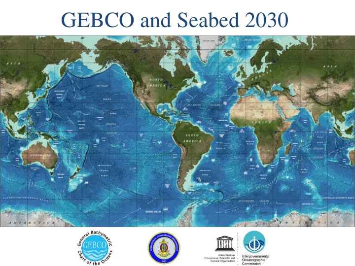
GEBCO and Seabed 2030 What is GEBCO? GEneral Bathymetric Chart of the Oceans An international group of experts who work on the development of a range of bathymetric data sets and data products Aims to provide the most authoritative,


slide-1
SLIDE 1

GEBCO and Seabed 2030

slide-2
SLIDE 2

What is GEBCO?

  • GEneral Bathymetric Chart of the Oceans
  • An international group of experts who work on the

development of a range of bathymetric data sets and data products

  • Aims to provide the most authoritative, publicly-available

bathymetric data sets for the world’s oceans

  • Operates under the auspices of the International

Hydrographic Organization (IHO) and the Intergovernmental Oceanographic Commission (IOC) of UNESCO

  • First GEBCO paper chart series initiated in 1903(!)
slide-3
SLIDE 3

International Hydrographic Organisation United Nations Educational Scientific and Cultural Organization Intergovernmental Oceanographic Commission

Guiding Committee

Technical Sub-Committee on Ocean Mapping (TSCOM) Sub-Committee on Regional Undersea Mapping (SCRUM) Scientific Committee on Undersea Feature Names (SCUFN)

slide-4
SLIDE 4

Regional mapping work

GEBCO has setup the Sub-Committee on Regional Undersea Mapping (SCRUM) to:

  • Build a closer collaboration with regional mapping efforts and

coordinate, as well as encourage, the incorporation of their compilations into GEBCO.

  • The Global GEBCO grid is continuously updated in part from

these regional grids, benefiting greatly from their local knowledge and expertise. www.gebco.net/regional_mapping/mapping_projects/

slide-5
SLIDE 5

GEBCO Products

  • Gridded Bathymetry (30 arc seconds)

– Digital atlas – Maps, Charts, and Viewers – Web Services

  • Undersea Feature Names
  • Bathymetry Processing Cookbook

Available at https://www.gebco.net

slide-6
SLIDE 6
slide-7
SLIDE 7

GEBCO’s products: Source Identifier Grid

The GEBCO Source Identifier (SID) Grid: Shows the source of depth value in each grid cell, i.e. if it is based on trackline data; pre-existing grids or if it is based on interpolation

slide-8
SLIDE 8

Seabed 2030

  • A program to produce the definitive map of the World Ocean

floor by 2030 to empower the world to make policy decisions, use the ocean sustainably, and undertake scientific research based on detailed information of the Earth’s seabed.

  • Supports United Nations Sustainable Development Goal 14:

to conserve and sustainably use the world’s oceans, seas and marine resources SDG14 will be impossible to achieve without a comprehensive map of the world’s ocean floor

slide-9
SLIDE 9

1 km If the World Ocean is divided into 1x1 km blocks (grid cells), about 82%

  • f them do not have depth values.

(Based on GEBCO 2014 grid)

slide-10
SLIDE 10

From……

slide-11
SLIDE 11

To……

slide-12
SLIDE 12
slide-13
SLIDE 13

June 2016 Mr Sasakawa, Chairman of the Nippon Foundation Proposed ‘…to map 100% of the topography of the World Ocean by 2030’ June 2017 1st August 2017

Nippon Foundation - GEBCO Seabed 2030 Project announced

Project start

Mr Sasakawa – 1 of 8 IOC-UNESCO “Champions of Global Ocean Science”

Seabed 2030: How we got here 2030

100% of ocean accurately mapped

slide-14
SLIDE 14

Project Plan

  • WP 1: Gathering, synthesizing, publishing bathymetric data

– Merging all available data into the high resolution ocean map

  • WP 2: Development of standards, data assembly and delivery tools

– Developing the tools and systems to facilitate building and using the map.

  • WP 3: Technology innovation

– Identifying and encouraging technical innovation in bathymetric mapping

  • WP 4: Networking: map the gaps

– Future mapping expeditions to increase the coverage

  • WP 5: Management

– Managing the project

slide-15
SLIDE 15

One Global Data Assembly and Coordination Centre (GDACC) and Four Regional Data Assembly and Coordination Centres (RDACC) will be established

CCOM/JHC

slide-16
SLIDE 16

WP 1: Gathering, compiling and publishing bathymetric data WP 2: Development of bathymetric

data and assembly tools

WP 4: Mapping the gaps WP 3: Technology innovation

GEBCO-Nippon Foundation Seabed 2030 World Ocean Map GDACC

EB EB EB EB

EB=Editorial Board for ocean regions RDACC RDACC RDACC RDACC

WWW download services Users

Bathy

  • databases

Cloud

Gridding tools Data processing Seabed 2030 storage of source data in DCDB

slide-17
SLIDE 17

Seabed 2030 project management

slide-18
SLIDE 18

Seabed 2030 Key Documents

https://seabed2030.gebco.net/

slide-19
SLIDE 19

Filling the data gaps with bathymetry from ENC data

  • To more accurately model the shape of the ocean floor in all

areas and serve a wider user community, GEBCO is striving to improve its gridded bathymetric datasets in shallower waters

  • In 2006 a request was made to IHO Member States to

provide bathymetry data from ENCs (usage bands 2 and 3) to GEBCO to help update its global model

  • New request to IHO MS for bathymetry data from ENCs sent
  • ut in March 2016 (circular letter 11/2016)
slide-20
SLIDE 20

Shallow water bathymetry from ENC data

ENC data coverage (usage bands 2 & 3) provided by IHO MS and organizations, to date, to GEBCO for grid updating work after calls in 2006 (yellow) and 2016 (red),

slide-21
SLIDE 21

Shallow water bathymetry from ENC data

Data for waters off Brazil

Soundings points extracted from ENCs recently supplied to GEBCO for the waters off Brazil

slide-22
SLIDE 22

Shallow water bathymetry from ENC data

Data for waters off Brazil

slide-23
SLIDE 23

The Postgraduate Certificate in Ocean Bathymetry Designed to train a new generation of scientists and hydrographers in

  • cean bathymetry

is funded by: The Nippon Foundation of Japan www.nippon-foundation.or.jp/en/ and taught at: The Center for Coastal and Ocean Mapping / Joint Hydrographic Center; University of New Hampshire, USA SEE CIRCULAR LETTER 13/2017 - 09 February 2017

Capacity-building initiative:

slide-24
SLIDE 24

78 scholars from 35 coastal states over last 13 years with the current class coloured red Add incoming Year 14 class (hatch) (84 people from 37 coastal states)

slide-25
SLIDE 25

Training Program Content

slide-26
SLIDE 26

For more information

  • GEBCO: https://www.gebco.net
  • Training:

https://www.gebco.net/training/training_programme/

  • Seabed 2030: https://seabed2030.gebco.net/
  • Johnathan Kool (GEBCO GGC)

– johnathan.kool@ga.gov.au