future land use map
play

FUTURE LAND USE MAP OUTLINE Evaluating Rezoning Requests The - PowerPoint PPT Presentation

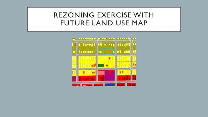
REZONING EXERCISE WITH FUTURE LAND USE MAP OUTLINE Evaluating Rezoning Requests The Future Land Use Map Overview of Rezoning Exercise & Handout Rezoning Exercise Break into groups and evaluate rezoning request Record


  1. REZONING EXERCISE WITH FUTURE LAND USE MAP

  2. OUTLINE • Evaluating Rezoning Requests • The Future Land Use Map • Overview of Rezoning Exercise & Handout • Rezoning Exercise • Break into groups and evaluate rezoning request • Record group (PC) motion • Share PC motion with the room

  3. EVALUATING ZONING REQUESTS Rezoning Decision Criteria • Consistency of proposed use and rezoning with Comprehensive Plan • Comprehensive Plan Goals and Policies • Future Land Use Map • Other criteria • Available infrastructure and capacity • Topography and hydrology • Support for nearby planned or existing use • Compatibility with surrounding uses • Small area plans

  4. FUTURE LAND USE MAP What is a Future Land Use Map? Collierville, TN Future Land Use Map • Map of the Communities Desired Future • How to GROW and Where • What to PRESERVE and Where • What Town should look in 20 years • Map of Future Land Use Categories • A range of recommended uses, densities, and zoning districts • A Guide for Land Use Policy Making • Rezoning decisions • Complement to Comp. Plan Policies • NOT a Zoning Map • Indicator of Policy Performance

  5. CREATING A FUTURE LAND USE MAP • Part of larger Comprehensive Planning process • INPUTS: • Natural constraints (Flood Plain, Steep Slopes) • Infrastructure (Streets, Water, Sewer) • Proximity to commercial centers and major roads • Existing land use and place types • Local and regional trends and growth projections • Local and regional plans • Public input

  6. REZONING EXERCISE T own Planning Commission Review of Rezoning Request • Scenario and Directions (p.1) • Review Case Report for Rezoning (p.2-7) • R-1 Residential Zone to R-T/Z Residential T ownhouse Zero Lot-Line Zone • Site: 0.75 acres, 4 vacant parcels • Surrounding Area: small lot single family neighborhood near town center • Proposal: subdivide into 6 lots and construct patio homes on each lot • Make recommendation to Board of Aldermen on PC Review form (p.8-10) • Determine consistency of proposed use and rezoning with Comprehensive Plan • Future Land Use Map • Plan Policies • Evaluate other impacts of proposal • Motion: Approve, Approve with conditions, or Deny

  7. REZONING REQUEST: R-1 TO R-T/Z Request: R-1 Residential to R-T/Z Residential Townhouse / Zero Lot-Line Existing: 0.75 acres, 4 vacant parcels Surrounding Area: older neighborhood near town center characterized by small lot single family homes; nearby duplexes, apartments and townhomes Average density: 5.8 DU/acre Proposal: subdivide into 6 lots and construct single family detached homes (patio homes) on each lot. Proposed density: 8 DU/acre

  8. SITE PLAN alley 45’ screening 39’ 134’ 12’ 15’ 1300 existing Sq. Ft. home HICKORY ST

  9. FUTURE LAND USE MAP Low-Medium Density Residential Uses: medium and small lot single family detached homes; townhouses and apartments as part of a conservation subdivision with open space set-aside. Density: 2 to 6 dwelling units per acre Zoning: R-1 Res. and R-1 Res. Conserv. Medium Density Residential Uses: small lot single family detached homes (including patio homes) and duplexes; townhouses and apartments with densities below 12 DU/ac Density: 6 to 12 dwelling units per acre Zoning: R-1 Res. , R-T/Z, R-2 Res. ; RZ-1 Zero Lot Line, RT -1 T ownhome, or R-3 Res. with conditions to limit density. T own Center This category envisions a mix of uses that support a vibrant town center. Uses: retail, office, service, housing, government, institutional, cultural, and entertainment Zoning: C-1 CBD, C-3 Nbhd. Comm. , MXU Mixed Use

  10. COMPREHENSIVE PLAN POLICIES Policy LU 2.2 - Compact Development New development and redevelopment should use a more compact land use pattern to support the efficient provision of public services, increase the utilization of existing streets and utilities, and create opportunities for more walkable neighborhoods. Policy LU 2.4 - Walkable Downtown Neighborhoods Allow higher density residential development within a quarter-mile of the town center to promote more pedestrian oriented neighborhoods that support local businesses and street life in the town center. Policy LU 4.7 - Diversity of Housing Types Encourage a greater diversity of housing types that appeal to a wide variety of home-buyers and reflect their evolving preferences. Policy LU 5.4 - Density Transitions Low- to medium-density residential development and/or low-impact office uses should serve as transitional densities between lower-density neighborhoods and more intensive commercial and residential uses. Policy LU 8.5 - Conservation of Single-Family Neighborhoods Protect and conserve the Town’s single -family neighborhoods and ensure that their zoning reflects their established low to medium density character. Carefully manage the development of vacant land and the alteration of existing structures in and adjacent to single-family neighborhoods to protect the character of the area, preserve open space, and maintain neighborhood scale. Policy LU 8.10 - Infill Development Encourage infill development on vacant land within the Town, particularly in areas where there are vacant lots that create “g aps ” that detract from the character of a commercial or residential street. Such development should complement the established character of the area.

  11. REZONING EXERCISE DIRECTIONS Use the Case Report and Comp Plan excerpt to fill out the PC Review Form Fill out PC Review Form Case Report Summary Future Land Use Map Zoning Map Zoning Dimensions Comp Plan Policies Record Motion Site Plan

  12. REZONING EXERCISE DIRECTIONS 1. Break into groups of 5 to 10 people 2. Read through the rezoning Case Report and related attachments listed below. a. Rezoning Case Report and Site Plan (p. 2 – 4) b. Comprehensive Plan Excerpt: Future Land Uses and Plan Policies (p. 5 – 7) 3. As a group, discuss whether the request is consistent with the Town’s Comprehensive Plan. Record your group’s answers to the follow questions on the Planning Commission Review form (p. 8 – 9). a. Is the proposal consistent with the Future Land Use Map? b. Does the proposal support relevant Comprehensive Plan Policies? c. Is there adequate infrastructure in place? Can the proposed development be made compatible with surrounding uses? Is the development anticipated to support a nearby use or have some other public benefit? 4. Decide as a group on a motion to approve, deny or approve with conditions. If a consensus cannot be reached call for a vote. Record the motion on the rezoning request on the Planning Commission Review Form (p. 10). a. Approve, Deny or Approve with Conditions b. Proposed Conditions 5. Share the group’s motion on the rezoning with the room.

  13. REZONING RECOMMENDATION • Future Land Use Map • Motion on Rezoning Request • Is the proposed development consistent with the • Approve, Deny, Approve with conditions medium-low density residential land use category? • Conditions • Support for Comprehensive Plan Policies • ??? • LU 2.2 Compact Development • ??? • LU 2.4 Walkable Neighborhoods near Town Center • LU 4.7 Diversity of Housing Types • LU 5.4 Density Transitions • LU 8.5 Conservation of Single Family Neighborhoods • LU 8.10 Infill Development • Other Considerations • ???????

Download Presentation
Download Policy: The content available on the website is offered to you 'AS IS' for your personal information and use only. It cannot be commercialized, licensed, or distributed on other websites without prior consent from the author. To download a presentation, simply click this link. If you encounter any difficulties during the download process, it's possible that the publisher has removed the file from their server.

Recommend


More recommend