February 12, 2019 Diane Ahern, aherndiane@gmail.com Image 1 is - - PDF document

february 12 2019 diane ahern aherndiane gmail com image 1
SMART_READER_LITE
LIVE PREVIEW

February 12, 2019 Diane Ahern, aherndiane@gmail.com Image 1 is - - PDF document

February 12, 2019 Diane Ahern, aherndiane@gmail.com Image 1 is cover of image from February 2018 Noise and Air Quality study to include both F-35 B and F-35 C variants. Image 2 is courtesy of the MCAS Miramar website and shows the


slide-1
SLIDE 1

February 12, 2019 Diane Ahern, aherndiane@gmail.com

  • Image 1 is cover of image from February 2018 Noise and Air Quality study to include both F-35 B and F-35 C variants.
  • Image 2 is courtesy of the MCAS Miramar website and shows the ideal/perfect state where aircraft departing MCAS Miramar

airport and participating in field carrier landing practice (touch and goes) remain east of the 805.

  • Image 3 is courtesy of the City of San Diego website and depicts the Accident Potential Zones (APZ’s) for MCAS Miramar airport.

You will note that the residential area of University City to the west of MCAS Miramar airport is not in the Accident Potential

  • Zone. The line stops at the 805. Areas in the northern tier of University City are in Accident Potential Zone 2.
  • Image 4 is courtesy of MCAS Miramar community plans and liaison office and depicts aircraft crashes from MCAS Miramar
  • airport. This document was obviously created sometime before 2008 because is does not include the December 2008 fatal crash

in University City that took the lives of four of our neighbors.

  • Image 5 is courtesy of the MCAS Miramar Noise and Air Quality Study of 2018. With this diagram, we are back to the ideal state

at MCAS Miramar airport where every F-35 pilot follows the Standard Departure Procedures. 1 -Noise and Air Quality Study – February 2018 2 - Fixed Wing Flight Corridors – 2006 – Miramar website 3 - APZ – Accident Potential Zones – 2007 – City’s website 4 - Accident Potential Zones with crash history pre 2008 5 - Noise contours for Record of Decision for home-basing both F-35 B & C – February 2018 EIS What’s missing? Map does not include fatal University City crash

  • f 2008 (Cather at Huggins) when four residents died; Clairemont

crash of 1959; Governor Drive crash of 1974.

slide-2
SLIDE 2

February 12, 2019, prepared for the Community Plan Update Sub-committee University . City . is . not . an . Accident . Potential . Zone . (APZ) Diane Ahern, University City:

  • The 2020 home-basing of F-35 squadrons at Miramar is new to the University Community plan. I ask you to recognize the impact,

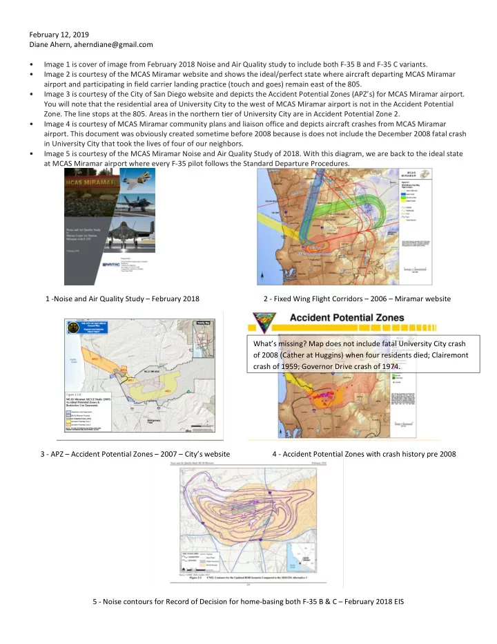
both environmental noise and safety, of the single engine F-35 when drawing up the new plan. (Refer to image 1)

  • Sub-committee members are asked to keep in mind that University City is not a designated aircraft Accident Potential Zone (APZ).

(Refer to images 2 and 3.)

  • Please remember that every time an aircraft from Miramar flies west of the 805, it puts the University community into an Accident

Potential Zone. This increases noise, decreases safety in the community, and increases the chance of a crash in University City. (Refer to images 3 and 4.)

  • Standard Departure and Approach Procedures have been developed for all San Diego airports in partnership with the FAA, the

Department of Defense, and the Airport Authority.

  • Following Standard Procedures keeps Miramar aircraft safely east of the 805 on departure and in the designated Accident

Potential Zones. (Refer to images 3 and 4.) This decreases environmental noise (refer to image 5) and increases the margin of safety for both the pilot and the people and property on the ground.

  • The community plan should require that the City work with Miramar command and the FAA and the Airport Authority to ensure

that the Standard Flight Procedures are followed by all pilots and aircraft using Miramar’s airport.

  • Doing so will allow the further development of the University Community in a manner that provides safety to those who live and

work and go to school in our community. Catherine Talley, University City:

  • When aircraft are not on the designated flight paths, allowable noise levels for residential areas are exceeded. Excessive noise

negatively affects learning capability and creates adverse effects on the health of children, as documented in the Noise Report commissioned for MCAS Miramar.

  • Current mandatory departure procedures keep departing aircraft east of the 805 freeway when they're followed. The new

community plan should require that the FAA and the DoD permanently shift departing flight procedures further north as is done with the Torrey Pines Farmers Open Golf Tournament to increase safety and reduce noise. If flight departures can be shifted for an annual golf tournament, why can’t they be shifted permanently for the safety and health of the University community?

  • The new community plan should require that Miramar release updated crash data that include the fatal crash of 2008 and all

crashes in our area from 1950 to date. (Refer to images 3 and 4).

  • These images (images 3 and 4) clearly indicate that most Miramar crashes have occurred in the Accident Potential Zones (APZ’s).

However, the accident slide is not up-to-date. How can you update the community plan without accurate and up-to-date information?

  • The new community plan should require that the City provide active oversight of Miramar flights with noise and other monitoring

devices to ensure that flights from Miramar airport do not overfly any portion of University City. It’s done with San Diego International and Montgomery-Gibbs; why not with Miramar's airport? Rick Ackermann, University City: Yes, Miramar was here first. But, keep in mind that our University City community was first planned and developed in the late 1950’s and 1960’s with DoD, FAA and Airport Authority representatives instituting procedures and flight paths that ensure that the University Community is not in an Accident Potential Zone. Let’s keep it that way. Andy Gurney, University City:

  • I would also like to state the need to follow existing protocols to ensure that MCAS Miramar departures and arrivals are flown on

proper flight paths under existing regulations.

  • It is a well-known fact that military aircraft crash at much higher rates than commercial aircraft. There have been many military air

vehicle crashes and incidents locally including two directly in University City and several others in bordering communities.

  • Crashes of military aircraft departing Miramar may have far more serious consequences as they are carrying huge amounts of fuel

and often fly with live ordnance on board.

  • Also, Miramar is a training facility, meaning some pilots have very little flight time in extremely complex aircraft.
  • Basing the single-engine F-35 at Miramar poses additional concerns if flight protocols are not followed. When engine failure is the

cause of a crash, single-engine fighter jets historically have twice the crash rate of twin-engine fighters. If the sole engine on an F-35 fails, and the aircraft remains disabled, the pilot has no choice but to eject and the aircraft crashes.

  • It is therefore imperative that MCAS-Miramar and the FAA attain 100% conformity and compliance with existing flight paths,

regulations, and mandatory protocols designed to reduce the risk of crashes in University City. University City does not lie beneath any published or necessary flight path and is not in an Accident Potential Zone if the flight paths and protocols are followed.

slide-3
SLIDE 3

Recap: UC vs Miramar Airspace

  • Yes, Miramar was here first. But, keep in mind that when UC was developed in the late 1950’s and 1960’s,


DoD, FAA and Airport Authority representatives designed procedures and flight paths to ensure that UC wasn’t in an Accident Potential Zone. Also, having seen the encroachment on the west side of Miramar, the Navy bought all the land on the east side between Poway and Miramar to prevent development in that area which has the highest crash potential.

  • San Diego’s airpace is like a Swiss watch. The most complicated, dense, high traffic, crowded 


airspace in the world - it’s claustrophobic:

  • To the west, the Pacific Ocean is all restricted airspace used for military training: W-291
  • To the south is the Mexican border with Rodriguez International airport smack on that border
  • To the east are rugged terrain and high mountains
  • Inside that small box - 9 large airports: San Diego International, MCAS Miramar, NAS North Island, Montgomery

Field, Gillespie Field, McClellan / Palomar, Brown Field, NALF Imperial Beach, Tijuana Rodriguez International and Torrey Pines Glider Port - all cheek by jowl.

  • And it gets very tense trying to fit all that air traffic into a small space. See the 3-D drawing on following page

which shows the air corridors just between Miramar and the coast.

  • MCAS Miramar is in Class-B Airspace. So all fixed wing aircraft must operate under positive FAA radar control. 


Aircraft are required by federal law and military regulations to follow strict departure and arrival procedures to enhance safety and reduce noise. With the coming of the F-35, which has only one engine, there is an increased risk of crashes and noise problems. So a review and update of the crash zones and procedures is required.

  • These tools are out of date must be re-studied and re-written to accomplish this:
  • F-35B West Coast Basing EIS (Environmential Impact Study) - Issued Oct 2010
  • MCAS Miramar AICUZ (Air Installations Compatible Use Zones) study - Issued Dec 2004
  • County MCAA Miramar ALUCP (Airport Land Use Compatibility Plan) study - Adopted Oct 2008

Comments to UCPG of 1 3 Ron Belanger 12 Feb 2019

slide-4
SLIDE 4

Recap: UC vs Miramar Airspace

Comments to UCPG of 2 3 Ron Belanger 12 Feb 2019

slide-5
SLIDE 5

Recap: UC vs Miramar Airspace

Comments to UCPG of 3 3 Ron Belanger 12 Feb 2019

slide-6
SLIDE 6

60

  • 7. Environmental Hazards &

Community Health

7.1 AVIATION NOISE AND SAFETY

Marine Corps Air Station (MCAS) Miramar and Montgomery-Gibbs Executive Field Municipal Airport create noise and potential safety impacts

  • n surrounding portions of University (see Figure 7-1: Airport Infmuence Area for areas potentially impacted by proximity to airports). Maintaining

compatibility with the airfjelds protects the safety of aviation operations and reduces exposure to nuisance or hazards for people in the community. The MCAS Miramar Airport Land Use Compatibility Plan (ALUCP) depicts noise contours based on a forecast of annual aircraft operations within areas commonly overfmown by fjxed-wing aircraft and helicopters arriving and departing from the MCAS Miramar and Montgomery-Gibbs Executive Field Municipal Airport airfjelds (See Figure 7-2: Noise Contours). Operations at MCAS Miramar generate noise contours of 60, 65, 70 and 75 decibels (dB) Community Noise Equivalent Level (CNEL) west of the military installation, afgecting eastern portions of University. 65 db CNEL is considered a threshold for a generally acceptable level of noise when outdoors. These contours indicate areas where higher than average noise exposure due to aircraft

  • perations could create nuisance in the community, particularly for noise sensitive uses, such as housing, schools, or health care facilities.

Safety zones around the airfjeld represent areas with a statistically higher risk of an aircraft accident given proximity to the runway. The ALUCP establishes land use compatibility policies to minimize the risk exposure for people on the ground in the event of an aircraft accident. Policies restrict concentrations of people through caps on dwelling units per gross acre or the number of people per gross acre on a sitewide average, set maximum lot coverage, and may prohibit particular types of land uses, such as assembly facilities or the storage of hazardous materials. The zones generally become less restrictive, permitting greater intensity and a wider range of land uses with distance from the airfjeld. As shown in Figure 7-1, most of University is within an Airport Infmuence Area (AIA), where there may be greater consideration paid to noise and safety considerations. University also has land categorized as Accident Potential Zone (APZ) I and II and Transition Zone (TZ), which is land situated along the corridor from which planes usually take

  • fg and land, where there is greatest potential for accidents.

The MCAS Miramar ALUCP also identifjes the Federal Aviation Administration (FAA) Height Notifjcation Boundary and Federal Aviation Regulation Part 77 Airspace Surfaces. University is located within the FAA Height Notifjcation Boundary and the Part 77 Surfaces for MCAS Miramar. Title 14 United States Code (USC) Chapter 1, Subchapter E, Part 77 – Aeronautics and Space – Safe, Effjcient Use, and Preservation of the Navigable Airspace (Part 77), establishes requirements for notifying the FAA of certain construction activities and alterations to existing structures, in order to ensure there are no

  • bstructions to navigable airspace. The boundary extends 20,000 feet from the runway. Within the boundary, Part 77 requires that the FAA be notifjed
  • f any proposed construction or alteration having a height greater than an imaginary surface extending 100 feet outward and 1 foot upward (slope
  • f 100:1) from the runway. Outside the boundary, projects that include construction or alteration exceeding 200 feet in height aboveground level are

required to notify the FAA.

Image Credit: Lance Cpl. Clare J. McIntire/MCAS Miramar MCAS Miramar is located immediately to the east of University. Image Credit: U.S. Geological Survey

slide-7
SLIDE 7

61

EXISTING CONDITIONS COMMUNITY ATLAS

R

  • s

e C a n y

  • n

MCAS MIRAMAR MIRA MESA LA JOLLA

University

  • f California

San Diego

CLAIREMONT MESA

P a c i f i c O c e a n

TZ TZ APZ 2 APZ 2

5 805 5 52

CARMEL VALLEY TORREY HILLS

GENESEE AVE N O B E L D R M I R A M A R R D C A R R O L L R D GILMAN DR T O R R E Y P I N E S R D EASTGATE MALL CAMINO SANTA FE L A J O L L A S H O R E S D R FAY AVE NORTH TORREY PINES RD PEARL ST LA JOLLA PKWY R E G E N T S R D C A R M E L V A L L E Y R D C AR M E L M O U N T AI N R D VISTA S O R R E N T O P K W Y S O R R E N T O V A L L EY B L V D L U S K BL V D G E N E S E E A V E L A J O L L A VILLA G E DR MI R A M A R R D GO V ER N O R D R R E G E N TS R D MIRA ME S A BL V D P RO S P E C T ST T O R R EY P I N E S R D V I L L A L A J O LLA LA JOLL A SCENIC D R N E L C A M I N O R E A L

Mcas Miramar Review Area 1 Montgomery Field Review Area 2 Mcas Miramar Review Area 2 Mcas Miramar Review Area 2 Mcas Miramar Review Area 1 Mcas Miramar Review Area 1 Mcas Miramar Review Area 2

TZ APZ 2 APZ 1 APZ 1 TZ CZ

Airport Safety Zones

Accident Potential Zone 1 (APZ 1) Accident Potential Zone 2 (APZ 2) Clear Zone (CZ) Transition Zone (TZ)

Airport Influence Area Montgomery Field

Review Area 2

Mcas Miramar

Review Area 1 Review Area 2 Airport Property Runways UCSD Campus City Parks and Open Space Freeway Railroad Community Plan Boundary

1 2 0.5 Miles Source: City of San Diego, 2018; SANDAG, 2018; Dyett & Bhatia, 2018.

Figure 7-1

Airport Influence Area

UNIVERSITY COMMUNITY PLAN UPDATE

NORTH TORREY PINES RD N O B E L D R MI R A M E S A B L V D SORR E NTOVALL E Y R D

slide-8
SLIDE 8

62

7.2 AIR QUALITY

Air quality is defjned by the concentration of pollutants related to human health. Concentrations of air pollutants are determined by the rate and location of pollutant emissions released by pollution sources, and the atmosphere’s ability to transport and dilute such emissions. Natural factors that afgect transport and dilution include terrain, wind, and sunlight. Therefore, ambient air quality conditions within the local air basin are infmuenced by such natural factors as topography, meteorology, and climate, in addition to the amount of air pollutant emissions released by existing air pollutant sources. The San Diego Air Basin (SDAB) covers roughly 4,200 square miles and encompasses all of San Diego County. Harmful air contaminants are most likely to occur in areas of population density, heavier traffjc patterns, and concentrations of industrial sources, particularly in the western portion of the

  • County. The County is currently in non-attainment at both the federal and State levels for Ozone (8-Hour) and is in non-attainment at the State level for

Ozone (1-Hour), PM10, and PM2.5. Attainment indicates that an area complies with the National and/or California Ambient Air Quality Standards. Motor vehicles are San Diego County’s leading source of air pollution. The SDAB has an ambient air quality network of 6 stations that monitor for a wide variety of pollutants, including ozone, fjne particulate matter (PM) 2.5 micrometers and less in diameter, particulate matter 10 micrometers and less in diameter, and a number of toxic compounds. The closest station to University is located at 6125A Kearny Villa Road in Kearny Mesa, approximately 3 miles away. Data collected in 2016 indicated ambient air concentrations

  • f PM2.5, PM10, NO2 and 8-hour ozone at the Kearny Mesa Monitoring Station did not exceed the National Ambient Air Quality Standards (NAAQS) or

California Ambient Air Quality Standards (CAAQS) in 2016. The San Diego Air Pollution Control District develops strategies and regulations to achieve the pollution emission reductions necessary to meet all health-based standards. Data from monitors throughout the County document the continued downward concentration trends of pollutants. Likely strategies in the community plan update, including a focus on active transportation, transit-oriented development, and healthy community design will reinforce improvements in local and regional air quality.

slide-9
SLIDE 9

63

EXISTING CONDITIONS COMMUNITY ATLAS

T

  • rrey Pines

State Natural Reserve T

  • rrey Pines

Golf Course Rose Canyon

MCAS MIRAMAR MIRA MESA LA JOLLA

University

  • f California

San Diego

CLAIREMONT MESA

P a c i f i c O c e a n

Campus Point Open Space

5 805 5 52

CARMEL VALLEY TORREY HILLS

GENESEE AVE NOBEL DR MIRAMAR RD CARROLL RD GILMAN DR TORREY PINES RD EASTGATE MALL CAMINO SANTA FE L A J O L L A S H O R E S D R FAY AVE NORTH TORREY PINES RD PEARL ST LA JOLLA PKWY REGENTS RD C A R M E LV A L L E Y R D C AR M EL M O U N T AI N R D VISTA S O RREN T O P K W Y S O R RE N T O V AL L E Y B LVD LUS K B L V D G E N E SEE A V E L A J O L L A VILLA G E D R M I R A MA R RD GO V ER N O R D R R E G E N TS R D MIRA ME S A BL V D P R O S P E C T ST T O R R EY P I N E S R D V I L L A L A J O LLA L A J O L L A S C E N I C D R N E L C A M INO R E A L

Existing Noise Contours 60 dB 65 dB 70 dB > 75 dB UCSD Campus City Parks and Open Space Freeway Railroad Community Plan Boundary

1 2 0.5 Miles Source: City of San Diego, 2018; SANDAG, 2018; Dyett & Bhatia, 2018.

Figure 7-2

Airport Noise Contours

UNIVERSITY COMMUNITY PLAN UPDATE

NORTH TORREY PINES RD N O B E L D R MI R A M E S A BLVD S O R R E N T O V A L L E Y R D

slide-10
SLIDE 10

64

7.3 COMMUNITY HEALTH

Healthy community design focuses on creating environments that promote the well-being and health of all residents. Thoughtful design promotes

  • pportunities for healthy behaviors, including outdoor exercise, healthy eating, and the avoidance of health risks. Healthy community design can

contribute to people’s well-being by:

  • Increasing physical activity;
  • Reducing injury;
  • Increasing access to healthy food;
  • Improving air and water quality;
  • Decreasing mental health stresses;
  • Strengthening the social fabric of a community; and
  • Providing fair access to livelihood, education, and other resources.

The physical environment plays a role in shaping behaviors infmuencing how we live, learn, work, and play. Central to the concept of healthy communities is incorporating opportunities for active living. Active living is a concept that recognizes the connection between physical activity and our surroundings. It seeks ways to make physical activity safe, convenient, and pleasant by creating communities where people want to walk, bike, and become more physically active. Generally, healthy communities make it easy to include physical activity in everyday life, as well as provide access to healthy foods and the outdoors. Proximity to places with recreational opportunities correlates with higher physical activity levels, which in turn correlate with lower rates of adverse health outcomes associated with poor diet, sedentary lifestyles, and obesity. In addition, convenient access to public transit helps community members bring healthy living into their daily routines. Creating bicycle and pedestrian connections to public transit may encourage people to incorporate exercise into their daily commute and reduce vehicle congestion on roadways. Figure 7-2 depicts access to parks, community facilities, and transit in University. Most residential areas in the community are within a fjve or ten minute walking distance to a park. Several parks, including Weiss Mandell Eastgate Park, Doyle Community Park, Nobel Athletic Area, and Standley Community Park are within a fjve minute walking distance to a bus stop. In general, most University residents have convenient access to parks and community facilities, and therefore more opportunities to engage in active and healthy lifestyles.

Open fjelds encourage recreational activities that help community members stay physically active. Mandell Weiss Eastgate City Park is a community park equipped with indoor and outdoor recreational facilities.

slide-11
SLIDE 11

65

EXISTING CONDITIONS COMMUNITY ATLAS

MCAS MIRAMAR MIRA MESA LA JOLLA

University

  • f California

San Diego

CLAIREMONT MESA

P a c i f i c O c e a n

Doyle Rec Center Standley Rec Center

5 805 5 52

CARMEL VALLEY TORREY HILLS

GENESEE AVE N O B E L D R MIRAMAR RD CARROLL RD GILMAN DR TORREY PINES RD E A S T G A T E M A L L C A M I N O S A N T A F E LA JOLLA SHORES DR F A Y A V E NORTH TORREY PINES RD PEARL ST LA JOLLA PKWY REGENTS RD CARM E LV A L L E Y R D C AR M EL M O U N T AI N R D V I S T A S O RREN T O P K W Y S O R RE N T O V A L L EY B LVD LUS K BL V D G E N E S E E A V E L A J O L L A VILLA G E DR M I R A M A R R D G O VE R N O R D R R E G E N TS R D M I R A M E S A BL V D P R O S P E C T ST T O R R EY P I N E S R D V I L L A L A J O LLA L A J O L L A S C E N I C D R N E L C A M INO R EA L

Torrey Pines State Nature Reserve Doyle Community Park Standley Community Park Nobel Athletic Area Marcy Neighborhood Park University Gardens Neighborhood Park Weiss Mandell Eastgate Park Villa La Jolla Park University Village Neighborhood Park East Gate Mini Park 1

Rose Canyon Open Space Carrol Canyon Open Space

East Gate Mini Park 2

Campus Point Open Space La Jolla Open Space Rose Canyon Open Space

Torrey Pines City Park

Standley Middle Curie Elementary Doyle Elementary Preuss High School University City High School Spreckels Elementary Nobel Rec Center University Community Branch Library

Library Hospitals Public Schools Recreation Centers Bus Stop City Parks Open Space Library Half Mile Service Radius

Parks Walkshed

5 Min Walking Distance (1/4 mile) 10 Min Walking Distance (1/2 mile)

Transit Accessibility (Walkshed)

5 min walking distance (1/4 mile) to Bus Stops UCSD Campus Residential Bus Routes Rivers Freeway Railroad Community Plan Boundary

1 2 0.5 Miles Source: City of San Diego, 2018; SANDAG, 2018; Dyett & Bhatia, 2018.

Figure 7-3

Access to Parks, Community Facilities, and Transit

UNIVERSITY COMMUNITY PLAN UPDATE

N O R T H T O R R E Y P I N E S R D N O B E L D R M I R A M E S A BLVD SORR E NTOVALL E Y R D