
SLIDE 1
Assessment of Southeast Alaska’s Estuarine and Coastal Ecosystems
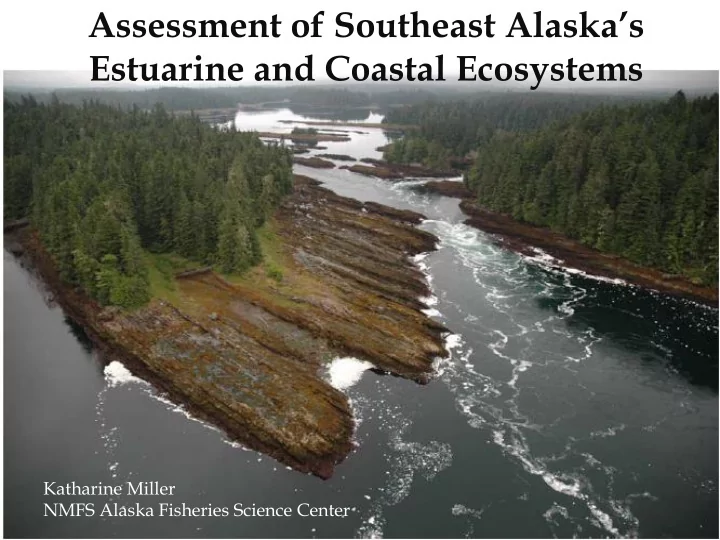
Katharine Miller NMFS Alaska Fisheries Science Center
Estuarine and Coastal Ecosystems Katharine Miller NMFS Alaska - - PowerPoint PPT Presentation
Assessment of Southeast Alaskas Estuarine and Coastal Ecosystems Katharine Miller NMFS Alaska Fisheries Science Center Initial Assessment Limited to SE Alaska Alexander Archipelago ~ 435 miles 1,100 islands ~ 36,000 km
Katharine Miller NMFS Alaska Fisheries Science Center
Initial Assessment
Alexander Archipelago
Map courtesy of the US Forest Service
Topography/bathymetry
EDAs CDAs Inland
Katlian Bay 5m depth contours
Tebenkof Bay Bathymetry (5m contours)
Indicators for coastal habitat condition
Category Threat / stressor Indicator Variables Data Source/AK Coverage (Comprehends single-or groups of descriptive variables) Connectivity Coastal construction: Dams, dikes, roads (stormwater), Dredging Area accessible to fish Barriers USACE / NID national Structures Tongass Streams SEAK Passages/corridors NHD national Hydrology / Oceanography Freshwater inflow Salinity AOOS partial Tidal flow Temperature - Ice AOOS partial Alteration/Discharge Water exchange/depth-tide height ratio Degree of estuarine channelization Hydrodynamics / current velocity, , Substrate composition ShoreZone AK Extent of shoreline armoring Benthic habitat loss ESI Turbidity NOAA/NOS, SeaWIFS national Land use/cover Nutrient load Land Use/Mgmt - VEG contamination ADEC Contam Sites/NPDES AK road density ADOT (calc) AK Water clarity Sediment load, suspended matter USGS/USACE/Regional? Water Quality Eutrophication Nutrient input Nutrient level NASA/SeaWIFS, AOOS? national Chlorophyll a water clarity dissolved oxygen Harmful Algal Blooms (HABs) Frequency & degree of HABs national Geomorphology Dredging, Sedimentation, Erosion Status of Soft bottom habitat Area, compositon of soft sediment ShoreZone AK Status of Hard Bottom Habitats Area, composition of hard substrates ShoreZone AK Biotic Habitats Habitat loss Status of Coastal Wetlands Area, composition of marsh NWI national Status of Submerged Aquatic Vegetation (SAV) Area, diversity, density of seagrass ShoreZone, MMS AK Area, diversity, density of macro algae Status of habitat forming invertebrates Area, diversity, density of coral reefs Area, diversity, density epibenthic bivalves Environmental Contamination Pollution Chemical contamination of sediments Point/no-point discharge EMAP SEAK (H) Chemical contamination in fish and mollusks (Shell)fish contaminant load NOAA/NCCOS/CCMA Biodiversity Food web alterations Non-indigenous and invasive species Number of species, abundance USGS/NAS Plankton density Zooplankton biomass COPEPOD-HOFU-DAT, BISERP partial Benthos community Benthic Invertebrate Index NOAA/NBI: EPA/EMAP
Variables Source Barriers Dam heights NHDPlus USACE: National Inventory of Dams Salinity River Alternation/discharge Water exchange Tidal/Inlet Data Temperature- Trends NOAA: Coastal Assessment Framework USGS – Gages (Limited) NOAA: Coastal Assessment Framework NOAA: Coastal Assessment Framework NOAA: Oceanographic Data Center Road density Contamination Point source discharges Federal Highway Administration EPA: Toxic Release Inventory EPA: NPDES Land Cover/Land Change NOAA: Coastal Change Analysis Program DO Chl a Water clarity NOAA: Nat’l Estuarine Eutrophication Assessment Submgd Aquatic Vegetation Habitat forming invertebrates Seagrass Database TNC Shellfish contamination Sediment toxicity Tissue Contaminants Benthic Invertebrates NOAA: Coastal Monitoring and Assessment EPA: Coastal Condition Report (Central AK only) EPA: Coastal Condition Report (Central AK only) EPA: Coastal Condition Report (Central AK only)
Southeast Alaska Preliminary Assessment
Mean Score: Flow, Land Cover, Pollutants
FISH SPECIES Life AUC FISH SPECIES Life AUC Stage Stage Shiner perch Pacific herring Cymatogaster aggregata A/J 100 87 0.94 Clupea pallasi J 54 20 0.72 Lingcod Tubesnout Ophiodon elongatus J 100 85 0.93 Aulorhynchus flavidus M 76 60 0.71 Pink salmon Bay Pipefish Oncorhynchus gorbuscha J 86 77 0.85 Syngnathus leptorhynchus A/(j) 71 62 0.70 Chum salmon Sturgeon Poacher Oncorhynchus keta J 82 81 0.85 Podothecus accipenserinus M 68 15 0.70 Pacific cod Pacific staghorn sculpin Gadus macrocephalus J 78 78 0.84 Leptocottus armatus A/J 50 20 0.70 Butter sole Threespine stickleback Isopsetta isolepis J 75 74 0.84 Gasterosteus aculeatus A 63 65 0.70 Kelp greenling Coho salmon Hexagrammos decagrammus J 81 70 0.82 Oncorhynchus kisutch J 68 30 0.68 Starry flounder Pacific sand lance Platichthys stellatus A/J 86 63 0.77 Ammodytes hexapterus J(a) 47 34 0.68 Rock sole Snake prickleback* Lepidopsetta sp. J(a) 72 63 0.77 Lumpenus sagitta M 61 59 0.67 Dolly varden Buffalo sculpin Salvelinus malma A(j) 72 63 0.76 Enophrys bison M 42 40 0.64 Yellowfin sole Crescent gunnel Limanda aspera J(a) 72 63 0.75 Pholis laeta A(j) 60 50 0.63 Silverspot sculpin* Great sculpin Blepsias cirrhosus J 67 69 0.75
J 72 63 0.63 Sockeye salmon Oncorhynchus nerka J 69 66 0.74 % Present Correct % Absence Correct % Present Correct % Absence Correct