
SLIDE 1
Major Roads are designed as thus (mirrored on the
- ther side). 8m of
designed as thus (mirrored on the other side). 8m of sidewalk, 6 - - PowerPoint PPT Presentation
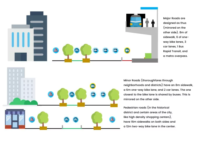
Major Roads are designed as thus (mirrored on the other side). 8m of sidewalk, 6 of one- way bike lanes, 3 car lanes, 1 Bus Rapid Transit, and a metro overpass. Minor Roads (thoroughfares through neighborhoods and districts) have an 8m