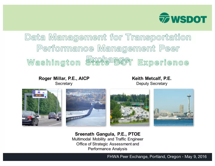
Data Management for Transportation Performance Management Peer - - PowerPoint PPT Presentation

data management for transportation performance management
SMART_READER_LITE
LIVE PREVIEW

Data Management for Transportation Performance Management Peer - - PowerPoint PPT Presentation

Data Management for Transportation Performance Management Peer Exchange Washington State DOT Experience Roger Millar, P.E., AICP Keith Metcalf, P.E. Secretary Deputy Secretary Sreenath Gangula, P.E., PTOE Multimodal Mobility and Traffic


slide-1
SLIDE 1

Data Management for Transportation Performance Management Peer Exchange

Washington State DOT Experience

FHWA Peer Exchange, Portland, Oregon - May 9, 2016

Roger Millar, P.E., AICP

Secretary

Keith Metcalf, P.E.

Deputy Secretary

Sreenath Gangula, P.E., PTOE

Multimodal Mobility and Traffic Engineer Office of Strategic Assessment and Performance Analysis

slide-2
SLIDE 2

WSDOT’S SYSTEM

  • 18,689 state-owned lane miles of highway
  • 22 ferry vessels on 9 routes carried 23.2 million passengers in FY2015
  • 3,288 state-owned bridges an average of 45 years old
  • 11 Amtrak Cascades trains daily served more than 744,000 passengers

in 2015

  • 31 public transit systems statewide carrying more than 113,200 riders

in 2014

  • 2,898 vanpools – largest in the nation
  • $39.6 million in bicycle and pedestrian grants and projects in 2015-17

biennium

2

slide-3
SLIDE 3

WASHINGTON’S LEGISLATED TRANSPORTATION POLICY GOALS

Mobility

3

Preservation Safety Economic vitality Environment Stewardship

slide-4
SLIDE 4

SOME OF WSDOT’S CURRENT MOBILITY INITIATIVES

  • Corridor sketches with partners to design projects using Practical

Solutions

  • Legislative request to study speed limit raise on I-90 in eastern

Washington

  • Annual Corridor Capacity Report
  • Interactive online maps
  • Connected autonomous vehicle work plan
  • MAP-21 System Performance rule
  • Mobility performance measure alignment with project planning
  • Tolling as a traffic management tool: SR 167, SR 520 and I-405
  • Downtown Seattle’s Alaskan Way Viaduct work zone closure planning
  • Gov. Inslee’s mobility measures in Results WA performance

management plan

  • Results WSDOT agency strategic plan mobility strategies

4

slide-5
SLIDE 5

WSDOT’S MOBILITY PARTNERS

MPOs and transit partners help fill in data gaps to make Washington an overall data-rich state from a multimodal stand point One mobility initiative for which WSDOT closely partners with MPOs, transit agencies, RTPOs, universities, etc. is the annual Corridor Capacity Report (CCR)

5

slide-6
SLIDE 6

IN PARTNERSHIP WITH…

  • Ben Franklin Council of Governments
  • C-Tran
  • Community Transit
  • Intercity Transit
  • King County Metro
  • Pierce Transit
  • Puget Sound Regional Council
  • Sound Transit
  • Southwest Washington Regional Transportation Council
  • Spokane Regional Transportation Council
  • Spokane Transit
  • Thurston Regional Planning Council
  • University of Washington

6

slide-7
SLIDE 7

The Corridor Capacity Report was created:

  • To apprise the Legislature, stakeholders, educational and research

institutions, the media, and the public about multimodal system conditions and how agencies and businesses can work together to reduce congestion

  • To help inform city, county and state agency policy makers, planners

and engineers as they examine multimodal capacity opportunities

  • To support WSDOT’s Practical Solutions and performance-based

planning initiatives

  • To continue WSDOT’s accountability streak since 2001 of reporting

system performance data

7

WHY DO WE NEED SYSTEM PERFORMANCE MEASUREMENT AND REPORTING?

slide-8
SLIDE 8

“Puget Sound traffic congestion up 19% since recession” “More drivers, more gridlock, more delays” “WSDOT blames economic rebound for worsening congestion” “Traffic congestion on the rise in Clark County” “South Sound traffic congestion accelerates” “Commutes around the state generally getting worse”

8

Other coverage:

RESPONSES: STRONG MEDIA INTEREST

slide-9
SLIDE 9

9

WHAT DATA TOOLS DOES THE CCR USE TO PROCESS ITS OWN AND PARTNERS’ DATA?

CDR TRACFLOW Highway Segment Analysis Program

slide-10
SLIDE 10

10

WHAT DATA TOOLS DOES THE CCR USE TO PROCESS ITS OWN AND PARTNERS’ DATA?

DRIVE Net Mobility Analysis Software

continued…

Transit Data Template Summary Stats Template

slide-11
SLIDE 11

11

DRIVE NET – NEXT GENERATION PERFORMANCE MANAGEMENT PLATFORM

continued…

slide-12
SLIDE 12

WSDOT KEY SYSTEM PERFORMANCE MEASURES AND THRESHOLDS

12

slide-13
SLIDE 13

WHAT DO WE DO WITH THIS DATA?

Annual Banner Measures

  • Miles traveled
  • Delay
  • GHG emissions
  • Miles traveled on transit
  • Capacity savings due to transit
  • Percent of transit seats occupied
  • Percent of Park and ride spaces
  • ccupied

Daily Measures

  • Travel times
  • Person throughput (SOV & HOV)
  • Routinely congested segments
  • Transit ridership, capacity and

utilization

  • Park and ride lot location, capacity

and utilization

13

slide-14
SLIDE 14

Transit ridership & percent utilized Park and ride facilities Travel times

14

EXAMPLE OF DAILY AM MEASURES ON I-5

slide-15
SLIDE 15

15

COMPARING MODES AT A GLANCE

slide-16
SLIDE 16

16

Annual delay VMT

STATEWIDE AND REGIONAL INDICATORS

slide-17
SLIDE 17

Corridor maps Story maps

bit.ly/CCR15statewidemap featured in ESRI gallery 17

INTERACTIVE ONLINE MAPS: WHAT ARE THE BEST WAYS TO COMMUNICATE?

slide-18
SLIDE 18

Quick links: bit.ly/CCR15statewidemap bit.ly/CCR15CentralSoundmap www.wsdot.wa.gov/accountability “Congestion Reporting and the Corridor Capacity Report” “WSDOT’s Annual Corridor Capacity Report” Click map image

Find links throughout the report for the corresponding story maps: http://wsdot.wa.gov/publications/fulltext/graynotebook/CCR15.pdf

18

HOW DO YOU GET TO THE STORY MAPS?

slide-19
SLIDE 19

Amtrak Cascades corridor

  • Parallel to I-5 highway corridor
  • Measures include:

– Passenger miles traveled – On-time performance – Capacity/utilization – Ridership

  • Lane capacity savings due to transit

19

MULTIMODAL MEASURE EXPANSION

slide-20
SLIDE 20

How do traffic signals affect congestion?

  • Pilot capacity analysis for

signalized corridor

  • Key commute and freight

route with eight traffic signals

  • Limited data but should

expand in coming years

20

ARTERIAL CORRIDOR PERFORMANCE ANALYSIS

slide-21
SLIDE 21
  • Washington ferry corridors

– Ridership – Trip reliability – Fuel usage – Capacity/utilization – On time performance

  • Before and After project analysis

– Wenatchee capacity expansion project analysis

  • Incident Response analysis
  • Future federal and state reporting requirements

– Moving Ahead for Progress in the 21st Century (MAP-21) – Results Washington

21

WHAT OTHER ANALYSIS DOES WSDOT REPORT?

slide-22
SLIDE 22

CORRIDOR CAPACITY REPORT & MAP-21

  • Each piece of the CCR requires extensive collaboration with other

WSDOT divisions, MPOs, transit agencies, stakeholders, universities, and other partners

  • These existing communication links will be crucial as the federal

transportation performance reporting rules come online for Moving Ahead for Progress in the 21st Century (MAP-21)

22

MAP-21 BACKGROUND

  • MAP-21 is federal legislation that is intended to increase the

transparency and accountability of states in their investment of taxpayer dollars in transportation infrastructure and services.

slide-23
SLIDE 23

WSDOT & MPO DATA MANAGEMENT PLANNING

  • WSDOT will need an even more robust communication and data

management/sharing plan with MPOs moving forward with MAP-21

– One initiative coming together is DRIVE Net, an online transportation platform aimed at data sharing, integration, visualization and analysis – RITIS interactive tool (MAP-21 module) developed by CATT Lab

  • DOTs and MPOs under current proposed rule will need to agree on

targets for performance measures such as the percent of interstate mileage within an urbanized area where peak hour travel times meet expectations, as well as the “desired peak hour travel times” for each reporting segment within an urban area (see next slide)

– For areas like Portland, this will involve multiple state DOTs and multiple MPOs, requiring complex coordination and communication

23

slide-24
SLIDE 24

24

Portland, Or. Vancouver, Wash. WA/OR border Portland urban boundary NHS roads

PORTLAND-VANCOUVER URBAN AREA

slide-25
SLIDE 25

NEXT STEPS

  • Expand partnerships with MPOs and
  • perating agencies
  • Follow WSDOT collaboration

guidelines for MAP-21

  • Expand analysis to National Highway

System as defined in MAP-21

  • Incorporate the data and analysis from

the report as a tool for Practical Solutions training

  • Refine our interactive online tools for

wider use of system performance data and measures internally and for external partners

  • Expand analysis to include

accessibility measures …many more ideas, but limited resources

25

slide-26
SLIDE 26

RESOURCES

§ WSDOT’s Congestion Website: http://www.wsdot.wa.gov/Accountability/Congestion/ § WSDOT’s Accountability Website: http://www.wsdot.wa.gov/accountability/ § Real Time Travel Times Website: http://www.wsdot.wa.gov/traffic/seattle/traveltimes/ § Plan Your Commute– 95% Reliable Travel Times Website: http://www.wsdot.com/traffic/Seattle/traveltimes/95reliable.aspx/ § WSDOT’s quarterly performance report: the Gray Notebook: http://www.wsdot.wa.gov/Accountability/GrayNotebook/navigateGNB.htm § Performance Measurement at WSDOT, four page folio http://www.wsdot.wa.gov/NR/rdonlyres/91089378-E709-49EF-AE42- AE80BC44A91C/0/TRB_Performance_Folio.pdf § WSDOT’s Strategic Plan: http://www.wsdot.wa.gov/Secretary/ResultsWSDOT.htm § Performance Journalism: http://www.wsdot.wa.gov/NR/rdonlyres/F0DE7328-BA3D-45A0- 95DB-641A4CE32D7B/0/2008_TRB_Performance_Journalism.pdf § Making the Case for Funding: The WSDOT Experience (2008, Transportation Research Record) http://www.wsdot.wa.gov/NR/rdonlyres/E5D34B36-6662-4464-B4BA- 1E858BBD710D/0/2007_TRB_Making_Case_Funding.pdf § Maximizing Highway System Capacity: Measuring and Communicating System Performance in an Evolving Field–(2008, Transportation Research Forum) http://www.wsdot.wa.gov/NR/rdonlyres/5FF329ED-A840-4F8A-A798- 468948BEE80B/0/Maximizing_Highway_Capacity_PM_finalvsn.pdf

26

slide-27
SLIDE 27

QUESTIONS?

27

CONTACT INFO: Sreenath Gangula, P.E., PTOE Multimodal Mobility and Traffic Engineer Office of Strategic Assessment and Performance Analysis Washington State Department of Transportation 360-705-6888 GangulS@wsdot.wa.gov