Copernicus implementation in Funded under H2020 - Climate action, - - PowerPoint PPT Presentation

copernicus implementation in
SMART_READER_LITE
LIVE PREVIEW

Copernicus implementation in Funded under H2020 - Climate action, - - PowerPoint PPT Presentation

GEO-CRADLE: Fostering regional cooperation and roadmap for GEO and Copernicus implementation in Funded under H2020 - Climate action, North Africa, Middle East and environment, resource efficiency and raw materials Balkans ACTIVITY:


slide-1
SLIDE 1

GEO-CRADLE: Fostering regional cooperation and roadmap for GEO and Copernicus implementation in North Africa, Middle East and Balkans

Funded under H2020 - Climate action, environment, resource efficiency and raw materials ACTIVITY: Developing Comprehensive and Sustained Global Environmental Observation and Information Systems CALL IDENTIFIER: H2020 SC5-18b-2015 Integrating North African, Middle East and Balkan Earth Observation capacities in GEOSS Project GA number: 690133 Total Budget: 2,910,800.00 €

  • Dr. Haris KONTOES

Project Coordinator Research Director NOA http://geocradle.eu/

slide-2
SLIDE 2

GEO-CRADLE

… is a unique EU funded Coordination Action running at regional level; … is looking at the territories of North Africa, Middle East and Balkans; It seeks to identify common needs, create synergies, and integrate capacities; Fosters the regional cooperation and integration of monitoring capabilities and networks, as well as scientific skills; Define and communicate goals that are clear and beneficial from societal and market wise point of view, and also realistic and in line with the domestic priorities and user needs; Proposes/sets up large scale regional initiatives based on the Earth Observation (space based and in- situ) for capacity building and also addressing societal priorities in the thematic areas of the project such as Adaptation to Climate Change, Access to Raw Materials, better exploitation of the renewable Energy resources, and Food Security.

 Promote the uptake of EO services and data in response to regional needs.  Support the effective integration of existing Earth Observation Capacities in the region.  Facilitate the engagement of the complete ecosystem of EO stakeholders in the region.  Enhance the participation in and contribution to the implementation of GEOSS and Copernicus in North Africa, Middle East and the Balkans.

Objectives

slide-3
SLIDE 3

Th Thematic Areas

Adaptation to Climate Change (ACC) Improved Food Security – Water Extremes Management (IFS) Access to Raw Materials (ARM) Access to Energy (SENSE)

slide-4
SLIDE 4

GEO-CRADLE

… is a unique EU funded Coordination Action running at regional level; … is looking at the territories of North Africa, Middle East and Balkans; It seeks to identify common needs, create synergies, and integrate capacities; Fosters the regional cooperation and integration of monitoring capabilities and networks, as well as scientific skills; Define and communicate goals that are clear and beneficial from societal and market wise point of view, and also realistic and in line with the domestic priorities and user needs; Proposes/sets up large scale regional initiatives based on the Earth Observation (space based and in- situ) for capacity building and also addressing societal priorities in the thematic areas of the project such as Adaptation to Climate Change, Access to Raw Materials, better exploitation of the renewable Energy resources, and Food Security.

 Promote the uptake of EO services and data in response to regional needs.  Support the effective integration of existing Earth Observation Capacities in the region.  Facilitate the engagement of the complete ecosystem of EO stakeholders in the region.  Enhance the participation in and contribution to the implementation of GEOSS and Copernicus in North Africa, Middle East and the Balkans.

Objectives

slide-5
SLIDE 5

NATIONAL OBSERVATORY OF ATHENS Coordinator

slide-6
SLIDE 6

Or Visit: http://195.251.203.238/surveygeocradle/index.php/inventories/capacities/gc-survey1

The Project Pil illars

http://cpdev.crowdpolicy.com/geo-cradle-stakeholders/

To join the network follow the link to create your profile:

slide-7
SLIDE 7

To join the network follow the link to create your profile

http://195.251.203.238/surveygeocradle/index.php/ inventories/capacities/gc-survey1

slide-8
SLIDE 8

To join& search the network follow the link

http://cpdev.crowdpolicy.com/geo-cradle-stakeholders/

slide-9
SLIDE 9

Or Visit: http://195.251.203.238/surveygeocradle/index.php/inventories/capacities/gc-survey1

The Project Pil illars

http://cpdev.crowdpolicy.com/geo-cradle-stakeholders/

To join the network follow the link to create your profile:

slide-10
SLIDE 10

Regional Data Hub – Connection wit ith GEOSS & Regional Portals

  • The GEO CRADLE Regional Data

Hub (GC-RDH) is going to provide its users with a transparent discovery and access mechanism

  • f the GEOSS portal’s resources,

and other regional portals!

  • This mechanism will heavily rely on the

GEO Discovery and Access Broker (DAB) APIs which is a middleware component in charge of interconnecting the heterogeneous and distributed capacities contributing to GEOSS; part of the GEOSS Common Infrastructure (GCI) since November 2011.

DKAN UI

slide-11
SLIDE 11

Utilizing the GEO DAB APIs for easy access and discovery of regional EO data

slide-12
SLIDE 12

Utilizing the GEO DAB APIs for easy access and discovery of regional EO data

slide-13
SLIDE 13

Or Visit: http://195.251.203.238/surveygeocradle/index.php/inventories/capacities/gc-survey1

The Project Pil illars

http://cpdev.crowdpolicy.com/geo-cradle-stakeholders/

slide-14
SLIDE 14

The Regional Priorities

Prio iority Defin init ition Workflow

Identify recommenda tions

Define the priority framework Develop the regional action plan Validate the action plan

  • Identify national EO

recommendations as perceived from GEO- CRADLE partners.

  • Propose a priority

framework

  • What are the

criteria to consider in the definition of priority goals?

  • Builds upon the

national priorities the regional priorities by looking at the commonalities

  • f national actions

with the RoI as well as the specificity of the region.

  • Validate the

action plan with decision makers.

  • How to ensure

that the action plan is in adequacy with real needs in the RoI?

slide-15
SLIDE 15

The Regional Priorities Adaptation to Climate Change (ACC)

The ACC pilot will pave the ground for the holistic monitoring and forecasting of region-specific atmospheric components, ECVs and hazards, in line with the standards and vision of GEOSS and Copernicus for information extraction and service delivery regarding the Climate SDG. Gap Analysis of the Regional Climate related Capacities End-users expressing interest in the ACC pilot Specifically, the GEO-CRADLE ACC will provide 3 services

  • n respective thematic pillars :

1. Desert dust services 2. Regional climate change projection services 3. Air quality services

(from the results of end user survey and gap analysis)

  • Tourism sector for dust forecasting
  • Meteorological agencies for dust forecasting
  • Civil aviation for dust forecasting
  • Insurance companies for Climate Change services
  • Agriculture sector for Climate Change services
  • Water river basin agencies for Climate Change

services

slide-16
SLIDE 16

The Regional Priorities Adaptation to Climate Change (ACC)

Energy

Potential solar and power production, as well as estimated energy requirements of households.

Agriculture

Droughts, intense rainfall, frost, evaporation or even growing season periods for plants.

Tourism

Favorable summer and winter conditions for tourists by combining various Essential Climate Variables.

Natural Hazards

Extreme rainfall, intense wind velocity and fires.

The interactive web application “Climate-Projection” will provide accurate past-present-future climate information using Essential Climate Variables (ECVs) and Climate Indices (CI). These open-access information are especially important for the following sectors:

slide-17
SLIDE 17

Indicative list of Climate variables and indices

http://geocradle.eu

ACC – Regional climate change services

slide-18
SLIDE 18

The September 2015 Middle East dust-storm results in dramatic reduction of visibility in Limassol Mamouri et al., 2016, ACP

Model Satellite

Landuse changes (desertification) and local meteorology increased the severity of this episode Solomos et al., 2016, ACPD Land type changes (MODIS)

ACC – Desert dust services

http://geocradle.eu

slide-19
SLIDE 19

EUFAR Athens - ACTRIS Finokalia - ACTRIS NEO - ACTRIS

http://geocradle.eu

ACC – Regional air quality services

Observational platforms

slide-20
SLIDE 20

Soil Spectral Library (Task 4.2 – IFS pilot) Pixel by pixel map on Sentinel -2 data using the prediction models Prediction (spectral based) models

  • f field moisture and clay content

Flood Forecast Model (Task 4.2 – WEM)

The Regional Priorities Improved Food Security (IFS) Water Extremes Management (WEM)

slide-21
SLIDE 21

The Regional Priorities Access to Raw Materials (ARM)

Establishing a roadmap for long-term monitoring, mapping, and management

  • f Quarries, Mineral Deposits in the ROI.

Use of existing regional capacities and skills Mapping of quarries and waste materials in abandoned mines Monitoring of ground deformation during/after mining Development of protocol for evaluating the level

  • f impact

Identification, collection, assessment and use of EO based and in-situ data Enrichment of the information content of the Regional Data Hub

slide-22
SLIDE 22

SOLar Energy Applications The Solar Energy Nowcasting SystEm (SENSE) pilot

Copernicus Atmospheric Monitoring Service Neural networks Satellite Data Radiative Transfer models

  • Solar power production now-casting and forecasts,

from t+0 min to t+2 hours ahead, with a time resolution from 15 minutes

  • Nowcasts and forecasts on different spatial

horizons: from the local plant production to the country scale

  • integration in any already existing Information
  • System. Possibility to add meteorological sensors
  • n-site to optimize forecasts
  • Use of solar irradiance spectra for: Agricultural,

health, biological and scientific application and studies Users: Municipalities, private and government based Energy transmission

  • perators,

solar farms, renewable energy planning, smart phone apps, health and agricultural sectors, scientific community

SENS SENSE Geo-Cradle users

slide-23
SLIDE 23
  • Areas with optimum solar energy potential
  • Operational energy planning

Solar Atlases Energy Maps

  • Optimum locations for CSP & PV installations using solar Atlas energy maps
slide-24
SLIDE 24

Solar radiation related products UV Index, Aegean and Adriatic sea

slide-25
SLIDE 25

The GEO-CRADLE Contribution

  • 1. Submit to the EC a roadmap with funding priorities in relation to capacity building,

filling in gaps (networks, infrastructures, data sharing, skills), training, education, service provision, and business uptake at regional level

  • 2. Engage the countries and regional stakeholders in the data sharing process, the use of
  • pen standards, and facilitate the access of the local actors to existing portals, web

servers, data repositories, and satellite image archives through big infrastructures such as GEOSS, the European Data Portal, Copernicus data/service portals, and any existing regional Data Hubs (e.g. GEO-CRADLE RDH)

slide-26
SLIDE 26

The GEO-CRADLE Contribution

3. Generate and sustain a network stakeholders to ensure visibility, and sharing of knowhow, excellence, and skills between the local actors and their counterparts worldwide 4. Deliver a prototype methodology and a detailed assessment on the nations’ (market and science) maturity in relation to EO. Compare the regional capacity/state-of-the-art with the

  • nes of developed countries in space, and find the complementary roles where they exist

5. Support the EO market uptake and internationalisation by,  Understanding the local market, and capacities  Mapping existing policies in sectors that may need support from EO  Facilitating access to open data  Mapping the local competitive landscape  Engaging the end-user community  Facilitating partnering with international interlocutors (companies, researchers, industries)  Building trust / Overcoming cultural and linguistic issues 6. Advance the role of the countries in GEO, and Copernicus by,  Setting up local GEO offices, Copernicus Relay Offices, and/or nominating official GEO representations at various levels

 Strengthening the EO industrial/research dimension by using Copernicus & GEO as key drivers  Helping the stakeholders understand how they can benefit from and contribute to GEOSS & Copernicus

slide-27
SLIDE 27

http://geocradle.eu

European Structural and Investment Funds (ESIF) 2014-2020

EU Funding Opportunities

1) European Regional Development Fund (ERDF)* 2) European Social Fund (ESF) 3) Cohesion Fund (CF) 4) European Maritime and Fisheries Fund (EMFF) 5) European Agricultural Fund for Rural Development (EAFRD) * including European Territorial Cooperation (ETC) / INTERREG

https://ec.europa.eu/info/funding-tenders/european-structural-and-investment-funds_en

slide-28
SLIDE 28

http://geocradle.eu

European Structural and Investment Funds (ESIF) 2014-2020

EU Funding Opportunities

200 86 63 6 96

Available budget for 2014-2020 (in Billions €)

The European Regional Development Fund (ERDF) The European Social Fund (ESF) The Cohesion Fund (CF) The European Maritime and Fisheries Fund (EMFF) The European Agricultural Fund for Rural Development (EAFRD)

slide-29
SLIDE 29

http://geocradle.eu

European Structural and Investment Funds (ESIF) 2014-2020

EU Funding Opportunities

ERDF ESF EAFRD CF

slide-30
SLIDE 30

http://geocradle.eu

European Structural and Investment Funds (ESIF) 2014-2020

EU Funding Opportunities

slide-31
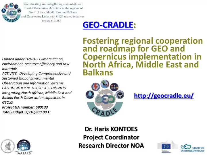
SLIDE 31

http://geocradle.eu

EU Framework Programme for Research and Innovation (Horizon 2020)

EU Funding Opportunities

Excellent Science

European Research Council Future and Emerging Technologies Marie Skłodowska-Curie actions Research Infrastructures, including e-Infrastructures

Industrial Leadership

Leadership in Enabling and Industrial Technologies

Nanotechnologies, Advanced Materials, Advanced Manufacturing and Processing, and Biotechnology Information and Communication Technologies Space

Access to risk finance Innovation in SMEs

Societal Challenges

Health, Demographic Change and Wellbeing Food Security, Sustainable Agriculture and Forestry, Marine, Maritime and Inland Water Research and the Bioeconomy Secure, Clean and Efficient Energy Smart, Green and Integrated Transport Climate Action, Environment, Resource Efficiency and Raw Materials Europe in a changing world - Inclusive, innovative and reflective societies Secure societies – Protecting freedom and security of Europe and its citizens

Spreading Excellence and Widening Participation Science with and for Society Cross-cutting activities (focus areas) Fast Track to Innovation Pilot European Institute of Innovation and Technology (EIT) Euratom Smart Cyber-Physical Systems

https://ec.europa.eu/programmes/horizon2020/

Highly relevant to GEO-CRADLE!

H2020 is the biggest EU Research and Innovation programme ever with nearly €80 billion of funding available

  • ver 7 years

(2014 to 2020), enhancing EU international research and Third Country participation

slide-32
SLIDE 32

http://geocradle.eu

EU Framework Programme for Research and Innovation (Horizon 2020)

EU Funding Opportunities

slide-33
SLIDE 33

http://geocradle.eu

EU Framework Programme for Research and Innovation (Horizon 2020)

EU Funding Opportunities

The PRIMA initiative

The Commission has agreed on a proposal for a Partnership for Research and Innovation in the Mediterranean Area, PRIMA, which is set to develop much-needed novel solutions for sustainable water management and food production. Funding for the €400 million partnership will come from the participating countries (currently around €200 million), matched by a €200 million contribution from the EU through its current research framework programme Horizon 2020. The partnership is scheduled to run for 10 years, starting in 2018. http://ec.europa.eu/research/environment/index.cfm?pg=prima The PRIMA Joint Programme involves 19 countries:

  • 11 Member States: Croatia, Cyprus, the Czech Republic,

France, Greece, Italy, Luxembourg, Malta, Portugal, Slovenia and Spain;

  • 8 third countries: Algeria, Egypt, Israel, Jordan, Lebanon,

Morocco, Tunisia and Turkey. Of these, 14 countries (Cyprus, the Czech Republic, Egypt, France, Greece, Israel, Italy, Lebanon, Luxembourg, Malta, Morocco, Portugal, Spain and Tunisia) have agreed to jointly undertake the PRIMA initiative. The participation of Germany is currently under negotiation. As the initiative is evolving over time, more participants are expected to follow, both EU and non-EU countries. Highly relevant to GEO-CRADLE!

slide-34
SLIDE 34

http://geocradle.eu

Instrument for Pre-accession Assistance II (IPA)

EU Funding Opportunities

https://ec.europa.eu/neighbourhood-enlargement/instruments/overview_en

The IPA provides assistance to countries directly in line to become members of the European Union (candidate countries: Albania, Montenegro, Serbia, the former Yugoslav Republic of Macedonia, and Turkey), as well as the rest Balkan countries (potential candidates: Bosnia-Herzegovina and Kosovo*).

* This designation is without prejudice to positions on status, and is in line with UNSCR 1244/99 and the ICJ Opinion on the Kosovo declaration of independence

slide-35
SLIDE 35

http://geocradle.eu

Instrument for Pre-accession Assistance II (IPA)

EU Funding Opportunities

Country 2016 Albania 89.7 Bosnia & Herzegovina 42.7 The former Yugoslav Republic of Macedonia 91.6 Kosovo* 88.7 Montenegro 37.4 Serbia 207.9 Turkey 630.7 Multi-country 390.0

The IPA is the means by which the EU supports reforms in the 'enlargement countries' with financial and technical help. The IPA funds build up the capacities of the countries throughout the accession process, resulting in progressive, positive developments in the region. Budget of IPA II for 2014-2020: € 11.7 billion. Pre-accession assistance is an investment in:  Public administration reform  Rule of law  Sustainable economy  People  Agriculture and rural development

Highly relevant to GEO-CRADLE!

slide-36
SLIDE 36

http://geocradle.eu

European Neighbourhood Instrument (ENI)

EU Funding Opportunities

http://ec.europa.eu/europeaid/funding/european-neighbourhood-and-partnership-instrument-enpi_en

The ENI funds the European Neighbourhood Policy (ENP) which covers cooperation with EU’s 16 Neighbours.

Russia takes part in Cross-Border Cooperation activities under the ENP and is not a part of the ENP as such.

* SYRIA: EU Cooperation with Syria is currently suspended due to the political situation ** PALESTINE: This designation does not entail any recognition of Palestine as a state and is without prejudice to positions

  • n the recognition of

Palestine as a state.

slide-37
SLIDE 37

http://geocradle.eu

European Neighbourhood Instrument (ENI)

EU Funding Opportunities

Budget of ENI for 2014-2020: € 15.4 billion.

http://www.enpi-info.eu/files/publications/ENI.pdf

Highly relevant to GEO-CRADLE!

slide-38
SLIDE 38

http://geocradle.eu

Development Cooperation Instrument (DCI)

EU Funding Opportunities

Geographic programmes support cooperation with around 47 developing countries in Latin America, South Asia and North and South East Asia, Central Asia, Middle East and South Africa. They support actions based on the European Consensus for Development and the following areas:  Human rights, democracy and good governance  Inclusive and sustainable growth for human development (e.g. health, education, social protection, sustainable agriculture, food and nutrition security…)  Migration and asylum  The link between humanitarian relief and development cooperation  Resilience and disaster risk reduction  Development and security, including conflict prevention. The DCI covers all the developing countries except the countries eligible for the Pre-Accession Instrument. There are 3 specific components covered: Geographic programmes Thematic programmes Pan-African Programme

Highly relevant to GEO-CRADLE!

slide-39
SLIDE 39

http://geocradle.eu

Development Cooperation Instrument (DCI)

EU Funding Opportunities

Thematic programmes benefit all developing countries (including those covered by the ENPI and the EDF). These programmes add value, complementarity and coherence to the geographical programmes. There are 2 categories:  'Global public good and challenges': this programme addresses climate change, environment, energy, human development, food security and migration while ensuring coherence with the poverty reduction objective. No less than 27% of this programme is spent on climate change and environment objectives. At least 25% of the programme is used to support social inclusion and human development.  'Civil society organisations and local authorities': this programme provides greater support to civil society and local authorities to encourage them to play a bigger role in development strategies. The DCI covers all the developing countries except the countries eligible for the Pre-Accession Instrument. There are 3 specific components covered: Geographic programmes Thematic programmes Pan-African Programme

Highly relevant to GEO-CRADLE!

slide-40
SLIDE 40

http://geocradle.eu

Development Cooperation Instrument (DCI)

EU Funding Opportunities

The newly established Pan-African Programme supports the strategic partnership between the EU and Africa. This programme complements other financing instruments which are used in Africa (in particular ENI and EDF) and supports activities of trans-regional, continental or global nature in and with Africa. The DCI covers all the developing countries except the countries eligible for the Pre-Accession Instrument. There are 3 specific components covered: Geographic programmes Thematic programmes Pan-African Programme

Highly relevant to GEO-CRADLE!

slide-41
SLIDE 41

http://geocradle.eu/

slide-42
SLIDE 42