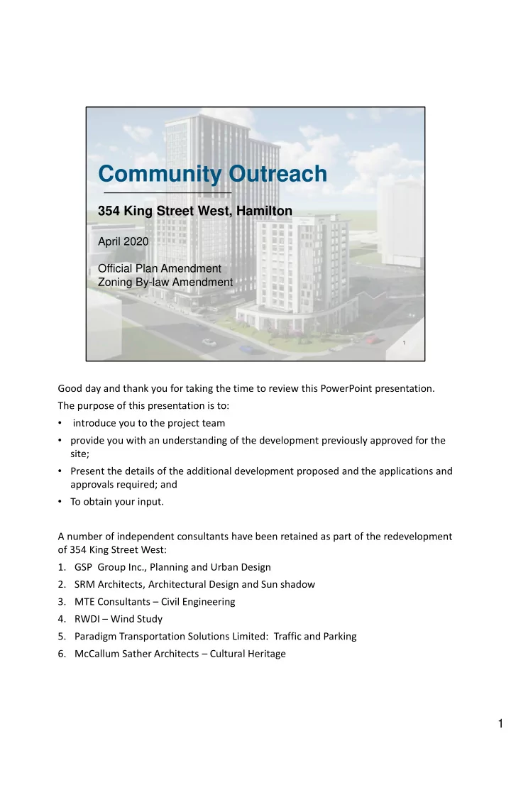
Community Outreach 354 King Street West, Hamilton April 2020 - - PDF document

community outreach
SMART_READER_LITE
LIVE PREVIEW

Community Outreach 354 King Street West, Hamilton April 2020 - - PDF document

Community Outreach 354 King Street West, Hamilton April 2020 Official Plan Amendment Zoning By-law Amendment 1 Good day and thank you for taking the time to review this PowerPoint presentation. The purpose of this presentation is to:


slide-1
SLIDE 1

1

Community Outreach

354 King Street West, Hamilton

April 2020 Official Plan Amendment Zoning By-law Amendment Good day and thank you for taking the time to review this PowerPoint presentation. The purpose of this presentation is to:

  • introduce you to the project team
  • provide you with an understanding of the development previously approved for the

site;

  • Present the details of the additional development proposed and the applications and

approvals required; and

  • To obtain your input.

A number of independent consultants have been retained as part of the redevelopment

  • f 354 King Street West:
  • 1. GSP Group Inc., Planning and Urban Design
  • 2. SRM Architects, Architectural Design and Sun shadow
  • 3. MTE Consultants – Civil Engineering
  • 4. RWDI – Wind Study
  • 5. Paradigm Transportation Solutions Limited: Traffic and Parking
  • 6. McCallum Sather Architects – Cultural Heritage

1

slide-2
SLIDE 2

2

Location of 354 King Street West

  • As you are aware, the Site is located at the northwest corner of

King Street West and Queen Street North at the boarder of Hamilton’s Downtown.

  • The Site has frontage along King Street West, Queen Street

North and Market Street.

  • Not included in the redevelopment are 2 semi-detached dwellings

at the southwest corner of Market Street and Queen Street North. One of these dwelling units was purchased by the City of Hamilton/Metrolinx in connection with the proposed LRT, while the second unit is still privately owned. Both of these units were to be used for the LRT. There long-term use as semi-detached dwellings was not envisioned.

  • Overall, the property is approximately 0.7 hectares (1.74 acres)

in area.

  • Historically, the Site contained the former Mount St. Joseph
  • rphanage which was demolished in 2015.

2

slide-3
SLIDE 3

3

What has been approved on the Site?

 6-storey Apartment Building  10-Storey Hotel  8, 2-storey Townhouse units on Market Street  Retail/commercial along King Street West Along Market Street

  • I am sure you are all aware that there are already development approvals associated

with the Site.

  • Specifically, the Site has been approved for a 10 storey hotel at the corner of King

and Queen, and a 6 storey apartment building west of the hotel, along King Street West.

  • In addition, the approved development includes 8 townhouse units fronting Market

Street.

  • Finally, the development includes some retail commercial uses on the ground floor
  • f the apartment building along King Street West.
  • As a part of the development a comprehensive podium (or building base) is being

constructed that contains the majority of the parking associated with the hotel and apartment building. Some surface parking is available beside the apartment building.

3

slide-4
SLIDE 4

4

Why was there no Public Consultation Before?

Site Plan Approval

  • Site Plan Approval is for development proposals that already conform to the

Official Plan/Secondary Plan, and comply with the Zoning By-law

  • Pursuant to the Planning Act, the Site Plan approval process is not a public

process and does not require public input

  • City reviewed and approved the following studies required through the Site

Plan approval process:

  • Stage 1 and 2 Archaeological Assessment
  • Erosion/Sediment Control Plan, Grading Plan, Servicing Plan
  • Cultural Heritage Impact Assessment
  • Site Plan and Building Elevations
  • Noise and Vibration Study
  • Tree Management Plan
  • Urban Design Brief
  • Landscape Plan
  • Pedestrian Wind Letter
  • Geotechnical Report
  • Sun-Shadow Study for Hotel
  • Dust and Pest Management Plan

Initially, when the owner considered the redevelopment of the site back in 2017 a proposal for a 25 storey residential building and an 11 story hotel was presented to the City’s Design Review Panel. Since this development would have required both an Urban Hamilton Official Plan Amendment and a Zoning By-law Amendment, the owner decided to scale back the development and build what was already permitted based on the existing zoning of the

  • Site. Specifically, a 10 storey hotel and a 6 storey apartment building.

When new development conforms to the policies of the Urban Hamilton Official Plan and Hamilton Zoning by-law 05-200, only Site Plan Approval is required. Site Plan approval under the Planning Act is not a public process – that is, no public consultation is required because the owner is building what has already been approved for the Site. On that basis, no public consultation occurred. This does not mean that the developer was not required to submit a host of studies to justify the proposed height and the limits of the development. As a part of the Site Plan approval process, the studies listed in this slide were prepared and approved by the City prior to the issuance of a Building Permit.

4

slide-5
SLIDE 5

5

When did this get approved?

April 2018 Site Plan Approval Application submitted for 10-storey hotel and 6- storey apartment building August 2018 City Conditionally Approves Site Plan, subject to Minor Variances October 2019 City Issues Final Site Plan Approval August 2018 – October 2019 Submission and Review of Studies and Reports (non-public process) July 2019 Foundation Building Permit Issued

  • This slide illustrates the timing of the approved development that is currently under

construction.

  • In April 2018 an application for site plan approval was submitted to the City to

permit the construction of a 10 storey hotel and 6 storey apartment building.

  • In August 2018 the City issued “conditional Site plan approval” that was subject to

the completion of various supporting studies as well as minor variances to address some of the site specifics associated with the development.

  • Between August 2018 and October 2019 the owner worked on clearing the

conditions of site plan approval imposed by the City which included a number of studies, reports and detailed drawings.

  • In July of 2019 a foundation permit was issued by the city.
  • Finally, in October 2019, the City issued final site plan approval for the 10 storey

hotel and 6 storey apartment building.

5

slide-6
SLIDE 6

Planning Review Framework

Key Policy and Regulatory Documents and Design Guidelines

Policies

  • 2020 Provincial Policy Statement
  • 2019 Growth Plan for the Greater Golden Horseshoe
  • Urban Hamilton Official Plan and Strathcona Secondary Plan

Regulations

  • Zoning By-law 05-200

Guidelines

  • Corridor Design Guidelines
  • Tall Buildings Guidelines
  • Transit-Oriented Development Guidelines
  • Site Plan Guidelines

6

Before we go on, I would like to provide you with some background related to Land Use Planning in Hamilton, and the province as a whole. First, the Planning Act is the legislative framework that all development in Ontario must adhere to. Next we have Provincial Policy. A document known as The Provincial Policy Statement (PPS) provides policy direction on matters of provincial interest related to land use planning and development. All planning decisions must be considered in the context of this document and the development must be consistent with these policies. At a high level, the Provincial Policy statement supports and encourages appropriate intensification within settlement areas to accommodate growth and discourage urban sprawl. Next we have the A Place to Grow: Growth Plan for the Greater Golden Horseshoe. The City of Hamilton is situated within the limits of the Growth Plan area. All land use planning and development matters must also to conform to these policies. The policies contained within the Growth Plan are more specific than the PPS and look at exactly where and how growth should occur within municipalities. It establishes density targets that municipalities are required to meet and require growth to be focused in: defined built up areas, strategic growth areas, locations with existing or planned transit, and areas where public services and facilities exist or are planned. The approved development of the Site “checks” all of these boxes. Next we look at the local level. The City of Hamilton’s long range planning document is the Urban Hamilton Official Plan (UHOP).

  • The UHOP designates the site as “Mixed Use - Medium Density” and permits both a hotel use and apartments at this locations.
  • Within the UHOP there are even more detailed policies for this site contained within the Strathcona Secondary Plan which designates the Site as

“Mixed Use Medium Density” and limits of height of development to a maximum of 10 storeys subject to appropriate justification. Once again, the approved development meets these policy requirements. Next we look to Hamilton’s Zoning By-law 05-200 for regulations related to development. This document identifies minimum and maximum development requirements. E.g. minimum setbacks from the street and maximum heights. The approved development was generally in compliance with these regulations with the exception of a few minor modifications that were addressed through the Committee of Adjustment. Finally, the City of Hamilton has approved a number of Guidelines to be adhered to that provide City Staff with the tools they need to evaluate development proposals. With respect to this Site, the key guidelines reviewed included:

  • Corridor Design Guidelines – noting that this site is located on a transit corridor.
  • Tall Buildings Guidelines – that address buildings over 13 storeys in height in the Downtown
  • Transit Oriented Development Guidelines - noting that this site is located on a transit corridor; and
  • The City’s Site Plan Guidelines

All of these policies, regulations and guidelines were reviewed by City Staff in their evaluation of the approved development of the Site.

6

slide-7
SLIDE 7

7

Urban Hamilton Official Plan

  • Designated “Mixed

Use – Medium Density”

  • Permits a mix of

residential, retail, commercial uses including apartment buildings and hotels

Hotel and apartment building are permitted

  • uses. No amendments required for site plan

approve development.

This slide illustrates part of a land use schedule included in the Urban Hamilton Official Plan (Schedule E-1). It illustrates that the Site is designated “Mixed Use – Medium Density” which corresponds with specific policies in the UHOP that must be considered. As noted, this designation permits a hotel and an apartment building. No amendment to the UHOP was required for the approved development.

7

slide-8
SLIDE 8

8

Strathcona Secondary Plan

  • Designated: “Mixed Use

– Medium Density”

  • Area “L”: prohibits drive

through facilities, gas bars, car washes, and vehicular service stations

  • Height of 6-storeys is

permitted with possibility

  • f increasing to 10

storeys without an amendment to the Plan subject to justification 10 storey height of Hotel justified through studies. No amendment to the Secondary Plan required for site plan approved development.

This slide illustrates a portion of the Strathcona Secondary Plan land use plan. It illustrates that the Site is designated “Mixed Use – Medium Density” and is subject to a special policy (Area “L”) which prohibits drive through facilities like gas stations, car washes and services stations on the site. The Secondary Plan provides more specific policies that must be considered. As noted, this designation permits a hotel and an apartment building. It also permit a maximum height of 10 storeys subject to appropriate justification to the satisfaction of the City. In this regard, the owner was required to provide a justification brief which was accepted by the City. No amendment to the UHOP was required for the approved development.

8

slide-9
SLIDE 9

9

Hamilton Zoning By-law 05-200

Zoned: Transit Orientated Corridor Mixed Use Medium Density (TOC1) with exception 295 Permits Minimum height of 11m (±3 storeys) and maximum height of 22m (±6 storeys) Approved Minor Variances (November 2018):

  • Hotel: Increase max. height

from 22m (±6 storeys) to 36.5m (10 storeys)

  • Increase number of entrance

driveways from 1 to 4

  • Allow for min. height of first

floor of 7m instead of 11m

Finally, this slide illustrates the existing zoning of the City. Specifically, the site is zoned in the Transit Oriented Corridor Mixed Use Medium Density (TOC1) zone and is subject to exception #295. This zone permits a hotel and apartment building and permits a maximum height 22m

  • n the Site.

Through the minor variance process approvals were granted to permit a maximum height of 36.5m to permit the hotel to be developed at 10 storeys.

9

slide-10
SLIDE 10

10

So What is Changing?

Now that we have an understanding of what is currently permitted on the Site, the next step is to understand what is being proposed and what approvals are being sought to allow for the change.

10

slide-11
SLIDE 11

11

Changes Proposed to the Hotel

Requesting approval for 2 additional storeys on hotel

First, an increase in the height of the hotel from 10 storeys to 12 storeys is proposed.

11

slide-12
SLIDE 12

12

Changes Proposed to the Apartment

Requesting approval for 19 additional storeys on the apartment building

Next, an increase in the height of the apartment buildings from 6 storeys to 25 storeys is proposed representing an increase in 19 storeys.

12

slide-13
SLIDE 13

13

What is Not Changing?

  • Podium on both buildings
  • Apartment - first 6 storeys
  • Hotel – first 10 storeys
  • 2 storey townhouses along

Market Street

Along Market Street

Not changes are proposed to the portion of the building that has already received approval and for which building permits have already been issued; Specifically, a 6 storey apartment building and a 10 storey hotel, as well as 2 storey townhouses along Market Street. What this means is that if the applicant’s request is not successful, then the areas highlighted in green in this slide will only be allowed to proceed.

13

slide-14
SLIDE 14

14

Approved Proposed

What Will the Proposed Changes Look Like?

This slide provides artists’ renderings of the approved development on the left, compared to the higher buildings proposed on the right.

14

slide-15
SLIDE 15

15

Approved Development Proposed Difference (+ / -)

  • Apt. = Apartment/townhouses

H = Hotel Units (Apt.) 86 units

  • 78 units within the

6-storey building

  • 8 units along

Market Street (townhouses) 322 units

  • 314 units within the

25-storey building

  • 8 units along

Market Street (townhouses) + 236 units Suites (Hotel) 126 suites 154 suites + 28 suites

  • Max. Building

Height (storeys) 6-storeys (Apt.) 25-storeys (Apt.) + 19 storeys (Apt.) 10-storeys (Hotel) 12-storeys (Hotel) + 2 storeys (Hotel)

  • Max. Building

Height (metres) 25.8 m (Apt.) 77.2 m (Apt.) + 51.4 m (Apt.) 36.1 m (Hotel) 41.7 m (Hotel) + 5.6 m (Hotel)

What Do these Proposed Changes Include?

Aside from what the buildings will and/or could look like, this slide provides a better understanding of what the proposed changes translate to in terms of change. The second column illustrates the number of units, suites, and maximum height permitted based on the approved development. The third column illustrates the total number of units, suites, and maximum height proposed based on the development application we are seeking approval for. The fourth and final column provides a measurable difference between the two. Specifically, if approved, the proposal will: a) increase the total number of units within the apartment by 236 units b) Increase the total number of hotel suites by 28 suites c) Increase the total height of the hotel by 2 storeys (5.6m) d) Increase the total height of the apartment building by 19 storeys (51.4m)

15

slide-16
SLIDE 16

16

What Approvals are Required?

Official Plan and Zoning By-law Amendments

Amendments Required to Permit additional height for both the Hotel and the Apartment:

  • Urban Hamilton Official Plan and

Strathcona Secondary Plan

  • Zoning By-law

Applications Submitted to City in December 2019

So what approval are required? Neither the Urban Hamilton Official Plan/Secondary Plan or the Hamilton Zoning by-law permit the proposed height increase. In addition, the Zoning By-law does not permit the parking ratio proposed. In order to permit the requested increase in height, amendments are required to both the Urban Hamilton Official Plan (including the Strathcona Secondary Plan) and the Zoning by-law. In order to address site specific regulations associated with the site, as well as the request for a parking ratio that is applicable to downtown properties, amendments to these documents are required. Accordingly, in December of last year, we submitted applications for amendments to the UHOP/Secondary Plan and Zoning By-law to the City of Hamilton for approval.

16

slide-17
SLIDE 17

17

Why a Public Process Now?

Proposed changes do not conform to the Urban Hamilton Official Plan and do not comply with the Zoning By-law. Amendments to these documents require Public Consultation under the Planning Act. It is these new applications that require public consultation pursuant to the Planning Act. As noted, the approved development conformed to the Official Plan and complied with the Zoning By-law – therefore no public consultation was required. Now that changes are proposed that do not meet the policy or regulatory requirements – a different process must be followed that requires consultation under the Planning Act.

17

slide-18
SLIDE 18

18

What was Submitted to Justify the Amendments?

Comprehensive submission of studies and reports to support the requested height increase.

Planning and Design GSP Group Inc. Planning Justification Report Urban Design Brief Engineering MTE Consultants Inc. Functional Servicing and Stormwater Management Report Traffic Paradigm Transportation Solutions Ltd. Transportation Impact and Transportation Demand Management Study Impact Assessments SRM Architects RWDI McCallum Sather Architects Inc. Sun-Shadow Study Wind Study Cultural Heritage Impact Assessment

As a part of our submission to the City for the requested changes, a number of technical studies were required to justify and substantiate the requested changes. This slide illustrates the required studies that were submitted to the City for approval. Each of these studies was based on a terms of reference that the City provides and consultants must follow/address. These technical studies are currently being reviewed by City staff in the various disciplines noted. Comments have not yet been received.

18

slide-19
SLIDE 19

19

Key Issues Considered

  • Height – community and local context
  • Privacy and Overlook – local impact
  • Sun / Shadow – local impact
  • Wind – pedestrian impact
  • Traffic / Parking – local impact

There are a number of issues that were considered as a part of these applications and that the various technically studies addressed. This slide illustrates 5 of the key issues considered and addressed through the studies noted in the previous slide: 1. Height – specifically is the proposed height appropriate at this location given its local context as well as its broader community context? 2. Privacy and Overlook – will the proposed height adversely affect adjacent development, and if so, how can it be mitigated? 3. Sun/shadow – based on the City’s criteria for sun/shadow studies – will the shadows generated by the proposed height increase meet the City’s standards, and if not, how can the shadows be mitigated. 4. Wind – once again, based on the City’s criteria for wind studies – will the proposed development cause unacceptable adverse wind impacts surrounding the proposed buildings and if so, how can it be mitigated. 5. Traffic and parking – finally, can the existing road network accommodate the anticipated traffic increase, and is the proposed parking ratio appropriate and reasonable for the proposed development. As noted, the applicant has responded to these issues through the various technical studies submitted with the application. As the community most directly affected by these changes, it is through your comments that the City obtains a different perspective that will be considered as well.

19

slide-20
SLIDE 20

20

Height: Community Context

From a broad, community perspective, it is noted that there are a number of tall buildings in the vicinity of the Site. In the top air photo, we have superimposed the proposed building in yellow which is located kitty corner to a building currently under construction at the southeast corner

  • f King and Queen known as “the Platinum” and illustrated I red. Also included is a

rendering of this development at an approved height of 23 storeys. The bottom air photo illustrates a number of buildings in the broader community in

  • range and includes the number of storeys each of these buildings has.

Of note are the two buildings north of the site on Queen street north that are 18 and 22 storeys in height respectively – one of the west side of Queen Street (22 storeys) and the other on the east side of Queen Street (18 storeys.

20

slide-21
SLIDE 21

21

Along Market Street

Height: Local Context

Views on Market and Ray

  • Visual Impact

Assessment Completed pursuant to City’s requirements being evaluated by City Staff. A Visual Impact Assessment was completed by GSP Group to evaluate significant views and vistas as defined by the City. With respect to views, Section 3.3.5 of the UHOP generally describes public views and vistas as “significant compositions of important public and historic buildings, natural heritage and open space features, landmarks, and skylines which enhance the overall physical character of an area when viewed from the public realm. Vistas are generally panoramic in nature while views usually refer to a strong individual features often framed by its

  • surroundings. Examples of existing significant vistas include the panorama of the Niagra Escarpment, Hamilton

Harbour and the downtown skyline as viewed from various vantage points throughout the City.” In accordance with the City’s terms of reference for VIA’s, specific view are required to be addressed. These views are chosen by the City, not the consultant, and are based on specific vantage points and views the City has identified through policy direction. Accordingly, the VIA prepared by GSP Group explored 3 potential impacts from the proposed development: 1. Potential visual impacts related to the Niagara Escarpment, either as potential vistas or broader skyline from a distance or views up the Queen Street corridor’ 2. Potential visual impacts on the Queen Street and King Street streetscapes; and’ 3. Potential visual impact on Victoria Park at the centre of the Strathcona neighbourhood. The report concludes that the building does not block any view corridors of the Niagara Escarpment and would not block any potential views up the Queen Street corridor to the Niagara Escarpment. The report further concludes that the proposed development will not negatively impact any significant vistas in Downtwon Hamilton. Although the 25 storey tower form is visible from several longer distance vantage points, it is perceived together with surrounding taller buildings and will dominate those vistas. With respect to the local context, we received a request to provide views from Market and Ray Street. The images presented in this slide show the local context with the new proposed building highly visible in the background similar to existing high rises along Queen when viewed from the interior streets.

21

slide-22
SLIDE 22

22

Along Market Street

Height: Local Context

Views at King and Ray This slide illustrates the proposed building when viewed from the intersection of King Street West and Ray Street.

22

slide-23
SLIDE 23

23

Privacy and Overlook: Local Context

  • No private balconies on

apartment building therefore no direct

  • verlook
  • 2nd storey balconies for

townhouses along Market Street overlook the Street

  • nly.

Along Market Street

3 m

  • Apartment

rooftop amenity area is setback 3m from edge of building line with 2m-high fence minimizing direct views into neighbourhood

With respect to privacy and overlook it should be noted that the proposed 25 storey building does not include any balconies. While the apartment building does provide rooftop amenity space, this space will be setback 3m from the edges of the building line and include fencing to ensure no one can walk to the edge of the building. The only balconies provided pertain to those townhouse units fronting Market Street. These balconies face Market Street and do not look into any privacy areas associated with existing residential development along Market Street.

23

slide-24
SLIDE 24

24

Sun / Shadow: Neighbourhood Impact?

March 21 12:51pm

Shadow Impact Study - Conclusions

March 21 3:51pm March 21 9:51pm

The proposed height increases satisfy the majority of the impact criteria of the Downtown Hamilton Terms of Reference for Shadow Impact Studies: 1. The proposed new net shadows allow for all affected adjacent residential and commercial amenity areas to receive at least 3 hours of sunlight between 10:00 a.m. and 4:00 p.m. pursuant to City standards. 2. The proposed new net shadows allow most affected public sidewalks to receive at least 3 hours of sunlight where existing conditions allow with the exception of a small portion of Market Street in front of the development. 3. The proposed new net shadows allow for at least 50% sun coverage at all times of the day on all public plazas, parks and open spaces in the surrounding area at any point pursuant to City standards, with the exception of McLaren Park with receives only 43% coverage 1.5 hours before sunset. 4. The proposed shadows do not extend to any of the City’s five identified primary civic gathering places in the down- town.

GSP Group prepared the Sun-shadow study pursuant to the City of Hamilton’s guidelines. The City provides 4 specific criteria that must be addressed as a part of the sun shadow study. This slide illustrates along the right margin how the shadow moves throughout the day.

  • The red area represents the proposed new net shadow created by the proposed

height increase.

  • The blue area represents the shadow that is permitted based on the approved

development

  • The yellow area illustrates public and private amenity areas in proximity to the site.

What this slide illustrates is that the proposed development meets the City’s standards for residential and commercial amenity areas, as well as for public sidewalks – with the exception of the sidewalk directly in front of the development on Market Street. In addition, the Shadow study demonstrates the that McLaren Park, located further north (not visible on the diagrams) does not meet the minimum criteria (by 7%) for a period of 1.5 hours before sunset.

24

slide-25
SLIDE 25

25

  • Pedestrian wind conditions on and

immediately surrounding the Site are expected to meet the safety criterion of the City.

  • Wind conditions are expected to

increase slightly overall

  • Appropriate wind conditions at

entrances and sidewalk areas.

  • Uncomfortable wind conditions

expected only in winter in parking area between apartment and hotel

Wind: Neighbourhood Impact?

Anticipated Winter Conditions Anticipated Summer Conditions

Pedestrian Wind Impact Study Conclusions

Wind Comfort Categories:

RWDI prepare a Pedestrian Wind impact Study pursuant to the City’s Terms of reference. A Pedestrian level wind study is a planning submission requirement which includes a visual model and written evaluation f how a proposed development will impact pedestrian level wind conditions at various times of the year on pedestrian areas and how the impact will be mitigated if applicable. The objective is to maintain “comfortable and safe pedestrian level wind conditions that are appropriate for the seasons and intended use of pedestrian areas -- which include street frontages, pathways, building entrances, open spaces, Amenity areas, outdoor sitting areas, etc. As noted in this slide, the pedestrian wind conditions on and immediately surrounding the Site are expected to meet the safety criterion of the city. If you look carefully at the coloured circles you can see the various wind comfort levels that were recorded around the site. The only areas where “uncomfortable” wind conditions (orange coloured circles) are anticipated are during the winter months between the apartment and hotel and at the northwest corner of Market and Queen Street. Additional wind mitigation (i.e. wind screens, addition landscaping) will be determined at a later stage, following a decision on the requested height increase.

25

slide-26
SLIDE 26

26

Traffic and Circulation

  • Four accesses to the Site:
  • 2 from King Street to

access visitor parking for apartments/retail

  • 1 from Queen Street

strictly for the hotel

  • 1 from Market Street to

access the underground parking garage for the apartments and townhouses

  • Transportation study

concludes that surrounding intersections will operate at acceptable levels with the expected increase of vehicles in/out of the Site.

Resident Parking Entrance Queen St N Hotel Parking Entrance Resident, Retail, & Visitor Parking Entrance

With respect to Traffic, Paradigm Transportation Solutions Limited completed a Traffic Impact Study and Transportation Demand Management Study. With respect to access, this slide illustrates where the principles accesses to the site are located as well as who the accesses serve.

  • 1. King Street: Two accesses to King Street W provide access to the surface parking lot

associated with the apartment building.

  • 2. Queen Street: This access services only the hotel. It provides access to the

underground parking garage as well as a few surface parking spaces directly north

  • f the hotel for drop off and pick up.
  • 3. Market Street: principal access to the underground parking structure that services

the apartment building and the townhouses. While traffic will clearly increase as result of the proposed development, the traffic study completed by Paradigm demonstrates that the intersections will operate at acceptable levels according to industry standards.

26

slide-27
SLIDE 27

27

Parking

HOTEL

  • Principal hotel guest parking

underground with entrance restricted to Queen Street only – small surface parking lot off Queen. RETAIL/VISITOR

  • Retail and visitor parking available

in surfacing parking lot only accessed from King Street. APARTMENTS/TOWNHOUSES

  • Resident parking for apartment and

townhouse units underground with access from Market Street. 115 underground parking spaces (25 will be valet) + 4 pick-up/drop-

  • ff spaces

(TOTAL 119) 21 surface parking spaces 93 underground parking spaces (TOTAL 114) Overall 255 On-Site Parking Spaces are Proposed Surface: 15 Commercial spaces + 5 Visitor Spaces + 2 Carshare spaces (TOTAL 22)

This slide illustrates the parking breakdown proposed for the development. One of the requested modifications to the Zoning By-law is to have the parking regulations for Downtown Zones apply, rather than the regulations of the Transit Oriented Corridor Zones based on the site’s location immediately abutting the downtown zone and adjacent to existing and planned public transit. Essentially, we are requesting that the parking standard that applies on the east side of Queen street across of the Site should apply to the west side of Queen Street as well. Paradigm Transportation Solutions Limited prepare a Parking Needs Analysis which concluded that due to the location of the site being adjacent to the Downtown area and the proximity to existing and proposed transit, along with a parking demand analysis using a proxy site “The project demand provides a statistically valid justification that the proposed parking supply of 255 spaces is sufficient to the intended use” Based on the proposed parking regulations, the proposed development meets the parking standards for Downtowns zones

27

slide-28
SLIDE 28

28

Parking

255 total spaces provided. Proposed Parking meets Proposed Downtown Parking Standards

Minimum Required Parking for Transit Orientated Corridor Zones Minimum Required Parking for Downtown Zones Provided Parking Hotel 154 spaces 92 spaces 119 spaces Multiple Dwelling Units 226 spaces 103 spaces 114 spaces Commercial 0 spaces 0 spaces 15 spaces Visitor / Car share 0 spaces 0 spaces 5 Visitor + 2 Car share spaces TOTAL 380 spaces 195 spaces 255 spaces

This slide provides a comparison of the number of parking spaces required for the various proposed uses based on two different zones. The 2nd column illustrates the parking required for the Transit Oriented Corridor Zone that 354 King Street is currently subject to. The 3rd column illustrates the parking required for Downtown zones immediately across the street on the east side of Queen Street. The 4th column identifies the actual number of parking spaces that are proposed for the proposed development.

28

slide-29
SLIDE 29

29

What is the Planning Rationale?

2014 and 2020 Provincial Policy Statement 2019 Growth Plan for the Greater Golden Horseshoe Urban Hamilton Official Plan Strathcona Secondary Plan Design Guidelines

  • Underutilized gateway site along a primary city corridor
  • Compact, transit-supportive development form next to HSR and GO

Bus stops (potential LRT/higher-order transit stop)

  • Increase employment opportunity (hotel) and diversification of the

housing stock (apartment and townhouses)

  • Improvement to public realm and pedestrian experience
  • Unbundled parking supply and secure bicycle storage
  • Addition to Hamilton skyline aesthetic
  • Meets the intent of the Official Plan and Secondary Plan by minimizing

impacts (sun/shadow, wind, noise) on neighbouring properties

As noted earlier, GSP Group prepared a detailed Planning Justification Report that was submitted with the application. This Report discusses in detail how the proposed requested additional height and parking supports provincial planning policy as well as the general policies of the UHOP. Overall, transit supportive intensification is encouraged across the province in appropriate locations. The bullets noted in this slide provide some of the key planning points that justify the requested height increase and parking modifications.

29

slide-30
SLIDE 30

30

Fill out the online comment sheet/ questionnaire (available on the same website as this presentation) and send via email to apaton@gspgroup.ca by Thursday, April 30th (please include your name and address)

Questions? Comments?

How Can you Provide your Comments? Thank you for taking the time to review this on line PowerPoint presentation. We would very much like to hear from you and would appreciate it if you could fill out the online comment sheet/questionnaire and return it to GSP Group.

30

slide-31
SLIDE 31

31

  • We will review all community comments and provide a

copy to City Planning Staff and the Councillor for the public record.

  • We will summarize the key concerns identified by the

community and post a response document on the project website by mid May.

  • We will review all City/agency staff comments.
  • We will review both the City/Community comments and

determine whether potential revisions to the proposal and resubmission are required to address the comments / concerns.

What Happens Next?

Following receipt of your comments, this slide explains how your comments/questions will be addressed.

31

slide-32
SLIDE 32

32

Municipal Planning Process

Community Outreach April 3-30, 2020 Circulation and Comments from City/Agencies Resolution of Comments Statutory Public Meeting and Planning Committee with City Staff Recommendation City council for Final Approval

  • The timing associated with this application is clearly not known at this time due to the COVID-19

crisis.

  • This slide illustrates the steps that are to be followed – but purposefully does not provide any

timelines beyond April 30.

  • The long blue arrow depicts a timeline and continuum of the Official Plan/Zoning By-law Amendment

planning approvals process at a high level.

  • The first circle at the far left end illustrates where we are today – requesting your input

throughout the month of April.

  • As you continue along the arrow (moving from left to right) a pink area is labeled as

“Circulation and comments from city/agencies. What this means is that at this point in time the City’s various departments and agencies are reviewing the various technical studies we submitted with our application. Once they have completed their review, the City will provide their comments back to us and we will review them and determine whether modifications are required to the proposed development to address their comments/questions.

  • At the same time, we will be reviewing your comments and take them into consideration.
  • The next step noted with an orange bar above, where the slide above states “Resolution of

comments” – is the time where we will be reviewing our proposed request with the benefit

  • f your comments and municipal staff comments. We review all of the comments together

and determine whether there are ways in which the comments that can be addressed. This may or may not result in changes the proposed design.

  • How long that process will take is not known at this time.
  • The remaining two circles noted in yellow and red above indicate the final steps in the

planning approvals process which includes a statutory public meeting hosted by the City, a staff report with recommendations, and a Planning Committee meeting where your elected representatives will make a decision.

  • Finally, the Planning Committee’s recommendations are then presented to Council who

makes the City’s final decision.

32

slide-33
SLIDE 33

33

Thank you for your time and input!

33