SLIDE 1 1
Module 12: Detention Pond Module 12: Detention Pond Design for Water Quality Design for Water Quality Improvement Improvement
Robert Pitt Department of Civil, Construction, and Environmental Engineering University of Alabama
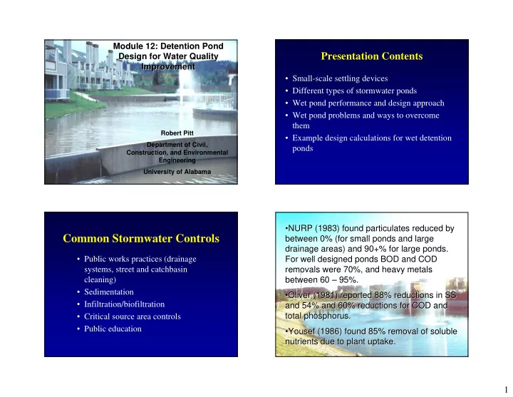
Presentation Contents
- Small-scale settling devices
- Different types of stormwater ponds
- Wet pond performance and design approach
- Wet pond problems and ways to overcome
them
- Example design calculations for wet detention
ponds
Common Stormwater Controls
- Public works practices (drainage
systems, street and catchbasin cleaning)
- Sedimentation
- Infiltration/biofiltration
- Critical source area controls
- Public education
- NURP (1983) found particulates reduced by
NURP (1983) found particulates reduced by between 0% (for small ponds and large between 0% (for small ponds and large drainage areas) and 90+% for large ponds. drainage areas) and 90+% for large ponds. For well designed ponds BOD and COD For well designed ponds BOD and COD removals were 70%, and heavy metals removals were 70%, and heavy metals between 60 between 60 – – 95%. 95%.
- Oliver (1981) reported 88% reductions in SS
Oliver (1981) reported 88% reductions in SS and 54% and 60% reductions for COD and and 54% and 60% reductions for COD and total phosphorus. total phosphorus.
Yousef (1986) found 85% removal of soluble (1986) found 85% removal of soluble nutrients due to plant uptake. nutrients due to plant uptake.
SLIDE 2 2
Retro-fitted Catchbasin with Sump Tested at Ocean County, NJ
Stormceptor Corp.
SLIDE 3 3
Sedimentation
- Dry detention ponds
- Wet detention ponds
- Wetlands
Wet Basins
Caltrans, San Diego, California
Extended Detention Ponds
Caltrans, San Diego and Los Angeles, California
SLIDE 4 4
Wet Detention Pond Advantages
- Very good control of particulate pollutants
- Opportunity to utilize biological processes
– Protozoa as bacteria predators – Aquatic plants enable higher levels of nutrient removal
- Outfall ponds capture and treat all storm sewer
discharges
– Wet weather stormwater runoff – Dry weather baseflows – Snowmelt – Industrial spills – Illegal discharges
Typical Dry Detention Pond, with Pilot Channel Unusual Dry Detention Pond Located on Hillside to Meet Peak Flow Rate Criterion
SLIDE 5
5
Dry Detention Pond Forebay for Stormwater Pump Station, Los Angeles, CA Scour and Sediment Transport in Dry Detention Ponds
Large Corrugated Pipes used for Underground Detention Below Parking Area
Wet Detention Facility at Shopping Center, Birmingham, AL
SLIDE 6
6
Wet Detention Facility at Shopping Center, Dayton, OH
Wet Detention Facility at Convention Center, Orlando, FL
Wet Detention Facility at Industrial Park, Birmingham, AL Wet Detention Facility at Apartments, Lake Oswego, OR (Part of Treatment Train)
SLIDE 7
7
Wet Detention Facility at Residential Area, Birmingham, AL
Advertising for New Wet Ponds, Austin, TX
Wetlands for Stormwater Control
Wetlands in Malmo, Sweden (under construction and mature) Watch your step Eric!
SLIDE 8
8
Inlet for Wetland in Malmo, Sweden for Treatment of CSOs and Stormwater
Mature Wetlands and Wet Detention Pond Facility, Malmo, Sweden New Wetlands being Planted by Volunteers, Malmo, Sweden New Wetlands being Planted by Volunteers, Malmo, Sweden
SLIDE 9 9
Lemna Systems
Necessary Harvesting of Aquatic Plants from Wetland used for Treatment of Municipal Wastewater
Observed Wet Pond Performance (when
constructed and operated according to best guidance)
- Suspended solids: 70 to 95%
- COD: 60 to 70%
- BOD5: 35 to 70%
- Total Kjeldahl nitrogen: 25 to 60%
- Total phosphorus: 35 to 85%
- Bacteria: 50 to 95%
- Copper: 60 to 95%
- Lead: 60 to 95%
- Zinc: 60 to 95%
Pond Problems
- Safety
- Nuisance conditions
- Maintenance
- Poorly known site conditions
- Critters
Safety of Detention Ponds
Numerous design features to maximize pond safety:
- Side slopes
- Depth
- Safety ledge
- Accessibility
- Outlet structure protection
- etc.
SLIDE 10 10
Deep Water Too Close To Shore
Thin Ice Near Shore
Steve Auger photo
Wisconsin DNR
Children are Attracted to Urban Waters
Frequent Maintenance and Adjustments to Outlets may be Needed
SLIDE 11 11
Sometimes the pond wins!
Wet Ponds Located in Areas of Karst Geology may have Sinkholes Ponds can be attractive and in some areas they actually encourage contact recreation, but water quality is usually
- poor. Birds and other wildlife are also
frequently attracted to ponds. However, they may be mutually exclusive uses
SLIDE 12 12
Bob Kort photo
Other critters also attracted to ponds (no geese at this pond!)
Existing Ponds can be Modified for Improved Performance
- Change outlet device
- Reshape pond
- Add internal berms to prevent
short-circuiting
Modification of Outlet for Improved Performance
Modification of Pond Outlet at Epcot Center, Orlando, FL
SLIDE 13 13
Re-building Pond (Re-shaping and Dredging), Moscow, Russia
Berm Located in Pond to Minimize Short-Circuiting, Gulfport, MS
Design Suggestions to Enhance Pollutant Control and to Minimize Problems
Composite list from literature and experience
- Locate and size ponds to minimize hydraulic
interferences.
- Keep pond shape simple to minimize short-circuiting.
- Slope ground leading to pond between 5 and 25%.
- Use shallow perimeter shelf as a safety ledge.
- Plant dense emergent vegetation on shelf.
- Plant thick vegetation barrier around pond perimeter.
- Provide at least 3 ft. of permanent pool depth for scour
protection.
- Provide at least 2 more feet as sacrificial storage.
Design Suggestions (cont.)
- Use sub-surface outlets to minimize clogging and to
retain floatables.
- Discourage water contact recreation and consumptive
fishing.
- Stock mosquito eating fish.
- Minimize water level fluctuations to reduce mosquito
problems.
- Place rocks at inlet and outlet areas to minimize scour.
- Use anti-seep collars around outlet pipes to minimize
piping.
- Provide trash and safety racks, plus baffles on outlets.
- Provide emergency spillway.
SLIDE 14 14
Use of Sedimentation in Conjunction with other Controls
- Effluent can be directed to infiltration or
wetland area.
- Sedimentation is a common pre-treatment
- ption for filtration and chemical
treatment
- Sedimentation can better handle large
flows and serves to protect downstream more “fragile” devices, such as wetlands
Infiltration Swale in Office Park Area, Downstream of Wet Pond, Lake Oswego, OR, Part
Wet Pond after Oil and Grease Trap and Step Aerator, Austin, TX
Settling Pond after Alum Injection, Orlando, FL
SLIDE 15 15
Dry Pond to Equalize Flows before Sand Filter, Austin, TX Equalizing Dry Pond to Control SSO Problems, Moody, AL
Percolation Ponds
- Can incorporate sedimentation with
infiltration
- Usually in areas of shallow groundwater
- Concern about possible groundwater
contamination, especially in industrial areas
Watertable Percolation Pond, Berlin, Germany
SLIDE 16 16
Watertable Percolation Pond, Madison, WI
Special Stormwater Control Considerations in Areas having Harsh Winters
- Snowmelt can contribute the majority of the
annual pollutant loads from urban areas
- Summer runoff is typically only considered
in the design of stormwater controls
- Cold weather hinders all stormwater control
processes (such as infiltration, settling, and plant uptake)
- Deicing salts are a special threat to urban
groundwater quality
Stormwater Design Considerations for Cold Climates
- “Oversize” wet ponds to accommodate reduced
settling rates (can be one-half of the summer rates)
- Protect sediment from scour during snowmelt
- “Oversize” infiltration areas due to reduced soil
infiltration rates, but substantial infiltration does
- ccur under snowpacks during long winters
- Divert snowmelt from infiltration areas
- Do not rely on wetlands and other controls utilizing
plants during long dormant season
- Follow good snow removal practices
- Reduce the use of deicing salts
- Prevention is especially important in design of land
development
Cost-Benefit Analysis for Various Stormwater Controls, SLAMM
SLIDE 17 17
Particulate Settling
- Ideal Settling – Particle
path is vector sum of particle velocity through pond and settling (upflow) velocity
A Q v
=
D L v V =
L – – Pond Length Pond Length
D – – Outlet Depth Outlet Depth
V – – Water Velocity through Pond Water Velocity through Pond
v – – Settling Velocity Settling Velocity
Qout
– Outflow from Pond Outflow from Pond
A – – Pond Surface Area Pond Surface Area
Pages 23-25 of detention pond design.pdf
Measured Particle Sizes, Including Bed Load Component, at Monroe St. Detention Pond, Madison, WI
- Ideal settling is modeled
Ideal settling is modeled
Using Stokes Law (laminar flow) for smaller (laminar flow) for smaller particles particles
Settling velocity as a function of Reynolds function of Reynolds number and particle size number and particle size for larger particles under for larger particles under turbulent flow conditions turbulent flow conditions
Calculated Settling Velocity
0.01 0.1 1 10 100 1000 10000 1 10 100 1000 Particle Size (microns) Velocity (ft/hr) Settling Velocity (ft/hr) Settling Velocity (ft/hr), R > 0.5
Particulate Settling
Transition from Stokes (laminar) to Newton (turbulent) Settling Curve
The Monroe St. detention pond in Madison has been monitored by the WI DNR and USGS for many years. The data have been used to verify the wet detention pond routines in WinSLAMM and Detpond.
SLIDE 18
18
Suspended Solids Control at Monroe St. Detention Pond, Madison, WI (USGS and WI DNR data) Total Dissolved Solids Control at Monroe St. Detention Pond, Madison, WI (USGS and WI DNR data) COD Control at Monroe St. Detention Pond, Madison, WI (USGS and WI DNR data)
SLIDE 19 19
Retrofitted to result in 90% SS control, the long-term monitored results were 87%.
Wet Pond Design Criteria for Water Quality
- Surface area should have a minimum
area based on land use and desired pollutant control
- Pond freeboard storage equal to runoff
associated with 1.25 inches of rain for the land use and development
- Select outlet device to obtain desired
pollutant control for all pond stages
- Incorporate special features for harsh
winters and snowmelt loads, if needed
- 1. Pond Area as a Percentage of
Drainage Area
0.5 1.5 Construction 0.2 0.6 Open space 0.3 0.8 Residential 0.6 1.7 Institutional 0.6 1.7 Commercial 0.8 2.0 Industrial 1.0 2.8 Totally paved 20 micrometer 5 micrometer
SLIDE 20 20
- 2. Design of Wet Detention Ponds (cont.)
The pond freeboard storage should be equal to the runoff associated with 1.25 inches rain for the land use and development type. The following is an example:
18.36 ac-in (1.53 ac-ft) 32.0 Total 16.56 0.6 27.6 Construction site (clayey soils) 1.14 0.3 3.8 Undeveloped area (clayey soils) 0.66 ac-in 1.1 inches 0.6 Paved area Pond WQ Volume Pond WQ Volume Factor Land Area (acres) Example site
- 3. The “dead” storage is needed to prevent scour of previously
deposited material and should be at least 3 ft deep over the
- sediment. Sediment storage volume is also needed and can be
estimated using RUSLE for the construction site. 10 18 60 7.7 14 44 6 6.6 9.6 38 4.9 7.2 28 5 3.8 4.4 22 2.8 3.3 16 4 1.8 1.6 11 1.4 1.2 7.8 3 0.7 0.3 3.8 0.5 0.3 2.8 2 0.3 0.2 1.9 0.2 0.1 1.4 1.5 0.1 0.05 0.7 0.1 0.03 0.5 1 0.02 <0.01 0.1 0.01 <0.01 0.1 0.5 Reqd. area (acres) 30° Storage (ac-ft) Flow (cfs) Reqd. area (acres) 22.5° Storage (ac-ft) Flow (cfs) Head (ft)
- 4. Selection of Outlet Control Device (this
example for two small V-notch weirs)
SLIDE 21
21
SCS TR-55 plot used to size additional freeboard needed for emergency spillway
Vs = 1.53 acre-ft Vr = 7.5 acre-ft and Vs/Vr = 0.20 for type II or III rain categories: qo/qi = 0.72 if the calculated peak discharge rate entering the pond (qi) = 8.7 cfs, the resulting peak discharge rate leaving the pond, qo, (through the water quality primary outlet plus the emergency spillway) is therefore: 0.72 (8.7) = 6.3 cfs Rain and watershed characteristics for the emergency spillway design: P = 8 inches CN = 86; therefore the Ia = 0.0366 Q = 6.2 inches and Ia/P = 0.041 Area (Am) = 0.021 mi2 (13.2 acres) Tc = 20 min (0.3 hr) The peak unit discharge rate from the tabular hydrograph method is 498 csm/in, and the peak discharge is therefore: Qpeak = (498 csm/in)(0.021 mi2)(6.2 in) = 63.7 ft3/sec Also, the volume of runoff for this event is: Vr = [(6.2 in)(13.2 ac)]/12 in/ft = 6.82 ac-ft
SLIDE 22 22
The maximum desired discharge rate for this pond (for both the water quality outlet plus the emergency spillway) is given as 46.5 ft3/sec. The ratio of the outlet to the inlet flow rate is therefore: qo/qi = 46.5/63.7 = 0.73 The ratio of the storage volume (Vs) to the runoff volume (Vr), for Type II rains is 0.2, for this ratio of
- utlet to inlet peak flow rates. Therefore the storage for
the pond to meet this peak discharge rate goal is: Vs = 0.2 (6.82 acre-ft) = 1.34 acre-ft The length (LW in feet) of a rectangular weir, for a given stage (HW in feet) and desired outflow rate (qo in ft3/sec) can be expressed as:
5 . 1
2 . 3
w
H q L =
The desired qo for the rectangular weir is 46.5 – 2.2 = 44.3 ft3/sec. If the maximum stage for the emergency spillway is 1 ft, then length for the emergency spillway is:
( )
ft ft ft H q L
w
8 . 13 1 2 . 3 sec / 44 2 . 3
5 . 1 3 5 . 1
= = =
Example Sizing of Wet Detention Pond
- the basic pond area,
- the “live” storage volume,
- the pond side slopes, top surface area, and “dead
storage” volume,
- the selection of the primary discharge device,
- the additional storage volume needed for the
emergency spillway,
- the sizing of the emergency spillway, and
- the sacrificial storage volume for sediment
accumulation.
the basic pond area and “live” storage volume
The following are the areas associated with each surface in the drainage area:
- paved areas: 0.2 acres
- undeveloped areas: 1.2 acres
- construction area: 32 acres
- total site area: 33.4 acres
19.8 ac-in = 1.65 ac-ft 0.49 acres Total: 0.6 inches x 32 acres = 19.2 ac-in 1.5% of 32 acres = 0.48 acres construction area (32 acres) 0.3 inches x 1.2 acres = 0.36 ac-in 0.6% of 1.2 acres = 0.007 acres undeveloped area (1.2 acres) 1.1 inches x 0.2 acres = 0.22 ac-in 3% of 0.2 acres = 0.006 acres paved area (0.2 acres) Pond “Live” Volume, runoff from 1.25 inches of rain fall (acre- inches of runoff) Pond Surface Area (acres) Site Subarea
SLIDE 23 23
pond side slopes, top surface area, and “dead storage” volume 1) If 3 ft deep: Top area:
( )
ft ac ft X acres − = + 65 . 1 2 3 49 . acres X 61 . =
at 0.61 acres:
2 2
570 , 26 ft r = π
r = 92 ft at 0.49 acres:
2 2
340 , 21 ft r = π
r = 82 ft side slope = 3 ft/(92-82 ft) = 3 ft/10 ft = 0.3 = 30% too steep Therefore try different pond depths and calculate diameters and slopes: If 1 ft deep; top area = 2.81 acres and r = 197 ft and side slope = 1.2% too shallow If 2 ft deep; top area = 1.16 acres and r = 126 ft and side slope = 4.5% suitable, but on the low side etc….. The “pond sizer” spreadsheet does this (and evaluates different outlet devices) for you.
the selection of the primary discharge device
At the top of the live storage volume, this pond will have 2 ft of stage and 1.16 acres maximum pond area: 45o V-notch weir requires at least 1.0 acres of pond surface at 2 feet of stage in order to provide about 90% control of sediment. 30o V-notch weir would require only 0.7 acres, 60o V-notch weir would require 1.4 acres. None of the rectangular weirs would be suitable, as the smallest 2 ft weir requires at least 2.6 acres at 2 feet of stage. The 45o weir is closest to the area available and is therefore selected for this pond. Another suitable outlet structure would be an 18” drop tube structure which requires at least 1.1 acres.
the sacrificial storage volume for sediment accumulation
Using RUSLE, calculate the sediment loss for the complete construction period for the site area draining to the pond: R = 350 LS = 1.28 (based on typical slope lengths of 300 ft at 5% slope) k = 0.28 C = 0.24 (assuming that 5 of the 32 acres of the construction area is being actively worked with a C=1, and the other 27 acres of the construction area is effectively protected with a C=0.1) A = (350)(1.28)(0.28)(0.24) = 30 tons per acre per year. Since the construction period is for one year and the active construction area is 32 acres, the total sediment loss is estimated to be about 960 tons. For a loam soil, this sediment volume is about 980 yd3, or 0.8 acre-ft. At least 1 or 2 ft should be used for stabilized areas.
SLIDE 24 24
The pond water surface is about 0.5 acres. With a three feet deep dead storage depth to minimize scour, the surface area at the bottom of this 3 ft scour protection zone (and the top of the sediment storage zone), can be about 0.35 acres (about 25% underwater slope). The sacrificial storage zone can be about 3 ft deep also, and the bottom pond area would be about 0.18 acre, as shown in the following calculations: Top of sacrificial storage area is 0.35 acres, at 0.35 acres:
2 2
250 , 15 ft r = π r = 70 ft
acres X 18 . =
Therefore, the area of the bottom of the sacrificial storage area needed to provide 0.8 acre-ft of storage, if 3 feet deep can be approximated by:
( )
ft ac ft X acres − = + 8 . 2 3 35 . at 0.18 acres, r = 50 ft side slope = 3 ft/(70-50 ft) = 3 ft/20 ft = 0.15 = 15%
the additional storage volume needed for the emergency spillway
Therefore, this example will only consider the capacity of the emergency spillway to meet the design storm flow rate, the 25- year event. Other watershed characteristics are:
- watershed area: construction area (32 acres), paved area (0.2
acres), and undeveloped area (1.2 acres) = 33.4 acres = 0.052 mi2
- clayey (hydrologic soil group D) soils (weighted curve number
= 94)
- time of concentration (Tc): 12 minutes (0.2 hours). Since the
pond is at the bottom of this watershed, there is no “travel time” through down-gradient subwatershed areas.
- rain intensity for a “25-year” rain for the Birmingham, AL,
area, with a 15 minute time of concentration (from the local IDF curve): 6.6 inches/hour (type III rain)
- Ia for this curve number is 0.128 inches.
- 24-hour, 25-year rain has a total rain depth (P) of 6.9 inches.
- Ia/P ratio is therefore: 0.128/6.9 = 0.019, which is much less than 0.1.
Therefore the tabular hydrograph table to be used would be Exhibit III, corresponding to a Tc of 0.2 hour. The top segment of “csm/in” (cubic feet per second per square mile of watershed per inch of direct runoff) values are therefore used, corresponding to Ia/P values of 0.1,
- r less. The top row is also selected as there is no travel time through
downstream subwatersheds. Examining this row, the largest value is 565 csm/in, occurring at 12.3 hours. The amount of direct runoff for a site having a CN of 94 and a 24-hr rain depth of 6.9 inches is 6.2
- inches. The AmQ value (area in square miles times the direct runoff in
inches) for this site is: (0.052 mi2)(6.2 inches) = 0.32 mi2-in. This value is multiplied by the csm value to obtain the peak runoff rate for this design storm: (0.32 mi2-in)( 565 csm/in) = 182 ft3/sec.
SLIDE 25 25
The first trial for an emergency spillway will be a rectangular weir, with one foot of maximum stage. At the one foot of stage on this weir, the 45o V-notch weir will have 3 feet of stage. The V- notch weir will discharge 16 ft3/sec at this stage. Therefore, the rectangular weir will need to handle: 182 – 16 ft3/sec = 166 ft3/sec. The rectangular weir can be sized from the rectangular weir equation :
( )( ) ( )( )
ft ft H q L
w
52 1 2 . 3 sec / 166 2 . 3
5 . 1 3 5 . 1
= = = This may be large for this pond, so another alternative is to try for a rectangular weir having 2 ft of maximum stage. Another alternative is to try for a rectangular weir having 2 ft of maximum stage. At this elevation (4 ft total), the 45o V-notch weir will discharge 33 ft3/sec. Therefore, the rectangular weir will need to handle: 182 – 33 ft3/sec = 149 ft3/sec. The rectangular weir can be sized from the rectangular weir equation:
( )( ) ( )( )
ft ft H q L
w
16 2 2 . 3 sec / 149 2 . 3
5 . 1 3 5 . 1
= = = This is a suitable length, but does result in an additional foot of pond depth. For this example, the 52 foot long weir is selected.
Final pond profile and expected performance
this is the bottom of the “dead” storage area, at least 3 feet above the pond bottom (this is 6 feet above the absolute bottom, but is 3 feet above the top of the maximum sediment accumulation depth) 4.5% 2.0 0.49 6 this is the top of the sacrificial storage area for the sediment 25% 0.8 0.35 3 the area close to the bottom can be the calculated/desired pond bottom area. This is the bottom of the sacrificial storage area for the sediment 15%
0.1 the pond bottom (datum) must be 0 acres for the routing calculations
Pond slope between this elevation and next highest noted elevation Pond Storage below Elevation (calculate d by Detpond) (acre-ft) Surface Area at Depth (acres) Pond Depth (ft from bottom
the datum)
Final pond profile (continued)
1 foot of freeboard above maximum expected water depth, the top of the pond
1.8 10 this is the top of live storage volume, and the bottom of the emergency spillway, a 52 ft long rectangular weir 4.5% 5.0 1.5 9 this is the bottom (invert) of the water quality outlet structure (and live storage volume), a 45o V-notch weir 4.5% 3.7 1.16 8
notes Pond slope between this elevation and next highest noted elevation Pond Storage below Elevation (calculate d by Detpond) (acre-ft) Surface Area at Depth (acres) Pond Depth (ft from bottom
the datum)
SLIDE 26 26
0.019 1.1 5.1 5.1 0.035 COV 1.9 0.57 0.26 0.54 0.22 Standard Deviation 99.6 0.39 0.0057 0.012 6.1 Median 92 2.6 1.4 n/a n/a Flow-weighted Average n/a n/a 0.05 0.10 6.2 Average 100 6.8 11 23 8.1 Maximum Partic. Solids Removed (%) Flow- weighted Particle Size (µm) Event Flushing Ratio Event Inflow Volume (ac-ft) Max. Pond Stage (ft)
The pond performance for a 30 year period of rain (3,346 events, ranging from 0.01 to 13.6 inches) was calculated using Detpond. During these 30 years, the expected maximum pond stage is slightly more 8 ft. The emergency spillway was used a total of four times in this period. The flow-weighted particulate solids removal rate was about 92%. Therefore, this pond is likely over-designed for these conditions and could be somewhat reduced in area and depth.
Appropriate Combinations of Controls
- No single control is adequate for all problems
- Only infiltration reduces water flows, along with soluble
and particulate pollutants. Only applicable in conditions having minimal groundwater contamination potential.
- Wet detention ponds reduce particulate pollutants and
may help control dry weather flows. They do not consistently reduce concentrations of soluble pollutants, nor do they generally solve regional drainage and flooding problems.
- A combination of biofiltration and sedimentation
practices is usually needed, at both critical source areas and at critical outfalls.
relative effectiveness of controls
Usually high
Wet detention ponds
????? Low to mod.
Public education
Moderate to high Low to mod.
Low impact development
Low to high High
Critical source control
Very low Moderate
Oil&water separators
Low to high Low to mod.
Floatable and litter control
Low to moderate Low to mod.
Erosion control
High Low
Inappropriate discharge
Effectiveness Cost