
SLIDE 1
Coastal Resiliency Along Neshaminy Creek for Creating, Enhancing - - PowerPoint PPT Presentation
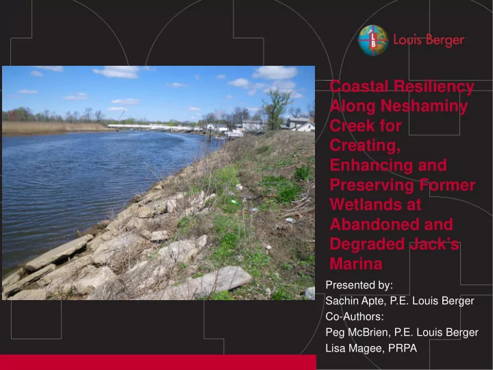
Coastal Resiliency Along Neshaminy Creek for Creating, Enhancing and Preserving Former Wetlands at Abandoned and Degraded Jacks Marina Presented by: Sachin Apte, P.E. Louis Berger Co-Authors: Peg McBrien, P.E. Louis Berger Lisa
2
3
4
5
6
7
LOCATION: CLIENT: 8
9
10
LOCATION: CLIENT: 11
12
13
14
15
16
LOCATION: CLIENT: 17
18
19