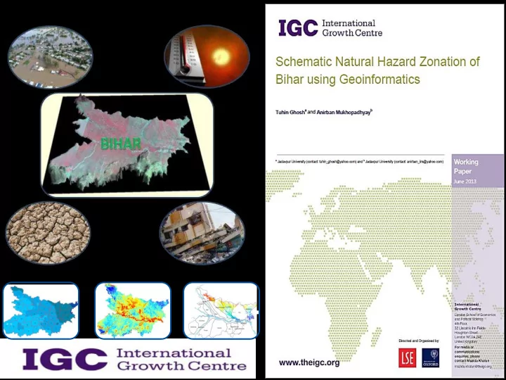
Cause damage to - Biomass Agriculture / Air Fisheries, etc. - - PowerPoint PPT Presentation

cause damage to
SMART_READER_LITE
LIVE PREVIEW

Cause damage to - Biomass Agriculture / Air Fisheries, etc. - - PowerPoint PPT Presentation

Affect all the primary resources e.g. - Land Water Cause damage to - Biomass Agriculture / Air Fisheries, etc. Population Gender and Age specific Negatively affect - Property Poverty alleviation Economy


slide-1
SLIDE 1
slide-2
SLIDE 2
slide-3
SLIDE 3
slide-4
SLIDE 4

Affect all the primary resources e.g. -

 Land  Water  Biomass  Air

Cause damage to -

 Agriculture /

Fisheries, etc.

 Population –

Gender and Age specific

 Property

Negatively affect -

  • Poverty alleviation
  • Economy
  • Education
  • Infrastructure
  • Health & Sanitation
  • Employment

As a consequence of such Natural Hazard, all developmental processes get impeded

slide-5
SLIDE 5

Impacts of Natural Hazards on the people of Bihar from different activity and background

The Natural Hazards, the People of Bihar face, and The range of sectors in which the impacts are felt

Drought

Social Sectors

  • Housing
  • Health
  • Education,
  • Culture and

Sports Infrastructure & Services

  • Transport
  • Communication
  • Energy
  • Water and

Sewage Productive Sectors

  • Agriculture
  • Industry
  • Services
  • Tourism, etc.

Environment

  • Land, Biomass,

Water & Air

  • Gender & Social

conditions

  • Employment

and Poverty Urban Heat Islands

Earthquake

Flood

Climate Change (?)

slide-6
SLIDE 6

After understanding the possible direct or indirect impacts of Natural Hazards, now the question arises –

 How do we manage the natural

hazards in terms of preventing or minimizing its impact to Society and Environment?

 And how do we keep away the

impacts of natural hazards from the pace of development and growth?

slide-7
SLIDE 7

Through

Hazards are inevitable Disasters are not

The strategy of managing any Disaster is not to

allow Natural Hazards to

become Natural Disasters

Natural Hazards Management should be all about breaking this link, as far as possible

Risk Assessment

  • f Vulnerable

Population Preventive & Impact Minimization Measures

Preparedness & Emergency Response

slide-8
SLIDE 8

The link up between Natural Hazards, Vulnerability & Disaster

Natural Hazards Disaster = Vulnerability + Hazard

Vulnerable People, Society, Environment & Economy

slide-9
SLIDE 9

Impact of Natural Disasters

Affect all the primary resources - Land, Biomass, Water, Air Cause damage to Agriculture Fisheries, Population - both gender and age specific, Property and infrastructure Negatively impact -  Development programmes including poverty alleviation  Economy & Education  Services & Infrastructure  Health & Sanitation  Employment

Growth Potential: Agriculture - Crop Yields, Irrigation Demand, Food Processing Fisheries – Productivity, Marketing Forestry - Forest Composition, Geographic Range of Forests, Health and Productivity Water Resources - Water Supply, Water Quality Energy - Hydroelectricity generation Biodiversity - Species and Natural Areas, Gain of Habitat and Species Strategies and interventions to minimize loss and cope with the worst scenario

RISK

The product of a hazard’s likelihood of occurrence and its consequences to society Risk = Likelihood x Consequence

HAZARDS

Events or physical conditions that have the potential to cause fatalities, injuries, property & infrastructure damage, agricultural loss, damage to environment, interruption of business, or other types

  • f harm or loss. – FEMA (1997)

A serious disruption of the functioning

  • f society, causing widespread human,

material, or environmental losses which exceed the ability of affected society to cope using only its own

  • resource. – The United Nations (1992)

DISASTER

slide-10
SLIDE 10
slide-11
SLIDE 11

Assessment Of Flood Assessment Of Drought Assessment Of Earthquake Assessment Of Thermal Heat island

Framework of the Project

slide-12
SLIDE 12

Flood

Flood Inundation Layers Digital Elevation Model River Basin Map Admin map

  • f Bihar

Flood extent Mapping Flood Affected District Landcover Map Flood Affected Landcover

slide-13
SLIDE 13

31-Jul-2009 23-Aug-2009 28-Aug-2010 13-Sep-2010 12-Jul-2011 20-Aug-2011 02-Oct-2011 26-Sep-2012

MODIS optical imagery during the flood period

  • f 2009 to 2012 .

The flood inundation is seen in the imagery.

Flood Plains of Bihar

slide-14
SLIDE 14
slide-15
SLIDE 15
  • The prime reason for floods was heavy

rainfall in the catchment area of Kosi in Nepal

  • Floods also occurred in Bagmati,

Mahananda, Kosi, Kamala Balan, Burhi- Gandak, and Adhwara river basins

  • Northern part of Bihar was highly affected

by floods

slide-16
SLIDE 16
slide-17
SLIDE 17
  • Floods occured in Bagmati-Adhwara, Mahananda,

Kosi, Kamala Balan and Burhi Gandak River basins

  • Northern part of Bihar was highly affected by floods.
  • Eastern parts of the state were also affected.
  • Though the intensity of the flooding was higher as

compared to 2009, but the distribution of flood was more widespread. 23 districts of Bihar were flood affected.

slide-18
SLIDE 18
slide-19
SLIDE 19
  • Kosi, Mahananda, Gandak, Bodhi, and Bagmati

witnessed rapid increase in water levels.

  • More than a hundred villages were inundated in

the flood prone districts of Muzaffarpur, Gopalganj, Purnia, Araria, Saharsa, Madhepura, Bagaha, and East and West Champaran.

  • Floods occurred in parts of Bagmati-Adhwara,

Mahananda, Kosi, Kamala Balan, Burhi-Gandak, Punpun, Harhar, and Kao-Gangi River basins, along with northern and eastern parts of Bihar, southern areas were also affected.

  • The intensity of the flood was higher in comparison

to 2009 and 2010 with widespread distribution

slide-20
SLIDE 20
slide-21
SLIDE 21
  • After the devastating flood of 2011, low intensity

flood situation occurred in 2012

  • The major affected districts were Darbhanga,

Kathihar, Muzaffarpur, Purnia, Khagaria, Patna, and East & West Champaran.

  • Floods occurred in parts of Bagmati-Adhwara,

Mahananda, Burhi-Gandak and Kamala-Balan River basins

slide-22
SLIDE 22

Conclusion

  • The northern of the state, along with some parts of

the east, are particularly susceptible to floods.

  • In general, Darbhanga, Kathihar, Muzaffarpur,

Purnia, Khagaria, Patna, and Champaran districts get affected by floods during every year.

  • The analysis for last few years has shown that the

year 2011 experienced the highest flooding.

  • Flood inundated areas since last few years were

integrated and the flood prone areas of Bihar have been delineated. The total flood prone area of Bihar is 14,950 sq km, which is 15.88% of its total geographical area

slide-23
SLIDE 23
slide-24
SLIDE 24

Deciduous Forest Semi evergreen Forest Scrub Intensive Agriculture (irrigated) Irrigated Agriculture Rain fed Agriculture Water bodies Barren land Built-up area

33.25 55.68 6242.25 5941.87 0.87 1130.37 39.93 16.18

Area affected by flood (Sq Km)

Forest Scrub Intensive Agriculture Irrigated Agriculture Rainfed Agriculture Water Bodies Barren land Built-up area

slide-25
SLIDE 25

UNDP Flood hazard zonation map Updated Flood hazard zonation map

Updating the previous work

slide-26
SLIDE 26

Vegetation Health Index Rainfall Vegetation Index (NDVI) Landcover Map Agricultural Drought Analysis Satellite Remote Sensing Admin map

  • f Bihar

District wise Drought analyse

Drought

slide-27
SLIDE 27

Rainfall in Bihar from 2009 to 2012 shows maximum rainfall in 2011 and less rainfall in 2009 and 2010

slide-28
SLIDE 28

Vegetation Health Index

  • f Bihar

from 2009 to 2012 shows Maximum In year 2011 and less in 2009 and 2010

slide-29
SLIDE 29

Drought affected areas

  • f Bihar

during 2009 to 2012 shows Minimum in 2011 while Intensity and spatial distribution of drought is much more in 2009 and 2010

slide-30
SLIDE 30
slide-31
SLIDE 31

NATMO drought hazard zonation map Updated drought hazard zonation map

Updating the previous work

slide-32
SLIDE 32

Conclusion

  • Analysis of droughts in Bihar suggests that the southern part
  • f river Ganga faces severe drought every year during Kharif

season.

  • The main reason for these droughts is the onset of monsoons

and its uneven spatial distribution.

  • The pre-monsoon droughts are more severe as compared to

those in the post-monsoon season.

  • A shifting pattern of pre-monsoon and post-monsoon droughts

has been observed. June, July, and October are the most drought prone months.

  • Ten districts of Bihar those are mostly affected by drought:

Kaimur Bhojpur Siwan Rohtas Gaya Gopalganj Aurangabad Jahanabad Buxar Patna

slide-33
SLIDE 33

Earthquake

Tectonic and earthquake zonation maps have been compiled using secondary data and other available maps, their analysis and finally transferred into the GIS platform and staellite images

slide-34
SLIDE 34
slide-35
SLIDE 35

UNDP Earthquake hazard zonation map Updated Earthquake hazard zonation map

Updating the previous work

slide-36
SLIDE 36

Conclusion

  • The compilation of the available earthquake maps

are showing some serious data gaps in tectonic framework of Bihar

  • The earlier and latest zonation are almost similar,

but needs to identify the potential impact on other geological processes and also the stability of other land features

  • The exact level of location specific impacts to be

estimated along the weak zones, if earthquake

  • ccurs
slide-37
SLIDE 37

MODIS Thermal data (night) Processing Town layer from Google Earth UHI Analysis MODIS LST GRUMPS Urban extent data

Urban Heat Islands

slide-38
SLIDE 38

The night time temperature of the urban areas is much higher than the surroundings including rural areas. It is observed that the major cities have higher temperature as compared to the less populated cities, and quantified.

slide-39
SLIDE 39

Extent of Urban areas in Bihar Urban extent and UHI

Urban extent with night time land surface temperature. It indicates that temperature is higher in urban extent. It signifies that urban extent is a significant potential for urban heat islands The geographical extent of urban areas in

  • Bihar. It indicates the

physical extent of the various cities of Bihar estimated from DMSP night time light data sets.

slide-40
SLIDE 40

Conclusion

  • The results achieved from the satellite data indicate that

Bihar is suffering from urban heat island (UHI) effect.

  • The night time land surface temperature is higher in urban

areas than in rural areas. With rapid urbanization and growth

  • f population density, the impervious surface area is

increasing in the cities.

  • Finally, all these factors are leading towards the formation of

heat islands.

Comment: The climate change scenario and release of greenhouse gases (GHGs) are also responsible for the formation of UHI. It is an accumulated effect of human activity level and climate change. Hence, the identification of different driving forces responsible for UHI and analysis of air temperature data in relation with climate change scenario are necessary to assess the environmental monitoring in the context of climate-change.

slide-41
SLIDE 41

SHZ = 𝑔 𝐺𝑚, 𝐸𝑠𝑢, 𝐹𝑟

𝑥𝑗 𝑗=1−10

Where; SHZ = Schematic Hazard Zonation 𝐺𝑚 = Flood 𝐸𝑠𝑢 = Drought 𝐹𝑟 = Earthquake

Multi-hazard zonation map using Spatial Decision Support System (SDSS) technique

slide-42
SLIDE 42

Map showing superimposition

  • f various types of hazards

Combining different categories of hazards to come up with the level of vulnerability

slide-43
SLIDE 43

Multi-hazard zonation map of Bihar

Can we now locate the areas with different ranking of vulnerability?

Can we use them in the process of development planning??

slide-44
SLIDE 44
  • Poverty
  • Limited access to
  • Power structures
  • Resources
  • Ideologies
  • Economic

systems Lack of

  • Local institutions
  • Education/training
  • Appropriate skills
  • Local investment
  • Local markets
  • Press freedom

Macro-forces

  • Population

expansion

  • Urbanization
  • Environmental

degradation

Fragile Physical Environment

  • Dangerous locations
  • Dangerous constructions
  • f buildings &

infrastructure

Fragile Local Economy

  • Livelihoods at risk
  • Low income levels

Public Actions

Vulnerability is the function of time and it depends on

Unsafe conditions Aggravating Factors Societal Situations

slide-45
SLIDE 45

Options to approach this problem?

 Do nothing  Avoid or remove the problem and send away the Hazard

somewhere else

 Weaken the Hazard  Do not allow the vulnerable people and society to live in the

hazardous areas.

 Convert vulnerable people/society/environment and

vulnerable economy in the hazardous areas into non vulnerable one

  • r

 Reduce the Vulnerability of people, society, environment &

economy and make use the natural event for economic growth & livelihood enhancement

 Prepare very well to face this hazard much before it strikes

slide-46
SLIDE 46

Basically we are towards the Disaster Proofing of Development by making a comprehensive Preparedness Plan creating further scope for better development perspective

slide-47
SLIDE 47

Managing response to disasters Managing risks and the underlying conditions that lead to disasters

1. Awareness, sensitization & training 2. Skill development and Knowledge transfer 3. Risk assessment 4. Hazard Analysis 5. Vulnerability reduction 6. Capacity enhancement 7. Prediction and warning System 8. Mitigation and preventive measures

Preparedness

Paradigm Shift

But hardly we are doing anything for

We are only responding to a situation This is what Preparedness is Getting changed to

All these are to be done much before disasters strike

Present Emphasis

slide-48
SLIDE 48

Preparedness is equal to

 Preparation of PLANS and ACTIONS there from, for

 Our Response in the next Emergency  Our Rehabilitation plan following that  Our Preventive and Mitigation Measures to be taken and being

taken before the disaster arrives

 Our success and involvement for Support Activities in

 R & D  Technology Transfer  Education & Training  Public Awareness  Mock Rehearsal

 All that above preparations or preparedness is only to MINIMIZE

the Impact of the coming hazard

Level of Preparedness?

  • can be measured by the components within it
slide-49
SLIDE 49

Preparedness – Impact – Rescue, Relief & Rehabilitation

  • The more we are “prepared”, lesser

will be the impact of disaster

  • The lesser the impact of disaster,

lesser will be requirements of Rescue, Relief and Rehabilitation

slide-50
SLIDE 50
  • How efficiently and effectively

we manage a disaster depends

  • n, how meticulously we are

prepared for that? Disaster = Hazard + Absence of Preparedness

slide-51
SLIDE 51

G R O W T H

Disaster Management – potentials & possibilities for Bihar

Agriculture

Crop Yields Irrigation Demand Food Processing

Energy

Hydroelectricity generation

Biodiversity

Species and Natural Areas

Gain of Habitat and Species

Activities -

  • Prepare relative

elevation map with close contours

  • 2. Demarcate the river

basins and identify their carrying capacity

  • 3. Risk analysis for the

vulnerable people, property and resources

  • 3. Prescribe probable

structural changes and land alteration

Forestry

Forest Composition Geographic Range of Forests, Health and Productivity

Fisheries

Water Resources

Water Supply Water Quality

An example on Flood Management

slide-52
SLIDE 52

Disaster Manager?? Scientists Engineers Social Activists Who else? Economists Geographers Social Scientists Policy Makers Army People Adminis- trators

slide-53
SLIDE 53

RECOMMEDATIONS

slide-54
SLIDE 54

R E C O M M E D A T I O N S

slide-55
SLIDE 55

R E C O M M E D A T I O N S

slide-56
SLIDE 56

Thank you

for your kind patience