
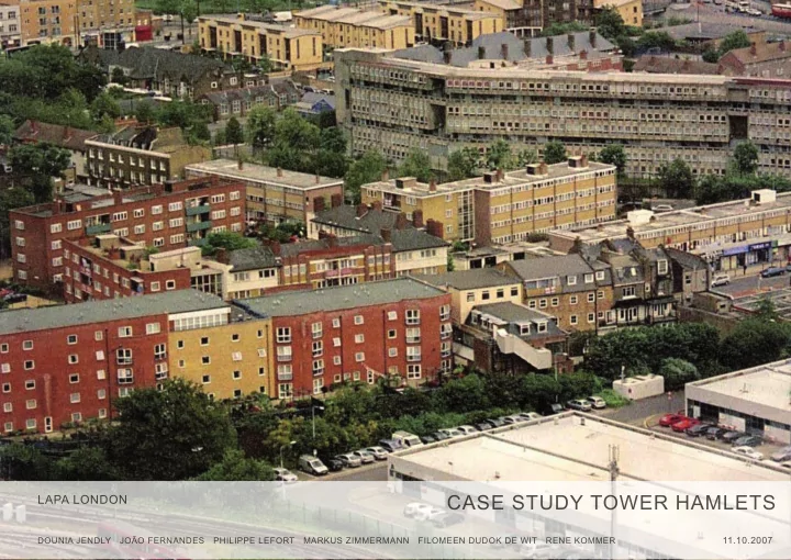
SLIDE 1
CASE STUDY TOWER HAMLETS
LAPA LONDON
DOUNIA JENDLY JOÃO FERNANDES PHILIPPE LEFORT MARKUS ZIMMERMANN FILOMEEN DUDOK DE WIT RENE KOMMER
11.10.2007
CASE STUDY TOWER HAMLETS LAPA LONDON DOUNIA JENDLY JOO FERNANDES - - PowerPoint PPT Presentation
CASE STUDY TOWER HAMLETS LAPA LONDON DOUNIA JENDLY JOO FERNANDES PHILIPPE LEFORT MARKUS ZIMMERMANN FILOMEEN DUDOK DE WIT RENE KOMMER 11.10.2007 introduction organisation environment transport housing education health conclusion
CASE STUDY TOWER HAMLETS
LAPA LONDON
DOUNIA JENDLY JOÃO FERNANDES PHILIPPE LEFORT MARKUS ZIMMERMANN FILOMEEN DUDOK DE WIT RENE KOMMER
11.10.2007
introduction
environment transport housing education health conclusion
devons road dlr chrisp street three mills
introduction: trajectory
portrait: history
civic history
The name «Tower Hamlets» was historically applied to the Tower divi- sion of the county of Middlesex, covering not only the present borough, but also part of the present-day London Borough of Hackney. The Constable of the Tower of London had special jurisdiction over the area from the 16th century until 1889. Later the Constable became Lord Lieutenant of the area, raising and
a parliamentary borough. The name continued to be used for constituen- cies until 1918. The borough was formed in 1965, and took this historic name, through amalgamation of the former metropolitan boroughs of Bethnal Green, Poplar and Stepney. These boroughs were the heart of the East End of London.
Tower Hamlets in 1872
portrait: population
general information
Total of people - 196 106 Males - 98 178 Females - 97 928 [London - 7 172 091] [England - 49 138 831] 52% are under 30 - the highest percentage in England (average 38%) Bethal Green North Mile End / Globe Town Weavers Bethnal Green South Spitalfjelds / Banglatown
Whitechapel Shadwell
Bow East Bow West Bromley by Bow Mile End East East India / Lansbury Limehouse Blackwell and Cubitt Town Millwall population by Ward
eight Inner London boroughs: Camden, Hackney, Hammersmith and Fulham, Islington, Kensington and Chelsea, Lambeth, ToWER HAMLETS, and Westminster – have densities in excess of twice the London average
population density, 2005 (people per sq km) 10,000 or over 7,500 - 9,999 5,000 - 7,499 2,500 - 4,999 2,499 or under
portrait: population
density
Density: 10,764 / km² Area: 19.77 sqkM
portrait: population
ethnicity
51% of the population is white 33% Bangladeshi 3% Black African 3% black Caribbean
white asian black
Tower Hamlets London
portrait: economy
new economic centers Canary Wharf
portrait: economy
How is the money spent
budget 07.08
950,836m £
service related
. employees - 141,915m £ . premises - 44,753m £ . transport - 11,854m £ . supliers and services - 32,677m £ . third party payments - 196,710m £ . transfer payments - 206,017m £ . suport services - 55,175m £ . capital financing costs - 20,659m £ . other expenditure - 7,344m £ . individual schools budget - 203,732m £
service related
. specific government grants - 305,880m £ . grants and other reimbursments - 15,279m £ . costumer and client receipts - 75,527m £ . recharges - 72,826m £ . individual schools budget - 203,732m £
general
. contribution to/from balances - 2,547m £ . revenue support grant - 30,727m £ . redistributed non-domestic rates - 183,094m £ . estimated surplus on collection fund - 1,505m £ . council tax - 64,817m £
50 100 150 200 250 300 350
IN OUT
50 100 150 200 250
1 1 2 2 3 3 1 1 2 2 3 3
portrait: economy - unemployment
IMD 2004 employment deprivation
The Local Context All but one of Tower Hamlets wards are within the most deprived 10% in the country. .
Organisation
UK Government
Queen: Elizabeth II of UK Speech: Exposal of the main thoughts for the two houses of government Parliament: Supreme Organ Powers: To promulgate, argue, change the laws and control the executive power - the government Government: Political Party with most elected Members of Parliament Powers: Executive Prime Minister: Direction of Internal and External Affairs Powers: Military and Civil Administration The Cabinet: Ministers of Finacial and Internal and External Affairs Upper House: Not elected by the people Powers: Controls the Government Deals with publict interests such as: Europe, Economy, Science, Constitution House of Commons: Elected by the people - 646 MoP - elected by the 646 constituancies Greater London Authority: Regional body
Headquarters: City Hall Mayor: Effective represantative of GLA Powers: Co-ordinate strategic issues that cut across London Assembly: Members elected by the 32 boroughs who are responsible for scrutnising the Mayors work as policy development Borough: Local tier of Unitary Authority with separate elecions from the GLA, with powers within education, health, urban development Council Leader: the one whose party gains a straight majority of councillors or forms a majority coalition. Local assembly: Councillors run for local wards within the UA's jurisdiction.
Local Authorities - Tower Hamlets Council
The borough is responsible for local services not overseen by the GLA, such as local planning, schools, social services, local roads and refuse collection. Parliament For the most recent election to Parliament, the Borough was split into two constituencies: _Bethnal Green & Bow, whose current incumbent is Geor- ge Galloway (Respect), since the 2005 general election. _Poplar & Canning Town (which also takes in Canning Town in the neighbouring London Borough of Newham), represented by Jim Fitzpatrick (La- bour), since the 1997 general election, when the consti- tuency was formed. The Borough is a part of the London constituency for elec- tion to the European Parliament. Greater London Assembly The borough lies within the City and East constituency, and is represented by John Biggs, Labour. Local council - 3 councillors elected per ward The controlling and majority group is Labour. Since the May 2006 local elections, the composition has been: Party councillors Labour 26 Respect 12 Conservative 7 Liberal Democrats 6
local area partnership - concept of community
LAP1 LAP2 LAP3 LAP4 LAP5 LAP6 LAP7 LAP8 The borough has 17 Wards although it has been divided into eight Local Area Partnership Areas (LAPs). Each one
say on the improvements in their area, and to infmuence how the changes are carried out. They therefore form an integral part of the Tower Hamlets partnership as, without the input of residents, changes made in the borough would be meaningless. LAP area 1 - Weavers, Bethnal Green North, Mile End/Glo- be Town LAP area 2 - Bethnal Green South, Spitalfjelds/Banglatown LAP area 3 - St Dunstan’s/Stepney Green and Whitechapel LAP area 4 - St Katharine’s/ Wapping, Shadwell LAP area 5 - Bow East,Bow West LAP area 6 - Bromley-by-Bow, Mile End East LAP area 7 - East India /Lansbury, Limehouse LAP area 8 - Blackwall/Cubitt Town & Millwall
physical landscape: water
Water web
1 2the Thames is not a river
Millwall & West India Docks St katherine’s Docks Shadwell bassin Limehouse bassinThames River Lea
River Lea navigation canal Limehouse cut Hertford Union canal Regent’s canal Tower HamletsThe lower Lea valley is characterised by the multi- ple waterways that run through. Most of them are actually in bad state and therefore not very attrac-
Hamlets Borough. The Lower Lea masterplan and the olympics venue in 2012 will contribute to chan- ge this situation into a major development area.
physical landscape: water
43 % of Tower Hamlets under sea level in a case of fmood
Storm surges are huge elevations in sea le- vel which strike unpredictably during the win- ter months. Those travelling down the North Sea pose a particular threat to the East Coast
fjce Storm Tide Forecasting Service records around twenty East Coast surge events a year.
low air pressure surge
fmood area
physical landscape: water
Business and industrial grounds are linked with water
1 2 1 2business and industrial activities
Canary Wharf
1865: Construction of Millwall Dock begins 1868: Millwall Dock opens to shipping 1927: Millwall Dock is joined to West India Dock 7 1940: Millwall Lock suffers bomb damage 1980: Millwall Dock closes 1982: Millwall Dock is part of a designated Enter prise Zone 1988: Construction of Canary Wharf begins 1997: British Waterways take over responsibility for Millwall and West India Docks 2009: The new State Street, Bear Stearns and KPMG Headquarters buildings to be completed
Canary Wharf
physical landscape: green spaces
Accessibles green spaces
physical landscape: transports
Major roads and railways as landscape divisors
1 2aerial train major roads
physical landscape: summary
Main features of Tower Hamlets’ landscape
aerial train major roads water accessible green spaces business / industrial areas fmood area
social environment: global criminality
recorded burglaries per 1000 households (2005-06)
13.8
19.8
23.4
social environment: global criminality
robbery and street crimes per 1000 population (2005-06)
1.9
vehicle crime per 1000 population (2005-06)
13.5
18.5
24.9
social environment: local criminality
residential / domestic burglary rate per 1000 households (2005-06)
0-15 15-25 25-35 35 and more
Weavers Bethnal Green North Bethnal Green South Spitalfields and Banglatown Mile End and Globe Town St Dunstan's and Stepney Green Whitechapel St Katharine's and Wapping Shadwell Limehouse Millwall Blackwall and Cubitt Town East India and Lansbury Bromley By Bow Mile End East Bow West Bow East Weavers Bethnal Green North Bethnal Green South Spitalfields and Banglatown Mile End and Globe Town St Dunstan's and Stepney Green Whitechapel St Katharine's and Wapping Shadwell Limehouse Millwall Blackwall and Cubitt Town East India and Lansbury Bromley By Bow Mile End East Bow West Bow East19-24 25-29 30-35 35 and more
violents crimes (2005-06)
3-7 8-11 12-15 15 and more
street crimes (2005-06)
3-7 8-11 12-15 15 and more
vehicle crimes (2005-06)
social environment: criminality summary
burglary / street crimes / violent crimes main areas
Weavers Bethnal Green North Bethnal Green South Spitalfields and Banglatown Mile End and Globe Town St Dunstan's and Stepney Green Whitechapel St Katharine's and Wapping Shadwell Limehouse Millwall Blackwall and Cubitt Town East India and Lansbury Bromley By Bow Mile End East Bow West Bow East25 % of occurency 50 % of occurency 75 % of occurency
economic environment: Thames Gateway
a national priority for urban regeneration
population: 1.45 million people households: over 600,000 households size: 100,000 hectares, brownfjeld land: 3,150 hectares employment: over 637,000 employees unemployment: 6% businesses: nearly 32,000 VAT registered businesses The vision for the Thames Gateway is to create: 180,000 new jobs, through business and economic investment 160,000 homes. a high quality transport system better education facilities high quality healthcare attractive open spaces with access to the river
economic environment: Lower Lea masterplanwning & Olympics
The lower Lea valley occupies an ideal position for future urban development. It is strategicly si- tuated at the west end of the Thames Gateway and betweeen three infrastructural nodes : the city airport, Canary wharf and Stratford. Between now and 2012, hosting the games is ex- pected to create at least 7,000 jobs and bring in £525 million in extra income into East London. After the event, the olympic Park in Stratford and the Lea Valley will be remodelled as an attractive, modern development. It will have a mixture of uses including at least 9,000 homes, up to 11,000 jobs, a new park and permanent sports facilities
a catalyst for Tower Hamlets
Lower Lea Valley development area New specifjc projects New development areas
transport development
transport network in 1980
Shadwell Limehouse Bromley-by-Bow Bow Road Mile End Stephey Green Whitechapel Aldgate East Bethnal Green Wapping Tower Hill Bethnal Green Cambridge Heath Hackney WickNational railway line and station Underground line and station main roads
transport development
transport network in 2000
Devons Road Westferry All Saints Blackwall East India Poplar West India Quay Canary Wharf Heron Quay South Quay Cross Harbour Mudchute Island Garden Shadwell Limehouse Bromley-by-Bow Bow Road Mile End Stephey Green Whitechapel Aldgate East Bethnal Green Wapping Tower Hill Bethnal Green Cambridge Heath Hackney Wick Bow ChurchNational railway line and station Underground line and station main roads Docklands Light Railway
evolution of the transport infrastructure
Docklands Light Railway is openend
Tower Gateway Stratford to Island GardensConstruction Canary Wharf
Phase oneExtension DLR into the City
Bank underground stationExtension DLR in the east
Poplar via Canning Town to BecktonConstruction Canary Wharf
Phasde twoExtension DLR in the south
LewishamExtension Jubilee Line
Central London to Ststford via Cannary WharfExtension DLR in the east
King George V via London City Airport transport public network
Underground Line
Canary Wharf Shadwell Whitechapel Stephey Green Mile End Bow Road Bromley-by Bow Bethnal Green Aldgate East Tower Hill Wapping
Central Line East London Line Jubilee Line District Line Hammersmith & City Line
The Borought is currently served by the London Un- derground, Docklands Light Railway, overland rail and buses. The London Underground service: District East London Hammersmith & City Central Jubilee lines London buses operating throughout the Borought are fairly comprehensive and the key corridors into/out
Road.
transport public network
Docklands Light Railway
5 min 15 minCanary Wharf Bank Stratford Lewisham Beckton London City Airport
10 mindistance from Canary Wharf
transport public network
railway network and frequency of stations
Bethnal Green Cambridge Heath Hackney Wick
2.246 millions
Limehouse
0.448 millions 0.046 millions
0.080 millions
West Anglia Route North London Line
use of railway to travel to work
10 20 30 40 50 60 70 train train bus bus underground & DLR underground & DLR
resident population daytime population
affluence
frequency of underground and railway station
34.21 millions
10.247 millions
2.409 millions10.826 millions
9.66 millions
1.66 millions 7.14 millions 1.44 millions 3.585 millions 3.658 millions17.446 millions
Underground station Annual entry and exitnumber of people employed in Canary Wharf
50'000 100'000 150'000 200'000 10'000 1995 1999 2004 2006 2009 2025Working population
method of travel to work
differents means of travel
On foot
Bus & Coach
10.4 %
Underground DLR
37.3 %
Train
5.1 % 1.1 % Bicycle 3.0 %
Car
17.9 % 0.7 % 1.0 % 15.8 %
Motorcycle, scooter or moped Taxi or minicab Others
61 % 15 % 36 % 42% 18 % 53 %
comparative schemes Tower Hamlets London England
traffic network
main roads and congestion charging zone
Central London Congestion Charging Zone
A11 A13 A12
pourcentage households with or without cars Part of the boundary of the central London congestion charging zone falls within Tower Hamlets borough.
Feb/Mar 2002 Spring 2002 Autumn 2002 January 2003 Feb/Mar 2003 Spring 2003 Autumn 2003 Spring 2004 Autumn 2004 20’000 40’000 60’000 80’000 100’000 Pre-charging Post-chargingtraffjc entering the charging zone during charging hours
Feb/Mar 2002 Spring 2002 Autumn 2002 January 2003 Feb/Mar 2003 Spring 2003 Autumn 2003 Spring 2004 Autumn 2004
’ ’ 000
Pre-charging Post-charging
car Tower Hamlets London England no car
traffic accidents and road safety
traffjc accidents by severity for the year 2005
Fatal Serious Slight Severityrate of road traffjc accident in which people killed or seriously injured par 1000 population
5 5.5 6 6.5 7 7.5 1997 1998 1999 2000 2001 2002 2003 2004 Tower Hamlets London NRF Authorities London Englandthe distribution of accidents is refmective of the layout of the road network, and the location of dangerous roads and accidents hotspots the frequency of road accidents is greatly infmuenced bye the location of major roads, as the A102 Northern Approach, A11 and Bethnal Green Road
London 2012 Olympic Games
transport plan
link the olympic Park with King’s Cross/St Pancras in just seven minutes Jubilee Underground line capacity increased by 45% DLR extension from Statford to City Airport Channel Tunnel Rail Link (CTRL) London-Paris 2 hours 15 minutes 100% accessible by public transport USD 30 milliards invest in transport communication 7.9 million spectators over 16 days
«our transport plans for the Games will help trans- form the Lower Lea Valley into one of the best connected areas in the capital, bringing economic and social benefjts that go far beyond 2012, and far beyond sport.»
density
density of homes built in London between 2001-2004
30-60 61-90 91-120 121-150 151+ homes per hectare
Tower Hamlets
decayed condition in social housing
non-decent housing
non-decent decent Spitalfjelds-Banglatown is 19% overcrowded 2.5% 6.6%
7% 8-9% 10-14% 15-17% 18% 19-20%
Spitalfjelds Banglatown Whitechappel
type of tenures: households
% of households
council RSL (registered social Landlords) private rented
Bethnal Green North Bethnal Green South St Dunstans/Stepney Green, Withechapel
Bow East, Bow West Bromley by Bow, Mile End East East India/Lansbury, Limehouse
Tower Hamlets London England
type of dwellings
In Tower Hamlets are 70% purpose built fmat
terraced semi-detached/detached purpose built fmat converted fmat
houshold amenities
lowest fmoor level in Tower Hamlets
3350 29371 39132 6688
basement ground 1st to 4th 5th or higher
prices an incomes
1 bedroom 2 bedroom 3 bedroom 4 bedroom £ 132 000 £ 274 000
minimum and average property prices in Tower Hamlets 2003
1 bedroom 2 bedroom 3 bedroom 4 bedroom
minimum prize average prize 7800
private rent 8112 9360 9776 10868 13728 12012 16692 < £30000 £30001-35000 £35001-40000 £40001-45000 > £45000
mean houshold income (2006) cost of housing per year (2004)
barriers to housing and services domain
wider barriers sub domain
the aim of this domain is to measure barriers to housing and key local services
1-92 93-196 197-336 337-504 505-844
IMD Index of multiple deprivation sustainable housing growth
housing options
The Mayor for London and Tower Hamlets Core Strategy set a target of 31,500 additional homes inTower Hamlets by 2016 The Core Strategy sets a minimum requirement of 35% affordable housing in the Borough in developments with 10 or more units The Council requires 30% of social rented housing to have 3+ bedrooms, and 15% to have 4+ bedrooms
Local Development Framework: Central area action plan March 2007
potential key areas for new housing provision potential location for larger family homes key estate regeneration areas a borough of extrems
extensive investment in the borough, Canary Warf and surrounding Docklands areas bringing an input of new businesses and employment opportunities Tower Hamlets is ranked as one of the most deprived areas in the country no transfer of the economic growth to the people living in the borough very high levels of unemployment and economic inactivity great deal of private housing development in the area, affordable only for high class the price of private housing - both sale and rental – is beyond the reach of many of the Borough’s residents
school
Education system in England
Nursery Infant School Junior School Primary School Secondary School Sixth Form College Secondary School with Sixth Form High Education Key Stage 1
(age: 7)
Key Stage 2
(age: 11)
Key Stage 3
(age: 14)
Key Stage 4
(age: 16)
A-levels
(age: 18) (age: 3)
c
c
c
costs:
leb by Gordon Brown, responsibility is divided between the Department for Children, Schools and Families, and the Department for Innovation, Universities and Skills.
funding of state schools is the responsibility of Local Education Authorities. e:
Nursery: £3800/year Prim., sec state school: £0
£Prim., sec. independent school: £6000 - £24000/year University: £3000/year
£
£
school
Location of the different types of schools
prim. (65) Nurseries Secondary schools Primary schools High education nurs. (28) sec. (22) high ed. (18)
the whole borough
than secondary schools Number of schools
school
Ethnicity of pupils and mother language: the majority of the pupils are of Bangladesh origin.
General ethnicity London General ethnicity Tower Hamlets Pupil ethnicity Tower Hamlets Tower Hamlets pupils home language White Asian Black Other Mixed White Asian Black Other Mixed White Asian Black Other Mixed English Bengali/Sylheti Somali Other European languages Other Asian languages Other African languages Other % % % %
school
Child poverty: Poverty has a major impact on children’s health and their life chances.
Eligibility for free school meals Nursery/primary school Secondary school % % Tower Hamlets London England
University (age: 18)
school
Pass rates: few pupils of Tower Hamlets get to a high education level.
%
Tower Hamlets London England Pupils elligible for year assessment Successful university applications 2755 pupils 2579 pupils 2256 pupils 690 students Key Stage 1 (age: 7) Key Stage 2 (age: 11) Key Stage 3 (age: 14)
school
Number of children: a lot of white families with children in age to go to school leave Tower Hamlets.
Number of schools Number of children in each age group age 0 - 4 age 5 - 11 age 12 - 18 Nurseries Primary schools Secondary schools
school
National fmoor targets plan: the level of the schools in Tower Hamlets is improving since 2001.
Tower Hamlets London England Percentage pass rates of 14 year old achieving level 5 at Key Stage 3 in English 2001/02 2002/03 2003/04 2004/05
% % % %
adult education
Even if the adult classes are not in increasing use, their quality could be improved and their number augmented.
Location adult education centers and idea stores (11) Adult education / evening classes, users’ satisfaction
%
1999/0 2001/2 2003/4 2005/6Tower Hamlets London Local services used Recycling facilities Libraries Parks, etc Leisure & sports Housing benefjt Primary education Social services Secondary educ. Nursery education Evening classes None of these 2004/5 2005/6
% 7 7 As the use of libraries is increasing, their number could go up.
libraries
Local services used Recycling facilities Libraries Parks, etc Leisure & sports Housing benefjt Primary education Social services Secondary educ. Nursery education Evening classes None of these Location libraries (6) Libraries, users’ satisfaction
%
1999/0 2001/2 2003/4 2005/6Tower Hamlets London 2004/5 2005/6
% 46 54 museums, art galleries, event spaces, visitor attractions
Location museums and art galleries (22) Localisation of visitor attractions (5)
Some laps could improve their cultural offer. More places could probably be changed into visitor attractions.
education: summary
schools:
adult education / libraries:
culture:
general health
life expectancy
health-institutions
dentists [28]
hospitals [5]
ThamesPharmacies [43] doctors [38]
health-institution: hospitals
Royal London Hospital in Whitechapel
the Thames barrier
the Thames is not a river
planned extension
hospital stays
hospital episodes by age and sex
total females <59: 17.646 total females >59: 8.576 total males <59: 14.907 total males >59: 8.742
causes for hospital episodes
illnesses
people suffering from long-term conditions (chronical deseases)
percentage of the total population of the exa- mind areas
healthcare
people providing unpaid care in tower hamlets
percentage of people caring for other people (mainly familiy members), not including general care for children. peolpe in care-homes (state and county): 0,36%
death
tower hamlets - causes of death
in percent.
Do the different masterplans have a potential to really improve Tower Hamlets, or are they a threat to the lack of urban mixity? Can they become catalysts?
conclusion