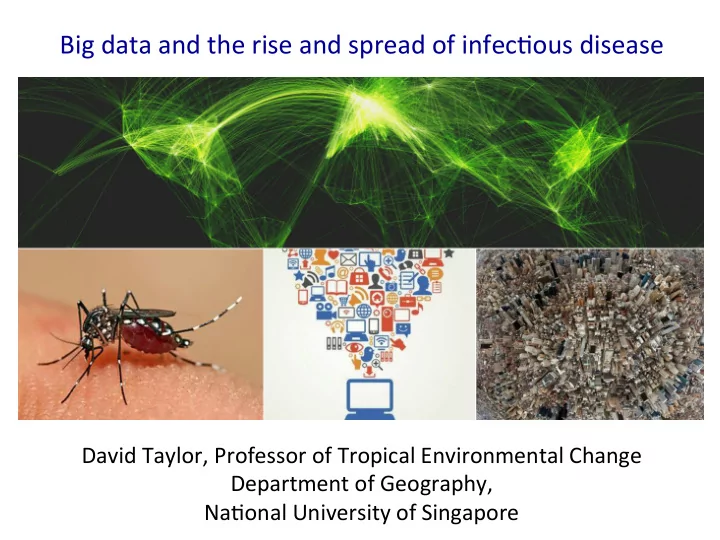
SLIDE 1
Big ¡data ¡and ¡the ¡rise ¡and ¡spread ¡of ¡infec1ous ¡disease ¡
David ¡Taylor, ¡Professor ¡of ¡Tropical ¡Environmental ¡Change ¡ Department ¡of ¡Geography, ¡ ¡ Na1onal ¡University ¡of ¡Singapore ¡
SLIDE 2 Climates ¡have ¡changed, ¡are ¡changing ¡& ¡will ¡con1nue ¡to ¡change ¡…… ¡
Temperature anomaly (°C) relative to 1961–1990
(a) (b)
Observed change in surface temperature 1901–2012
−0.6 −0.4 −0.2 0.0 0.2 0.4 0.6
Annual average
−0.6 −0.4 −0.2 0.0 0.2 0.4 0.6 1850 1900 1950 2000
Decadal average (°C) Observed globally averaged combined land and ocean surface temperature anomaly 1850–2012
−0.6 −0.4 −0.2 0.2 0.4 0.6 0.8 1.0 1.25 1.5 1.75 2.5
Year
Figure SPM.2 | Maps of observed precipitation change from 1901 to 2010 and from 1951 to 2010 (trends in annual accumulation calculated using the
−100 −50 −25 −10 −5 −2.5 2.5 5 10 25 50 100
(mm yr-1 per decade)
1901– 2010 1951– 2010
Observed change in annual precipitation over land
- IPCC ¡A5(2013) ¡Summary ¡for ¡Policy ¡Makers ¡– ¡WG1 ¡report ¡
−20 −10 −30 −50 −40 10 20 30 40 50
(b) (c)
RCP 2.6 RCP 8.5 Change in average precipitation (1986−2005 to 2081−2100) Northern Hemisphere September sea ice extent (average 2081−2100)
39 32
(%)
(a)
Change in average surface temperature (1986−2005 to 2081−2100)
39 32
(°C) −0.5 −1 −2 −1.5 1 1.5 2 3 4 5 7 9 11 0.5
SLIDE 3 Dengue ¡~ ¡clima1cally-‑sensi1ve ¡vector-‑borne ¡virus ¡ Dengue ¡distribu1on ¡(2013) ¡From ¡WHO ¡ E.g. ¡Dengue ¡… ¡
mosquitoes ¡(Ae. ¡aegyp* ¡ and ¡Ae. ¡Albopictus) ¡
vectors ¡
- Same ¡vectors ¡transmit ¡
chikungunya, ¡yellow ¡ fever ¡and ¡zika ¡(and ¡Ri< ¡ Valley ¡fever ¡virus ¡in ¡ Africa!) ¡ ¡
- Vectors ¡and ¡diseases ¡are ¡
expanding ¡range ¡& ¡ severity ¡of ¡infec1ons ¡is ¡ increasing ¡
- Not ¡everyone ¡infected ¡
shows ¡symptoms! ¡
Can ¡expect ¡distribu1on ¡and ¡epidemic ¡ poten1al ¡of ¡climate ¡sensi1ve ¡infec1ous ¡ diseases ¡to ¡shi\ ¡…. ¡
SLIDE 4
Recent ¡spread ¡of ¡dengue ¡to ¡higher ¡al1tude ¡parts ¡of ¡Asia ¡(e.g. ¡Nepal) ¡suggests ¡that ¡ climate ¡change ¡may ¡be ¡a ¡factor ¡
Dengue ¡epidemics ¡in ¡southern ¡ Taiwan: ¡a ¡possible ¡link ¡to ¡climate? ¡ Dengue ¡in ¡southern ¡ Taiwan ¡associated ¡ with ¡laWer ¡stages ¡of ¡ wet ¡season ¡ But ¡epidemics ¡correlate ¡with ¡El ¡Niño ¡ Especially ¡with ¡ modoki ¡form ¡of ¡El ¡ Niño ¡– ¡modoki ¡El ¡Niño ¡ forces ¡south ¡the ¡main ¡ typhoon ¡track ¡bringing ¡ more ¡rain ¡to ¡Taiwan ¡
SLIDE 5
From ¡Messina ¡et ¡al. ¡(2014) ¡Global ¡spread ¡of ¡dengue ¡virus ¡types: ¡mapping ¡the ¡70 ¡year ¡history, ¡Trends ¡ in ¡Microbiology ¡22: ¡138-‑146 ¡
Spread ¡of ¡dengue ¡from ¡late ¡1970s ¡suggests ¡more ¡than ¡climate ¡change ¡
SLIDE 6
Rate ¡of ¡spread ¡of ¡ new ¡and ¡exis1ng ¡ infec1ous ¡diseases ¡ raises ¡ques1ons ¡ about ¡conven1onal ¡ disease ¡surveillance ¡ and ¡containment ¡ techniques ¡… ¡
Quaran*ne ¡– ¡the ¡first ¡ public ¡health ¡ini1a1ve? ¡ First ¡men1oned ¡in ¡12th ¡ century, ¡the ¡re-‑ emergence ¡of ¡plague ¡ around ¡Bari ¡in ¡the ¡1690s ¡ led ¡to ¡soldiers ¡being ¡used ¡ to ¡enforce ¡restric1ons ¡on ¡ movement ¡…. ¡
SLIDE 7
Other ¡factors ¡behind ¡the ¡rapid ¡spread ¡of ¡some ¡infec1ous ¡diseases ¡ include ¡land ¡cover ¡change, ¡travel ¡& ¡trade, ¡pollu1on ¡etc ¡
SLIDE 8 Just ¡as ¡modern ¡technologies ¡have ¡facilitated ¡the ¡rapid ¡spread ¡of ¡ infec1ous ¡diseases, ¡we ¡can ¡also ¡use ¡modern ¡technologies ¡to ¡ monitor ¡and ¡an1cipate ¡their ¡effects ¡
11 011010110 11011010101 1 0101 0110010 1010 1 0100
Bird marking Radio-tracking developed Acousc telemetry Argos satellite network Mobile phones satelite launched Small radio transmiers GPS Tags Camera tags Big data Fastloc GPS and Web2.0 Wearables 1900 1910 1950 1960 1970 2000 Smart phones ICARUS 1990 1980 2010 PSAT Proximity tags and Tags with accelerometers Time-depth recorder 1st human mobility paper Satellite transmier First GPS
Timeline ¡of ¡technological ¡ advances ¡in ¡animal ¡ movement ¡and ¡human ¡
¡
From ¡Meekan ¡et ¡al. ¡(2017) ¡ The ¡ecology ¡of ¡human ¡
- mobility. ¡Trends ¡in ¡Ecology ¡& ¡
Evolu*on ¡32: ¡198-‑210 ¡
SLIDE 9 Generally ¡(e.g. ¡Kitchin ¡2013) ¡large ¡datasets ¡that ¡are ¡characterised ¡by ¡the ¡three ¡vs ¡ ++: ¡ ¡
- Huge ¡in ¡volume ¡
- High ¡in ¡velocity ¡
- Diverse ¡in ¡variety ¡
¡ And ¡a ¡4th ¡“v”: ¡veracity ¡(?) ¡ ¡ ¡ And ¡ ¡
- Exhaus1ve ¡in ¡scope ¡– ¡capture ¡en1re ¡popula1ons ¡of ¡data ¡
- Fine-‑grained ¡in ¡resoluAon ¡
- RelaAonal ¡– ¡different ¡datasets ¡can ¡be ¡linked ¡
- Flexible ¡– ¡easy ¡to ¡add ¡to ¡and ¡to ¡vary ¡the ¡scale ¡
No ¡agreed ¡defini1on ¡of ¡Big ¡Data ¡
Also ¡includes ¡the ¡technologies ¡to ¡analyse ¡big ¡data ¡
SLIDE 10
Different ¡sources ¡of ¡big ¡data: ¡ ¡ 1) Directed ¡– ¡generated ¡by ¡digital ¡forms ¡of ¡surveillance ¡ 2) Automated ¡– ¡generated ¡by ¡an ¡inherent, ¡automa1c ¡func1on, ¡e.g. ¡credit ¡card ¡ transac1ons, ¡use ¡of ¡travel ¡cards, ¡tweets, ¡interac1ons ¡with ¡the ¡internet ¡ (clickstream ¡data ¡etc) ¡etc ¡ 3) Volunteered ¡– ¡gi\ed ¡by ¡users, ¡e.g. ¡crowdsourcing ¡of ¡data, ¡social ¡media ¡posts ¡ etc ¡
SLIDE 11
We ¡all ¡contribute ¡to ¡the ¡produc1on ¡of ¡data ¡(create ¡“data ¡shadows”), ¡ ¡ much ¡of ¡it ¡with ¡spa1al ¡aWributes ¡(“geotags”) ¡
The ¡total ¡amount ¡of ¡data ¡produced ¡and ¡consumed ¡is ¡rapidly ¡increasing ¡
SLIDE 12
Big ¡data ¡comes ¡in ¡different ¡forms, ¡and ¡generally ¡needs ¡“cleaning” ¡
Structured Semi-Structured Unstructured
(texts, photos, videos)
Need ¡to ¡separate ¡signal ¡from ¡noise, ¡iden1fy ¡misinforma1on ¡(“fake ¡news”) ¡and ¡ determine ¡how ¡representa1ve ¡the ¡informa1on ¡is ¡
SLIDE 13
Huang, ¡Z. ¡et ¡al. ¡(2012) ¡Web-‑based ¡GIS: ¡the ¡vector-‑borne ¡disease ¡airline ¡importa1on ¡risk ¡ (VBD-‑AIR) ¡tool. ¡Interna*onal ¡Journal ¡of ¡Health ¡Geographies ¡11: ¡33 ¡
VBD-‑AIR ¡tool ¡is ¡used ¡to ¡ determine ¡the ¡disease ¡ importa1on ¡risk ¡at ¡airports ¡ around ¡the ¡world ¡– ¡e.g. ¡ dengue ¡for ¡Miami ¡airport, ¡ US ¡ Big ¡data ¡creates ¡new ¡opportuni1es ¡(e.g. ¡new ¡sub-‑disciplines ¡of ¡ infodemiology ¡and ¡macroecology) ¡and ¡brings ¡new ¡insights ¡(e.g. ¡link ¡ between ¡travel ¡& ¡spread ¡of ¡infec1ous ¡disease) ¡
SLIDE 14
Air ¡network ¡data ¡(a) ¡airports, ¡(b) ¡flight ¡routes ¡for ¡2011 ¡ Informa1on ¡on ¡risk ¡of ¡chikungunya ¡infec1on ¡(a) ¡ and ¡suitability ¡for ¡Aedes ¡alopictus ¡vector ¡(b) ¡ ¡
SLIDE 15 ¡ Big ¡data ¡have ¡the ¡poten1al ¡to: ¡ ¡
- Augment ¡exis1ng ¡surveillance ¡systems ¡
- Provide ¡an ¡early ¡warning ¡of ¡a ¡disease ¡outbreak ¡
- Provide ¡a ¡basis ¡for ¡research ¡on ¡health ¡and ¡related ¡maWers ¡
¡
SLIDE 16 ¡ Big ¡data ¡have ¡the ¡poten1al ¡to: ¡ ¡
- Augment ¡exisAng ¡surveillance ¡systems ¡
- Provide ¡an ¡early ¡warning ¡of ¡a ¡disease ¡outbreak ¡
- Provide ¡a ¡basis ¡for ¡research ¡on ¡health ¡and ¡related ¡maWers ¡
¡
SLIDE 17 (Mobile) ¡Cellular ¡phone ¡data ¡provide ¡up-‑to-‑date ¡informa1on ¡
- n ¡loca1ons ¡on ¡individuals ¡and ¡their ¡movements ¡
Cellular ¡network ¡comprises ¡a ¡network ¡of ¡ Base ¡Transceiver ¡Sta1ons ¡(BTS) ¡ ¡ Each ¡cell ¡in ¡the ¡network ¡has ¡a ¡Cell ¡Iden1fier ¡ (ID) ¡ ¡ During ¡movement ¡between ¡cells, ¡the ¡ network ¡commands ¡the ¡mobile ¡unit ¡to ¡ switch ¡to ¡the ¡next ¡cell ¡ ¡ The ¡cellular ¡handover ¡records ¡all ¡of ¡the ¡cells ¡ through ¡which ¡the ¡mobile ¡unit ¡passes ¡ ¡ Cellular ¡network ¡is ¡divided ¡into ¡larger, ¡geo-‑ administra1ve ¡zones ¡(Loca1on ¡Areas, ¡LA) ¡ ¡ Cellular ¡network ¡must ¡know ¡the ¡posi1on ¡of ¡ all ¡mobile ¡units ¡at ¡all ¡1mes ¡to ¡facilitate ¡high ¡ connec1on ¡speeds ¡
SLIDE 18 Mobile ¡phone ¡data ¡collected ¡either ¡ac1vely ¡or ¡passively ¡
AcAve ¡data ¡collecAon ¡involves ¡ provoking ¡produc1on ¡of ¡ localisa1on ¡informa1on ¡for ¡a ¡ specific ¡mobile ¡device ¡(e.g. ¡ through ¡so\ware ¡or ¡a ¡GPS ¡ device ¡included ¡in ¡the ¡phone) ¡ ¡ Can ¡be ¡complemented ¡with ¡ seman1c ¡informa1on ¡ ¡ Generally ¡requires ¡agreement ¡
- f ¡mobile ¡unit ¡owner ¡to ¡
par1cipate ¡
Data ¡collec1on ¡& ¡decoding ¡using ¡cell ¡tracing ¡on ¡a ¡mobile ¡ phone ¡(doWed ¡line ¡real ¡trajectory, ¡solid ¡line ¡= ¡cell ¡change ¡ based ¡trajectory ¡
SLIDE 19
Call ¡Detail ¡Records ¡(CDR), ¡which ¡are ¡the ¡basis ¡of ¡telephone ¡operators’ ¡ most ¡popular ¡form ¡of ¡mobile ¡phone ¡data ¡among ¡researchers. ¡They ¡cover ¡each ¡customer’s ¡com tion ¡records ¡are ¡based ¡solely ¡on ¡the ¡user’s ¡communication ¡activities. ¡ Figure 10. Location information using CDRs (dotted line - real trajectory; soli
Passive ¡data ¡collecAon ¡u1lises ¡ billing ¡data, ¡or ¡Call ¡Detail ¡Records ¡ ¡ ¡ Mobile ¡phone ¡operators ¡collect ¡a ¡ large ¡mass ¡of ¡data ¡for ¡billing ¡ purposes/system ¡management ¡ ¡ Mass ¡of ¡data ¡available ¡ ¡ Main ¡draw-‑back ¡is ¡the ¡lack ¡of ¡ seman1c ¡informa1on ¡and ¡the ¡ need ¡for ¡valida1on ¡ ¡ Also ¡ques1ons ¡re ¡privacy ¡
Loca1on ¡informa1on ¡using ¡Call ¡Detail ¡Records ¡ (doWed ¡line ¡= ¡real ¡trajectory, ¡solid ¡line ¡= ¡route ¡ based ¡on ¡CDR ¡(2 ¡SMSs ¡and ¡one ¡call) ¡
SLIDE 20
e.g. ¡malaria ¡in ¡Zanzibar ¡
From ¡Le ¡Menach ¡et ¡al. ¡(2011) ¡Travel ¡risk, ¡malaria ¡importa1on ¡and ¡malaria ¡transmission ¡in ¡Zanzibar ¡ Scien*fic ¡Reports ¡1:93 ¡
Malaria ¡infec1ons ¡in ¡Zanzibar ¡largely ¡result ¡from ¡malaria ¡imported ¡from ¡parts ¡of ¡mainland ¡ Tanzania ¡where ¡malaria ¡is ¡endemic ¡and ¡subsequent ¡transmission. ¡ ¡
SLIDE 21 Mobile ¡phone ¡usage ¡data ¡used ¡ to ¡refine ¡models ¡of ¡ importa1on ¡of ¡Plasmodium ¡ falciparum ¡malaria ¡to ¡Unguja ¡ – ¡help ¡quan1fy ¡risk ¡from ¡ infec1ous ¡visitors ¡and ¡
¡ Most ¡malaria ¡on ¡Unguja ¡is ¡ from ¡returning ¡islanders, ¡ rather ¡than ¡visitors ¡to ¡the ¡
¡ Improved ¡malaria ¡control ¡ measures ¡based ¡as ¡a ¡result ¡ contribute ¡towards ¡ elimina1on ¡of ¡malaria ¡
SLIDE 22 ¡ Big ¡data ¡have ¡the ¡poten1al ¡to: ¡ ¡
- Augment ¡exis1ng ¡surveillance ¡systems ¡
- Provide ¡an ¡early ¡warning ¡of ¡a ¡disease ¡outbreak ¡
- Provide ¡a ¡basis ¡for ¡research ¡on ¡health ¡and ¡related ¡maWers ¡
¡ ¡
SLIDE 23 Early ¡warning ¡of ¡disease ¡outbreaks ¡ ¡ through ¡tracking ¡consumer ¡behaviour ¡
Simple ¡idea ¡= ¡human ¡behaviour ¡as ¡reflected ¡in ¡our ¡data ¡shadows ¡can ¡be ¡used ¡as ¡ an ¡early ¡warning ¡of ¡disease ¡outbreak ¡and ¡to ¡track ¡the ¡spread ¡of ¡illness ¡ Simple ¡idea ¡– ¡but ¡fraught ¡with ¡difficul1es ¡(e.g. ¡agreement ¡over ¡defini1on ¡of ¡terms ¡ such ¡as ¡fever, ¡malaria, ¡dengue, ¡uncertain1es ¡in ¡self-‑diagnosing ¡etc) ¡ Data ¡on ¡the ¡purchasing ¡of ¡drugs ¡from ¡pharmacies ¡available ¡several ¡days/weeks ¡ before ¡hospital ¡data ¡on ¡posi1ve ¡disease ¡tests ¡available ¡
Figure ¡depicts ¡the ¡1melines ¡of ¡ pharmacy, ¡clinical ¡and ¡laboratory ¡ data ¡rela1ve ¡to ¡the ¡es1mated ¡onset ¡
- f ¡illness ¡and ¡the ¡availability ¡of ¡the ¡
informa1on ¡for ¡the ¡purpose ¡of ¡ respiratory ¡surveillance. ¡ ¡ From ¡Muchaal ¡et ¡al. ¡(2015) ¡ Evalua*on ¡of ¡a ¡na*onal ¡pharmacy-‑ based ¡syndromic ¡surveillance ¡ system ¡CCDR ¡online ¡41 ¡(9) ¡
SLIDE 24 ¡ Big ¡data ¡have ¡the ¡poten1al ¡to: ¡ ¡
- Augment ¡exis1ng ¡surveillance ¡systems ¡
- Provide ¡an ¡early ¡warning ¡of ¡a ¡disease ¡outbreak ¡
- Provide ¡a ¡basis ¡for ¡research ¡on ¡health ¡and ¡related ¡maKers ¡
¡ ¡
SLIDE 25
Infodemiology ¡in ¡an ¡age ¡of ¡TwiWer ¡
Social ¡media ¡plauorms ¡(SMPs) ¡mean ¡that ¡the ¡public ¡is ¡no ¡longer ¡a ¡passive ¡ recipient ¡of ¡informa1on ¡ ¡ Public ¡now ¡play ¡a ¡larger ¡role ¡in ¡knowledge ¡transla1on, ¡including ¡informa1on ¡ genera1on, ¡filtering ¡and ¡amplifica1on ¡ ¡ Public ¡health ¡authori1es ¡can ¡use ¡informa1on ¡from ¡SMPs ¡to ¡monitor ¡public ¡ percep1ons ¡of ¡and ¡responses ¡to ¡health ¡risks, ¡and ¡the ¡effec1veness/ penetra1on ¡of ¡health ¡campaigns ¡ ¡ E.g, ¡public ¡health ¡researchers ¡use ¡TwiWer ¡– ¡established ¡in ¡2006 ¡– ¡to ¡interact ¡ with ¡the ¡public ¡and ¡to ¡mine ¡the ¡plauorm ¡for ¡data ¡
SLIDE 26 Taxonomy Description Articles,
Examples Use of Twitter data Content analysis Assessment of body of tweets for themes in relation to a specific subject 77 (56) Smoking, diabetes, obesity, concussion Sentiment analysis Assessment of body of tweets for positive or negative discussion of a specific subject 21 (15) Schizophrenia, vaccination, trans health Image analysis Assessment of images within body of tweets for themes in relation to a specific subject 1 (1) #thinspo Surveillance Monitoring of Twitter traffic for mentions of a particular topic above the normal background level of discussion 36 (26) Influenza, Ebola, adverse drug reactions Prediction Using Twitter to estimate prevalence of disease or behavior 7 (5) Heart disease mortality, influenza infection, Affordable Care Act enrollment, asthma emergency department visits Engagement Assessing impact of discussion on Twitter by analyzing presence of an account, number of retweets, favorites, followers, etc. 19 (14) Nutrition public health marketing campaign, social media impact of local health departments, social media adoption by pharmaceutical companies Network analysis Assessing the relationship and interactions between Twitter users about a certain topic 5 (4) Communities of cancer patients, sharing of health information by health
Taxonomy ¡of ¡use ¡of ¡twiWer ¡generated ¡data ¡in ¡health ¡ar1cles, ¡2010-‑2015* ¡
*See ¡Sinneberg ¡et ¡al. ¡(2017) ¡TwiWer ¡as ¡a ¡tool ¡for ¡health ¡research: ¡A ¡systema1c ¡review. ¡AJPH ¡107, ¡e1-‑8. ¡
SLIDE 27
Applica1on ¡Programme ¡Interface ¡(API)s ¡such ¡as ¡BirdIQ ¡provide ¡a ¡means ¡of ¡downloading ¡ informa1on ¡on ¡tweets ¡that ¡can ¡then ¡be ¡analysed ¡(loca1on, ¡content ¡etc). ¡ ¡ BirdIQ ¡allows ¡informa1on ¡to ¡be ¡exported ¡as ¡an ¡EXCEL ¡file ¡ ¡ NCapture ¡exports ¡social ¡media ¡informa1on ¡to ¡Nvivo ¡ hWp://www.qsrinterna1onal.com/support/faqs/what-‑is-‑ncapture ¡ ¡ ¡ Other ¡online ¡tools ¡– ¡such ¡as ¡the ¡One ¡Million ¡Tweet ¡Map ¡– ¡maps ¡the ¡tweets ¡for ¡a ¡par1cular ¡ hashtag ¡or ¡keyword ¡ hWps://birdiq.net/twiWer-‑search ¡ ¡
SLIDE 28
hWp://onemilliontweetmap.com/ ¡
SLIDE 29 From ¡Odium ¡& ¡Yoon ¡(2015) ¡What ¡can ¡we ¡learn ¡about ¡the ¡Ebola ¡outbreak ¡from ¡tweets? ¡AJIC ¡563-‑571 ¡
Daily ¡geographic ¡spread ¡of ¡tweets ¡ men1oning ¡Ebola ¡Virus ¡Disease ¡ (EVD). ¡ ¡ ¡ Following ¡July ¡29 ¡2014 ¡health ¡ advisory ¡announcement ¡by ¡CNC, ¡ US ¡– ¡awareness ¡of ¡EVD ¡spread, ¡ but ¡possibly ¡at ¡expense ¡of ¡ aWen1on ¡to ¡Chikungunya ¡
everywhere ¡but ¡in ¡Caribbean ¡ ¡ e.g. ¡Ebola ¡Virus ¡Disease ¡outbreak, ¡2014 ¡
SLIDE 30 e.g. ¡H1N1 ¡pandemic, ¡2009 ¡
Tweets ¡containing ¡H1N1, ¡swine ¡flu, ¡or ¡both ¡from ¡May ¡to ¡December ¡2009. ¡Lines ¡= ¡ absolute ¡number. ¡Bars ¡= ¡rela1ve ¡percentage. ¡Blue ¡= ¡‘‘swine ¡flu’’ ¡or ¡swineflu. ¡Red ¡= ¡
- H1N1. ¡Green ¡= ¡(‘‘swine ¡flu’’ ¡or ¡swineflu) ¡AND ¡H1N1 ¡
From: ¡Chew ¡& ¡Eysenbach ¡(2010) ¡Pandemics ¡in ¡the ¡age ¡of ¡twiWer: ¡content ¡analysis ¡of ¡ tweets ¡during ¡the ¡2009 ¡H1N1 ¡outbreak ¡PLoS ¡ONE ¡5, ¡e14118 ¡
SLIDE 31 Rela1ve ¡propor1on ¡of ¡tweets ¡sharing ¡personal ¡experiences, ¡1 ¡May-‑31 ¡December, ¡2009. ¡Figure ¡was ¡ scaled ¡to ¡the ¡highest ¡peak ¡on ¡Oct. ¡20. ¡Red ¡= ¡indirect ¡(family/friend) ¡experience. ¡Yellow ¡= ¡personal/ direct ¡experience. ¡Blue ¡= ¡vaccina1on ¡experience. ¡A ¡= ¡June ¡11: ¡WHO ¡pandemic ¡level ¡6 ¡announcement. ¡1 ¡ = ¡Oct ¡6: ¡H1N1 ¡vaccina1ons ¡arrive ¡in ¡the ¡US. ¡ ¡ Rela1ve ¡propor1on ¡of ¡tweets ¡expressing ¡misinforma1on, ¡1 ¡May-‑31 ¡December, ¡2009. ¡Figure ¡was ¡scaled ¡to ¡ the ¡highest ¡peak ¡on ¡Sept. ¡20. ¡A ¡= ¡June ¡11: ¡WHO ¡pandemic ¡level ¡6 ¡announcement. ¡1 ¡= ¡Aug ¡2: ¡CBS ¡reports ¡
- n ¡parental ¡concerns ¡about ¡H1N1. ¡2 ¡= ¡Sept ¡18–21: ¡Ten ¡swine ¡flu ¡lies ¡told ¡by ¡the ¡mainstream ¡media. ¡3 ¡= ¡
Nov ¡27: ¡WHO ¡and ¡drug ¡companies ¡in ¡collusion. ¡4 ¡= ¡Dec ¡25: ¡Carbon ¡monoxide ¡poisoning ¡can ¡create ¡same ¡ symptoms ¡as ¡H1N1 ¡
SLIDE 32
Quick ¡summary ¡ ¡ (Re)-‑emergence ¡& ¡spread ¡of ¡(exis1ng ¡and) ¡new ¡infec1ous ¡diseases ¡occur ¡at ¡a ¡high ¡rate ¡ ¡ ¡facilitated ¡by ¡human ¡ac*vity, ¡including ¡climate ¡change ¡impacts ¡ ¡ Rate ¡means ¡that ¡conven1onal ¡surveillance ¡methods ¡– ¡where ¡they ¡exist ¡– ¡are ¡not ¡fit ¡for ¡ purpose ¡ ¡ Big ¡data ¡offer ¡opportuni1es ¡to ¡health ¡researchers/prac11oners ¡ ¡ But ¡not ¡straighuorward, ¡as ¡big ¡data ¡ ¡ ¡ ¡are ¡not ¡the ¡same ¡as ¡total ¡data ¡ ¡ ¡may ¡not ¡be ¡representa*ve ¡ ¡ ¡require ¡new ¡forms ¡of ¡analysis ¡– ¡current ¡sta*s*cal ¡techniques ¡not ¡designed ¡to ¡handle ¡ ¡the ¡variety, ¡volume ¡and ¡velocity ¡of ¡big ¡data? ¡