SLIDE 1
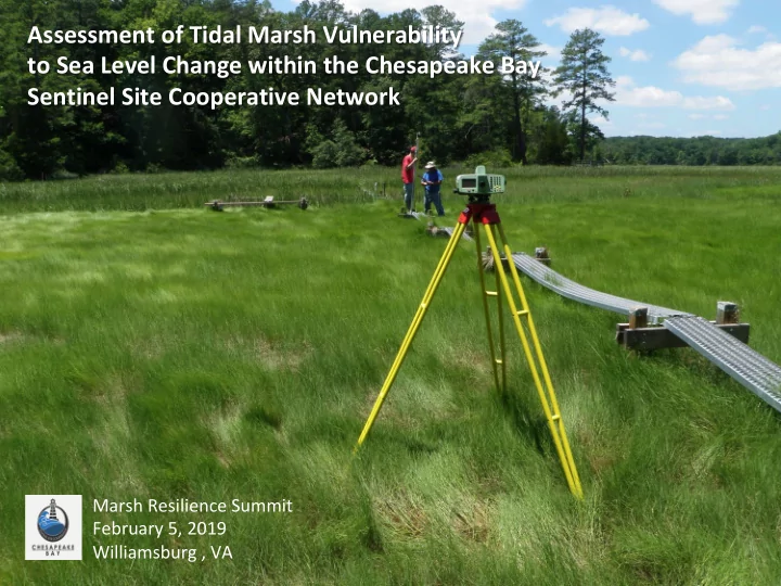
Assessment of Tidal Marsh Vulnerability to Sea Level Change within the Chesapeake Bay Sentinel Site Cooperative Network
Marsh Resilience Summit February 5, 2019 Williamsburg , VA
SLIDE 2
CBSSC NETWORK DATA CONTRIBUTORS
Chesapeake Bay NERR – MD/DNR Kyle Derby Chris Snow Pati Delgado Virginia Coast Reserve – LTER/UVA Linda Blum Jessica Flester Cora Johnston Chesapeake Bay NERR – VA/VIMS William Reay Hank Brooks Scott Lerberg* Alex Demeo NOAA National Geodetic Survey Philippe Hensel Maryland Sea Grant Taryn Sudol Smithsonian Environmental Research Center Patrick Megonigal James Holmquist University of MD – UMCES Lora Harris Erin Reilly* Lorie Staver Court Stevenson University of MD Andrew Baldwin
SLIDE 3 PRESENTATION OVERVIEW
- Cooperative Assets and Capabilities
- Background and Sentinel Site Concept
- Vertical Marsh Movement - SET
- Lateral Marsh Movement – DSAS and Slope
SLIDE 4 0.2 0.4 0.6 0.8 1 500 1,000 1,500 2,000 2,500 3,000 3,500 4,000 4,500 5,000
1950s-1970s 1970s-1980s 1980s-1990s 1998-2004 2004-2009
Annual Change (%)
More Indirect Human Activity No Net Loss Policy (1st adopted by Bush in 1989) Hydrology modifications and land conversion slowed due to Wetlands Protection Regulations (Clean Water Act 1977, Sec. 404)
Data Sources: (1) Frayer et al. 1983, (2) Dahl and Johnson 1991, (3) Dahl 2000, (4) Dahl 2006, (5) Dahl 2011, (6) Dahl and Stedman 2013.
(2) (3) (4) (5) (1)
CONTERMINOUS UNITED STATES – ESTUARINE EMERGENT WETLANDS: STATUS AND CHANGE
Acres (x 1,000)
Start year End year % Change
Atlantic (0.1%) Gulf (1.0%) Pacific (0.0%) (6)
SLIDE 5 Adapted from: Glick et. al. 2011
- ↓ Sensitivity
- ↓ Exposure
- ↑ Adaptive Capacity
Species • Habitats • Ecosystems •
r Policies •
r Practices • Institutional r •
Targets
Vulnerability
Monitor Review Revise
Options
Options
A ROADMAP TO DEVELOPING ADAPTATION STRATEGIES
SLIDE 6
- Managed area that is representative
- f regional ecosystem types;
- Operational capacity for intensive
and sustained study (high-frequency and multivariate measures; historical data record);
- Physical, chemical and biological
monitoring referenced to accurate geospatial infrastructure;
- Network or subset of network must
encounter the stressor of interest and be responsive to that stressor;
- Monitoring leads to an understanding
- f the nature of variability and
underlying forces;
- Detection of change or trends should be possible (heightened sensitivity
to stressors and/or low background variability); and
- Be of a size that is practical for testing adaptive management approaches
and for education and outreach.
Sentinel Site Criteria
SENTINEL SITE – DEFINED
SLIDE 7 CBSSC NETWORK CAPACITY – SOIL PROCESSES
Phillips Creek VA
annual root volume increment (gdw yr-1)
500 1000 1500 2000
annual elevation increment (cm)
0.0 0.2 0.4 0.6 0.8 1.0
Soil and plant processes facilitating marsh migration into forest and agricultural lands. Sediment and organic matter contributions to marsh surface elevation change.
SLIDE 8
CBSSC NETWORK CAPACITY – CLIMATE EXPERIMENTATION
Rhode River MD
Marsh elevation response to manipulated levels of temperature, CO2, nutrients, and sea level. Forecast invasion rates of Phragmites in response to global change factors - elevated CO2 and nutrient loadings.
SLIDE 9 Coupled Geomorphic & Ecological Marsh Evolution Model
- M. Kirwan et al. 2016. Geophys. Res. Lett., 43, doi: 10.1002/2016GL068507.
SCHISM based Tidal Marsh Model
- K. Nunez et al. 2019. Submitted Estuaries and Coasts
CBSSC NETWORK CAPACITY – NUMERICAL MODELING
Taskinas Creek
Goodwin Island VA
Image credit: D. Walters
SLIDE 10 CBSSC NETWORK CAPACITY – RESTORATION APPROACHES
Poplar Island MD 1,140 acres 5 acres 1,140 acres
Effectiveness of planting methods (grid vs group) in varying soil types. Impacts of initial elevation, vegetation type and proximity to tidal inlets on marsh surface elevation dynamics.
Image credit: Staver, Poplar Island Image credit: Staver, Poplar Island
SLIDE 11
CBSSC NETWORK CAPACITY – ELEVATION CHANGE
Jug Bay MD
Spatial, seasonal and episodic event influences on marsh elevation dynamics. Vegetation responses to changing trends in groundwater salinity.
SLIDE 12 NATIONAL MARS ANALYSIS
Site
Marsh Elevation Elevation Change Sediment Accretion Tidal Range Sea-level Rise MARS Risk MARS Average MARS Ratio Great Bay NH 4.3 4.0 3.0 5.0 4.0 5 4.1 2.4 Waquoit Bay MA 3.0 1.0 1.0 1.0 2.0 1 1.6 0.6 Narragansett Bay RI 3.3 1.0 1.3 1.0 2.0 1 1.7 0.7 Hudson River NY 3.7 5.0 4.3 3.0 1.5 4 3.5 4.8 Delaware DE 4.3 4.0 5.0 3.0 1.5 4 3.6 1.2 Chesapeake Bay MD 4.7 2.0 4.0 2.0 1.0 2 2.7 0.7 Chesapeake Bay VA 4.0 5.0 3.0 2.0 1.0 3 3.1 1.1 VCR/LTER VA 3.2 3.7 2.7 2.0 2.0 2 2.9 1.0 North Carolina NC 3.0 1.0 2.0 2.0 3.5 2 2.3
NI-WB SC 3.3 2.0 2.0 3.0 3.0 3 2.7 0.8 ACE Basin SC 3.0 1.0 3.0 4.0 3.0 4 2.8 0.6 Grand Bay MS 3.3 4.0 1.5 1.0 3.0 3 2.6 1.3 Padilla Bay WA 2.3 N/A 2.5 5.0 4.0 2 3.5 N/A South Slough OR 4.3 1.0 1.3 4.0 5.0 3 3.1
San Francisco Bay CA 4.3 3.0 3.7 3.0 4.0 5 3.6 2.0 Elkhorn Slough CA 3.0 1.0 3.0 3.0 4.5 4 2.9 0.5 Tijuana River CA 3.3 5.0 3.5 2.0 3.5 4 3.5 2.9
MArsh Resiliency to Sea level Indices (MARS) Raposa et al. 2016.
SLIDE 13 (-) Erosion (±) Vertical Maintenance (+) Upland Transgression
Lateral Vertical
Environmental Drivers Accretion Processes
Taken from Titus et al. 2009
MARSHES ON THE MOVE
Image credit: M. Kirwan
SLIDE 14 LOW AND HIGH MARSH – VERTICAL ACCRETION
High Marsh Interior Ponding & Creek Enlargement High Marsh:
(MHW-HTspring) Low Marsh:
(MSL-MHW)
HM LM
5 cm
SLIDE 15 SEDIMENT ELEVATION TABLE – JUST THE BASICS
10 20 30 40
0.5 1 1.5 2 2.5 3
Cumulative elevation r mm Years
Y=8.88x r2=0.89
Figure Source: USDOI, USGS Patuxent Wildlife Research Center Lynch et al. 2015
SLIDE 16 Historical RSLR Rates
- Source: NWLON reported RSL trends
- Nearest 3 Neighbors
- Range 3.5 to 4.6 mm/yr
Current RSLR Rates
- USCOE Sea Level Rise Calculator
- 2006 NOAA RSLR slopes, adj. for
recent IPCC/NRC projections (intermediate curve RCP4.5) and local subsidence.
2050 RSLR Rates
- Source: Boesch et al. 2018
(SLR Projection for MD; RCP4.5)
Monie Bay
METHODS: RSLR RATES
SLIDE 17 VERTICAL ELEVATION CHANGE – SALT MARSHES
Site (L/H: Low/High Marsh, N) Median SET Slope mm/yr RSLR Rate (mm/yr) Historic Current 2050 (SET Slope – RSLR) (mm/yr) Historic Current 2050 Prospect Bay MD (L,2) 11.9 3.2 4.0 7.3 8.7 7.9 4.6 Poplar Island 3D MD (L,6) 7.0 3.7 4.2 7.3 3.3 2.8
Poplar Island 1C MD (L,3) 8.6 3.7 4.2 7.3 4.9 4.4 1.3 Tar Island MD (L,3) 3.1 3.7 4.2 7.9
Parkers Creek MD (L,4) 7.9 4.2 4.2 7.3 3.7 3.7 0.6 Cove Point MD (L,2) 3 4.2 4.7 7.3
Monie Bay MD (L,12) 1.9 4.2 4.7 7.9
Phillips Creek VA (L,3) 4.7 4.3 4.9 8.2 0.4
Goodwin Island VA (L,4) 7.3 4.4 4.7 8.2 2.9 2.6
Prospect Bay MD (H,2) 5.2 3.2 4.0 7.3 2.0 1.2
Nanticoke River (H,6) 1.6 4.2 4.7 7.9
Monie Bay (H,6) 1.7 4.2 4.7 7.9
Phillips Creek (H,6) 4.1 4.3 4.9 8.2
Goodwin Island (H,6) 2.2 4.4 4.7 8.2
SLIDE 18 VERTICAL ELEVATION CHANGE – OLIGOHALINE AND TFW MARSHES
Site (L/H: Low/High Marsh, N) Median SET Slope mm/yr RSLR Rate (mm/yr) Historic Current 2050 (SET Slope – RSLR) (mm/yr) Historic Current 2050 Jug Bay NERR MD (L,6)
3.5 4.0 7.3
Sweet Hall Marsh VA (L,4) 7.6 4.7 5.0 8.2 2.9 2.6
Jug Bay NERR (H,6) 2.0 3.5 4.0 7.3
Jug Bay USF&WS (H,6) 0.9 3.5 4.0 7.3
Nanticoke River (H,9)
4.2 4.7 7.9
Sweet Hall Marsh (H,8) 1.4 4.7 5.0 8.2
SLIDE 19
NET LATERAL CHANGE – DSAS METHODOLOGY
2004 NAIP 2 m resolution 2016 NAIP 1 m resolution 2002 VGIN 1 m resolution 2017 VGIN <1 m resolution
Digital Shoreline Analysis System (DSAS; Esri ArcGIS). 10 m spaced perpendicular transects off shoreline and forest-marsh baselines. Change rates determined as mean transect distance differences between year images. Imagery: USDA National Agriculture Imagery Program (NAIP): 2004/2016 MD, 2005/2017 VA.
SLIDE 20 NET LATERAL CHANGE – DSAS
Site Shoreline Erosion m/yr Forest Retreat m/yr NET Marsh Change m/yr SERC, MD .14 .03
Jug Bay 1 MD .02 .10 .08 Jug Bay 4 MD .12 1.55 1.43 Poplar Island 3D MD .12 Poplar Island 1C MD .24 Tar Island MD .25 Parkers Creek MD .24 .07
Cove Point MD .50 Monie Bay 3 MD .29 .98 .69 Monie Bay 4D MD .26 .08
Phillips Creek VA
.57 73 Sweet Hall Marsh VA .44 .98 .54 Goodwin Island VA .35 .67 .32
SLIDE 21
MARSH TRANSGRESSION – SLOPE & RSLR
1st Quartile 2nd Quartile 3rd Quartile 4th Quartile
Slope
TRAN2018 = RSLR2018 ÷ SlopeUpland TRAN2050 = RSLR2050 ÷ SlopeUpland TRANHST = RSLRHST ÷ SlopeUpland
SERC
Rhode River 2017 Forest Boundary 50 m buffer
SLIDE 22 MARSH TRANSGRESSION – SLOPE & RSLR
0.1 0.2 0.3 0.4 0.5 0.6 0.7 0.8 0.9 1
Upland Transgression Potential m/yr
m 0.005 m 0.01
Mean DSAS
1.55
SLIDE 23 PRESENTATION SUMMARY
- Regarding Vertical Sediment Surface Elevation Changes:
- Low TFW and saltmarsh zones have the potential to keep pace with
current and 2050 RSLR rates but are vulnerable in regions of low sediment and tide range.
- High TFW and saltmarsh zones appear vulnerable under current and
2050 RSLR rates.
- Regarding Lateral Marsh Changes:
- Image based shoreline erosion rates varied between 0.02 and 0.50 m/
yr.
- Image based forest retreat rates varied between -0.02 and 1.55 m/yr.
- Slope based forest retreat rates were generally reduced as compared
to image based results and reflect leverage of elevated slope in buffer zones.
SLIDE 24
THANK YOU FOR YOUR INTEREST.
WILLIAM REAY, VIRGINIA INSTITUTE OF MARINE SCIENCE, WREAY@VIMS.EDU