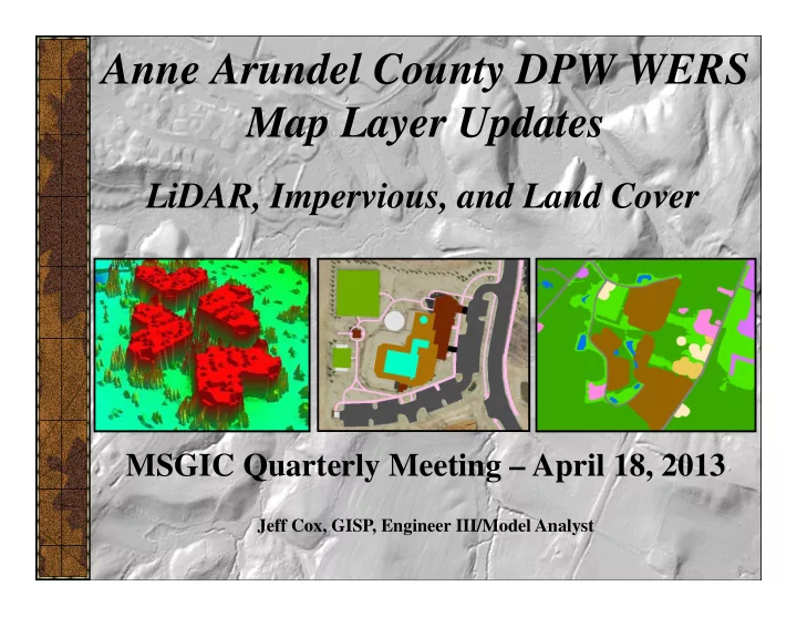
SLIDE 1 Anne Arundel County DPW WERS Map Layer Updates
LiDAR, Impervious, and Land Cover
Jeff Cox, GISP, Engineer III/Model Analyst
MSGIC Quarterly Meeting – April 18, 2013
SLIDE 2
DPW WERS
Rick Fisher, Senior Engineer/Model Administrator Jeff Cox, GISP, Engineer III/Model Analyst
Department of Public Works Bureau of Engineering Watershed, Ecosystem, and Restoration Services Watershed Assessment and Planning Program WERS also includes the Ecosystem Assessment/Protection Program and Environmental Restoration Project Management.
SLIDE 3
Project Overview
In 2011, DPW WERS purchased consultant services from the Sanborn Mapping Company to collect LiDAR elevation data and create an associated DEM. Sanborn also updated the County’s Impervious Surfaces and Land Cover map layers using the 2011 Statewide Aerial Photos (thanks, Jim Cannistra!).
SLIDE 4
LiDAR
LiDAR is an acronym for LIght Detection And Ranging, which is a remote-sensing technology that uses laser pulses to measure distances to reflective surfaces, such as tree canopy, building rooftops, or the ground.
SLIDE 5
LiDAR
The County last acquired LiDAR in 2004. Substantial development has occurred since 2004, as well as several hurricanes and tropical storms, which can dramatically alter the landscape.
SLIDE 6
LiDAR
LiDAR specs: LAS (LASer) format. Binary. Not ASCII like old .txt format. Flown in March 2011. Collected the County and a 100 meter buffer outside. Nominal Pulse Spacing (NPS) of 1-2 meters. Often tighter. FVA <= 24.5cm, 95% confidence level. LAS point cloud classifications:
SLIDE 7
LiDAR
LiDAR examples (Color By Elevation):
SLIDE 8 LiDAR
LiDAR examples (Color By Intensity):
Intensity is a quantitative measure of the intensity for each
- return. The intensity values range from 0 to 255, where 0
represents the darkest reflections (ex. new asphalt) and 255 represents the brightest reflections (ex. white rooftop).
SLIDE 9
LiDAR
LiDAR examples (Color By Elevation – 3D):
SLIDE 10
LiDAR
LiDAR examples (Color By Elevation – 3D):
SLIDE 11
LiDAR
LiDAR examples (Color By Elevation – 3D):
SLIDE 12
LiDAR
LiDAR examples (Color By Intensity – 3D):
SLIDE 13 LiDAR
LiDAR examples (3D and Profile View):
Profile starts here
SLIDE 14 LiDAR
LiDAR Notes:
This data can be used for preliminary and planning purposes but does NOT replace the need for an accurate site survey. Previous examples were created using a trial 30 day evaluation license of a software called MARS7. Also tested QCoherent’s LP360. ArcGIS 9.3.1 can NOT display the LiDAR LAS files. ArcGIS 10.0 can display them, but very limited multi-point functionality. ArcGIS 10.1 has enhanced LAS viewing capability but DPW WERS has not tested this yet. However, I saw some great examples of 10.1 LiDAR use at the ESRI Federal UC in late February. Roughly ~2 million points per tile (636 total tiles, 33 GB total).
SLIDE 15
DEM
DEM is short for Digital Elevation Model, which is a computer model or 3D representation of a terrain's surface… in this case, the County’s surface… that was created from the LiDAR LAS point data. The DEM is a raster (image) grid consisting of equal sized cells attributed with an elevation value. The County last acquired a DEM (2 meter resolution) in 2004.
SLIDE 16
DEM
DEM Specs: Flown in March 2011. Collected the County and a 100 meter buffer outside. 3 foot resolution (interpolates LiDAR points and averages). Considered “bare earth” based on last returns. Major bridges removed from the DEM.
SLIDE 17 DEM
DEM comparison (2004 vs 2011):
Area just west of Muddy Creek Road and MD 214 in the Rhode River watershed. 2004 DEM hillshade - 2 meter 2011 DEM hillshade – 3 feet
Defined stream channel
SLIDE 18
DEM
DEM examples (Patapsco Tidal and Bodkin Creek Watersheds):
SLIDE 19
DEM
DEM examples (Hillshading):
SLIDE 20 DEM
DEM examples (vs Aerial Photography):
141 Ft 15 Ft
Closed Landfill Dredge Spoil Disposal
SLIDE 21
DEM
DEM examples (Bridge Removed):
SLIDE 22
DEM
DEM examples (Bridge Removed):
SLIDE 23
DEM
DEM examples (Symbology):
SLIDE 24
DEM
DEM Useage (ArcHydro): DPW WERS uses an ArcGIS extension called ArcHydro, which is geared to support water resource applications. Use the DEM to model water flow, create watershed boundaries, drainage areas, flow path tracings, etc… Each of the major 12 watersheds has its own dedicated model and each takes at least 1 - 2 weeks to create. Intensive combination of automated and manual processing, plus quality control efforts.
SLIDE 25
DEM
DEM Useage (ArcHydro): The DEM must be “reconditioned” using GIS storm pipe and culvert layers (from the County, SHA, Fort Meade, Annapolis City, and adjacent Counties) to effectively model water conveyance under the ground or under the road.
SLIDE 26
DEM
DEM Useage (ArcHydro): Another non-County culvert example.
SLIDE 27
DEM
DEM Useage (ArcHydro): County does not maintain private BMPs/pipes/culverts/outfalls so DPW WERS maintains a “DEM Modifications” layer… …which allows water conveyance and eliminates ponding.
SLIDE 28 DEM
DEM Useage (ArcHydro): Sometimes the County has to digitize private pipes off of 40 scale
SLIDE 29
DEM
DEM Useage (ArcHydro): Also, other jurisdictions may capture data at a smaller scale (larger area, less detail) that might not match up well against the County’s larger scale data. This state culvert does not quite reach the western side of the road, which is a low flow point, so DPW WERS will extend it to avoid a ponding situation and continue flow.
SLIDE 30 DEM
DEM Useage (ArcHydro):
Flow Direction Grid Flow Accumulation Grid Watershed catchment polygons Drain Lines
SLIDE 31 DEM
DEM Useage (ArcHydro):
Stormwater Management Pond
SLIDE 32 DEM
DEM Useage (ArcHydro):
Drop a point at the outfall on the FAC Drainage area created. Flow Path Tracing Determines how water is flowing thru the landscape from a starting point.
SLIDE 33
DEM
NOTE: If ArcHydro is not performing properly, ESRI online support suggests deleting the files in the temp directory on the PC local drive associated with your user account. This usually fixes any ArcHydro glitches. For example: C:\Documents and Settings\USER\Local Settings\Temp\
SLIDE 34
DEM
DEM Notes:
Again, there are 636 individual tiles (~534 acres each). 6.5 GB+ total. Users may need to “mosaic” the individual tiles to analyze a larger area. In ArcToolbox, use the “Mosaic To New Raster” tool, which mosaics multiple raster datasets into a new raster dataset. Please note that the regular “Mosaic” tool, which mosaics multiple input rasters into an existing raster dataset, sometimes leaves empty/no data “seams” at the edge of individual tiles. Many great ArcToolbox tools if you have Spatial/3D Analyst. 3D Interpolation, Line of Sight, Create Profile, Hillshading, etc…
SLIDE 35 Impervious Surfaces
Impervious surfaces are defined as artificial structures that are covered by impenetrable materials, which eliminate storm water infiltration and increase storm water runoff. For example, buildings, parking lots, & roads.
The County last acquired impervious surfaces in 2007 using raster extraction techniques based on the 2007 aerial imagery.
SLIDE 36
Impervious Surfaces
Increased amounts of impervious surfaces increase the amount of storm water runoff, which can contain pollutants such as pet waste, car oil and gas, lawn fertilizers, trash, etc…
SLIDE 37
Impervious Surfaces
… that discharge into our streams and Bay causing sediment dumps, algae blooms, and fish kills.
SLIDE 38 Impervious Surfaces
Impervious Specs:
Used the 2011 Maryland Statewide Aerial Photography Project imagery. Unlike previous Countywide impervious layers, this was manually digitized using heads-up processes (not raster extraction). The County last acquired impervious surfaces in 2007 using raster extraction techniques. Planimetric data acquired by the County via the 2007 imagery was used as basis. New impervious features not captured in the 2007 planimetrics were added, as well as any major changed surfaces. Impervious features that no longer exist on the ground were deleted. 11 Classifications: athletic fields, buildings, driveways, other paved areas, parking lots, patios/decks, piers, rails, roads/highways, sidewalks, and swimming pools.
SLIDE 39 Impervious Surfaces
Impervious Comparison (2007 vs 2011):
2007 raster
Regatta Bay
2011 vector
SLIDE 40 Impervious Surfaces
Impervious Comparison (2007 vs 2011):
Tanyard Springs – new development
2007 raster 2011 vector
SLIDE 41 Impervious Surfaces
18% 12% 19% 5% 6% 6% 5% 4% 16% 28% 27% 10%
SLIDE 42 Impervious Surfaces
Considerations:
What is impervious? What does the State consider impervious? Is crushed gravel impervious? Is packed dirt impervious? Are decks impervious? Many decks have slats that allow water to flow through. But there might be a concrete patio below. Are railroad beds impervious? Research suggests that most ballasts track beds are pervious. What portion of a swimming pool is impervious? The pool itself? Or just the surrounding patio? In vs out-of-ground pools. Most orthos are flown in the late winter when pool covers are still on. New astroturf fields at high schools are considered pervious. Expect discrepancies in TYPE between data capture staff. True ortho imagery (no building lean) vs aerial imagery (building lean, shadows).
SLIDE 43
Land Cover
Land Cover can be defined as the classification of land according to the vegetation, material, or man made structures that cover most of its surface. Not to be confused with Land Use which can be defined as how people utilize the land. For ex, Woods vs Vacant.
SLIDE 44
Land Cover
SLIDE 45
Land Cover
SLIDE 46
Land Cover
Sanborn was concerned with detection of changed areas through comparison of the 2007 and 2011 aerial photography. These imagery datasets were processed, along with the 2007 LC dataset, into spectrally homogeneous segments using Definiens Developer software. Using Sanborn’s object change methodology, the segments and their spectral statistics were examined for significant differences which indicated that the area may have changed land cover. The 4-band imagery, with emphasis on the infrared band, is very sensitive to changes in moisture and vegetation.
SLIDE 47 Land Cover
Tanyard Springs – new development
2007 Land Cover 2011 Land Cover
SLIDE 48
Land Cover
Land Cover classifications often vary between organizations. Even within the same organization. DPW WERS uses a customized classification in support of internal modeling efforts based on estimated EMC (Event Mean Concentrations) values. An EMC is the average concentration of a pollutant measure during a storm runoff event… per Land Cover class. For ex, the Total Nitrogen value for Row Crops is 16.06 mg/l, while the Total Nitrogen value for Woods is 1.0 mg/l.
SLIDE 49
Modeling and Analysis
So why do we need these map layer updates? Citizen drainage complaints, flooding issues, restoration of streams, retrofits of BMPs and outfalls. Input into models, such as TR20/HY8/WMT, for hydrologic analysis, hydraulic engineering and design, water quality and BMP efficiencies, and pollutant load reductions. ArcGIS Geoprocessing of the Drainage Area, Impervious, and Land Cover plays an integral role.
SLIDE 50
Modeling and Analysis
SLIDE 51 Watershed Protection and Restoration Special Revenue Fund and Program
http://www.aacounty.org/DPW/WPRF.cfm
Impervious Surfaces map layer used as the basis for determining amount
- f impervious on non-residential properties. Not just for internal DPW
WERS use anymore… directly impacts citizens and business owners. Its imperative that the County continue to accurately capture impervious surfaces in a timely manner. Yearly? “Real-time” using development plans, drawings, as-builts, etc...? Residential properties pay based on zoning and an Equivalent Residential Unit (ERU) calc (2,800 sq ft is the mean amount of impervious on res props):
* High density R10, R15 R22 = $34 (apts and condos, 1 ERU * .4) * Medium density R2, R5 = $85 (single fam homes, 1 ERU) * Low density R1, RA, RLD = $170 (larger single fam homes, 1 ERU x 2)
SLIDE 52 Data Availability
Impervious and Land Cover are posted on the County’s GIS Data Download web page: http://www.aacounty.org/OIT/GIS/GISData.cfm
DEM not posted due to large size (6.5 GB) but an
associated request form can be submitted to DPW MGI front counter. LiDAR also not posted. Contact Rick Fisher to request access to this data (33 GB).
SLIDE 53
Data Availability
DEM is also posted as a service by the Eastern Shore Regional GIS Cooperative (ESRGC). http://www.esrgc.org/mapservices/
SLIDE 54
Questions? THANKS! DPW WERS 410-222-4240
http://www.aacounty.org/DPW/Watershed/