
SLIDE 1
Albion Park Rail bypass
Flood Focus Group meeting #4
28 September 2015
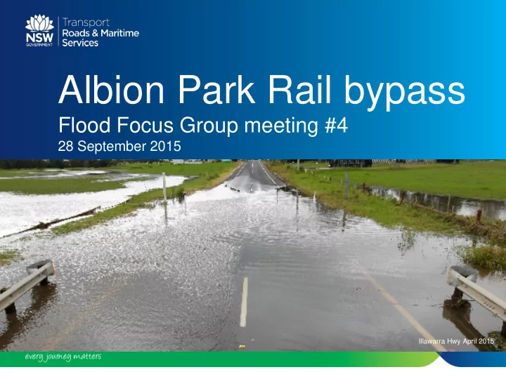
Illawarra Hwy April 2015
Albion Park Rail bypass Flood Focus Group meeting #4 28 September - - PowerPoint PPT Presentation
Albion Park Rail bypass Flood Focus Group meeting #4 28 September 2015 Illawarra Hwy April 2015 APRb Flood Focus Group 4 Agenda 1. Welcome 2. Recap of key points from last meeting 3. Review of feedback reviewed from Councils and OEH on
28 September 2015
Illawarra Hwy April 2015
Report
2
– Duck Creek catchment – Macquarie Rivulet catchment – Horsley Creek catchment
3
– A 20 year annual recurrence interval (ARI) objective is considered too low for this project – 100 year ARI plus is more appropriate – Level of flood immunity is unclear in the executive summary – Could some access for emergency services be maintained during flood events over what is designed? – Objectives should be developed through assessment of impacts on:
4
– 400mm for Agricultural lands is considered unacceptable.
– Access will not be achieved – Addressed by raising access road next to Green Meadows Basin.
Basin
– Expect a separate Dam Break Analysis for any proposed basin. – Need to be included in correspondence with the Dam Safety Committee.
5
– There are at least 10 proposed discharge points into this reserve – Who will be responsible for the ongoing maintenance of the basin?
– Has a basin upstream of the Oak Flats interchange been included in the flood plan? – This could provide benefits for the Princes Highway
– Will discharge from the new proposed basin be directed to Frazers Creek? – Who will be responsible for the ongoing maintenance of the basin?
6
– How would water quality impacts be managed? – What devices are proposed and where would they be? – How / who would manage maintenance?
– Who would maintain council structures proposed for extension / expansion?
– Modelling indicates negative impacts in most flood events particularly more frequent events – What has been considered to manage flood levels and duration?
7
– Macquarie Rivulet flood study has identified significant issues with the 2013 Bureau
– RMS should avoid use of this data until further advice is received
– Two properties in Macquarie Rivulet are reported as having over floor flooding – Unclear what impacts are expected on houses and garages – Identifying these impacts is important.
8
– Critical locations adjacent to proposed project extents be summarised for pre and post development
– Obstacle Limitation Surface (OLS) need to be shown – Resolution, wording and colour presentation should be improved
– Are they included in modelling? – Would they affect flooding?
9
– Detention basin information not included
– Consideration of climate and land use change for the range of flood events, based
ARIs as proxies.
– How have the bridges been modelled in TUFLOW? – Have bridge piers, deck etc been included?
10
– Potential environmental impacts due to flooding during construction – Location of temporary waterway crossings, ancillary sites etc
– Geomorphic assessment should be completed at the same time as flood modelling particularly where creek alignment / function would change – This should consider flow behaviour including:
11
– Current flood immunity standard does not consider uncertainty in modelling or factors such as wind and wave action – Should incorporate a freeboard to provide a safety factor – Without freeboard design standard could be reduced from 100 year ARI to 20-50 year ARI – Duck Creek from 50 year ARI to 10-20 year ARI without freeboard – Under climate and land use changes immunity could be further reduced – Suggest report needs to incorporate freeboard when referring to a flood design standard to avoid creating unrealistic expectations of flood immunity
12
– Methodology used to work out flood immunity to a given ARI may have resulted in a higher level of flood immunity – This is because data was calculated from the edge line of the carriageway rather than the relevant bridge levels – This is particularly critical for planning by emergency services as the level of immunity may be lower than claimed
13
– Suggest carrying out 100 year, 200 year & 500 year ARI models that include sea level rise to better assess of climate change implications – This would help assess impacts to the motorway and as a result of the motorway
14
– Functioning of major roads during flood events is critical for the safety of road users including emergency services – Where design level of motorway is restricted, flood markers and variable message boards should be considered – NSW State Emergency Services, Bureau of Meteorology and WaterNSW could assist with identification of key locations and real-time flood warning information
15
– Need to manage:
– Management and staging of construction impacts should be clearly referenced in motorway design – Stockpiles should be placed as far out of the floodplain as possible
16
– Two properties are reported as having over floor flooding in the 100 year ARI. – Issues should be resolved before final design and independent of the flood model being developed for Shellharbour City Council. – Model indicates and increased flood damage at existing residential/commercial areas in the 500 year ARI, particularly in the Macquarie Rivulet / Frazers Creek / Albion Creek catchments – Increasing the waterway area of the proposed bridge over Frazers Creek may assist in alleviating these impacts – Additional modelling should be undertaken when the Macquarie Rivulet flood model is closer to adoption
17
– Models for anything greater than 50 year ARI show significant increase in flood level upstream of bypass – Increase mostly away from existing residential dwellings – however there is significant increase in inundation within private property – Potentially critical for reducing isolation rural properties and future development – Consider measures to reduce the potential for blockage – The Wollongong City Council Duck Creek flood study was not carried out through the Office of Environment and Heritage the Floodplain Management Program – Further analysis should be considered
18
– Modelling has assumed:
– Proposed redesign of the Green Meadows basin is based on 10 year ARI event to the 100 year ARI event. Where possible the redesign of the basin should:
downstream of the basin in the 100 year ARI event
19
– Must provide an improvement on the current basin design identified by the NSW Dam Safety Committee which should lead to improved safety of residents – Consultation with NSW Dam Safety Committee and Shellharbour City Council be maintained – These comments are also applicable to the proposed new detention basin adjacent Croome Road to ensure no adverse impacts downstream and that the potential for improving flooding downstream is also explored and incorporated in the design process.
20
construction to start by early 2019
21
22