Advanced Geophysical Classification Treatability Study Hawthorne - - PowerPoint PPT Presentation

advanced geophysical classification treatability study
SMART_READER_LITE
LIVE PREVIEW

Advanced Geophysical Classification Treatability Study Hawthorne - - PowerPoint PPT Presentation

Military Munitions Response Program Advanced Geophysical Classification Treatability Study Hawthorne Army Depot, NV M2S2 Webinar February 26, 2015 1 Project Team Nevada Division Hawthorne Army of Environmental Depot


slide-1
SLIDE 1

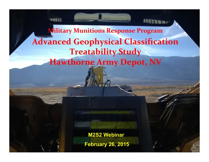
Military Munitions Response Program ¡

Advanced ¡Geophysical ¡Classification Treatability Study Hawthorne Army Depot, NV

M2S2 Webinar February 26, 2015

1

slide-2
SLIDE 2

¡ ¡ ¡

Project ¡Team

Nevada Division Depot Hawthorne Army

  • f ¡Environmental

Chuck King

Protection ¡

Greg ¡Jacobs Raquel Diedrichsen

Army Bureau ¡of ¡Land Environmental Management Command Angelica Rose

Rich ¡Mendoza Marilyn Plitnik (retired)

Army Corps of ¡ Environmental Security Engineers (CESPK) Technology ¡Certification

Kathy Siebenmann Jim ¡Lukasko

Program ¡

John Jackson

Herb ¡Nelson ¡ Parsons ¡

Greg ¡Van John Baptiste

2

slide-3
SLIDE 3

Walker Lake Land Test ¡Range Treatability Study

  • ObjecNve of this demonstraNon was to perform treatability study

using the MetalMapper electromagneNc inducNon sensor classificaNon approach as part ¡of the remedial invesNgaNon (RI) and feasibility study (FS) at ¡Hawthorne Army Depot ¡.

  • The classificaNon method is included in the FS as a remedial

alternaNve.

  • This site was selected for the program because of its relaNvely flat ¡

and tree-­‑less terrain, high density of muniNons debris and MEC items, and an opportunity to involve a stakeholder community including state regulators in the classificaNon pilot ¡program.

3

slide-4
SLIDE 4

Walker Lake ¡Land Test Range ¡MRS

– Realigned MRS is 10,269 acres (6,653 acres of land and 3,616 acres of water) – High Density Land area covers over 1,975 acres. – Potential TOI

  • 2.25-­‑in rockets
  • 2.75-­‑in rockets
  • 3.5-­‑in rockets
  • 4.5-­‑in rockets
  • 5-­‑in rockets
  • 7.2-­‑in rockets
  • 300-­‑lb depth

charges

– RAO is 2.75-in rocket at 2 ft

4

slide-5
SLIDE 5

Treatability Study Elements

– Pre-­‑survey site prep (surface sweep, IVS, site seeding) – Dynamic MetalMapper detecNon survey – DetecNon survey data ¡processing and target ¡selecNon – Cued data ¡collecNon over detecNon survey targets – Cued survey data ¡processing, classificaNon, and dig list ¡ development ¡ – Intrusive invesNgaNon – validaNon grid and TOI-­‑only excavaNons – Treatability Study results

5

slide-6
SLIDE 6

Test Pit Data Collection

  • Based on 2.75-­‑in rocket ¡warhead at ¡

2 ?, horizontal orientaNon

  • Summed Nme gates 5-­‑9; averaged 5

middle ¡receivers ¡

  • 23 mV/A ¡response ¡determined

through tesNng

  • Used 20 mV/A as threshold

6

slide-7
SLIDE 7

MetalMapper Detection Survey

  • DQOs were generally based off of

exisNng USACE detecNon survey guidance (IVS response, coverage, point ¡to point, seed detecNon and

  • ffset)
  • Equipment ¡failures resulted in only 9
  • f 10 intended acres covered

7

slide-8
SLIDE 8

Detection Survey Results

Validation grid

8

slide-9
SLIDE 9

Detection Survey Target Selection

  • 2,948 anomalies selected using 20 mV/A threshold
  • Used size filter to remove smaller anomalies
  • Final list ¡for cued survey included 1,880 targets
  • All seeds correctly idenNfied; two TOI ¡recovered during intrusive

not ¡detected in dynamic (below required depth of detecNon)

  • 39 naNve TOI ¡below 2 feet ¡were picked in detecNon survey and

classified correctly

9

slide-10
SLIDE 10

¡ ¡ ¡ ¡ ¡ ¡ ¡ ¡ ¡ ¡ ¡ ¡ ¡ ¡ ¡ ¡ ¡ ¡ ¡ ¡ ¡ ¡ ¡ ¡ ¡ ¡ ¡ ¡ ¡ ¡ ¡ ¡ ¡ ¡ ¡ ¡ ¡ ¡ ¡ ¡ ¡ ¡ ¡ ¡ ¡ ¡ ¡ ¡ ¡ ¡ ¡ ¡ ¡ ¡ ¡

MetalMapper Cued Survey and Classification ¡

  • 1,800 of 1,880 targets collected
  • Library Match Digs:

– 3-­‑curve Library match > ¡0.6 – 2-­‑curve Library match > ¡0.7 – 1-­‑curve Library match > ¡0.8

  • Targets added at ¡the discreNon of the analyst ¡

– noisy data ¡with confidence metrics close to the thresholds – locaNon within feature space, parNcularly large objects (demo pits, depth charges)

  • Can’t ¡Analyze targets

– All 3 curves idenNfied as poor by analyst/ bad fit ¡ – DetecNon data ¡looks real (not ¡noise spike, anomaly present ¡on mulNple lines)

  • No dig: ¡

– Targets not ¡meeNng the above criteria ¡

10

slide-11
SLIDE 11

TOI Results in Feature Space

Training targets 11

slide-12
SLIDE 12

Validation Grid Results

477 targets. All excavated regardless of classificaNon

  • 78% reducNon in overall digs
  • 68% of “dig” targets were TOI ¡
  • 93% reducNon in cluPer ¡digs ¡

Non-­‑ValidaNon Grid Results

  • 75% classified as non-­‑TOI ¡
  • Subset ¡of classified TOI ¡dug (134
  • f 307) ¡
  • 82% of invesNgated targets were

TOI ¡

12

slide-13
SLIDE 13

¡ ¡ ¡ ¡ ¡ ¡ ¡ ¡ ¡ ¡ ¡ ¡ ¡ ¡ ¡ ¡ ¡ ¡ ¡ ¡ ¡ ¡ ¡ ¡ ¡ ¡ ¡ ¡ ¡ ¡ ¡

¡ ¡ ¡ ¡ ¡ ¡ ¡ ¡ ¡ ¡

Classification Treatability Study

Tradi>onal Using Classifica>on ¡ Total Anomalies 10,000 10,000 Total Digs 10,000 2,180 Total TOI Digs 1,487 1,487 Total Non-­‑TOI Digs 8,513 693 Digs Saved 7,820 Cost Assump>ons: All other costs equal. MetalMapper Adds $39/anomaly and Intrusive costs ¡$200/anomaly ¡(higher site specific costs) ¡ MetalMapper Costs ¡ $0 $390,000 Intrusive Costs ¡ $2,000,000 $436,000 Subtotal ¡ $2,000,000 $826,000

– Walker Lake Land Test ¡Range High-­‑Density Area ¡is ~1,700 acres. Assuming an average of 100 anomalies/acre that ¡is 170,000 anomalies – Assuming ~$1.15M ¡saved for each 10,000 anomalies. Using classificaNon could potenNally save up to ~$19.6 Million.

13

slide-14
SLIDE 14

¡ ¡ ¡ ¡ ¡ ¡ ¡

Hawthorne Army Depot ¡Advanced ClassificaNon Treatability Study:

A State ¡Regulator’s Crash Course in Advanced ClassificaNon

Raquel Diedrichsen Nevada ¡Division of Environmental ProtecNon

14

slide-15
SLIDE 15

Agenda ¡

  • My Background with Advanced ClassificaNon
  • Tools I Used To Get ¡Up To Speed
  • My PercepNon of the DemonstraNon Plan
  • Terminology that ¡I Needed Clarified
  • Big QuesNon that ¡Arose from the Treatability

Study

  • Path Forward at ¡the Hawthorne Army Depot ¡

15

slide-16
SLIDE 16

Advanced ClassificaNon -­‑ WHAT?

  • May 2013 – informed of Technical Project ¡Planning (TPP) MeeNng

for the Feasibility Study (FS) phase of the Military MuniNons Response Program (MMRP) at ¡Hawthorne Army Depot ¡

– Advanced ClassificaNon Treatability Study may be conducted at ¡ Hawthorne Army Depot ¡Walker Lake Land Test ¡Range MuniNons Response Site (MRS)

  • June 24, 2013 – FS TPP MeeNng #1
  • September 2013 – First ¡Dra? of the DemonstraNon Plan for

Advanced ClassificaNon (work plan) received for review

  • October 2013 – NDEP concurred with third version of

DemonstraNon Plan

  • October 2013 – Blind seeding begins at ¡Hawthorne Army Depot ¡

Walker Lake Land Test ¡Range MRS

  • December 2013 – Intrusive invesNgaNon completed

16

slide-17
SLIDE 17

Tools for GeQng Up to Speed on Advanced ClassificaNon

  • ESTCP website

– hPps://www.serdp-­‑estcp.org/Tools-­‑and-­‑Training/MuniNons-­‑Response/ ClassificaNon-­‑in-­‑MuniNons-­‑Response

  • “ImplemenNng ClassificaNon on a MuniNons Response Project” –

posted ¡April ¡2012

  • Treatability Study MeeNng at ¡Hawthorne Army Depot ¡
  • ITRC documents

– Geophysical ClassificaNon for MuniNons Response

  • hPp://itrcweb.org/GuidanceDocuments/GCMR-­‑1.pdf

– Introductory Fact ¡Sheet, October 2012 – Technical Fact ¡Sheet, June 2013 – Regulatory Fact ¡Sheet, October 2014

  • Advanced ClassificaNon Advisory Group meeNng, March 2014
  • Site Visit, November 2013

17

slide-18
SLIDE 18

Site Visit ¡

18

slide-19
SLIDE 19

DemonstraNon Plan (Work Plan)

Work ¡Plan Is: Work ¡Plan Needs To:

  • ScienNfic
  • Provide ¡more ¡

background/explanaNon

  • Research oriented
  • Maintain complexity, but ¡
  • Complex ¡

gear it ¡to stakeholders

  • More geared to those
  • Provide clearer

familiar with geophysics explanaNons of and advanced terminology classificaNon

19

slide-20
SLIDE 20

¡ ¡ ¡ ¡

Terminology ClarificaNon

  • Cued Data ¡CollecNon

– CollecNng data ¡with advanced sensor over detecNon survey targets

  • ClassificaNon

– Process of using data ¡from detecNon/dynamic surveys and cued data ¡collecNon to make decision about ¡ whether buried metal is a ¡ Target ¡of Interest ¡(TOI) or cluPer ¡or debris ¡(using ¡ library matching, staNsNcal classifier)

20

VS. VS.

  • Traditional Sensor
  • EM61
  • Advanced Sensor
  • MetalMapper
  • TEMTADS
  • MPV
  • BUD
slide-21
SLIDE 21

Terminology ClarificaNon

  • DetecNon ¡Survey

VS.

  • Dynamic Survey

– Done with EM61, Advanced Sensor, Schonstedt ¡ – DetecNon ¡survey done with an advanced sensor

  • Anomaly
  • Geophysical

response clearly different than background

VS.

  • Target
  • Anomaly selected

for further investigation based on it being above thresholds for response and size

21

slide-22
SLIDE 22

Big ¡QuesNon

WHAT DO WE DO WHEN MUNITIONS ITEMS CAN BE DETECTED AND CLASSIFIED WITH ¡ADVANCED CLASSIFICATION BELOW THE DEPTH ¡IN THE REMEDIAL ACTION OBJECTIVE?

22

slide-23
SLIDE 23

Remedial AcNon ObjecNves (RAOs)

  • Zero accidents resulNng from commercial/

industrial worker interacNon with surface and subsurface muniNons and explosives of concern (MEC) to 3 feet ¡below ground surface (bgs) ¡

  • Zero accidents resulNng from recreaNonal user

and site visitor interacNon with surface and subsurface MEC to 1 foot ¡bgs

23

slide-24
SLIDE 24

Recommended Remedial AlternaNve

  • Surface MEC removal to 1 foot ¡bgs using analog

detecNon methods in low-­‑density area ¡ (surface removal is 1 foot ¡due to shi?ing sands)

– Use on-­‑call MEC support ¡to achieve RAO of 3 feet ¡during future intrusive acNvity

  • Subsurface MEC removal to 2 feet ¡bgs using Advanced

ClassificaNon for protecNon of recreaNonal users and site visitors in high-­‑density area ¡ (shi?ing sands and expectaNon of digging 1 foot)

– Use on-­‑site MEC support ¡to achieve RAO of 3 feet ¡during future intrusive acNvity

24

slide-25
SLIDE 25

Advanced Sensor DetecNon Depth

  • MetalMapper detected and classified targets of interest ¡

(TOI) at ¡the Walker Lake Land Test ¡Range MRS below 2 feet ¡

  • MEC removal only recommended to 2 feet ¡

NDEP will request ¡

IF TARGETS OF INTEREST (TOI) HAVE BEEN DETECTED AND CLASSIFIED, REMOVE THEM.

25

slide-26
SLIDE 26

Path Forward at ¡the Walker Lake Land Test ¡Range MRS

NDEP has concurred with the use of Advanced ClassificaNon as the Remedial AlternaNve in the High-­‑Density Area ¡at ¡the Walker Lake Land Test ¡Range MRS

26