
SLIDE 1
92 Norsemens Rd Coronet Bay Residential Hotel proposal Presentation - - PowerPoint PPT Presentation
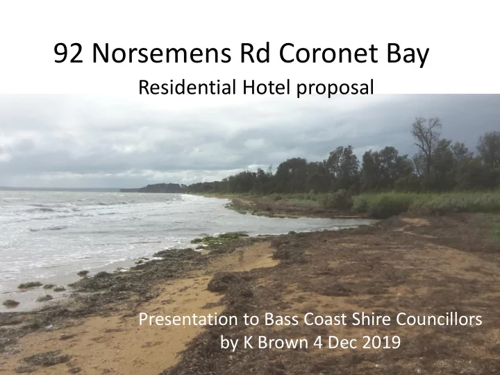
92 Norsemens Rd Coronet Bay Residential Hotel proposal Presentation to Bass Coast Shire Councillors by K Brown 4 Dec 2019 Development plan by Henderson Architects Bass Coast Planning Scheme Rural Land Use Strategy, 2014 (main reference
Development plan – by Henderson Architects
and surrounding land uses
conflicts with surrounding land uses
in association with and complimentary to agriculture
Development plan – by Henderson Architects
Local rainfall flooding 19th August 2019 looking West
High Tide prediction 0.93 m AHD at 1615 hrs 17 Oct. 2019 Storm surge likely 1.4 m AHD up to reeds Drain outlet inland 2.0 m AHD Sand/silt bank (estimate max. 1.8 m AHD) protecting from inland inundation
Coastal flooding
Consultants assessment Sea level Storm surge component Chart Datum, m AHD (m) (m) Current Mean Sea Level (MSL) 1.7
0.0 0.0
Year 2100 MSL
0.8 0.0
1 % AEP (1 in 100 yr) Storm Surge at MSL
3.4 2.6
Minimum built floor level (Melbourne Water corrected consultant Cardno 3.5 m value )
4.0
AHD Australian Height Datum
Coastal flooding
KB projections Sea level Storm surge component AHD (m) (m) BOM data Elizabeth Island 2019 predictions -
http://www.bom.gov.au/australia/tides/#!/vic-elizabeth-island
Mean High Tide Yr 2019 (97 events >= 1.2 m AHD) 1.15 0.0 (MHWS) Yr 2070 0.5 m sea level rise projection 1.65 0.0 Yr 2100 0.8 m sea level rise projection 1.95 0.0 (MHWS = Mean High Water Spring i.e. mean of higher daily High Tides; based on existing tidal range) Common 0.5 m storm surge at High Tide (MHWS) Yr 2070 2.15 0.50 Yr 2100 2.45 0.50 10 % AEP (1 in 10 yr) storm surge at High Tide (MHWS) Yr 2030
From Cardno report
3.08 1.73 Yr 2070
From Cardno report
3.53 1.88 Yr 2100
From Cardno report
3.98 2.03
Modelled on Coastal Risk Australia Current MSL +2.2 m Added Land drainage runoff would raise flood levels YR 2070 Mean High tide MHWS plus 0.5 m storm surge
Modelled on Coastal Risk Australia Current MSL +2.5 m Added Land drainage runoff would raise flood levels YR 2100 Mean High tide MHWS plus 0.5 m storm surge
Modelled on Coastal Risk Australia Current MSL +3.0 m Added Land drainage runoff would raise flood levels YR 2030 Mean High tide MHWS plus 10 % AEP (1 in 10 Year) storm surge
Modelled on Coastal Risk Australia Current MSL +3.5 m Added Land drainage runoff would raise flood levels YR 2070 Mean High tide MHWS plus 10 % AEP (1 in 10 Year) storm surge
Modelled on Coastal Risk Australia Current MSL +4.0 m Added Land drainage runoff would raise flood levels YR 2100 Mean High tide MHWS plus 10 % AEP (1 in 10 Year) storm surge