
SLIDE 1
2019 State of Our Rivers: South, West, and Rhode
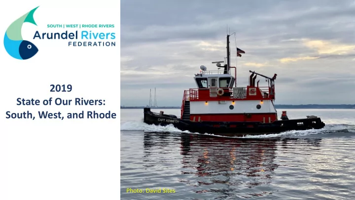
Photo: David Sites
2019 State of Our Rivers: South, West, and Rhode Photo: David - - PowerPoint PPT Presentation
2019 State of Our Rivers: South, West, and Rhode Photo: David Sites Arundel Rivers on the Half Shell Online Auction Starts Next Week! Tuesday, May 5 through Tuesday, May 12 Thank You! All the volunteers who helped collect the data
2019 State of Our Rivers: South, West, and Rhode
Photo: David Sites
Tuesday, May 5 through Tuesday, May 12
weekly summer commitment
Quality Assurance Officers MOST OF ALL: To You for caring, participating, and supporting Arundel Rivers
All Three Rivers Improved in 2019:
Water Temperature Scores Improved Rhode Bottom Temperature (+10) West Bottom Temperature (+17)
Nutrient Scores Improved: Total Phosphorus (+12) Total Nitrogen (+11)
52 Stations:
36 Stations:
(unsafe swimming >=104 cfu/100mL)
County Community College
15 county stations
If you are interested in having your community beach tested- email jesse@arundelrivers.org
Bacteria!
3 stations:
Monthly sampling
(Total Nitrogen) (Total Phosphorus)
(Sediment)
4 Flight Paths:
Underwater Grasses have Returned!
Living Shoreline
Underwater Grasses
Oyster Sanctuary Reef
Acid idification? → Getting Back to “Basics”
Ways to Help lp Our Riv ivers
It will start next week! Want to paddle your creek and map where the grasses are growing? email: Jesse@arundelrivers.org
Raise oysters on your own or your community’s dock
More information about individual creeks can be found at our interactive data map www.southriverdata.org
For Annapolis: 2010-17 average rainfall was 40.2 inches 2018 = 56.7 inches 2019 = 25.4 inches
Do your chores
Healthiest Creeks 2019 2019 2019-2018 MS1 74.07 B 1.91 MS1A 72.9 B 3.41 Selby 69.97 B 4.57 MS1B 68.3 B 3.21 Crab 66.75 B 6.92 Unhealthiest Creeks 2019 2019 2019-2018 MS5 52.23 C 6.12 Broad 53.5 C 2.73 MS4 56.75 C+ 4.03 Church 58.76 C+ 9.5 Beards 59.67 C+ 8.89
South River
Most improved from last year Least Improved (No creeks got worse!) 2019 2019 2019-2018 2019 2019 2019-2018 Little Aberdeen 63.35 B- 9.87 Glebe 65.91 B 3.36 Church 58.76 C+ 9.5 MS1B 68.3 B 3.21 Beards 59.67 C+ 8.89 Broad 53.5 C 2.73 Warehouse 59.88 C+ 8.63 Harness 62.55 B- 2.15 Pocahontas 63.54 B- 7.49 MS1 74.07 B 1.91
South
Rhode River
2019 Unhealthiest Creeks Score Grade River Club Estates 59.77 C+ Sellman Creek 59.89 C+ Ponder Cove 60 B- Big Island 61.4 B- Rhode River Marina 62.27 B- 2019 Healthiest Creeks Score Grade Off Camp Wabanna 69.75 B Cadle Creek 68.75 B Mouth of Rhode River 68.2 B Locust Pt. Marker #7 65.8 B High Island 64.55 B-
West River
2019 Unnhealthiest Creeks Score Grade Fords Creek 56.18 C+ Lerch Creek 57.39 C+ Johns Creek 58.31 C+ Smith Creek 58.57 C+ LaFayette Creek 61.41 B- 2019 Healthiest Creeks Score Grade Float-Free Channel 68.75 B Parrish Creek Marker #1 68.69 B Parrish Creek 68.33 B Cheston Point 65.55 B Popham Creek 65.12 B
Why are the Severn and South Rivers so much clearer than the West & Rhode?
(acres) Severn South Rhode West Total Area 44,160 36,433 8,783 7,809 Impervious 19% 12% 6% 6% Forest 32% 45% 54% 41% Agriculture 4% 15% 10% 19%
Our Job Is Is Never Done
More Investigation is Needed
place at the wrong time?
giving frequency.
world to us!
To donate monthly
You can change or stop your gift at any time!