
SLIDE 1
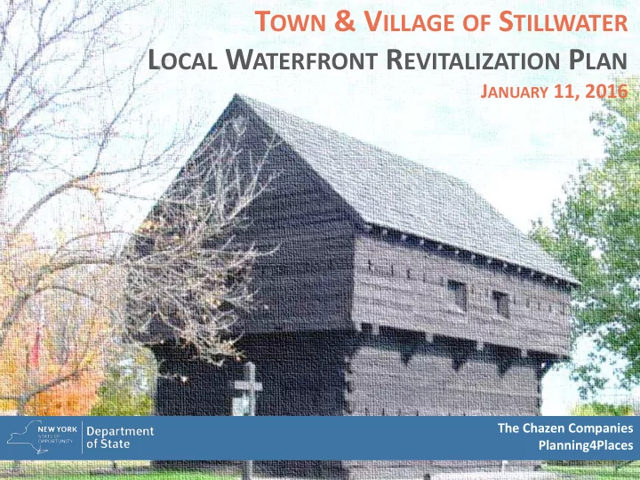
TOWN & VILLAGE OF STILLWATER LOCAL WATERFRONT REVITALIZATION PLAN
JANUARY 11, 2016
The Chazen Companies Planning4Places
1 Inventory & Analysis Public Workshops 2 Stakeholder Input - - PowerPoint PPT Presentation
T OWN & V ILLAGE OF S TILLWATER L OCAL W ATERFRONT R EVITALIZATION P LAN J ANUARY 11, 2016 The Chazen Companies Planning4Places T ONIGHT ' S A GENDA 0 Project Background 0 Preliminary Recommendations 0 Open House Breakout Sessions 0 Quality of
The Chazen Companies Planning4Places
0 Project Background 0 Preliminary Recommendations 0 Open House Breakout Sessions
0 Quality of Life 0 Land Use & Zoning 0 Economic Development 0 Transportation & Infrastructure
0 2004 Village Comprehensive Plan 0 2006 Town Comprehensive Plan 0 2006 US Route 4 Corridor Plan 0 2007 Farmland Protection &
0 2008 Stillwater Brownfield
0 2008 Stillwater GEIS
Hudson River Champlain Canal US Route 4
4
76
Village of Stillwater Riverside Neighborhood Saratoga Battlefield
67
DOWNSIZED HOUSING MORE ACTIVE DESIRE TO STAY in COMMUNITY SEEK AMENITY RICH LOCATIONS DESIRE WALKABLE COMMUNITIES DECLINE in INSTITUTIONAL LIVING
INCREASE PUBLIC TRANSIT DECLINE in DRIVING INCREASE in BICYCLING DECLINE in HOME OWNERSHIP DECLINE in HOUSING SIZE DESIRE for DOWNTOWN MIXED USE LIVING
0 Waterfront Market Analysis:
0 Saratoga County’s population continues to grow 0 Saratoga County’s economy built upon three pillars: agriculture,
tourism, and select business/industries (e.g., health care and social services, education, retail, emerging tech industry, etc.)
0 Over 40 organizations focused on economic growth in Saratoga County 0 Agriculture is vital to economy, but limited economic development
coordination within sector
0 Need to prioritize regional collaboration between tourism clusters and
improve marketing (with a focus on downtown and waterfronts)
0 Develop “social centers of gravity” for entertainment and cultural
activities
Saratoga County Economic Development Strategic Plan
0 Waterfront Market Analysis:
0 Study Area population and spending characteristics cannot yet
support many new/desired businesses
0 Existing Study Area businesses do not meet all of the goods and
services demands of nearby residents
0 Consumer willingness within region to regularly travel 15-30
minutes for select goods and services
0 Study Area and Regional residents are traveling for select goods
and services (e.g., specialty foods, clothing, home furnishings, healthcare, etc.)
0 Spending Potential Index (SPI) is high within 20-30-mile drive of
Study Area
0 Waterfront Market Analysis:
0 Saratoga County is among the largest tourism destinations in
the state
0 Largest share of tourism spending is on food and beverage and
lodging and transport
0 There are limited dining and lodging opportunities within Study
Area
0 Saratoga National Historic Park (SNHP) tourism related spending
is ~$3.3 Million
0 Stillwater section of NYS Canal has fewer users and limited
boating options compared to other communities along the canalway
0 The existing Lakes to Locks Passage program provides regional
and local based tourism information and marketing
0 Economic Development:
0 Leverage existing marketing initiatives (e.g., Lakes to Locks
Passage, etc.)
0 Develop a localized marketing strategy. Focus on attracting
people from within a 30-minute drive
0 Explore ways to support local business startups (e.g., funding
through IDA, technical support, business mentoring, allow for pop-ups etc.). Focus on restaurants, specialty shops, lodging, boating-related, etc.
0 Engage in broader economic development initiatives and help
facilitate local implementation (e.g., CREDC, Saratoga County Prosperity Partnership, SEDC, etc.), including CFA funding
0 Explore strategic sites for redevelopment and public/private
waterfront revitalization partnerships (e.g., enhanced use of Admiral's Marina, etc.)
Admiral’s Marina Redevelopment
0 Economic Development:
0 Leverage tourism through coordinated events strategy that
builds on existing facilities (e.g., SNHP, Blockhouse, Hudson Riverfront Park, Community Center, Stillwater CSD, Earl J. Manning American Legion Recreation Fields, etc.)
0 Partner with and market Saratoga National Historical Park to
collaborate on events and attract visitors and educate them about Stillwater Waterfront amenities and activities
0 Work with Saratoga National Historical Park to develop historic
tour boat rides. Consider developing dock at Hudson Riverfront Park and Village destination (e.g., Admiral’s Marina)
0 Economic Development
0 SNHP Historic Boat Tour (i.e. Fort Ticonderoga)
0 Quality of Life:
0 Explore improved and additional waterfront access
Admiral's Marina, this may include access near the proposed Esplanade project, at the Blockhouse, and NYS Canal lands behind SCSD (along Hudson River).
0 Explore improved and additional recreation opportunities,
including upgrades to Earl J. Manning American Legion Recreation Fields. Provide pocket parks with future growth (e.g., Major Dickinson Children's Playground, etc.)
0 Explore aging in place initiatives to ensure quality of life for
seniors (e.g., senior housing, affordable housing programs, housing modification and maintenance assistance programs, transportation and mobility assistance, etc.)
0 Develop permanent farmers market pavilion (possibly
at/near Blockhouse) that could be used for other events.
0 Provide space for
0 Improve
0 Add wayfinding
0 Allow for car-top
0 Possible (future)
0 Land Use & Zoning:
0 Promote conservation around Saratoga National Historical
Park (buildout analysis indicates the potential for ~1,900 new homes within vicinity). Town has funding to develop Transfer
0 Land Use & Zoning:
0 Promote mixed use development within southern limits of Study
Area (e.g., Village, Riverside Neighborhood, etc.). Use “Transect District” approach to zoning to complement existing land use patterns and address current mix of zoning district and increase property owner’s development potential
The proposed urban-to-rural transect approach is illustrated in these three views, as the T5 “urban” environment (left) transitions between smaller scale mixed use (T4) to mostly high or moderate density residential (T3). It is important to note that commercial use opportunities exist in all three scenarios.
Image Courtesy: Jericho, VT Planning
0 Land Use & Zoning:
0 Provide incentives for desired growth and community benefits:
0 Density Bonuses 0 Reduced application and review fees 0 Expedited approvals
Community benefits may include community facilities, municipal parking, infrastructure improvements, streetscape improvements, sustainable development, open spaces, waterfront access, public parks, and affordable or senior housing
0 Encourage senior housing by incorporating senior housing types
into zoning and/or require senior housing in select development types
0 Transportation & Infrastructure:
0 Expand transit and/or carpooling options 0 Develop comprehensive parking management strategy 0 Improve multimodal, complete streets options (e.g.,
walking, biking, etc.)
0 Continue to develop Champlain Canalway Trail 0 Help develop Hudson River Blueway Trail 0 Improve/expand sewer and water infrastructure within the
southern limits of the Study Area (e.g., Village, Riverside Neighborhood, etc.)
0 Expand natural gas infrastructure/service area
0 Transportation & Infrastructure:
0 Expand transit and/or carpooling options
0 Transportation & Infrastructure:
0 Develop comprehensive parking management strategy:
0 User Information (signage, online info, etc.) 0 Efficient utilization (no need for too many spaces) 0 Shared parking (between noncompeting uses) 0 Pricing (metered parking in high demand areas) 0 Municipal parking (possibly paid through with in lieu of fees) 0 Event parking plans (temporary parking, shuttles, etc.)
Access Management Pedestrian Access & Safety Corridor Beautification Traffic Calming Green Streets
0 Transportation & Infrastructure:
0 Continue to develop Champlain Canalway Trail (day-users of
trails spend between $1 to over $30 per visit. Overnight and multi-day trail users may average $100 to $300 per day)
0 Transportation & Infrastructure:
0 Help develop Hudson River Blueway Trail
0 Transportation & Infrastructure:
0 Improve/expand sewer and water infrastructure within the
southern limits of the Study Area (e.g., Village, Riverside Neighborhood, etc.)
0 Expand natural gas infrastructure/service area
Transect Zoning Enhanced Streetscapes Pedestrian Access Multimodal Access Sewer, Water & Gas Infrastructure Enhance Transportation
0 How can the economy of the study area be improved? 0 What help/assistance do new or existing businesses need? 0 What types of business would you like to see? 0 What type of housing should be encouraged and where? 0 Where should new development happen? 0 What areas should be preserved? 0 How can zoning facilitate growth or conservation? 0 What infrastructure improvements should be made (e.g., sewer, water, etc.) 0 What are the pedestrian related needs or opportunities (trails, bike lanes
sidewalks, amenities, etc.)?
0 What are the transportation issues and how can they be addressed 0 Where are existing public waterfront access locations and how can they be
improved?
0 Where are new public waterfront access opportunities? 0 Where do recreation, open space, cultural resources exist and how can they be
preserved and/or enhanced?
0 What type of community do you want to live in?
The Chazen Companies Planning4Places
PCUMMINGS@CHAZENCOMPANIES.COM