
SLIDE 1
N
200
SCALE: 1"=400'
400 400 800
ELLI S CREEK T E RRI T O R Y B L V D . H O M E W A R D W A Y H O M E W A R D W A Y BLVD.Cu
n ni n g h
a
m
C
r
e e
k
S
a
n d h
i l l
Ho m
e
wa
r
d
W a
y
W al
k
e
r
s
Sc
h
- l
El
l i
s
C
r
e e
k N
e
w
Bend Blakely Pointe Lake Creek Stone Forest Preston Watermill Place Greyston Glen River Meadow
West Park
Cambridge Ridge
Crescent Ridge
Autumn Meadows High
G
a
t
e
w
a
y
U
S
H w
y 9
Gr
a
n d
P
a
r
k
w
a
y
Br
a z
- s
R
i
v
e
r
New Territory
T
e
r r
i t
- r
y
C
r
e e
k
E
l l i
s
Park Cambridge Park Cambridge
TRACT OUT
Sports ComplexM.S. Sartartia Crest Laurel Pointe Brandon's
Lakewind Landing Robinson's
New Territory
)
9 9
H
S
(
Y A
W
K
R
A
P
D N A
R
G
E
V
I
R
D
L L
I
H D
N A
S
A
9
S
U
E
V
I
R
D
L
L
I
H
D
N A
S
Y A
W
D
R
A
W
E
M
O H
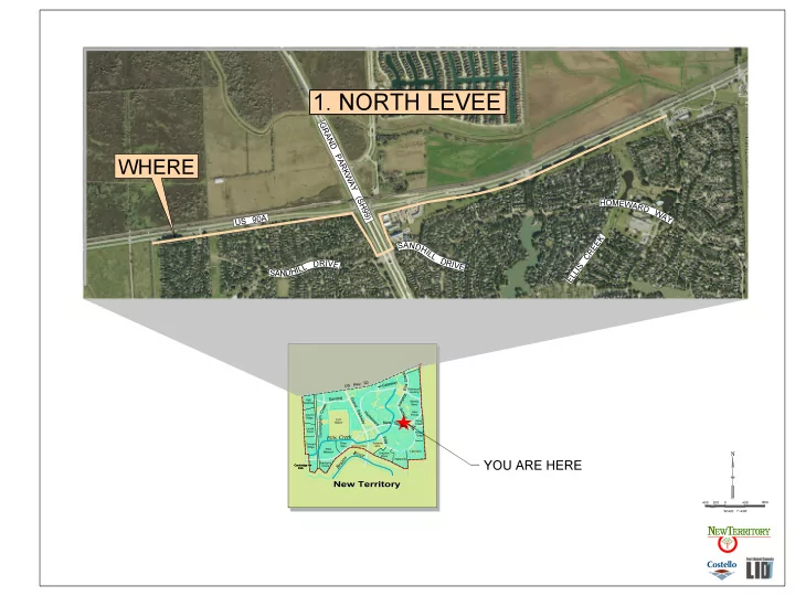
YOU ARE HERE
K
E E
R C
S
I
L L E
WHERE
- 1. NORTH LEVEE