
UPPER
GARNOCK FLOOD
PROTECTION
SChcME
1 INTRODUCTION
Welcome
to
the
second
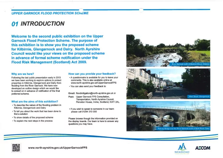
public exhibition on the
Upper
Garnock
Flood Protection
Scheme. The
purpose
- f
this
exhibition
is
to
show
you the proposed
scheme
for
Kilbirnie,
Glengarnock and
- Dalry. North
Ayrshire
Council
would
like your
views
- n
the proposed
scheme
in
advance
- f
formal
scheme
notification under
the
Flood
Risk
Management
(Scotland) Act 2009. Why
are
we
here?
How
can you provide your feedback?
Following
the
last public presentation early in 2013
- A
questionnaire
is available for
you
to leave your
we
have been working
to explore
- ptions
to protect
comments. This
is also available
- nline
at:
properties
in Kilbirnie,
Glengarnock and Dalry from www.north-ayrshire.gov.uk/UpperGarnockFPS
flooding
from the River Garnock.
We
have
now
- You
can
also
send your feedback
to:
developed an
- utline
design which
we
would
like
to consult
- n
in advance
- f
notification of
the
final
preferred scheme. Email:
floodmitigation@north-ayrshire.gov.uk
- r
What
are the
aims
- f
this exhibition?
- To
describe the nature
- f
the
flooding
problem
in
Kilbirnie, Glengarnock
and
Dalry
- To
tell you
about the work
that
has been done
to
find
a
solution
- To
show
details
- f
the proposed
scheme
- To
explain the next steps
in the
process Post: Upper Garnock
FPS
Consultation,
Transportation,
North Ayrshire Council,
Perceton House,
Irvine,
Scotland,
KA11
2AL
- If you
wish to speak to
someone
in our
team please
call
01294 310 000
Please
browse though the
information provided
- n
the display boards.
Our team
is here
to
answer any questions you may have.
0 0
www.north-ayrshire.gov.uk/UpperGarnockFPS
D
'
/~~
North
Ayrshire Council