
SLIDE 1
MISSION-GENEVA NEIGHBORHOOD TRANSPORTATION PLAN
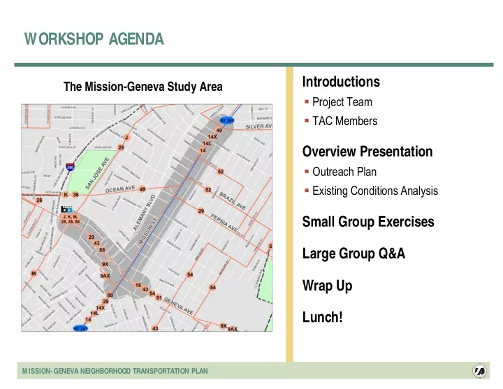
WORKSHOP AGENDA Introductions The Mission-Geneva Study Area - - PowerPoint PPT Presentation
WORKSHOP AGENDA Introductions The Mission-Geneva Study Area Project Team TAC Members Overview Presentation Outreach Plan Existing Conditions Analysis Small Group Exercises Large Group Q&A Wrap Up Lunch! MISSION-GENEVA
MISSION-GENEVA NEIGHBORHOOD TRANSPORTATION PLAN
MISSION-GENEVA NEIGHBORHOOD TRANSPORTATION PLAN
MISSION-GENEVA NEIGHBORHOOD TRANSPORTATION PLAN
―Community leaders ―Merchants ―Commercial property owners ―Residents ―Faith based organizations
―Community organization ―Staffing ―Organizational capacity ―Technical support ―Community building
MISSION-GENEVA NEIGHBORHOOD TRANSPORTATION PLAN
―Excelsior Festival ―Community Branding and Marketing ―Special events: Safe R Treat,
MISSION-GENEVA NEIGHBORHOOD TRANSPORTATION PLAN
Form Former M cD r M cDonal nald’s ’s 2004 2004
MISSION-GENEVA NEIGHBORHOOD TRANSPORTATION PLAN
―Power wash sidewalks quarterly ―Conduct annual neighborhood
―Improve access to public transit,
―Educate and support
MISSION-GENEVA NEIGHBORHOOD TRANSPORTATION PLAN
MISSION-GENEVA NEIGHBORHOOD TRANSPORTATION PLAN
MISSION-GENEVA NEIGHBORHOOD TRANSPORTATION PLAN
―Asian, 44.7% ―Hispanic/Latino 32.5% ―African American, 2.1%
US Census Bureau 2000
MISSION-GENEVA NEIGHBORHOOD TRANSPORTATION PLAN
―Pedestrians ―Transit riders ―Bicyclists ―Motorists ―Commercial users
MISSION-GENEVA NEIGHBORHOOD TRANSPORTATION PLAN
Attend Community Mtgs. to Introduce the Study Establish Encore Transportation Committee Community Survey Multilingual Focus Groups
Senior program facilities (2) Youth group at the Filipino Community Center Merchants and property owners Off-peak transit commuters (2)
Walking Tour With Community Leaders 3 Large Community Workshops
Prioritize Needs Prioritize Design Solutions Implementation Strategy/Refined Designs
Mobile Workshops (after Workshop 2) Excelsior Festival – Celebrate Final Plan
MISSION-GENEVA NEIGHBORHOOD TRANSPORTATION PLAN
MISSION-GENEVA NEIGHBORHOOD TRANSPORTATION PLAN
Community Action Plan For Safer Streets in the Excelsior SF County Transportation Authority Outer Mission Strategic Analysis Report Balboa Park Master Planning Strategy ENCoRe Action Plan
Majority of residents surveyed in past study indicate they rarely or never feel safe on study area streets “T” and offset intersections make crossing Mission Street difficult Muni connections to BART are difficult in this neighborhood Pedestrian and bicycle access to balboa park BART station should be improved Many crosswalks are worn and difficult to see
52% Cars Parked on Sidewalk 55% Sidewalks Lack Curb Ramps for Wheelchairs 55% Collisions Between Vehicles and People 58% Enforcement of Traffic Laws 60% Missing and/or Poorly Marked Crosswalks 66% Driver Education about Safety 69% Intersections Without Stop Signs or Lights Concerns about Pedestrian Safety 53% Right Turns on Red Lights 55% Too Much Traffic on Streets 57% Double Parking 60% Illegal Turns or U-turns 64% Reckless Driving 65% Vehicles Running Red Lights and Stop Signs 82% Vehicles Speeding Concerns about Traffic These charts document the top seven neighborhood concerns for traffic and pedestrian safety. They were developed for the Community Action Plan for Safer Streets in the Excelsior, November 2003.
SFCTA is coordinating closely with other public agencies including BART, Muni, and DPT to ensure that the many projects in the area compliment each other
MISSION-GENEVA NEIGHBORHOOD TRANSPORTATION PLAN
Key need to coordinate with other city agencies
MISSION-GENEVA NEIGHBORHOOD TRANSPORTATION PLAN
Poor pedestrian environment along Geneva Avenue due to:
― Combination of narrow sidewalks (8 feet) and
wide roadway
― High volume and speed of traffic ― Lack of street trees
Poor conditions at transit stops due to:
― Confined waiting areas at busy bus stops ― Narrow sidewalks behind bus shelters
Inconsistent street tree planting and maintenance
― May reflect poorly on adjacent businesses ― Missed opportunity for establishing street’s identity
Lack of pedestrian-scale lighting:
― Reduces pedestrians’ sense of safety ― Reduces business activity after night fall ― Missed opportunity for establishing street’s identity
Gas station area at Mission-Geneva intersection:
― Lack of clear distinction between sidewalk, bus stop,
and gas station areas
― Frequency of driveways creates confusion for drivers
and pedestrians
― Curb ramps may be mistaken for driveways
Narrow Sidewalk behind Bus Shelter (Mission) Narrow Sidewalk behind Bus Shelter (Mission) Narrow Sidewalk behind Bus Shelter (Mission) Narrow sidewalk behind bus shelter (Geneva) Narrow sidewalk behind bus shelter (Geneva) Narrow sidewalk behind bus shelter (Geneva) Confined waiting area at bus stop With high number of boardings Confined waiting area at bus stop Confined waiting area at bus stop With high number of boardings With high number of boardings Poorly maintained trees on Mission Street Poorly maintained trees on Mission Street Poorly maintained trees on Mission Street Trees are not used effectively to Build an image for the Mission Street Trees are not used effectively to Trees are not used effectively to Build an image for the Mission Street Build an image for the Mission Street Narrow sidewalk on key Access route to transit Narrow sidewalk on key Narrow sidewalk on key Access route to transit Access route to transit Confined waiting area at bus stop With high number of boardings Confined waiting area at bus stop Confined waiting area at bus stop With high number of boardings With high number of boardings Cars in front yards, narrow sidewalks, And a lack of street trees combine to Make this pedestrian route uninviting Cars in front yards, narrow sidewalks, Cars in front yards, narrow sidewalks, And a lack of street trees combine to And a lack of street trees combine to Make this pedestrian route uninviting Make this pedestrian route uninviting Geneva Avenue’s wide roadway “invites” Higher traffic speeds Geneva Avenue Geneva Avenue’s wide roadway s wide roadway “invites invites” Higher traffic speeds Higher traffic speeds Poor distinction between pedestrian and Vehicular space at gas station Poor distinction between pedestrian and Poor distinction between pedestrian and Vehicular space at gas station Vehicular space at gas station Vast roadway space at intersections Is intimidating to pedestrians Vast roadway space at intersections Vast roadway space at intersections Is intimidating to pedestrians Is intimidating to pedestrians The Mission Street-Ocean-Persia Avenue Triangle is hard to maneuver for pedestrians The Mission Street The Mission Street-Ocean Ocean-Persia Avenue Persia Avenue Triangle is hard to maneuver for pedestrians Triangle is hard to maneuver for pedestrians
MISSION-GENEVA NEIGHBORHOOD TRANSPORTATION PLAN
― Corner of Mission-Geneva
MISSION-GENEVA NEIGHBORHOOD TRANSPORTATION PLAN
Pedestrian collisions are highest in the commercial core, where pedestrian activity is greatest Review of individual collision diagrams did not reveal significant trends in collision type
Double-parked vehicles obscure view
Skewed intersections create longer crossing distances Existing pedestrian refuges are narrow
Skewed intersections, such as Mission and Geneva, create longer crossing distances and lead to unusual configurations This map depicts the number of pedestrian collisions in the study area between 1998 and 2003. As shown, the study area includes the intersections with the highest number of pedestrian collisions. The project team reviewed details of individual collisions based
collision intersections to identify trends. Existing pedestrian refuges function poorly Parked (and double parked) vehicles
(particularly at T-intersections)
MISSION-GENEVA NEIGHBORHOOD TRANSPORTATION PLAN
Community surveys and focus groups identify pedestrian safety as a major concern
― Ocean/Mission/Persia triangle ― Mission/Santa Rosa ― Others
Area is home to relatively high concentrations of youth and seniors Drivers frequently do not realize they must yield to pedestrians at unmarked crossings There are sometimes long distances between signalized crosswalks There are many distractions for drivers that divert driver attention from pedestrians
― Double parking ― Lots of buses ― Unusual offset intersections
If no existing outline on graphic, use grey (RGB: 77, 77, 77), 6 pt
MISSION-GENEVA NEIGHBORHOOD TRANSPORTATION PLAN
―Double-parked vehicles obscure
―Skewed intersections create
―Existing pedestrian refuges are
―Ocean/Mission/Persia triangle ―Mission/Santa Rosa
MISSION-GENEVA NEIGHBORHOOD TRANSPORTATION PLAN
During non-commute times, on- time performance of 14-Mission:
Minutes between buses on 14-Mission (non-commute times)
0% 5% 10% 15% 20% :00 :01 :02 :03 :04 :05 :06 :07 :08 :09 :10 :11 :12 :13 :14 :15+
Supply of Transit is Good
Frequent Muni service BART is nearby 24-hour service
Muni Performance is an Issue
Travel speeds are slow Buses often do not arrive evenly spaced Wait times are unpredictable and sometimes very long Congestion on Mission Street between Geneva and Silver harm reliability – it gets worse in this area rather than better Unreliable service is especially bad for riders on infrequent routes (for example, Owl Routes or Routes 52 and 54) because schedules are also unreliable
Other Issues
Buses are sometimes overcrowded Lack of security (especially at night) Driver behavior Connections to BART Lighting and cleanliness at many bus stops
Busy bus stops at Mission & Geneva lack amenities for waiting passengers Riders sometimes risk their safety to run across the street to catch the bus Narrow Sidewalk behind Bus Shelter (Geneva)
MISSION-GENEVA NEIGHBORHOOD TRANSPORTATION PLAN
MISSION-GENEVA NEIGHBORHOOD TRANSPORTATION PLAN
High Traffic Volumes are Not the Primary Source of Congestion on M ission Street Congestion on Mission Street
Many factors contribute to congestion
― Buses stop in traffic lane ― Double-parking ― Cars waiting to make left-turns often block traffic
Because of frequent lane blockages, Mission Street functions more like a 2-lane street than a 4-lane street Traffic levels on Mission Street are lower than comparable 4-lane streets in SF Awkward intersection angles and configurations leads to driver confusion Congestion is greater in the evening peak hours
Community Concerns
Slow, frustrating driving conditions
― Double parking ― Heavy auto and pedestrian traffic
Congestion hot spots
― Mission Street between Brazil and Excelsior ― Ocean/Mission/Persia triangle
20,000 2 Valencia St Commercial Core 16,300 2 Polk St, South of Post Street 26,900 4 Guerrero St, near 20th Street 18,300 4 Mission St, Near Santa Rosa Average Daily Traffic Volume Number of Lanes Street Comparison of Mission Street Between Geneva and Silver with Other Similar Streets Traffic volumes on Mission Street are comparable to other similar commercial streets in San Francisco with only two lanes Many factors, including double-parking, buses, and cars waiting for left-turns contribute to congestion on Mission Street 4:30 3:12 3:10 SB 3:59 3:45 3:46 NB PM Midday AM Average Travel Times (Between Geneva and Silver) 800 550 500 SB 850 500 850 NB PM Midday AM Peak Hour Traffic Volumes (On Mission, Near Santa Rosa) During the evening peak periods, travel times along Mission Street increase by approximately 40 percent in the southbound direction.
MISSION-GENEVA NEIGHBORHOOD TRANSPORTATION PLAN
Buses stop in traffic lane Double-parking Delivery vehicles Cars waiting to make left-turns
Driver frustration Unreliable/slow transit service Pedestrian safety
MISSION-GENEVA NEIGHBORHOOD TRANSPORTATION PLAN
Lack of available commercial loading spaces contributes to:
― Truck double-parking ― Parking in bus stops
Difficult to find street parking in commercial core
― Parking survey conducted by community
members in December 2005
― Parking is nearly fully occupied between
Brazil and France streets
― On-street parking is more difficult to find
during midday than evening
Cars parked for long durations decrease the availability of parking
Many cars are parked on sidewalks in neighborhoods
Commercial loading/unloading frequently blocks the curb lane due to occupied commercial loading spaces In the neighborhood streets adjacent to Mission Street, illegally parked cars frequently block sidewalks
MISSION-GENEVA NEIGHBORHOOD TRANSPORTATION PLAN
MISSION-GENEVA NEIGHBORHOOD TRANSPORTATION PLAN