within FEMAs Community Rating System (CRS) Monmouth County CRS - - PowerPoint PPT Presentation

within fema s
SMART_READER_LITE
LIVE PREVIEW

within FEMAs Community Rating System (CRS) Monmouth County CRS - - PowerPoint PPT Presentation

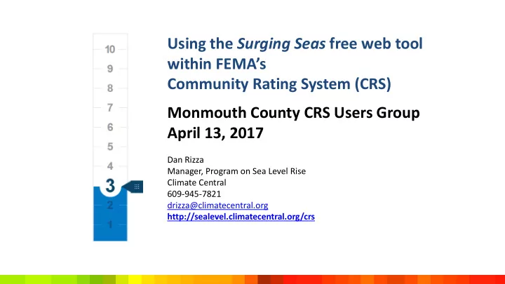
Using the Surging Seas free web tool within FEMAs Community Rating System (CRS) Monmouth County CRS Users Group April 13, 2017 Dan Rizza Manager, Program on Sea Level Rise Climate Central 609-945-7821 drizza@climatecentral.org


slide-1
SLIDE 1

Monmouth County CRS Users Group April 13, 2017

Dan Rizza Manager, Program on Sea Level Rise Climate Central 609-945-7821 drizza@climatecentral.org http://sealevel.climatecentral.org/crs

Using the Surging Seas free web tool within FEMA’s Community Rating System (CRS)

slide-2
SLIDE 2

http://sealevel.climatecentral.org/crs

slide-3
SLIDE 3
slide-4
SLIDE 4

How Are Surging Seas Web Tools Utilized?

Thousands of stakeholders – many of them planners – have customized and downloaded Surging Seas maps, slides, analysis, and projections from the Surging Seas web tools: Risk Zone Map, Risk Finder and Mapping Choices They tell us they use our web tool and its downloads to inform:

  • screening-level planning
  • vulnerability assessments
  • emergency preparedness efforts
  • research
  • policy analysis
  • public presentations
  • education/communication
  • training
  • more
slide-5
SLIDE 5

Surging Seas Risk Finder - http://riskfinder.org Surging Seas Risk Zone Map - http://ss2.climatecentral.org

These interconnected Surging Seas screening-level tools provide:

  • an interactive submergence risk map: shows areas vulnerable to

flooding from combined sea level rise, storm surge, and tides; includes layers for social vulnerability, population, ethnicity, income, and property value; based primarily on LIDAR elevation data supplied by NOAA

  • localized sea level rise and flood risk projections: dozens of sea level

rise models and emissions scenarios

  • exposure analysis: 100+ demographic, economic, infrastructure and

environmental variables

  • community comparisons: zip codes, towns, cities, counties, planning

districts, agency districts, and more

  • downloads: handouts, PowerPoint slides, spreadsheets & more – for

coastal locations in the lower 48

slide-6
SLIDE 6

http://ss2.climatecentral.org

slide-7
SLIDE 7
slide-8
SLIDE 8
slide-9
SLIDE 9
slide-10
SLIDE 10
slide-11
SLIDE 11
slide-12
SLIDE 12
slide-13
SLIDE 13
slide-14
SLIDE 14

Link to Surging Seas Maps

We welcome you to link to our Surging Seas Risk Zone Maps or share links within your organization. Links that you use will reflect any customization you have done on the map (water level, zoom level, etc.).

To link to a map:

  • 1. Visit ss2.climatecentral.org
  • 2. Search for your location
  • 3. Set water level
  • 4. Set zoom level
  • 5. Select an impact layer (if

desired), such as population, property, or social vulnerability

  • 6. Copy the URL
  • 7. Use this URL when you link

to your customized map from your website

slide-15
SLIDE 15

Embed Surging Seas Maps on Your Website

We welcome you to embed Surging Seas Risk Zone Maps on your website. Embeds will reflect any customization you have done on the map (water level, zoom level, population overlays, etc.).

To embed a map on your site: 1. Visit ss2.climatecentral.org 2. Search for your location 3. Set water level 4. Set zoom level 5. Select an impact layer (if desired), such as population, property, or social vulnerability 6. Click the embed button on the top right of the screen 7. Enter your Name and Organization, Caption, and URL 8. Preview how the map will look

  • n your site

9. Copy the code from the pop-up window for use on your website. Write sealevel@climatecentral.org for help

slide-16
SLIDE 16

View and Download Surging Seas Maps

Surging Seas Risk Zone Map allows you to see, customize, download, and share free maps that show areas vulnerable to coastal flooding from storm surge, tides, and permanent submergence from sea level. Land shaded in blue is below the selected water level. Land shaded in green indicates the area is potentially protected by natural ridges or levees. Elevation data supplied by NOAA.

1. Visit ss2.climatecentral.org 2. Search for your location in the search box in the top right 3. Zoom into neighborhoods,

  • r out to broader regions

using the + and - round buttons located in the bottom right corner. 4. Set water level using the water slider on the left. 5. Click the download arrow icon in top right to download PowerPoint slide, image, or Google Earth layers. Request maps: sealevel@climatecentral.org

slide-17
SLIDE 17

Select Data Overlays on Surging Seas Maps

Surging Seas Risk Zone Map allows you to overlay different data layers pertaining to social vulnerability, population density, ethnicity, income, property value, and landmarks. Click “?” for source information.

1. Visit ss2.climatecentral.org 2. Click on Population, or

  • ther layers at the bottom
  • f the screen.

3. Further customize the map by zooming using the +/- buttons, setting the water level, or panning around. 4. Click the download arrow icon in top right to download PowerPoint slide, image, or Google Earth layers. Write us at sealevel@climatecentral.org to request maps by email

slide-18
SLIDE 18
slide-19
SLIDE 19
slide-20
SLIDE 20
slide-21
SLIDE 21

http://riskfinder.org

slide-22
SLIDE 22
slide-23
SLIDE 23
slide-24
SLIDE 24
slide-25
SLIDE 25
slide-26
SLIDE 26
slide-27
SLIDE 27
slide-28
SLIDE 28
slide-29
SLIDE 29
slide-30
SLIDE 30
slide-31
SLIDE 31
slide-32
SLIDE 32
slide-33
SLIDE 33
slide-34
SLIDE 34
slide-35
SLIDE 35
slide-36
SLIDE 36
slide-37
SLIDE 37
slide-38
SLIDE 38
slide-39
SLIDE 39

http://riskfinder.org

slide-40
SLIDE 40

http://riskfinder.org

slide-41
SLIDE 41
slide-42
SLIDE 42
slide-43
SLIDE 43
slide-44
SLIDE 44
slide-45
SLIDE 45
slide-46
SLIDE 46
slide-47
SLIDE 47
slide-48
SLIDE 48
slide-49
SLIDE 49
slide-50
SLIDE 50
slide-51
SLIDE 51
slide-52
SLIDE 52
slide-53
SLIDE 53
slide-54
SLIDE 54
slide-55
SLIDE 55
slide-56
SLIDE 56
slide-57
SLIDE 57
slide-58
SLIDE 58

Thank you

Dan Rizza Manager, Program on Sea Level Rise Climate Central 609-945-7821 drizza@climatecentral.org http://sealevel.climatecentral.org/crs

Using the Surging Seas free web tool within FEMA’s Community Rating System (CRS)