SLIDE 7 INITIATE PLANNING
∗ Discuss purpose and need for project with sponsors/Initiate study.
Step 1 - IDENTIFY PROBLEMS, OPPORTUNITIES & CONCERNS
∗ Identify the need for the proposed action (quantify, extent, magnitude, timing, frequency etc.)
Step 2 - DETERMINE OBJECTIVES
∗ Write purpose and need statement and Write scope of plan-EA/EIS
Step 3 - INVENTORY RESOURCES
∗ Conduct detailed resource inventories and watershed assessment ∗ Economics, social effects, Archeological and historic resources ∗ Engineering/Geology/Support maps ∗ Document problems
Step 4 - ANALYZE RESOURCE DATA
∗ Geology, Hydrology & Hydraulics, Cultural, Economics and Social
Step 5 - FORMULATE ALTERNATIVES
∗ Develop reasonable alternatives, mitigation strategies and costs (Preliminary plans)
Step 6 - EVALUATE ALTERNATIVES
∗
- Env. Resources, Geotechnical, Hydrology & Hydraulics, Economics, Significance of effects,…
Step 7 - MAKE DECISIONS (EA/EIS, Public Involvement,…)
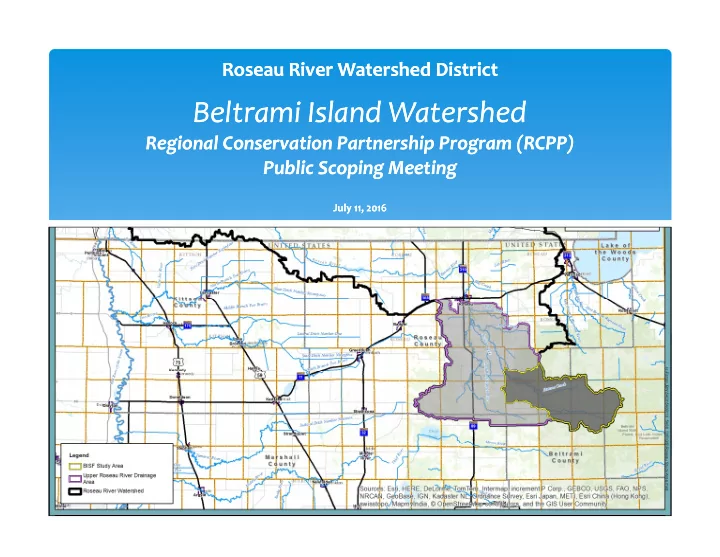
RCPP Planning Process