
SLIDE 1
#1
Welcome! PUBLIC DROP-IN EVENT Thursday, November 14 th , 2019 6 - - PDF document
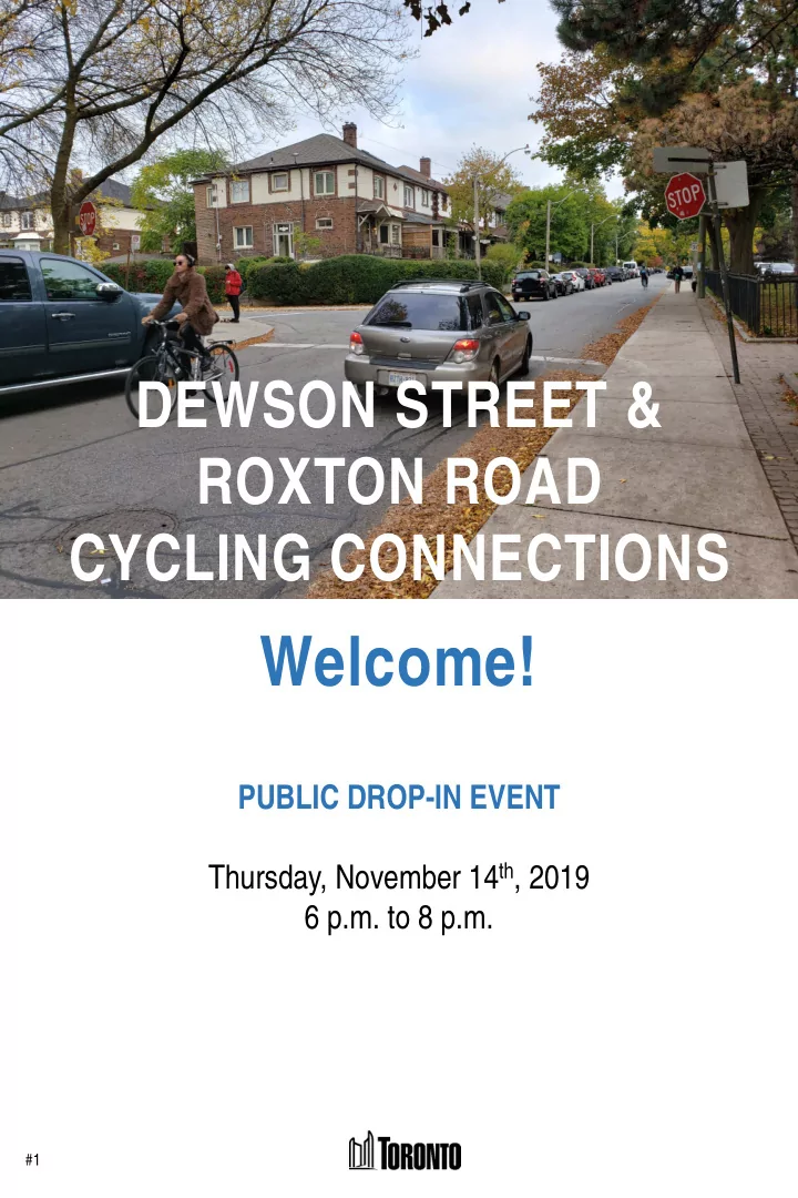
DEWSON STREET & ROXTON ROAD CYCLING CONNECTIONS Welcome! PUBLIC DROP-IN EVENT Thursday, November 14 th , 2019 6 p.m. to 8 p.m. #1 PURPOSE OF TODAYS DROP-IN EVENT 1. Present proposed cycling connections and parking options to connect
#1
#2
1. Present proposed cycling connections and parking options to connect cycling routes, improve safety and traffic conditions 2. Share your comments and questions directly with City staff
We value your input!
comments tonight or by mail
Please provide your feedback by November 28th, 2019
Dewson St facing east from Ossington Ave Roxton Rd facing south from Dewson St
#3
Official Plan Goals
Make Toronto a walking city and bring all Toronto residents within 1km
Road to Health: Healthy Toronto by Design
Increased physical activity is associated with reduced risk of obesity, type 2 diabetes, cardiovascular disease, and some cancers
Vision Zero Road Safety Plan
Fatalities and serious injuries on our roads are preventable, and we must strive to reduce traffic-related deaths and injuries to zero by prioritizing the safety needs of our most vulnerable road user
TransformTO: climate action strategy
75% of trips under 5 km are walked or cycled by 2050
Complete Streets
Streets are for people, placemaking and prosperity. Complete streets consider all modes, prioritize safety, and balance the need to move people and goods, while recognizing streets as places
Reduce reliance on driving
Providing alternatives to driving allows for roadways to be used more efficiently and for users who have no choice (e.g. emergency, deliveries)
Encouraging people of all ages and abilities to ride
The majority of people rate themselves as “interested but concerned” about cycling, and will only do so if bikeways feel safe
3 #4
Shaw Street is a Major City-Wide Cycling Route in the 2019 Cycling Network Plan 2019-2021 Cycling Network Plan Implementation Program Map in the area
Shaw Street contra-flow bike lane installed
from Dupont Street to Dundas Street West along with bike lanes to the north and shared routes to the south
Dewson Street shared lane markings installed
from Havelock Street to Ossington Avenue
Signal installed at Ossington Avenue and Dewson Street
to improve safety and connectivity for people walking and cycling
22 collisions occurred in the last five years
person walking or cycling. 27% of the collisions resulted in injuries.
Shaw Street named as a Major City-Wide Cycling Route
in Toronto’s Cycling Network Plan update
Dewson, Roxton and Ossington included in the 2019-2021 Cycling Network Plan Implementation Program
The Cycling Network Plan’s goals are to grow, connect and renew Toronto’s cycling network to ensure people of all ages and abilities have the option to
have an all ages and abilities option.
2013 2019 2019 2015 2016 2019 2019 2014
to
2018
Roxton Rd Ossington Av Shaw St
Harbord St
Bloor St W College St Dufferin St
#5
There are no cycling facilities connecting the route on Dewson Street with the bikeways on Shaw Street & Harbord Street
Yet, more than 3000 people cycle on Shaw Street and 3600 on Harbord Street every day. Improvements to the network will ensure more people have the option to cycle.
#6
Proposed Changes Project Goals
#7
Bike Lanes, Contra-flow Bike Lanes and Shared Lanes are proposed for Dewson Street and Roxton Road
Bike Lanes
Designated bicycle lanes create dedicated space for people
there is low to medium motor vehicle volumes and speeds.
Contra-flow Bike Lanes
Contraf-low bicycle lanes allow people cycling to legally travel in the opposite direction on a one- way street in a designated lane.
Shared Lanes
Share Lane Markings, or “Sharrows” are road markings used to indicate a shared environment for people cycling and driving.
#8
Observed
Parking Spaces Available Number of Permit Holders Average Demand Average Use Rate Maximum Demand Maximum Use Rate Roxton Road Dewson Street to Dewson Street (west side) 15 1 10 68% 13 87% Dewson Street Roxton Road to Shaw Street (both sides) 24 1 19 80% 22 92% Dewson Street Shaw Street to Crawford Street (south side) 9 2 6 65% 7 78%
Approximately 20-30% of on-street parking spaces are available on Dewson Street, Roxton Road, and in permit parking area 4C.
Permit Area 4C has parking spaces available Permit area 4C has 365 parking spaces available and only 258 permit holders which means it is undersubscribed by nearly 30%. The number of parking permit holders with addresses on each of the affected streets is low compared to the available spaces. Parking surveys show 65-92% use rate Observed demand is higher, but spaces are still
average and maximum of seven parking counts conducted in September 2019. Counts were conducted at various times during the week and day, including evenings.
#9
OPTION 1: Preferred
The proposed cycling connections will require changes to parking on Roxton Road and Dewson Street. Two options are proposed.
OPTION 2: Alternate
Dewson Street between Shaw Street and Crawford Street is made one-way eastbound and parking would be added on the north side. Dewson Street between Shaw Street and Crawford Street would be kept as it is.
#10
and Shaw Street with a contra-flow bike lane
Street is unchanged
What is the same between the options?
Options Emergency services passable space target met Net impact to parking spaces Area 4C Permit Parking use rate after change One-way and two-way streets
Yes
74% Unchanged
No
72%
Dewson Street, between Shaw and Crawford Streets is made one-way eastbound
What is different between the options?
#11
Contact Us: If you have any questions or concerns, feel free to contact: Elysia Leung Senior Public Consultation Coordinator elysia.leung@toronto.ca 416-392-6505
TODAY and ONLINE – Submit your feedback by November 28th, 2019
December 2019 – City staff will report on the feedback received throughout the comment period, adjust the design based on findings and will finalize the proposed design March 2020 – City staff will recommend a design to the Infrastructure and Environment Committee and City Council for consideration and approval Summer/Fall 2020 –Installation of the approved design