Using BARRA to assess climate related hazards Chun-Hsu Su 1 , Nathan - - PowerPoint PPT Presentation

using barra to assess climate related hazards
SMART_READER_LITE
LIVE PREVIEW

Using BARRA to assess climate related hazards Chun-Hsu Su 1 , Nathan - - PowerPoint PPT Presentation

Using BARRA to assess climate related hazards Chun-Hsu Su 1 , Nathan Eizenberg 1 , Peter Steinle 1 , Doerte Jakob 1 , Paul Fox-Hughes 2 , Samuel Sauvage 2 , Mitchell Black 1 , Robert Fawcett 1 , Robert Smalley 1 , Stuart Matthews 3 1 Bureau of


slide-1
SLIDE 1

Using BARRA to assess climate related hazards

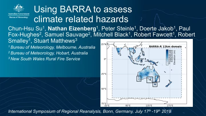
Chun-Hsu Su1, Nathan Eizenberg1, Peter Steinle1, Doerte Jakob1, Paul Fox-Hughes2, Samuel Sauvage2, Mitchell Black1, Robert Fawcett1, Robert Smalley1, Stuart Matthews3

1 Bureau of Meteorology, Melbourne, Australia 2 Bureau of Meteorology, Hobart, Australia 3 New South Wales Rural Fire Service

International Symposium of Regional Reanalysis, Bonn, Germany, July 17th -19th 2018

slide-2
SLIDE 2

Climate & weather hazards in Australia

Source: http://www.bom.gov.au/climate/about/ Lake Hume, 2007 during the Millennium Drought 1996-2010 in South Australia Photo: https://www.flickr.com/photos/suburbanbloke/381634787/

slide-3
SLIDE 3

Climate & weather hazards in Australia

Bushfire satellite image Victoria 19th February 2009 - NASA's Goddard Space Flight Centre, MODIS Rapid Response Team (colour corrected) Source: https://me.me/

slide-4
SLIDE 4

Reanalysis-based climate analysis products

As well as forecasts, the Bureau of Meteorology provides a freely accessible, web based climate analysis explorer for Australian climate and past weather products

  • BARRA will start to inform national climate monitoring
  • Regional reanalysis derived climatology
  • Regional reanalysis to initialise statistical spatial

interpolation of observational 'analyses' (right c.f zero- initialised on left)

R Fawcett, R Smalley (BOM)

slide-5
SLIDE 5

Evolution of climate analysis products

Fig 1. Manually analysed seasonal

  • utlook map for rainfall

September - November 1989 Fig 2. Spatial Barnes analysis (distance weighted statistical interpolation) of Australian Climate Observation Reference Network – Surface Air Temperature (ACORN- SAT) Fig 3. Composite analysis using combined statistically interpolated anomalies (Fig 2) and thin plate spline-smoothed 3D mean for max surface temp. Current

  • perational analysis technique

Fig 4. Composite analysis for rainfall using a more sophisticated (experimental) statistical interpolation

  • method. In

development. Fig 5. Reanalysis rainfall map – the future

  • f climate analyses?

1989 2010 2000

R Fawcett, R Smalley (BOM)

slide-6
SLIDE 6

Reanalysis in National Fire Danger Ratings System prototype

The NFDRS will replace the current system to improve communication, preparedness, response and planning around fire events and bushfire risk in Australia. Reanalysis value

  • Informing better selection of fire danger rating

category thresholds

  • Providing grid cell 95th percentile Continuous

Haines Index values for 'red flag' warnings within the system

  • Improved diurnal behaviour of peak fire indexes

95th percentile daily maximum NFDRS ratings over the reanalysis period (2010-2015) (P F Hughes, S Sauvage & S Matthews in draft July 2018)

slide-7
SLIDE 7
  • Hourly reanalysis data distinguishes diurnal

behaviour of fire indexes

  • Mean peak fire season index in the early-mid

afternoon (dark blue and yellow) and mid-late morning (cyan and green)

Reanalysis in National Fire Danger Ratings System prototype

P F Hughes, S Sauvage & S Matthews (draft July 2018) (Top) Fire season mean time of max index in UTC. (Inset) Mean time of daily max Continuous Haines index. Note that 12 UTC = 20 AWST = 22 AEST

slide-8
SLIDE 8

BARRA reanalysis used to provide atmosphere and soil conditions for case studies of fire events simulated by fire spread models (Phoenix, Spark, Australis Landgate) The simulation output informs bush fire risk planning and emergency response policy

  • Fire intensity
  • Attack mechanism (flames vs embers)
  • Effect of fuel management on risk

Reanalysis in bush fire risk planning

S Matthews (NSW RFS) Cobbler Road fire simulation comparison Chris Bridge (Bureau of Meteorology)

slide-9
SLIDE 9

Conclusions

  • The Bureau of Meteorology regional reanalysis (BARRA) has exciting value for

Australian climate and weather applications

  • Regional reanalyses (RR) will continue to form the basis for many climate, and

weather products at the Bureau in the future

  • RR climatologies add value to station-based climate analyses
  • High-resolution RR data are invaluable to fire danger risk analysis

(climatologies and conditions)

  • Sub-daily information is valuable for case-study applications and diurnal

behaviour analysis

slide-10
SLIDE 10

Thank you

Nathan.eizenberg@bom.gov.au Helpdesk.reanalysis@bom.gov.au

slide-11
SLIDE 11

References

  • Bushfire satellite image - NASA's Goddard Space Flight Center, MODIS Rapid Response Team

(colour corrected)

  • Aussie climate http://www.bom.gov.au/climate/about/
  • https://me.me/i/you-know-australia-sidangerous-fire-danger-rating-today-code-red-5122568