U.S. Department of the Interior U.S. Geological Survey November 2014
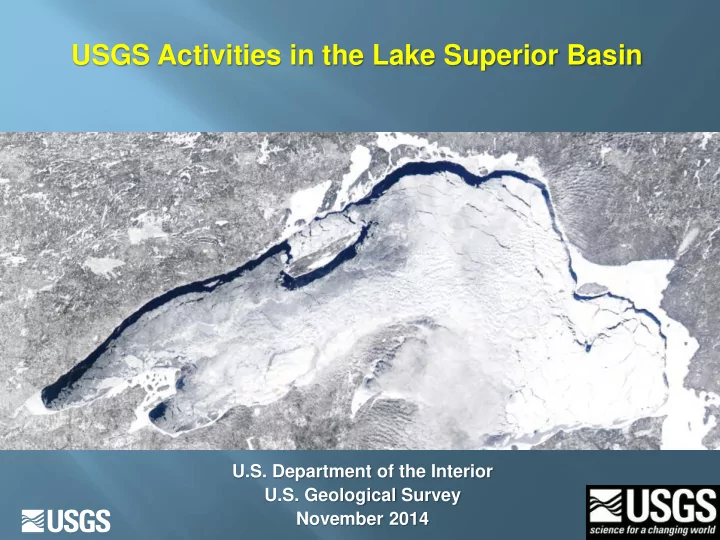
USGS Activities in the Lake Superior Basin U.S. Department of the - - PowerPoint PPT Presentation
USGS Activities in the Lake Superior Basin U.S. Department of the Interior U.S. Geological Survey November 2014 USGS MISSION Collect, monitor, analyze, and understand natural resources Conduct multi-disciplinary investigations that
USGS MISSION
- Collect, monitor, analyze, and understand
natural resources
- Conduct multi-disciplinary investigations that
provide impartial scientific information
- Address broad societal and environmental
problems--with partners and stakeholders
Integrated Science
- Hydrology and water quality
- Biology and ecosystem health
- Contaminant occurrence, transport, fate
- Science to assess environmental effects
- Quality and quantity of mineral resources
USGS Science Centers provide integrated science
Hydrology and water quality
Aquatic/terrestrial biology/ecosystem health
Toxic/contaminant
- ccurrence,
transport, fate
Science to assess environmental effects
Studies of the quality and quantity of mineral resources.
Mineral resources in the Lake Superior Basin
Bedrock contains tremendous mineral wealth. Iron and copper mining for more than 150 years The Eagle Mine (Michigan) is the first of several Ni-Cu- PGE mines that may be permitted
Concerns about Mineral Extraction Involving Water Quality/Quantity and Ecosystem Health
Mining is a polarizing issue. There is need for reliable, unbiased scientific data We need to work together to address these concerns
2011- Mining Workshop
“Understanding Impacts of Mining”
- Multiple agencies involved: Bad River Band of Lake Superior
Chippewa, Great Lakes Indian Fish and Wildlife Commission (GLIFWC), Fond du Lac Band of Lake Superior Chippewa, and USGS
- 24 presentations, 150 attendees from federal, state, local and tribal
- rganizations as well as mining companies
- Outcomes: Information for the public. What do we know? What are the
concerns and impacts? What information is needed for the environmental review? Set the stage for future work.
USGS Model to Address Concerns Around Mining
Impartial data and synthesis to address concerns and potential problems
Binational input from LaMP Working Group
Partnership with Federal, State, and Tribal partners. Input from USGS subject matter experts.
Backbone for USGS focus on mining issues
USGS Partners and Stakeholders
- GLNPO, EPA-ORD, BIA, NOAA, Forest
Service and other federal agencies
- LaMP Binational Working Group, Coop
Science and Monitoring Initiative (CSMI), Binational Forum
- State Entities-- MPCA, MN DNR, LCCMR
- University Partners: (NRRI), MGS
- Tribal partners, including GLIFWC
USGS, GLIFWC EPA-5
(2011-2015)
Synthesis Studies: USGS-NRRI- MN DNR
(2013-2016)
USGS projects and partners
(long history of USGS work in iron country)
USGS – Mineral Resource Program focus
- n the Midcontinent Rift
(2014-2017)
USGS Regional funding
(2008-2009)
USGS Mining Initiative funding
(2012-2014)
USGS Seed Funding: 2008-2009
Water quality and geochemical baseline conditions prior to metal exploration or development in a small watershed in Michigan
Refined an approach for regional environmental baseline studies in the Lake Superior Basin
http://pubs.usgs.gov/sir/2010/5121/
Additional Baseline Studies- 2011-2012
- Baseline Studies in Michigan, Minnesota, and Wisconsin
- Stream gage installation
- Synoptic sampling of water quality and streambed sediment in
watersheds with potential future mining
- Support from USGS, GLIFWC, EPA-5, Tribal Entities
- Status of pre-mine hydrology and water quality?
Sampling in the St. Louis River, MN
Stream gage installation and seasonal sampling of water and streambed sediments
Sampling Salmon Trout River
USGS monitoring in watersheds with mineral deposit development or exploration
Area produced more than 11 billion pounds of native copper
Sites in Keweenaw Peninsula: 2014-2015
Sites in Bad River Basin, Wisconsin
Proposed Taconite Mine Site
Sites in NR Minnesota
(Filson and Keeley Creeks, St. Louis River)
Bad River Basin--Groundwater Modeling
How does groundwater flow and interact with streams and wetlands?
Assessment of potential mining on Apostle Islands National Lakeshore
Baseline hydrodynamic and
water quality study at the Bad River mouth, Long Island, and Madeline Island
Baseline sampling of Bad
River tributaries related to potential iron mining
Compilation of existing
data
Coordinated with NPS and
Bad River Tribal Government
Bad River mouth
Results from towable fluorescence sensor following small runoff event
USGS, GLIFWC EPA-5
(2011-2015)
*Synthesis Studies: USGS-NRRI- LCCMR-MN DNR
(2013-2016)
Understanding and Synthesis Studies
* USGS – Mineral Resource Program focus
- n the Midcontinent Rift
(2014-2017)
USGS Regional funding
(2008-2009)
USGS Mining Initiative funding
(2012-2014)
Minnesota: USGS–LCCMR-NRRI–MNDNR Study: 2014-2017
(expanding on the Mining Initiative)
- Water quality, streambed sediment, soil, and
bedrock sampling in watersheds with potential for nickel-copper-platinum group elements or iron-titanium oxide mining
- Developing models to understand water
balances and to simulate hydrologic conditions under different potential mining scenarios
USGS–NRRI–MNDNR Cooperative study
(Filson and Keeley Creeks, St. Louis River)
USGS Minerals Program: 2014 – 2017
(geo-environmental modeling)
- Understand the environmental risks of Cu-Ni-PGE
mineralization in differing geologic settings
- Studies of exploratory drill core from the Duluth Complex
to assess potential for acid generation
- Determine the resiliency of watersheds and
ecosystems to possible toxicity from metals in the vicinity of proposed mining
- Biotic ligand models to estimate surface-water resiliency
to metals potentially released by mining
- Baseline landscape geochemistry in an area of past
and possible future copper mining (rocks and soils)
- Water quality, streambed sediment, and soil sampling
across the western Upper Peninsula, Michigan
Wild Rice?
- Chemistry is important!
- Sulfate is related to sulfide in sediment
- Sulfate is toxic to rice!
- However, sulfate co-occurring with Iron
and low organic carbon seems to mitigate the problem
There’s more!
Lake Superior Biological Station
Tributary Monitoring -- Streamgages
25
Lake Superior Tributary Streamflow Trends
(LaMP/CSMI/USGS/NPS/USFS/EC collaborative effort for U.S./Canada)
- Sparse data network
- Decreasing base flows
- Increased peak flows, indicating increased intensity of rainfall events
USGS Work in the big lake - Water quality and Ecosystem Activities
CSMI, ORD, CSMI, Binational LaMP
Lake Superior Biological Station
USGS Lake Superior fish survey focus areas
- Annual surveys – 115 locations, spring and summer sampling: water
profiles, zooplankton, larval and benthic fish, predator diets, micro- plastics
- Research – fish community dynamics, fish stock assessments, food web
dynamics, methods development
- CSMI integrated studies – energy transfer, survey design
Lake Superior Biological Station
USGS Program Model
Small efforts focused on synoptic and baseline environmental data: Pre- permit Follow-up time series and detailed studies Understanding environmental fate, transport and potential effects
Collecting basic data> Focusing data collection> Synthesis
What is needed?
- Common platform to understand the body of
knowledge for the watershed– What has been done? Who is involved? Where are the data? How do we share?
- Hydrology: Impact of wetlands on water quality and
hydrology ( DOC)
- Groundwater/surface water interaction
- Three dimensional understanding of geology/hydrology
(geologic atlas)
- Groundwater flow in fractured rocks
- Continued cooperation from partners and stakeholders
THANK YOU!
Lake Superior Biological Station