Upper Feather River IRWMP Benefits Workgroup Integration Workshop - - PDF document

upper feather river irwmp
SMART_READER_LITE
LIVE PREVIEW

Upper Feather River IRWMP Benefits Workgroup Integration Workshop - - PDF document

9/1/2015 Project Integration Combining of similar objectives of local interests with a regional project Opportunity to look at strategic considerations that may benefit multiple stakeholders Upper Feather River IRWMP Benefits Workgroup


slide-1
SLIDE 1

9/1/2015 1

Upper Feather River IRWMP Workgroup Integration Workshop

AUGUST 21, 2015

UPPER FEATHER RIVER IRWM Featherriver.org

Project Integration

Combining of similar objectives of local interests with a regional project Opportunity to look at strategic considerations that may benefit multiple stakeholders Benefits

  • Greater impact in the region
  • Better IRWM Plan implementation
  • Economy of scale – resources of staff, finance, and equipment

Examples….

WORKGROUP INTEGRATION WORKSHOP 2

Water for fire suppression ALS 5 – Sierra Co. Stock well, Fire Storage. ALS 11 – Cold Stream Impound- ment Soil Health ALS 3 – Enhanced Mgmt

  • f Livestock Grazing

ALS 2 – Working Lands Infrastructure/H2O Quality ALS 9 – Soil Health ALS 7 – SVRCD Resource Mgmt Plan FMW 13–S Valley Meadow Assesment ALS 3 – Enhanced Mgmt

  • f Livestock Grazing

Fencing ALS 2 – Working Lands Infrastructure/H2O Quality ALS 7 – SVRCD Resource Mgmt Plan FMW 17 – Mtn. Meadows Fencing Irrigation Efficiency ALS 3 – Enhanced Mgmt

  • f Livestock Grazing

ALS 2 – Working Lands Infrastructure/H2O Quality ALS 10 – S Valley Groundwater Sustainability Plan ALS 7 – SVRCD Resource Mgmt Plan ALS 8 – Weather Stations MS 33 – Sierra County Road Improvement?? FMW 13–S Valley Meadow Asmt.? ALS 12 – Alfalfa Alternative

slide-2
SLIDE 2

9/1/2015 2

Groundwater ALS 10 – Sierra Valley Groundwater Sustainability Plan ALS 5 – Sierra Co. Stockwell, Fire Storage.. ALS 7 – SVRCD Resource Mgmt Plan MS 33 – Groundwater Monitoring?? MS 33 – Sierra County Road Improvement?? MS 35 – Sierraville Alt Water Source FMW 12 – Little Last Chance Lake FMW 13–S Valley Meadow Asmt.? ALS 12 – Alfalfa Alternative Water for fire suppression Soil Health Irrigation Efficiency ALS 12 – Alfalfa Alternative ALS 3 – Enhanced Mgmt

  • f Livestock Grazing

Fencing ALS 2 – Working Lands Infrastructure/H2O Quality Groundwater ALS 10 – S Valley Groundwater Sustainability Plan ALS 9 – Soil Health ALS 5 – Sierra Co. Stockwell, Fire Storage.. ALS 7 – SVRCD Resource Mgmt Plan ALS 8 – Weather Stations MS 33 – Groundwater Monitoring?? MS 33 – Sierra County Road Improvement?? MS 35 – Sierraville Alt Water Source FMW 7 - LiDAR/GIS TAC 6 - TEK FMW 12 – Little Last Chance Lake FMW 13–S Valley Meadow Asmt.? ALS 11 – Cold Stream Impound- ment FMW 17 – Mtn Meadows Fencing

Traditional Ecological Knowledge (TEK)

TRINA CUNNINGHAM

9

UFR IRWMP Proposal Summaries

AGRICULTURAL LAND STEWARDSHIP

UPPER FEATHER RIVER IRWM Featherriver.org

Sierra Valley groundwater basin sustainability plan

Organization: Sierra Valley Groundwater Management District Contact: Carl Genasci, Board Chair Summary: Preparation of a 20-year horizon Groundwater Sustainability Plan for Sierra Valley

Basin characteristics, historical data (quality, quantity, levels, demands) & maps Groundwater-surface water interactions Projected water demands Recharge areas identified Measurable objectives to achieve sustainability within 20 years Monitoring protocols

9/1/2015 AG LAND STEWARDSHIP STEP 2 PROJECT SUMMARIES 10 11

Feasibility study, pilot: Alternatives for alfalfa production to reduce water usage

Organization: Sierra Valley Resource Conservation District Contact: Rick Roberti, Kristi Jamason, Tom Getts (UCCE), Holly George Summary: Investigate alternative production possibilities to existing alfalfa hay production and methods that maintain the agricultural heritage of the watershed without increasing risks to producer viability, community values and natural resources.

Research of alternative appropriate crops and more efficient alfalfa irrigation methods Feasibility study Pilot testing, monitoring/measurement, reporting

The project will seek more water-efficient alfalfa hay production methods and/or alternatives to alfalfa production with lower water demands and minimal disruption to existing operations, as well as solid/equivalent returns.

AG LAND STEWARDSHIP STEP 2 PROJECT SUMMARIES 12 12

slide-3
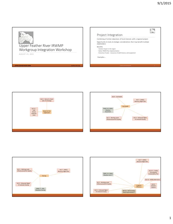
SLIDE 3

9/1/2015 3 Soil health assessment

Organization: University of California Cooperative Extension Contact: Holly George Summary: Further the understanding of the impacts of land, agriculture and livestock management practices on soil health and resultant soil-based ecosystem services, such as water regulation, sequestration of greenhouse gasses, vegetation productivity and other biogeochemical processes.

Establish baseline for soil health of ag lands / link with Soil Health Network Identify ecosystem processes to target for improvement Research effects of differing land management practices on targeted soil biogeochemical processes Region-wide outreach and education

AG LAND STEWARDSHIP STEP 2 PROJECT SUMMARIES 9 13

Coldstream agricultural and fire storage impoundment

Organization: Sierra Valley Resource Conservation District Contact: Jeff Carmichael Summary: The concept is consideration of an earthen dam located in a feasible location within the Coldstream drainage south of Sierraville to store agricultural water enabling better utilization and more efficient use of available supplies, provide flood control and water storage for fire suppression that is accessible, functional and reliable. Also included within the concept is a small hydro electric plant. Limited recreational

  • pportunities may occur but the first phase of this undertaking is a technical feasibility study.

This phase will identify engineering and geotechnical findings, mapping and soil/water conditions, biological conditions, and issues of concern to the consideration of future phasing of the project.

AG LAND STEWARDSHIP STEP 2 PROJECT SUMMARIES 11 14

Sierra Valley agricultural water diversion efficiency & improvement project

Organization: Sierra Valley Resource Conservation District Contact: Jeff Carmichael Summary: The Sierra Valley Water Company operates and maintains a diversion dam and conveyance channel allowing water from the Little Truckee River to be diverted under specific conditions and during a specific season into the Feather River watershed (Sierra Valley). The proposed project is to provide a mechanism for conduit to be installed from the diversion dam for approximately 2.5 miles to significantly increase agricultural water use efficiency and to restore the watercourse ecosystem from Little Truckee Summit to Onion Valley. The efficiencies in delivery of agricultural water to Sierra Valley under the 1870 water right will also be significantly improved.

9/1/2015 AG LAND STEWARDSHIP STEP 2 PROJECT SUMMARIES 6 15

Improving water quality with upgrades to infrastructure on working lands

Organization: Feather River Resource Conservation District (FRRCD) Contact: Nils Lunder Summary: The project will identify opportunities to improve water quality, reduce erosion and sedimentation and increase water use efficiency in the region. The FRRCD will work in partnership with the SVRCD and other organizations in order to connect with landowners in the project area to install infrastructure to protect and enhance riparian areas, to monitor and improve water quality and to better utilize water supplies in the Upper Feather River watershed. Reduce livestock impact on sensitive riparian areas 30 solar-powered off-stream stock watering systems 30,000 feet of riparian fencing 3000 acres of wetlands restored/enhanced Assess and improve water delivery infrastructure Irrigation efficiency, 30,000 feet of new pipe

AG LAND STEWARDSHIP STEP 2 PROJECT SUMMARIES 2 16

Taylorsville Mill Race Farmers Dam resurfacing

Organization: Taylorsville Mill Race Group sponsored by Feather River Resource Conservation District Contact: Brian Kingdon Summary: Resurface the Mill Race Dam in Taylorsville, within the next 10 years, to repair damage and ensure its continued viability for irrigation, wildland fire suppression, flood control, etc. The dam was last resurfaced in 1986 when the Taylorsville Mill Race Group undertook the work

  • f resurfacing the face of the dam with significant amounts of in-kind labor and donated

expertise and equipment, but it still cost the participants $34,400.

AG LAND STEWARDSHIP STEP 2 PROJECT SUMMARIES 1 17

Technical assistance for livestock grazing

Organization: Feather River Resource Conservation District and Sierra Valley Resource Conservation District Contact: Russell Reid Summary: There is an ongoing need to provide technical assistance to working landscape managers and owners to ensure that their operations continue to stay viable, and that improvements to water quality and quantity management can continue to be made. This project would provide cost-sharing assistance for the following general stewardship practices:

  • Technical assistance and training workshops to develop soil and water quality/conservation plans
  • Baseline documentation of existing conditions on working landscapes in the region to identify most critical

practices

  • Management practices to improve soil health
  • Fencing to support specific grazing management plans
  • Infrastructure to increase irrigation efficiency and water conservation

AG LAND STEWARDSHIP STEP 2 PROJECT SUMMARIES 3 18

slide-4
SLIDE 4

9/1/2015 4 Eradicate invasive weed species

Organization: Plumas-Sierra County Department of Agriculture Contact: Tim Gibson Summary: This multi-year project would support the cohesive strategy of the Plumas-Sierra Ag Department and the Sierra Valley RCD to protect waterways, croplands, timber lands, riparian and wetlands, and recreation areas from the spread of destructive and invasive noxious weeds. The Sierra Nevada Conservancy as well as both Plumas and Sierra RACs are past and current partners in this effort to enhance watershed health by controlling and eradicating invasive weed

  • species. This project will ensure continuation of the successful weed management program in

the UFR.

AG LAND STEWARDSHIP STEP 2 PROJECT SUMMARIES 4 19

Sierra Co. agriculture stock well, fire storage, drought reduction project

Organization: County of Sierra – Road Department Contact: Tim H. Beals Summary: Water source development and improvements - Retrofit existing water tanks, construct new tanks, develop sites for drought stock wells, fire water storage, continued ag/recreational uses for storage, development, distribution within Sierra Valley. USFS, RCD and Sierra County to develop strategic plan for improvements Cooperative water resource development Mitigates additional groundwater development Alternate water supplies for limited community systems in wildland-urban interface

AG LAND STEWARDSHIP STEP 2 PROJECT SUMMARIES 5 20

Sierra Valley RCD – Resource management plan

Organization: Sierra Valley Resource Conservation District Contact: Bill Nunes Summary: The proposed project will result in a “Resource Management Plan” for the Sierra Valley Resource Conservation District that will have a similar effect as a County General Plan has to counties and their respective land use programs. The Resource Management Plan will include the district organizational information, financial information, district services contemplated, a funding component, project review guidelines, education and outreach programs, process for plan updating, and a process for adopting and updating priorities for the many chapters of the plan that define the role and interests of the Resource Conservation District.

AG LAND STEWARDSHIP STEP 2 PROJECT SUMMARIES 7 21

Upper Feather River weather monitoring infrastructure

Organization: Feather River Resource Conservation District (FRRCD) Contact: Nils Lunder Summary: This project will establish a weather station in each of the main valley areas in the upper Feather River. These stations will provide real-time, internet accessible data on temperature, precipitation, humidity, soil moisture, wind speed, and solar radiation. This information will be available to residents of the region including ranchers, water managers and municipalities.

AG LAND STEWARDSHIP STEP 2 PROJECT SUMMARIES 8 22

UFR IRWMP Proposal Summaries

FLOODPLAINS/MEADOWS/WATERBODIES

UPPER FEATHER RIVER IRWM Featherriver.org

Restore creek to original path

Organization: Maidu Summit Consortium Contact: Carl Felts Summary: Restore creek that runs year round to original path that flows into Lake Almanor. Crew of 4-6 people to walk creek and clear debris to restore it to its former flow. Over the years debris has fallen across the creek which has diverted its flow and caused the creek to spread out across a larger area. This accounts for loss of water due to evaporation and absorption.

9/1/2015 FLOODPLAINS MEADOWS WATER STEP 2 PROJECT SUMMARIES 1 24

slide-5
SLIDE 5

9/1/2015 5 Promoting, expanding water quality monitoring in the Almanor Basin

Organization: Lake Almanor Watershed Group; Sierra Institute for Community and Environment Contact: Aaron Seandel Summary: To expand and extend lake and streamflow monitoring program throughout the Feather River watershed, and provide central clearing house (s) where monitoring data can be assessed and maintained, and programs of interest and for educational purposes about the watershed can be developed. distributed, and maintained. To continue the sampling program at Lake Almanor.

FLOODPLAINS MEADOWS WATER STEP 2 PROJECT SUMMARIES 2 25 9/1/2015

Mountain Meadows Reservoir wildlife enhancement, water quality improvement

Organization: Mountain Meadows Conservancy (MMC) Contact: Nils Lunder Summary: The project will lead to the development of infrastructure that will protect the shoreline of the Mountain Meadows Reservoir (MMR) in an attempt to enhance wildlife habitat and improve water quality. It will also fund the development of an annual monitoring program to assess the impact that the infrastructure has on wildlife in and around the MMR and the downstream effects on water quality in partnership with the Lake Almanor Watershed Group.

FLOODPLAINS MEADOWS WATER STEP 2 PROJECT SUMMARIES 4 26 9/1/2015

Upper Feather River interpretive and education sites

Organization: Mountain Meadows Conservancy (MMC) Contact: Nils Lunder Summary: The project will facilitate the development of two interpretive and educational sites in the upper Feather River. There will be two sites; one will be located approximately 4 miles east of Westwood along the edge of the Mountain Meadows on Highway 36. The second site is located 1 mile east of Chester on Highway 36. The proposed project will increase awareness of the management of lands of the upper Feather River and how those management actions are related to the delivery of water from the watershed to downstream water users. The sites will showcase adaptive management techniques that are being implemented in the region to ensure that downstream water users have reliable, high quality water into the future. Management techniques include rangeland management, forest management, reservoir management, wastewater management, recreational management and wildlife management.

FLOODPLAINS MEADOWS WATER STEP 2 PROJECT SUMMARIES 5 27 9/1/2015

Watershed monitoring program

Organization: USDA Natural Resources Conservation Service (NRCS Contact: Dan Z. Martynn Summary: To expand and extend existing streamflow monitoring Program throughout watershed to include Lake Almanor basin and provide central clearing house where monitoring data can be assessed and maintained. Sharing of water quality and quantity data with stakeholders in watershed will allow local water users to make informed decisions and aid in collaboration on future projects.

9/1/2015 FLOODPLAINS MEADOWS WATER STEP 2 PROJECT SUMMARIES 6 28

UFR cooperative LiDAR and GIS support program

Organization: Plumas County Contact: Randy Wilson Summary: This project will directly support mapping and project-design for a large number of

  • ther currently-proposed IRWM projects, and each project could potentially contribute a small

portion of their budget to an overall mapping budget for the entire UFR Region. This project will be a collaborative effort between the US Forest Service, Plumas County, and

  • ther IRWM signatories to fund acquisition of LiDAR topography data for the remainder of the

Upper Feather River Watershed.

FLOODPLAINS MEADOWS WATER STEP 2 PROJECT SUMMARIES 7 29 9/1/2015

Plumas County Spanish Creek restoration

Organization: Plumas County Department of Public Works – Engineering Contact: Robert A. Perreault , Jr Summary: During the past several years, the amount of gravel extracted has been curtailed due to permitting requirements by the California Department of Fish and Game. As a result, an increasing amount of gravel has deposited in American Valley, resulting in a re-initiation of bank erosion and land loss. As a result, the Spanish Creek landowners have approached Plumas County for assistance. The community and landowners recognize the need for a holistic and long-term approach to managing the problems.

FLOODPLAINS MEADOWS WATER STEP 2 PROJECT SUMMARIES 8 30 9/1/2015

slide-6
SLIDE 6

9/1/2015 6 Feather River Watercourse: Plumas to Pacific

Organization: Plumas Unified School District Contact: Rob Wade Summary: The Watercourse: Plumas to Pacific is an integrated, year-long course of study that uses the Feather River and its tributaries to teach concepts in life science, earth science, social studies, and mathematics. Building upon established elements of the sixth grade curriculum, students examine the influences of mining, logging, ranching/farming in the region, as well as water uses for transportation, recreation, wildlife/fisheries, hydroelectric power, commerce, and municipal/domestic purposes. Plumas Corporation had successfully secured funding for the coordination of The Watercourse for the last ten years.

FLOODPLAINS MEADOWS WATER STEP 2 PROJECT SUMMARIES 9 31 9/1/2015

Advancing watershed stewardship: Outreach and education

Organization: Sierra Institute for Community and Environment/Lake Almanor Watershed Group Contact: Courtney Gomola Summary: There is an imminent need for large-scale reductions in non-point sources of nutrient deposition into the Lake and widespread education on the role of residents and visitors in these issues. This project will build upon established community connections and previous research to engage the public in activities that increase understanding of human-mediate influences on water quality and invasive species in Lake Almanor, and develop action to reduce nutrient deposition into the Lake Almanor and the potential for invasive species introduction.

FLOODPLAINS MEADOWS WATER STEP 2 PROJECT SUMMARIES 10 32 9/1/2015

Runoff and nutrient deposition in the Almanor Basin watershed

Organization: Sierra Institute for Community and Environment/ Lake Almanor Watershed Group Contact: Charles Plopper Summary: Goal: Protect, maintain and improve water quality in the Lake Almanor Basin, by 1) exploring current practices used in other lake side communities to minimize impact of activity, 2) develop recommendations to address modification of current practices, 3) develop and engineer plans for addressing identified problems.

FLOODPLAINS MEADOWS WATER STEP 2 PROJECT SUMMARIES 11 33 9/1/2015

Restoration of Little Last Chance Lake and surrounding meadow

Organization: Sierra Wildlife Habitat & Community Foundation (SWHCF) and Sierra Valley Resource Conservation District (SVRCD Contact: Rick Roberti Summary: This project will restore and enhance 450 acres of wetland and sub-irrigated meadows back to how this land was before the creek was altered. General tasks that will be completed:

  • Assessment and evaluation of project concept with NRCS assistance.
  • Meet with DWR to apply for a supplemental right to divert water from Middle Fork Feather River.
  • Obtain signed agreements between all landowners involved in project.
  • Finalize design and budget.
  • Set project schedule and timeline.
  • Develop bid documents.
  • Select contractors.

FLOODPLAINS MEADOWS WATER STEP 2 PROJECT SUMMARIES 12 34 9/1/2015

Sierra Valley meadow assessment

Organization: Sierra Valley Resource Conservation District Contact: Rick Roberti Summary: Sierra Valley RCD would like a study done based solely on the meadows in Sierra

  • Valley. Over the years there have been studies done on meadows in our watershed, but many of

those studies were done nearly 50 years ago. There are capable people who know Sierra Valley and have conducted studies in Sierra Valley, such as UC Cooperative Extension and University Nevada, Reno. The above-mentioned research facilities would be contacted as potential participants in conducting a meadow assessment study..

FLOODPLAINS MEADOWS WATER STEP 2 PROJECT SUMMARIES 13 35 9/1/2015

Folchi Meadow restoration

Organization: U.S. Forest Service Contact: Randy Westmoreland Summary: Restore the meadow, stream and riparian ecosystems in the Folchi Sub Watershed of Carman Creek Watershed. The project is to remove railroad grade on the north side of the valley to reconnect ephemeral and intermittent drainages that have been disconnected by the rail road grade construction. Obliterate the gully (existing channel) through approximately 1 mile of Folchi Valley using a combination of off-site material and locally generated (in channel) material to intermittently fill the existing channel. This will reconnect the stream with the historic channels on the meadow surface and the floodplain.

FLOODPLAINS MEADOWS WATER STEP 2 PROJECT SUMMARIES 14 36 9/1/2015

slide-7
SLIDE 7

9/1/2015 7 Priority projects of FRTU

Organization: Feather River chapter of Trout Unlimited ( FRTU) Contact: Cindy Noble Summary: the chapter intends to work with the USFS to

  • expand the Interpretive Sign program that is currently being developed in the Storrie Fire area,
  • work with PCUSD to expand our regional Trout in the classroom program,
  • further investigate and plan for a total renovation of the Indian Jim School site in the Feather River

Canyon, and

  • address fish passage on private lands by installing fish screens where willing landowners exist.

FLOODPLAINS MEADOWS WATER STEP 2 PROJECT SUMMARIES 15 37 9/1/2015

Climate change effects on Upper Feather River fisheries

Organization: Ecosystem Sciences Foundation/Upper Feather River Trout Unlimited Contact: Mark Hill Summary: This project will develop distribution models from fish species and temperature data for separate time periods, then comparisons made between periods for locations of upstream and downstream distributional boundaries. The shift in fish species across boundaries will be evaluated using bioclimatic models

FLOODPLAINS MEADOWS WATER STEP 2 PROJECT SUMMARIES 16 38 9/1/2015

Mountain Meadows fencing

Organization: W.M. Beaty & Associates Contact: Ryan Hilburn Summary: The proposed project includes the installation of approximately 10 miles of fence in

  • rder to exclude livestock from active stream channels. The riparian fencing would be one

component of a larger effort by participating landowners to restore the historic creek channels, improve pasture management, increase irrigation efficiency and improve forage conditions on lands within the project area.

FLOODPLAINS MEADOWS WATER STEP 2 PROJECT SUMMARIES 18 39 9/1/2015

Debris dam survey, inventory and characterization

Organization: Trout Unlimited Contact: Mike Caltagirone Summary: This project will locate and characterize all existing dams within the Upper Feather River watershed allowing for prioritization for removal. Former dam sites will also be cataloged, where available, and characterized as potential remediation projects depending on prioritization levels and residual impacts. Samples will be taken from the dam sites for contamination testing. Once identified, the prioritization list of existing and failed dam sites will be utilized to guide the remediation of these sites.

FLOODPLAINS MEADOWS WATER STEP 2 PROJECT SUMMARIES 19 40 9/1/2015

UFR IRWMP Proposal Summaries

MUNICIPAL SERVICES

UPPER FEATHER RIVER IRWM Featherriver.org

41 Project Submittals

15 - Infrastructure Upgrades 4 - Water supply improvement projects 5 - Water efficiency projects (meter installation, Inflow/Infiltration) 2 - Water reuse projects 1 - Groundwater monitoring 12 - Water quality projects (solid waste/wastewater management, roadway/erosion control) 14 – DAC projects

42

slide-8
SLIDE 8

9/1/2015 8 Initial Integration Ideas

Wildfire hazard reduction Groundwater monitoring Agricultural and fire flow supplies

43

UFR IRWMP Proposal Summaries

UPLANDS AND FOREST

UPPER FEATHER RIVER IRWM Featherriver.org

Marian Meadow

Organization: Cal Poly – San Luis Obispo Contact: Christopher Surfleet Summary: Quantifying the response of meadow restoration assists forest, range, and agricultural land managers determine the effect of their investment in meadow restoration. This study is using a before after control intervention (BACI) study design to study the hydrologic change conifer removal from a historic meadow (Marian Meadow). We have been measuring soil moisture, groundwater levels, and soil hydric characteristics for two years prior to meadow restoration and currently have funding for study one year following meadow restoration. This application is requesting funding to increase the length of study by two years.

9/1/2015 UPLANDS/FOREST STEP 2 PROJECT SUMMARIES 1 45

Rock Creek Meadow restoration

Organization: Collins Pine Company Contact: Jay Francis Summary: . This study will use a before/after control intervention (BACI) study design to study the hydrologic change conifer removal from a historic meadow (Rock Creek Meadow). We will be measuring soil moisture, groundwater levels, and soil hydric characteristics for two years prior to meadow restoration and two years following meadow restoration.

9/1/2015 UPLANDS/FOREST STEP 2 PROJECT SUMMARIES 2 46

Round Valley/Keddie handthin

Organization: Plumas National Forest Contact: Ryan Tompkins Summary: The project includes 375 acres of handthinning, piling and burning to reduce hazardous ladder and surface fuels in and around the Round Valley Reservoir and the Wildland urban interface east of the reservoir proximate to the community of Greenville. The areas proposed for treatment include NFS lands within the Greenville Municipal Water District (near Round Valley Reservoir) and within the lower Wolf Creek watershed which is a Plumas NF priority watershed classified as “Functioning at Risk” watershed.

9/1/2015 UPLANDS/FOREST STEP 2 PROJECT SUMMARIES 6 47

U.S. Forest Service road improvements

Organization: USDA – Plumas National Forest Contact: Joe Hoffman Summary: This project will reduce road-generated sediment delivery to streams in four priority watersheds on Plumas National Forest by improving drainage along roughly 80 miles of Forest roads or motorized trails. All of the 260 miles of road in the 4 watersheds will be field surveyed and treatments will target problem road segments.

9/1/2015 UPLANDS/FOREST STEP 2 PROJECT SUMMARIES 7 48

slide-9
SLIDE 9

9/1/2015 9 Goodrich Creek biomass

Organization: W.M. Beaty & Associates Contact: Ryan Hilburn Summary: The project would provide for biomass harvesting to be conducted on approximately 2,800 acres of private forestland that is adjacent to a recently funded pond and plug project on tributaries that flow into Goodrich Creek. The pond and plug project is designed to restore approximately 125 acres of upland meadow to its original hydrologic condition allowing for increased natural water storage.

9/1/2015 UPLANDS/FOREST STEP 2 PROJECT SUMMARIES 8 49

Greenville Creek biomass

Organization: W.M. Beaty & Associates Contact: Ryan Hilburn Summary: The project would provide for biomass harvesting to be conducted on approximately 1,350 acres of private forestland that is adjacent to a recently funded pond and plug project on Greenville Creek which flows into Mountain Meadows Reservoir. The project will also reduce fuel levels on the northern slopes of Keddie Ridge reducing the risk

  • f catastrophic wildfire in that area protecting resources such as Deerheart and Homer Lakes.

9/1/2015 UPLANDS/FOREST STEP 2 PROJECT SUMMARIES 10 50

Mountain Meadows Creek biomass

Organization: W.M. Beaty & Associates Contact: Ryan Hilburn Summary: The project would provide for biomass harvesting to be conducted on approximately 1,700 acres of private forestland that is adjacent to Mountain Meadows Reservoir. This project will be designed to decrease the density of small understory trees reducing the amount of evapotranspiration and canopy interception.

9/1/2015 UPLANDS/FOREST STEP 2 PROJECT SUMMARIES 11 51

UFR cooperative regional thinning

Organization: Soper Company Contact: Ryan J. McKillop Summary: The purpose of the project is to: 1.) Reduce catastrophic wildfire in overstocked forests through forest thinning ,

  • 2. Restore the forest hydrograph by reducing the rate of conifer evapotranspiration, and
  • 3. Reduce conifer interception of rain and snow and enhance the infiltration of soil moisture by

increasing spacing of dominant and codominant overstory trees. The phased, cooperative project will be designed and implemented at a broad, multi-ownership, landscape level.

9/1/2015 UPLANDS/FOREST STEP 2 PROJECT SUMMARIES 12 52

UFR IRWMP Proposal Summaries

TRIBAL ADVISORY COMMITTEE

UPPER FEATHER RIVER IRWM Featherriver.org

Big Springs vegetation management

Organization: Maidu Summit Consortium Contact: Kenneth Holbrook Summary: The Big Springs site is largely public land owned by the U.S.F.S. Staff at the Almanor Ranger District has a standing Aspen Restoration Project that they have been planning for some

  • time. The plan calls for mechanical treatment of the surrounding conifer stands, as well as hand

treatment for the immediate area surrounding the Springs. We propose that The Maidu Summit Consortium be contracted for this work, and that a Traditional Ecological Knowledge (TEK) driven ethno-botany study be performed in conjunction with the Aspen restoration.

9/1/2015 TRIBAL ADVISORY COMMITTEE STEP 2 PROJECT SUMMARIES 2 54

slide-10
SLIDE 10

9/1/2015 10 Mud Creek habitat recovery

Organization: Maidu Summit Consortium Contact: Kenneth Holbrook Summary: The site at Mud Creek is currently grossly undermanaged and the Maidu Summit wishes to restore and improve this site using Maidu Traditional ecological Knowledge (TEK). The Maidu Summit will be granted ownership of this area by PG&E within the next two years along with a comprehensive vegetation management program, critical to long-term recovery of the stressed species found there.

TRIBAL ADVISORY COMMITTEE STEP 2 PROJECT SUMMARIES 3 55

Humbug Valley outdoor research/learning center

Organization: Maidu Summit Consortium Contact: Kenneth Holbrook Summary: Develop a research area in Humbug Valley featuring Traditional Ecological Knowledge (TEK) and western science in long term impacts of TEK implementation on ecological resources. Hydrology, soil analysis, botanical resources, sensitive species, invasive species, habitat inventory, wildlife resources, cultural resources, identifying needed restoration, cultural resources, fire management, boundaries and public use/access are all areas for further development and research. The area will be used as a long term outdoor research area and will serve as an outdoor learning center.

TRIBAL ADVISORY COMMITTEE STEP 2 PROJECT SUMMARIES 4 56

Indian Jim River resource center

Organization: Maidu Summit Consortium Contact: Kenneth Holbrook Summary: We seek to complete the remediation of hazardous materials at the old Indian Jim School site and to recover the building, if possible, in order to establish a River Resource Center. If the building is unable to be saved, we would secondarily seek to construct a new building.

TRIBAL ADVISORY COMMITTEE STEP 2 PROJECT SUMMARIES 5 57

Traditional Ecological Knowledge

Organization: Maidu Summit Consortium Contact: Trina Cunningham Summary: The Upper Feather River Tribal Review Project provides a mechanism for relevant Upper Feather River (UFR) Tribe(s), the Maidu Summit Consortium and/or Tribal Review Committee to evaluate and provide recommendations to each project submitted to the UFR RWMG to incorporate Traditional Ecological Knowledge (TEK). Project reviewers will be comprised of Tribal Environmental Directors, Tribal Elders, and other persons with knowledge of Traditional Practices and sustainability.

TRIBAL ADVISORY COMMITTEE STEP 2 PROJECT SUMMARIES 6 58

Integration

NEXT STEPS….

59

Next Steps in Integration

  • 1. Coordinators will develop a combined list of integration ideas and concepts
  • 2. Review integration list at the next workgroup meetings
  • 3. Recommend integration list to RWMG

60

slide-11
SLIDE 11

9/1/2015 11

Break Out Session

WORKGROUP TABLES

61

Next Workgroup Tasks

PLANNING YEAR 2

62

Year 2 Workgroup Tasks

Resource Management Strategies

  • Develop regionally relevant recommendations for RWMG consideration

Chapter Review

  • Review and provide input on drafted Plan chapters

Forest-Water Balance Study

  • Review and provide comment on Study

Community Vulnerability Assessment

  • Review and provide comment on Assessment

Meetings

  • Three workgroup meetings in 2nd year
  • One workgroup integration workshop

NEXT WORKGROUP TASKS 63

Climate Change Working Session

1:00 PM THIS AFTERNOON’S SESSION WILL COVER REGIONAL VULNERABILITIES TO CLIMATE CHANGE – WE LOOK FORWARD TO YOUR PARTICIPATION!

64

BBQ!!!

11:30 – 1:00 EAT, MIX AND MINGLE SEE YOU BACK IN HERE AT 1:00 FOR CLIMATE CHANGE WORKING SESSION!!

65