SLIDE 1
Zach Siegrist, D P Harrison, M G Hinton, F J O’Brien, D A Kiefer, Dimitris Menemenlis, Yibo Jiang, E M Armstrong Program: NASA Data Operations and Assessment
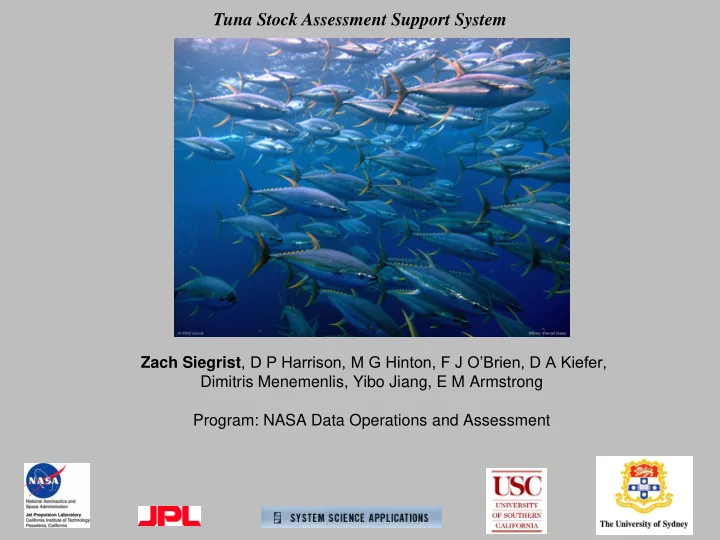
Tuna Stock Assessment Support System
SLIDE 2 Satellite Imagery
sea surface, temperature, height, winds, chlorophyll, the diffuse attenuation coefficient at 490 nm, as well as primary production.
Output & Input from ECCO 2 circulation model
sea surface mixed layer depth, sea surface height, & vertical profiles of temperature & horizontal and vertical flow rates
Tuna fishery time series for Eastern Tropical Pacific
catch, effort, recruitment from stock assessment models
Field Surveys
climatology of the vertical distribution of
Tuna Stock Assessment Support System
stock assessment system
TSASS Products
- maps of the distribution of fleets and tuna species
- predicted recruitment
Algorithm for spatial-temporal matching
- f fishery data with environmental data
Species and fleet habitat characteristics stored as a look-up table or habitat model Dynamic mapping algorithm EOF analysis routine recruitment prediction algorithm
SLIDE 3 TSASS screen of habitat interface and selected graphical analyses
Selected features of 4-dimensional (latitude, longitude, depth, and time) marine GIS :
- automated importing of imagery from satellites, output of circulation models, gridded survey and fishery data, and vector
files of coastline, etc.
- automated matching in space and time of these diverse data types and built-in statistical analyses including EOF
- Play back of time series data and output from models
- Dynamic plugin of our EASy marine GIS system which runs dozens of different aquaculture, organism tracking and
research-based projects as well as broader fisheries, water quality and climate change analyses
SLIDE 4
Bigeye Thunnus obesus
SLIDE 5
Yellowfin Thunnus albacares
SLIDE 6
Skipjack Katsuwonus pelamis
SLIDE 7 TSASS can model horizontal and vertical movements and general patterns of tuna based upon cost
- benefit. Cost of encountering prey
and benefit of assimilating prey
SLIDE 8
Gills Stomach Muscles O2 heat Prey heat O2 metabolic fuels Visual acuity Primary Production Trophic transfer efficiency CO2 CO2 CO2 O2 search & capture Conceptual Model of Optimized Energy Budget- assimilation and thermal balance heat
SLIDE 9
Purse Seine & Longline Fishing Grounds Longline Fishing Ground Eastern Pacific Tuna Fishery IATTC Catch and Effort at monthly time steps at 1 (purse seine) or 5 (longline) degree resolution starting in 1976.
SLIDE 10
Purse seine recording stations superimposed upon a climatological image of annual average oxygen concentration at 150 m depth. Vertical compression of predators and prey above the hypoxic layer helps explain the purse seine fishery boundaries, also controls chlorophyll concentrations because of more efficient cycling of limiting nutrients. TSASS screen shots. The purse seine fishing ground (indicated by +) strongly matches surface waters where chlorophyll concentration exceeds 0.1 μg/L (upper panel) & overlies the hypoxic layer (lower panel).
SLIDE 11 0.05 0.1 0.15 0.2 0.25 0.2 0.4 0.6 0.8 1 1.2 1.4 1.6 1.8 Triangle Background Frequency Preference Quotient GHRSST (°C)
PS-tYFT (1994-2012)
0.05 0.1 0.15 0.2 0.5 1 1.5 2 Triangle Background Frequency Preference Quotient NODC-O2 (ml/L)
PS-tYFT (1994-2012)
0.05 0.1 0.15 0.2 0.25 0.3 0.35 0.4 0.45 0.5 0.5 1 1.5 2 2.5 3 3.5 4 0.05 0.15 0.25 0.35 0.45 0.55 0.65 0.75 0.85 0.95 Triangle Background Frequency Preference Quotient Chlorophyll (ug/L)
PS-tYFT (1994-2012)
Example of our preference quotient for purse seine habitat of yellowfin tuna. The orange line in the figure is the preference quotient for sea surface temperature, oxygen at 150 depth, and sea surface chlorophyll a concentration. The 95% confidence limits for the value of the preference index is either above or below that expected for a random distribution of catch, and is depicted by the dashed line that is centered on a value of 1. The blue bar graph is the discrete frequency distribution of the area fished, and the green bar graph is the discrete frequency distribution of the total catch weight of yellowfin. After automatic import and processing of data by the EASy software, a variety of statistical analyses can be run. Preference and avoidance leads to dynamic mapping as shown in the next slide
SLIDE 12
March, 1981. Predicted distribution of Yellowfin Tuna overlaid with average purse seine catch in metric tons/month.
SLIDE 13 EOF 1st Seasonal spatial component & temporal expansion coefficient (right hand corner) of sea surface temperature
- Seasonal component is the
strongest After extracting the seasonal component, we can observe EOF 1st nonseasonal spatial component & temporal expansion coefficient
- Reveals ENSO events
- Red/purple areas – the two
poles of spatial variability We have developed an algorithm to predict the recruitment of yellowfin tuna based upon Empirical Orthogonal Function (EOF) extraction of patterns of variability from time series of satellite imagery.
SLIDE 14
1985 1990 1995 2000 2005 2010 50 100 150 200
YFT RecruitsPerSpawnerBiomass: Stock Assessment blue , Satellite SST Predictions red
Correlation between EOF temporal expansion coefficients and yellowfin recruitment.
Yellowfin Tuna Recruits per Spawner Biomass: Stock Assessment & Satellite Sea Surface Temperature Predictions
El Nino El Nino El Nino
SLIDE 15
Snapshots of EOF variability in the satellite sea surface temperature as newborn Yellowfin Tuna mature
yellowfin strong cohorts are newborn during El Nino strong cohorts are 3 months old strong cohorts are 6 months old – transitioning to La Nina strong cohort are 9 months old
SLIDE 16
El Nino cohort at birth – same El Nino event, very little chlorophyll, absence of predation El Nino cohort at 4 months El Nino cohort at 7 months El Nino cohort at 9 months El Nino cohort growing up in colder water with higher productivity – as they mature, they can better avoid predation because of rapid growth and possible cohort cannibalism
SLIDE 17 Findings
- We have developed an automated tool to characterize the habitat of the commercial tuna
species of the Eastern Pacific Ocean. We find that there are multiple important
- ceanographic variables including chlorophyll, sea surface temperature, sea surface height,
depth of the hypoxic layer, and ocean currents that characterize these habitats. Finally, we have demonstrated that this information can provide reasonably good predictions to dynamically map the distribution of these species.
- The distribution of tuna in equatorial waters is driven by the strengths of the equatorial
current, the equatorial counter current, and the north equatorial current. It is also driven by the strength of coastal upwelling. This is most clearly illustrated with changes in distribution and catch with ENSO signals.
- We propose that the hypoxic layer of the eastern tropical Pacific vertically compresses the
planktonic and pelagic ecosystem leading to a more efficient cycling of nitrogen. The depth
- f the hypoxic layer shapes the vertical and horizontal distribution of the 3 commercial
species.
- EOF analysis of time series of satellite imagery and the output of NASA’s ECCO 2 global
circulation model can be used to monitor the recruitment of yellowfin tuna (we will soon test this with the other 2 species). We have proposed a mechanism for this relationship based on the evolution of temperature and chlorophyll changes during ENSO events.