
SLIDE 1
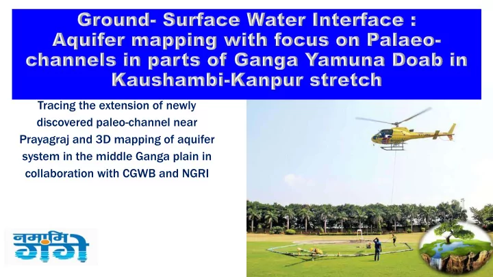
Tracing the extension of newly discovered paleo-channel near Prayagraj and 3D mapping of aquifer system in the middle Ganga plain in collaboration with CGWB and NGRI
Tracing the extension of newly discovered paleo-channel near - - PowerPoint PPT Presentation
Tracing the extension of newly discovered paleo-channel near Prayagraj and 3D mapping of aquifer system in the middle Ganga plain in collaboration with CGWB and NGRI Ground and surface water linkages Surface water and ground water are
Tracing the extension of newly discovered paleo-channel near Prayagraj and 3D mapping of aquifer system in the middle Ganga plain in collaboration with CGWB and NGRI
Recently (December, 2018), the CSIR-NGRI, under the aegis of MoWR-RD-GR, conducted helicopter borne geophysical survey covering Prayagraj and Kaushambi region led significant findings as: ❑ 3D structural settings of aquifer system ❑ Discovery of a buried paleo channel (ancient river, now underground) that joins Yamuna river at Durgapur village, roughly 26 km south of the current Ganga-Yamuna Sangam at Prayagraj. ❑ Aquifer merging at places due to tectonic activities. ❑ River Ganga has good hydrogeological connectivity with surrounding aquifers
ALLHABAD Sangam Flight Line Tie Line Elevation (amsl m) 10 20 Distance scale (m)
N
Block-A: CGWB approved area
Block-A+
NGRI acquired additional data using
Prayagraj Kaushambi
Dimension: ❑ Around 4 km wide, ❑ 45 km long and ❑ ~15 m thick layer ❑ buried under 10- 15 m thick soil
Volume of Paleochannel 40-50% can be used for GWR storage through managed aquifer recharge
Confirmed by drilling
Proposed area of extension for paleo channel Mapping
A: CGWB approved block A+: CSIR-NGRI extended block of A B: proposed area of Extension
Proposed to extend the survey further west ward from Kaushambi to Kanpur (Bock B) to conclude the finding of paleo channel which will work as potential feature for managed aquifer recharge. Knowledge on subsurface connectivity between Ganga and Yamuna rivers will play very crucial role in planning of Ganga cleaning as well as protecting the safe groundwater resources. Area: ~ 8500 sq.km Location: Ganga-Yamuna doab between Kaushambi and Kanpur, U.P.
Objectives
channel further northwestward
system
aquifer system including paleo channel with river system
Methodology/approach
heliborne, ground and borhole geophysics.
settings
from the region along and adjacent to the paleo channel for reconstruction.
NGRI (2009)
RIVER DISCHARGE CONTRIBUTION FOR HIMALAYAN RIVERS Monsoon Season Dry Season Glacier
5% 60%
Precipitation
90% 5%
Groundwater (baseflow)
5% 35%
Groundwater
declining of water level Reduction of Baseflow Reduction in river water flow
Distance [m] 52000 50000 48000 46000 44000 42000 40000 38000 36000 34000 32000 30000 28000 26000 24000 22000 20000 18000 16000 14000 12000 10000 8000 6000 4000 2000 130 120 110 100 90 80 70 60 50 40 30 20
Buried paleo R. Ganga R. Yamuna R.
Vindhyan Hard rock.
Principal aquifer-I
A B
The river Ganga, Yamuna and discovered ancient river are connected at places through first principal aquifer ?
A B
Distance [m] 64000 63000 62000 61000 60000 59000 58000 57000 56000 55000 54000 53000 52000 51000 50000 49000 48000 47000 46000 45000 44000 43000 42000 41000 40000 39000 38000 37000 36000 35000 34000 33000 32000 31000 30000 29000 28000 27000 26000 25000 24000 23000 22000 21000 20000 19000 18000 17000 16000 15000 14000 13000 12000 11000 10000 9000 8000 7000 6000 5000 4000 3000 2000 1000 150 100 50
E F
5 0 1 0 1 5 2 01 10 100
5 0 1 0 1 5 2 0 2 51 10 100
5 0 1 0 1 5 2 0 2 51 10 100
Aquifer-I Aquifer-II
Ganga R.
Connectivity of Ganga R sediment with Aquifer-I Merging of Aquifer-I & II
EW6 EW4 EW2
SUBSURFACE INTER- LINKAGES
recharge and groundwater contamination & Ganga Cleaning ?
C D
37500 37000 36500 36000 35500 35000 34500 34000 33500 33000 32500 32000 31500 31000 30500 30000 29500 29000 28500 28000 27500 27000 26500 26000 25500 25000 24500 24000 23500 23000 22500 22000 21500 21000 20500 20000 19500 19000 18500 18000 17500 17000 16500 16000 15500 15000 14500 14000 13500 13000 12500 12000 11500 11000 10500 10000 9500 9000 8500 8000 7500 7000 6500 6000 5500 5000 4500 4000 3500 3000 2500 2000 1500 1000 500 100 50
C D
Ganga R.
Aquifer-I Aquifer-II
Vindhyan formation
Connectivity of Ganga R with Aquifer-I
10 15 5 20 25 30 35 Distance (km) 100
Paleo River
Aquifer-I
E F
Treatment Plants Sewer Networks Cleanliness Drives Ghat development Water body conservation Research and Innovations
River City, Gothenburg, Sweden, Europe Busan River City, South Korea Södertälje, Sweden, Europe Vancouver’s River Dist., Canada Qinhuangdao, China
National Mission for Clean Ganga Department of Water Resources, River Development and Ganga Rejuvenation Ministry of Jal Shakti Government of India 27th September, 2019
PATNA VARANASI ALLAHABAD KANPUR KANNAUJ NARORA JOSHIMATH GANGOTRI HARIDWAR KOLKATA
HOOGHLY
Catchment area of the basin is 8,61,404 km2. 11 states in the Ganga Basin with 5 on Ganga main stem Total length of river is 2525 km with longest stretch of 1000 km in Uttar Pradesh
2
Habitat for rich Biodiversity Ganga Basin covers 26 % of India’s total landmass Contributes 28% of India's water resources
Information Source: National Mission for Clean Ganga; Ganga River Basin Management Plan; Agropedia (IIT Kanpur)
3
India’s 43% population resides in Ganga Basin
4
5
Critically Polluted Stretch in terms
Issues related to Faecal Coliform Issues related to Faecal Coliform
Central Pollution Control Board Standard for Bathing (Class ‘B’)
Dissolved Oxygen (DO) >= 5mg/l, Biochemical Oxygen Demand (BOD) <= 3mg/l Faecal Coliform <= 500mpn/ 100ml
6
GAP I
1985
stem of River Ganga
Covered
GAP II
GAP I in 1993
NRCP in 1996
Yamuna, Gomti, Damodar & Mahananda NRCP
1995
rivers viz Ganga, Yamuna, Gomti, Damodar Mahananda, Betwa, Mandakini, Ramganga NGRBA
Authority for Ganga in 2009
Prime Minister
implementing body at center and SPMGs at states Namami Gange
2015
conservation mission
included
:Ganga Action Plan
A Shift Towards Basin Based Approach
7
8
PREVIOUS EFFORTS NAMAMI GANGE River Wise program : (GAP I, GAP II, YAP I, Gomti Action Plan etc.) Comprehensive integrated programme Centrally sponsored Central Sector (100% Govt. of India funding for new projects) O&M main bottleneck with state funds Long term O&M (15 years) included in project cost Lack of Finances/ Uncertainty on availability of funds 5 years dedicated budget allocation No Performance based PPP Approach Hybrid Annuity Mode – Performance linked payments Focus on Urban Sector only Comprehensive program including Rural sanitation, Aviral dhara, Afforestation, Biodiversity, Communication and Public
9
Components: i. Pollution Abatement ❖ Sewerage Infrastructure ❖ Solid waste management ❖ Industrial Pollution Abatement ❖ Rural Sanitation ❖ Water Quality Monitoring ii. River Front, Ghats and Crematoria iii. Urban River Management plan iv. Aviral Dhara v. Research and Knowledge management vi. Afforestation and Biodiversity conservation vii. Public participation
10
powers of Section 5 of Environment Protection Act 1986.
active Flood Plain area.
150 sewerage projects worth Rs. 23,130.95 Crore (Total – 298 projects with sanctioned cost Rs. 28,534.62 Crore.)
Salient Features :
The River Ganga Authorities Order, 7th October 2016
The River Ganga Authorities Order, 7th October 2016
11
National Council for River Ganga (Rejuvenation, Protection and Management)
Empowered Task Force National Mission for Clean Ganga District Ganga Committees State Ganga Committees
5 Tier structure of Governance
12
S. No. Type of Project Name of State No of works Taken up Total Cost of Project (Rs in Cr ) 1 Sewerage Projects Uttarakhand 34 1,144.77 Uttar Pradesh 50 10,263.28 Bihar 28 5,186.55 Jharkhand 2 156.12 West Bengal 22 3,789.71 Haryana 2 217.87 Delhi 11 2,361.08 Himachal Pradesh 1 11.57 Total 150 23,130.95 2 Industrial Pollution Abatement 12 964.58 3 River front, Ghats and Crematoria 76 1441.01 4 Afforestation and Biodiversity conservation 24 387.1 5 Rural Sanitation 1 1421.26 6 Other Projects 35 1189.72
Grand Total 298 28,534.62
14
Sewerage Infrastructure Projects
Sewage generation vs. Treatment capacity in 97 Ganga towns Number of Sewerage projects before and after 2014
Sewerage Infrastructure Projects
15 Projects STP Capacity (MLD) Completed Work-in- Progress Under Tendering Ganga Main stem 111 2158.46 41 48 22 Ganga Tributaries 39 2685.85 2 18 19
satisfactory performance
Hybrid Annuity Based PPP: Improving Long Term Performance
STP, Sarai (14 MLD)
payments – 40% of capital cost
payments – 15 Years (60% quarterly Capex Annuity with Interest with additional O&M payments)
17
treatment in the entire city
sewage treatment infrastructure under HAM
City Total STP capacity (MLD) Prayagraj 343.5 Kanpur 475 Kolkata 183 Howrah 187 Patna 150
“One City One Operator” - STPs in towns/city Clusters (Kanpur – Unnao - Shuklaganj, Prayagraj, Mathura, Farrukhabad, Mirzapur – Ghazipur, Patna, Bhagalpur, Kolkata, Howrah-Bally-Kamarhati-Baranagar, and Maheshtala – Hugli Chinsura, Bareilly, Agra, Mathura, Muzzaffarnagar - Budhana, Meerut etc.) are being integrated & tendered with Hybrid Annuity based projects.
18
➢No. of Ghats: 20 ➢Promenade: 6.6 km ➢Crematoria : 1
19
RFD PATNA
Promenade
20
Ghat and Crematoria projects
➢ Ghats: 161 ➢ Completed: 121 ➢ Under progress: 40
➢Crematoria: 43 ➢Completed : 33 ➢Under progress: 10
Before After
Atal Ghat ,Uttar Pradesh Chandi Ghat, Haridwar
Solid Waste Management –Status of Towns Along Ganga
21
may end up in River Ganga directly or through drains.
to Energy etc common waste processing technologies.
22
Sl No Name of Project Sanction Cost (Rs in Cr) Date of Sanction Duration
project Total expenditure incurred (Rs in Cr) Brief Status on Physical Progress Tentative year of completion 1 Cleaning of the 84 Ghats at Varanasi 15.00 17.10.16 3yrs 12.18 Ongoing 2019-20 2 Ghat cleaning Project at 4 towns
Kanpur (20), Allahabad (21), Mathura- Vrindavan (27) 12.97 20.07.18 3yrs 0.00 Ongoing 2020-21 3 Cleaning of the 72 Ghats at Haridwar 15.90 17.07.18 3yrs 0.00 Ongoing 2020-21 Total 43.87 12.18
Ghat Cleaning projects
Kshameshwar Ghat Before After
23
24
River Surface Cleaning projects
Uttarakhand Delhi Uttar pradesh Bihar Jharkhand West bengal Haridwar Okhla Zone Allahabad Patna Sahibganj Howrah Garhmukteshwar Nabadwip Kanpur Mathura-Vrindavan Varanasi Location of Trash Skimmers
not maneuverable. At least 10 dedicated workers deployed with skimmers.
independent institutions of repute
– 538 out of 1109 industries non-complying during 2016-18 – 122 out of 961 industries non-complying during 2018-19 – Action against non-complying units by issuing direction to
closed) Industrial Pollution Abatement
GPI – Industry with BOD ≥ 100 kg/day and /or using Hazardous Chemicals
26
Industrial Sector Development
Tannery CETP approved at Jajmau (Kanpur) at the cost of Rs. 554 Crore with adoption of cleaner process and reduced water consumption. Paper and Pulp Zero black liquor discharge achieved. Estimated reduction in the fresh water consumption and effluent generation are about 45-50% as compared to 2012. Distillery Zero liquid discharge achieved in molasses based distillery. Sugar Effluent generation reduced from 400 to 200 litres per tonne of cane crushed Textile Most of the units are in process of upgrading existing ETPs/ installation of new ETPs/CETPs. Upgradation of CETP, Mathura sanctioned at the cost of Rs 13.87 Cr
Industrial Pollution Abatement
Water Quality Monitoring
27
locations through respective SPCBs and data compiled at CPCB.
Real Time Water Quality Monitoring Stations (RTWQMS) installed on river Ganga.
2018 indicates improvement in water quality trends as compared to 2017.
improved at 36 locations, Biological Oxygen Demand (BOD) levels improved at 42 locations and out of 65 locations, 46 show improvement in terms
Faecal Coliform Count.
Sanitation in ensuring sanitation in Ganga villages.
Independent Household Latrines (IHHL).
Released
Mainstreaming Urban River Management in Planning Process
29
attention that a River receives in their long term planning process.
weaving through the very character of the city, does not find prominence or mention in its planning.
iitiated y NMCG ith the deelopet of Idias first Ura ‘ier Maageet Pla (URMP).
by combining environmentally sustainable, socially inclusive and economically viable programmes, projects and proposals based on improving the health of the river in the long run.
Local bodies, sensitizing them towards river health and guiding them to create their
Ground water augmentation River Zone Delineation Landuse, use zone, use premise Development Control Norms/ Zoning Regulations River water extraction for city use River pollutants and pollution level River Background Overall strategies for the river zone MP Vision/ Objectives vis-à-vis river Urban flooding River navigation - Inland waterways
Patna Master Plan, 2031 Kanpur Master Plan, 2021 Dehradun Master Plan, 2025 Allahabad Master Plan, 2021
Current Status – Ganga Towns
4 1 4.5 1
Master Plan for Delhi, 2021
Agra Master Plan, 2021 MP for Chennai Metro. Area, 2026
Best Practices – River Towns
4 4 2 9 G A P S EC TO R S
Essential components of river management in a Master Plan Relative Scoring (of 11 components) Assessment of Gaps
New Orleans Master Plan, 2030 Ulaanbaatar Master Plan, 2030
Best Practices – International
9 5.5
Generic Extent of coverage in the Master Plan Basic details
Analysis of City Masterplans for River Planning
No mention
ENVIRONMENTAL RESPONSIBILITY SOCIALLY INCLUSIVE ECONOMICALLY VIABLE ELEMENTS River Health Social Cohesion Economic Value VISION Rivers Supports Aquatic Life Citizens are connected to River River supports economic development OBJECTIVES
1.Abate pollution in the rivers, waterbodies (ponds, lakes) & local drains 2.Maintain environmental/ecological flow in the river 3.Rejuvenation of waterbodies (ponds, lakes) 4.Adopt rainwater harvesting 5.Control erosion along river banks 1.Increase awareness
waterbodies 2.Engage citizens in river, waterbody management 1.Develop eco-friendly riverfronts 2.Promote River Tourism 3.Develop Waterways UNDER EACH ELEMENT
OUTPUTS
MONITORING & EVALUATION, ACCOUNTABILITY
INDICATORS
SHORT-MEDIUM-LONG TERM PROJECTS
INTERVENTIONS
32
Uttarakhand and from Haridwar – Unnao stretch
conservation and improving water use efficiency
Wetlad oseratio is a itegral opoet of Naai Gage. As part of Jal Shakti Abhiyan, a special drive has been taken through NMCG-Wildlife Institute of India team with key focus on -
around the wetlands.
the wetlands.
area to restrict nutrient inflows.
species.
and water conservation.
.
Revival of connecting channel with Noon River Dried up Baraila wetland Connectivity revived in the Baraila wetland after restoration
Kakrakhera pond, Hardoi
Restoration of Kashipur wetland
Restoration of Bilona wetland Sensitization activities for villagers
wetlands situated in 27 Ganga districts in U.P. up to 5 Kms. on either side of river.
management plan. A similar exercise would also be taken up in other States.
requested to take up inventorization and rejuvenation of traditional water
in Varanasi.
under development for integrated management and rejuvenation of urban wetlands with the case study of Bhagalpur. This is also being coordinated with the Urban Development Departments of States. Recent projects include -
BhairavaTalaab DhobiaTalaab ShahjangiTalaab
the lives of common people by way of various uses.
base flow to the river especially when settlement is on the banks of the river.
37
Forestry Interventions for Ganga
2300 cr. for plantation over 1.34 lakh ha.
campaigns like : Ganga Haritma Abhiyan (Uttar Pradesh), Harela (Uttrakhand), Har Parisar Hara Parisar (Bihar), Van Mahotsav (Jharkhand & West Bengal).
four years supporting in patrolling of ghats & river, public outreach, afforestation water quality testing, etc.
natural indicator for pristine Ganga.
institutes. – Wildlife Institute of India (WII), Dehradun – ICAR-Central Inland Fisheries Research Institute (CIFRI), Kolkata – Centre for Environment Education (CEE)
research and promoting community participation for Conservation.
40
farming and to create awareness about balanced use of chemicals, fertilizers and pesticides, promote micro irrigation for water conservation in Ganga Basin.
Krishi Vikas Yojana (PKVY) guidelines.
Preparation of Vermi compost pit
Marketing of organic produce
conservation of medicinal plants in Ganga catchment area.
Plantation of Vetiver in Kanpur Nagar Forest Nursery in Alaknanda
Demonstration of Juice & Seed Pickle of Sea Buckthorn Fruit
Ranging)
Ganga main stem panning 5 states
1. Bioinformatic analysis of generated sequence data to identify taxonomy and functional genes, viz, multi-drug resistant markers as well as genes of xenobiotic degradation pathways 2. Estimating projected health risks 3. Understanding ecosystem services of microbial community 4. Developing bioinformatics pipelines to differentiate E.coli from human and animal origin
Architectural Intangible Built Natural What’s being mapped ?
1 Uttarkashi 8 Jyotibaphule Nagar 15 Unnao 22 Allahabad 29 Chapra 36 Khagaria 2 TehriGarhwal 9 Bulandshahr 16 Kanpur Dehat 23 Mirzapur 30 Vaishali 37 Bhagalpur 3 Rudraprayag 10 Badaun 17 Kanpur Nagar 24 Varanasi 31 Bhojpur 38 Katihar 4 Haridwar 11 Etah 18 Fatehpur 25 Chandauchi 32 Patna 39 Sahibganj 5 Bijnor 12 Farukhabad 19 Rae Bareli 26 Ghazipur 33 Begusarai 40 Malda 6 Muzzafarnagar 13 Hardoi 20 Pratapgarh 27 Balia 34 Mungher 41 Murshidabad 7 Meerut 14 Kannauj 21 Kaushambi 28 Buxar 35 Kaushambi 42 To Ganga Sagar
Where it is being mapped ?
Synergy With Other Ministries
farming in Ganga Catchment.
within 50 kms distance.
literacy in villages along Ganga.
MGNREGA Scheme.
47
814 Projected Expenditure
individuals, NRIs, Corporate Entities for funding Ganga rejuvenation projects.
Tax and qualify for Corporate Social Responsibility projects. Treatment of drains in Allahabad. Development of Ghats in Badrinath and Gangotri. Plantation of Rudraksh in Uttarakhand and afforestation in Gautam Budh Nagar. Provision of amenities at Katwa Ghat West Bengal. Provision of amenities at Triveni Ghat and Astha Path in Rishikesh.
Public and Corporate Engagement in ‘Namami Gange’
CSR Projects
49
Mission Gange River Rafting Expedition Bal Ganga Mela
Launch of ‘Clean Ganga’ Messages in Bank ATMs & Branches The Great Ganga Run, Varanasi - Mar’19 Ganga Swachhta Pakhwada The Great Ganga Run, Delhi - Sept’19
50
Kumbh Mela- 2019 Ganga Pavilion
Theatre Promos and Outdoor Publicity Travelogue series ‘Rag Rag Mein Ganga’ and ‘Ganga Quiz’
Ganga Quest 2019
51
National Mission for Clean Ganga (NMCG) participated in the World Water Week 2019 held at Stockholm, Sweden during 25th to 30th August, 2019. His majesty King Carl XVI Gustaf and Her Royal Highness Crown Princess Victoria and Duchess of Vastergotland who took keen interest in various activities displayed in the exhibition and spent quality time in the pavilion.
– Completion of all Sewerage projects including those on Tributaries & Monitoring of their operation – Improving Regulation and enforcement at ULB and Industry level for all aspects; Urban River Management Plans – Non-point source pollution, Organic farming
– Implementation of e-flow Notification for Ganga for Uttarakhand and for Haridwar-Unnao Stretch – Similar approach for important tributaries such as Yamuna – Afforestation – Conservation of Wetlands and Water Bodies – Spring Rejuvenation – Rain Water Harvesting – Demand side management-Water use efficiency, Micro- irrigation, sustainable agriculture, Reuse policies
52
53
Jyoti Nale India Water Week-2019
Special Session : REJUVENATION OF THE RIVER GANGA – FROM PLANNING TO ACTION 27 September 2019, 10:00 – 13:00, Vigyan Bhavan, New Delhi
The guidance document will be finalised after the assessments in three pilots; including the lessons
IEWP PMU EU Expertise CWC CIFRI WII State WRDs State Fisheries/ Forest
economic benefits/impacts of E-flows and river ecoservices.
E-flows including pilot implementation and monitoring of e-flows.
Diverse hydro-climatic regions of India
The Basis of Selection -heterogeneity in terms of hydro-meteorological and ecological domain
appropriate methodologies.
Locations visited
1. Below Kalagarh Dam- (on Ramganga River)
Kho- (Seohara on Ramganga River)
Cross section surveys during October 2018
Fishermen/locals Consulted Species noted- Soli, Lachi, Chaal, Singhara, Muraki, Kalabans and Golden Mahseer
Adult Golden Mahseer: Flow Depth- 0.5 to 2 m Juvenile Golden Mahseer Flow Depth- 0.3 to 0.6 m
Ecological Benefits Flow Hydrological Methods Hydraulic Rating Methods Habitat Analysis Methods
Jowett, 1997
Approaches-
Percentages of flows (e.g. 10% of flow) Hydrological Alteration limits-
Understanding hydrological regime
Baseline/reference scenarios Present Scenario Vision/objectives of E-flows
400 300.* 200 150.* 100.* 50.*
Legend WS Flow 100 cumec Ground Bank Sta Ground
function of flow.
Habitat Area (m2/km) against Discharge.
Golden Mahseer Habitat Requirements-
0.2 0.4 0.6 0.8 1 Suitability
Flow Depth (cm)
Adult Juvenile 0.2 0.4 0.6 0.8 1 0.2 0.3 0.5 0.6 1.0 Suitability
Flow Velocity (m/s)
4 8 12 16 20 24 28 32 20 40 60 80 100 120 Habitat Area (sq m / km) Thousands Flow (cumecs) Adult-Habitat Juvenile-Habitat
Kalagarh Site
January-01 February 2019.
ecological scenarios of the delta.
15 April-17 April 2019.
Training/Workshop on Environmental Flow Assessment-Approaches (Focus: Ecological Approaches and Assessments – experiences from the EU) CWC MERO Office, Bhuvneshwar - On 18 April 2019
Bharathapuzha Basin: Field visit during 07-11 January 2019 to identify the critical sites
CWC Site Barrage/weir
Indo-German Technical Co-operation Project- Support to Ganga Rejuvenation - GIZ India will organize-
International Workshop on
On 21-22 October 2019 in New Delhi
in cooperation with the
India-EU Water Partnership, National Mission for Clean Ganga & Central Water Commission
Project Advisor, IEWP