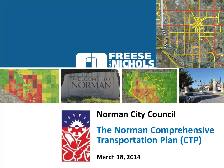
SLIDE 1
The Norman Comprehensive Transportation Plan (CTP)
March 18, 2014
Norman City Council
SLIDE 2 Transportation Planning for Moving Forward
- Framework for growth
- Land Use/transportation interface
- Multi-modal considerations
- System Alignments/ROW Preservation/Design Standards
- Coordination with other agency/city plans
- Infrastructure and utilities coordination
- Capital Improvements Programming
- Funding of Improvements
- Economic benefit
- Statement of Community Policy
SLIDE 3 Benefits of Transportation Planning
- Informed Public
- Increased Mobility, Options and Safety
- Facilitate Growth and Development
- Community Connectivity
- Sensitivity to Land Planning
SLIDE 4 Project Overview
– Existing System – System Needs
- Sub-Committee Work
- Plan Concepts and Refinement
- Modal Plans
- Draft CTP Document
- Basis for the Plan
- Transportation System Needs
- Transportation System Master Plan
- System Implementation Plan
- 1. Guiding Principles, Goals &
Objectives
- 2. Assessment of Existing
Systems
- 3. Assessment of Needs
- 4. Travel Forecast Modeling
- 5. Transportation Plan and
Prioritization
- 6. Transportation Policies
and Programs
- 7. Implementation
- 8. Documentation
CTP Planning Process
SLIDE 5 Guiding Principles, Goals, Objectives
Special Place to Live
- Vibrant Norman Community in 2035
- Transportation and Infrastructure focus on both people and places
- Enhanced transportation choices and accessibility
- Create a unique place with lasting value
- Blends seamlessly with the character of Norman’s neighborhoods, employment centers and activity centers
Mobility
- Seamless system of transportation options and solutions
- Norman Moving Forward’s emphasis on system management and operations, context sensitive and complete streets designs
- Range of accessible and convenient, multi-modal transportation choices that provide connections between neighborhoods and
destinations
Maintain and Preserve Existing Infrastructure
- Priority on maintenance, rehabilitation, safety and reconstruction
- Neighborhood viability through maintaining streets, sidewalks, utilities, storm water systems and other infrastructure facilities
- Investments balance transportation needs of the community and local neighborhoods
Fiscal Stewardship
- Provide a detailed roadmap of actions for transportation and infrastructure improvements
- Investments maximize the benefits for multiple user groups in a way that is fiscally and environmentally responsible
- Input from the community-at-large and ongoing dialogue with stakeholders
Enhance Economic Vitality
- Promotes economic growth while using resources in an efficient and effective manner
- Supports a diverse, vibrant local economy with a strong tax base
- Reduces the fiscal burden on residents to provide city services
SLIDE 6 Public Input to the CTP
Mar 2013 Dec 2012
- 1. Guiding Principles, Goals and
Objectives
- 2. Existing Transportation Systems
- 3. Assessment of Transportation
Needs
- 4. Forecast Transportation Conditions
- 5. Develop Long Range Improvements
Plan
- 6. Transportation Policies and
Programs
- 7. Implementation
- 8. Documentation
Sep 2013 Mar 2014 Jun 2013 Dec 2013
Subcommittee Meetings CVC and CTPC Meetings Public Meetings Public Hearings
May 2014 Apr 2014
SLIDE 7 Norman Comprehensive Transportation Plan
A Multi-Modal Plan for 2035. Modal Elements
- Thoroughfare Plan and Typical Sections
- Bike & Pedestrian Plan, Sidewalk Completion Plan
- Transit Service Plan
- Airport, Freight and Emergency Response
SLIDE 8
Thoroughfare Plan
SLIDE 9
Thoroughfare Plan
SLIDE 10
Thoroughfare Plan
SLIDE 11
Thoroughfare Plan
SLIDE 12
Thoroughfare Plan
SLIDE 13 Highlights of the Thoroughfare Plan
- Added definition to functional
classification and network
- Design options for roadway
sections
- Formalization of internal loop for
regional connection
- Identification of Collector network
supporting section grid
- Creation of Special Corridors
- Railroad grade separations
SLIDE 14 Highlights of the Thoroughfare Plan
- Added definition to functional
classification and network
- Design options for roadway
sections
- Formalization of internal loop for
regional connection
- Identification of Collector network
supporting section grid
- Creation of Special Corridors
- Railroad grade separations
SLIDE 15 Highlights of the Thoroughfare Plan
- Added definition to functional
classification and network
- Design options for roadway
sections
- Formalization of internal loop for
regional connection
- Identification of Collector network
supporting section grid
- Creation of Special Corridors
- Railroad grade separations
Principal Urban Arterial Minor Urban Arterial Collector
SLIDE 16 Highlights of the Thoroughfare Plan
- Added definition to functional
classification and network
- Design options for roadway
sections
- Formalization of internal loop for
regional connection
- Identification of Collector network
supporting section grid
- Creation of Special Corridors
- Railroad grade separations
Principal Rural Arterial
SLIDE 17 Highlights of the Thoroughfare Plan
- Added definition to functional
classification and network
- Design options for roadway
sections
- Formalization of internal loop for
regional connection
- Identification of Collector network
supporting section grid
- Creation of Special Corridors
- Railroad grade separations
SLIDE 18 Highlights of the Thoroughfare Plan
- Added definition to functional
classification and network
- Design options for roadway
sections
- Formalization of internal loop for
regional connection
- Identification of Collector network
supporting section grid
- Creation of Special Corridors
- Railroad grade separations
SLIDE 19 Highlights of the Thoroughfare Plan
- Added definition to functional
classification and network
- Design options for roadway
sections
- Formalization of internal loop for
regional connection
- Identification of Collector network
supporting section grid
- Identification of Special Corridors
- Railroad grade separations
SLIDE 20 Highlights of the Thoroughfare Plan
- Added definition to functional
classification and network
- Design options for roadway
sections
- Formalization of internal loop for
regional connection
- Identification of Collector network
supporting section grid
- Identification of Special Corridors
- Railroad grade separations
SLIDE 21
Bicycle/Pedestrian Plan
SLIDE 22 Highlights of the
Bicycle/Pedestrian Plan
- On-Street Facility Standards
– Bike lanes on urban minor arterials – Shoulder bike lanes on all rural principal/minor arterials
- Side-paths: 8-10’ along roadway
– 12th Ave. E – 48th Ave. E (thru rural Norman) – Lindsey (12th Ave. E to Classen) – Robinson /Main corridor
- Multi-use paths: 10-12’ off road
– Extension of Legacy Trail around Max Westheimer Airport – SH 9 Path – Robinson Waterline Path
- Notable Bike Lanes along:
- Berry Road (Lindsey to Robinson)
- Lindsey (Elm to 24thAve. W)
- Rock Creek Road, E and W of Airport
- University/Webster
SLIDE 23 Highlights of the
Bicycle/Pedestrian Plan
- On-Street Facility Standards
– Bike lanes on urban minor arterials – Shoulder bike lanes on all rural principal/minor arterials
- Side-paths: 8-10’ along roadway
– 12th Ave. E – 48th Ave. E (thru rural Norman) – Lindsey (12th Ave. E to Classen) – Robinson /Main corridor
- Multi-use paths: 10-12’ off road
– Extension of Legacy Trail around Max Westheimer Airport – SH 9 Path – Robinson Waterline Path
- Notable Bike Lanes along:
- Berry Road (Lindsey to Robinson)
- Lindsey (Elm to 24thAve. W)
- Rock Creek Road, E and W of Airport
- University/Webster
SLIDE 24 Highlights of the
Bicycle/Pedestrian Plan
- On-Street Facility Standards
– Bike lanes on urban minor arterials – Shoulder bike lanes on all rural principal/minor arterials
- Side-paths: 8-10’ along roadway
– 12th Ave. E – 48th Ave. E (thru rural Norman) – Lindsey (12th Ave. E to Classen) – Robinson /Main corridor
- Multi-use paths: 10-12’ off road
– Extension of Legacy Trail around Max Westheimer Airport – SH 9 Path – Robinson Waterline Path
- Notable Bike Lanes along:
- Berry Road (Lindsey to Robinson)
- Lindsey (Elm to 24thAve. W)
- Rock Creek Road, E and W of Airport
- University/Webster
SLIDE 25 Highlights of the
Bicycle/Pedestrian Plan
- On-Street Facility Standards
– Bike lanes on urban minor arterials – Shoulder bike lanes on all rural principal/minor arterials
- Side-paths: 8-10’ along roadway
– 12th Ave. E – 48th Ave. E (thru rural Norman) – Lindsey (12th Ave. E to Classen) – Robinson /Main corridor
- Multi-use paths: 10-12’ off road
– Extension of Legacy Trail around Max Westheimer Airport – SH 9 Path – Robinson Waterline Path
- Notable Bike Lanes along:
- Berry Road (Lindsey to Robinson)
- Lindsey (Elm to 24thAve. W)
- Rock Creek Road, E and W of Airport
- University/Webster
SLIDE 26 Highlights of the Transit Plan
- 2008 CARTS Plan; enhanced for:
– Porter-Classen corridor – Moore Norman Technology Center – University North Park – SH9/Cedar Lane area
- Increased service frequency and
hours of operation
- Better accommodation of patrons
with wheelchairs
- ADA compliance at stops
- Regional Commuter Rail Stations
– Tecumseh, Downtown, SH9/Imhoff – Platform for OU special events
- IH35 – Reversible HOV lane concept
SLIDE 27
Sidewalk Completion Plan
SLIDE 28 Airport, Freight and Emergency Response Needs
- Protect zoning around airport
and industrial districts to serve freight, rail and air transportation needs
- Additional grade separated
crossings with railroad
- Corridor enhancements
- Land use coordination
SLIDE 29 System Implementation Plan
– Immediate, Ongoing – Short Range (0 to 5 years) – Medium Range (5 to 10 years) – Long Range (10 to 20 years)
- Actions to Achieve CTP Goals
– Institute design standards and procedures – Focus on Goals & Objectives, Performance Measures
- Prioritized Projects and Programs
– Special Corridors – Strategic funding opportunities
– Local and Public – Private Partnerships – Regional & State – Federal
SLIDE 30 What We Heard from The Citizen Visioning Committee
- Review/Comment on CTP Recommendations
– Thoroughfare Plan:
- Specific issues on RR grade separations, associated cost and prioritization
- Discussion of key corridors, potential timing and configuration relative to
- ther recommended projects
- Considerations for project prioritization.
– Transit Plan:
- Incorporation of 2008 CARTS plan, need to have more incremental projects
(“Pilot projects”) to advance current transit to recommended system.
- Approval to commuter rail station locations
– Bike Plan: Specific feedback on system additions.
- Comments to Implementation and Funding Strategies
- General approval of short/medium/long-range prioritization.
- Any new funding strategies need to be evaluated relative to current policies
and benchmarking with other municipalities in the region.
SLIDE 31
Next Steps Going Forward (Dates Tentative)
Comprehensive Transportation Plan Upcoming Meetings March – April 2014
Planning Commission Meeting City Council Study Session Planning Commission Public Hearing City Council Public Hearing Thursday March 13, 2014 6:30 p.m. Tuesday, March 18, 2014 5:30 p.m. Thursday, April 10, 2014 6:30 p.m. Tuesday, May 13, 2014 6:30 p.m. Public Input
SLIDE 32
Your Thoughts…..
Comments and Questions
SLIDE 33
Thank You!
March 18, 2014
Norman Comprehensive Transportation Plan