The Metropolitan District Status of LTCP Update January 9, 2017 - - PowerPoint PPT Presentation

the metropolitan district
SMART_READER_LITE
LIVE PREVIEW

The Metropolitan District Status of LTCP Update January 9, 2017 - - PowerPoint PPT Presentation

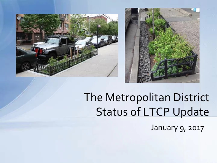
The Metropolitan District Status of LTCP Update January 9, 2017 Agenda CH2M Hill LTCP Peer Review/Water Quality Analysis CDM Smith LTCP Update & CSO Meters Affordability Analysis Hartford MDC - LTCP Peer Review Water Quality


slide-1
SLIDE 1

January 9, 2017

The Metropolitan District Status of LTCP Update

slide-2
SLIDE 2

Agenda

  • CH2M Hill LTCP Peer Review/Water Quality

Analysis

  • CDM Smith LTCP Update & CSO Meters
  • Affordability Analysis
slide-3
SLIDE 3 3

Hartford MDC - LTCP Peer Review Water Quality Monitoring & Assessment Analysis of Data:

Characterization of Impairment CSO Contribution to Impairment

slide-4
SLIDE 4

North Tunnel

  • North Tunnel starts

at N-2 on the North Branch Park River

  • CH2M focus on

North Branch Park River watershed above Farmington Avenue

North Tunnel

slide-5
SLIDE 5
  • NBPR watershed

components:

– Hartford – West Hartford – Bloomfield

  • Watershed much larger

upstream than section with 4 CSO outfalls

Water Quality Assessment of North Branch Park River

slide-6
SLIDE 6

Water Quality Classification

  • Part of rationale for zero discharge (complete elimination
  • f CSOs) was NBPR’s status as a Class A stream

– Initial development of standards in 1967 – Most recently updated and approved by EPA in 2013 – No use attainability study completed

  • Is this appropriate? What’s different about Class B

streams?

– Class B streams:

  • Carry same set of

designated uses, minus potential for public water supply

  • Shall have good to

excellent aesthetic value

  • Have less restrictive

allowances for discharges

  • Class B streams have 1-year level of control

NBPR at entrance to Farmington Ave culvert

slide-7
SLIDE 7
  • To summarize available information on water

quality impairment of North Branch Park River (NBPR) including DEEP’s own data and 2010 study

  • To complete a preliminary assessment of the

contributions of CSOs toward use attainment of NBPR with currently available data

  • To identify additional studies and/or data gaps

required to complete a more rigorous assessment

  • To implement a seasonal water quality assessment

Goal of Review

slide-8
SLIDE 8

Historical Data: Indicator Bacteria

Indicator Bacteria Sampling Data: 2008 - 2010, 2016

Station Name* Station Location Year(s) Wet Events sampled Dry Events sampled Geometric Mean Wet Only Mean Dry Only Mean 2741 Sunny Reach Drive 2010 2 3 776 3164 304 6142 University of Hartford 2010 1 3 824 N/A 307 2274 Behind Woodland Street 2008 2009 2010 11 18 656 1459 402

Source: CTDEEP, 2012

*Sites listed upstream to downstream Geomean standard: 126 MPN/100 mL Geometric mean: Commonly used with bacterial water assessments, which often show a great deal of variability. Unlike the arithmetic mean, a geometric mean reduces the effect

  • f an occasional high or low value on the average
slide-9
SLIDE 9

Indicator Bacteria Sampling Data: 2008 - 2010, 2016

Station Name* Station Location Year(s) Wet Events Sampled Dry Events Sampled Geometric Mean Wet Only Mean Dry Only Mean 2741 Sunny Reach Drive 2010 2 3 776 3164 304 6142 University of Hartford 2010 1 3 824 N/A 307 2274 Behind Woodland Street 2008 2009 2010 11 18 656 1459 402

Source: CTDEEP, 2012

*Sites listed upstream to downstream Geomean standard: 126 MPN/100 mL

Upstream of CSOs DEEP’s in-depth study showed the upstream issues as well Downstream

Historical Data: Indicator Bacteria (cont.)

slide-10
SLIDE 10

Stream Sampling Sites:

S1: CTDEEP 2741 – Sunny Reach Drive S2: NBPR Bridge at the University of Hartford S3: USGS Gage at Albany Avenue S4: Asylum Avenue – South Side S5: CTDEEP 2274 – Upstream of Farmington Avenue Conduit S6: Tributary at Hartford Golf Club

Stormwater Outfall Sampling Sites:

SW1: Mark Twain Drive SW2.1: End of Woodland Drive (North) SW2.2: End of Woodland Drive (South) SW5: Asylum Avenue South Side

(other sites identified, but difficult to obtain clean samples)

CSO Sampling Sites:

N-2, N-4, N-10

S1, S2, S6 above CSO influence

Final CH2M Hill Sampling Locations

slide-11
SLIDE 11

Indicator Bacteria Sampling Data: 2008 - 2010, 2016

Station Name* Station Location Year(s) Wet Events sampled Dry Events sampled Geometric Mean Wet Only Mean Dry Only Mean 2741 Sunny Reach Drive 2010 2 3 776 3,164 304 2016 8 6 762 2,074 200 6142 University of Hartford 2010 1 3 824 N/A 307 2016 8 6 1066 3,638 207 2274 Behind Woodland Street 2008 2009 2010 11 18 656 1,459 402 2016 8 6 305 700 118 Source: CTDEEP, 2012 *Sites listed upstream to downstream of CSO influence Indicator bacteria water quality standard: 126 MPN/100 mL

Water quality standard violated at all sites and in all years Upstream of CSOs Downstream

Summary: Bacteria Data (Historical Data Plus CH2M Hill Data)

slide-12
SLIDE 12

Characterization of Impairment

0.425 0.322 0.009 0.074 0.254 0.137 2.230 0.002 0.017 3.470

0.000 0.500 1.000 1.500 2.000 2.500 3.000 3.500 4.000

Discharge (Million Gallons)

CSO Discharges, May - October 2016

Total Overflow (MG) Cumulative Overflow (MG)

(North Branch Only?)

Total overflows during sampling period: 3.47 MG

slide-13
SLIDE 13

CSO Contributions: Analysis of wet weather flows August 21-22 Wet Weather Event

CSO patterns match rainfall patterns, but are quick to end compared to stream flow response to each rainfall event.

slide-14
SLIDE 14

CSO Contributions: Analysis of wet weather flows August 21-22 Wet Weather Event

CSO patterns match rainfall patterns, but are quick to end compared to stream flow response to each rainfall event. At flow of 100 cfs, takes approximately 2.4 hours for overflows from N-2 to enter the Farmington Ave conduit

~Time CSO remains in NBPR

Data indicate water quality violated long after CSO overflows have moved out of system

slide-15
SLIDE 15

Results indicate that bacteria levels are more due to land uses and stormwater runoff than CSOs alone.

  • Weather Conditions: Results show water quality

impairment for the recreational standard in both dry and wet weather

  • Watershed-wide Issue: Wet weather water quality results

are similar across stream sites, regardless of location upstream or downstream of CSO influence

  • Water quality standards are not being met upstream of MDC’s

jurisdiction either

  • Whole watershed approach required to make progress towards

water quality standard

Key Conclusions: Peer Review and Sampling Results

slide-16
SLIDE 16
  • LTCP required to be updated every 5 years
  • Original LTCP
  • Originally submitted by the MDC in 2004, revised in 2005
  • Approved by DEEP in 2007
  • 2012 LTCP Update
  • Originally submitted 12/2012, revisions through 12/2014
  • Approved by DEEP April 2015
  • Next 5-year LTCP Update
  • MDC suggested 5 yrs from 2014 submission – due 12/2019
  • DEEP 11/2015 letter notes 5 yrs from 2012 submission – due 12/2017
  • Includes evaluation of effectiveness of work completed to date

CWP Requires a Long Term Control Plan

16

slide-17
SLIDE 17

17

2017 LTCP Update could incorporate 2017 LTCP Update could not incorporate

 132 flow meters in 2016  Large sewer pipe inspection  Field inspection of CSO regulators  Survey of interceptor rims/inverts

  • Review other CSO communities programs

that have been approved by EPA

  • More metering in 2017 due to drought
  • Cleaning priority interceptors/siphons

and corresponding sewer performance improvement

  • Update to hydraulic model
  • Assess how projects completed to date

helped system operations

  • Alternatives analysis
  • Develop updated plan moving forward
slide-18
SLIDE 18

18

DEEP’s Current Expected Schedule Consider Engaging DEEP now

  • 2017: Model re-calibration

Submit next 5-yr LTCP Update

  • 2o18: Complete improvements to HWPCF
  • 1/2019: Start North Tunnel BODR
  • 2021: Eliminate 2 of 4 CSOs to NBPR

(N9 and N10)

  • 1/2024: South Tunnel online (eliminate

CSOs to Cove)

  • 2029: North tunnel online

Primary reasons for tunnel: 1) Eliminate CSOs to NBPR 2) Capture remaining CSOs up to and including 1-year storm

slide-19
SLIDE 19
  • Consider Integrated Planning

– CSO Consent Order -DEEP approval – SSO Consent Decree - EPA approval – ~$450M CMOM program initiatives not part of CWP (inspections, easement clearing, repairs) – $35M/yr Sewer asset mgmt./CIP – Stormwater (i.e., MS4) – Green infrastructure

  • Consider all in affordability analysis
  • Engage DEEP staff during 2017 to

get consensus of possible changes to current LTCP

Next LTCP Update

19

slide-20
SLIDE 20

Purpose of Affordability Update

  • MDC faces significant capital improvement requirements for

CWP and Sewer (prior slide/integrated plan) PLUS Water CIP

  • Funding those requirements will:

– Impact the District’s customers (water bill) – Impact member town appropriations (Ad Valorem) – Impact District’s ability to borrow (debt cap)

  • Develop/update long-term financial model and project

potential impacts (both water and sewer)

slide-21
SLIDE 21

What is Considered “Affordable”??

 EPA Affordability process identifies an average dwelling unit sewer cost

exceeding 2% of median household income (MHI) as high burden

 Affordability based on a per dwelling (single family, multi family, mobile

home) unit cost, so differs from MDC definition of residential customers

 Does include sewer CIP ($35M/year), stormwater, green infrastructure  Does not include water CIP ($25M/year) nor impact on water rates due to

SSSC -> reduced water consumption

 If collectability is low due to non payment, everyone else pays more

slide-22
SLIDE 22

Affordability Evaluation will Include:

  • All sewer expenditures (integrated plan) plus stormwater

expenditures from 8 member towns

  • Specifically look at Hartford, and areas of Hartford,

affordability vs. the average of all MDC member town MHI

  • Assess impact of Hartford potentially not being able to pay
  • Impact of SSSC on water bill thus reducing water

consumption which impacts water CIP

  • Consider with and without water CIP/cost of service
slide-23
SLIDE 23

District Wide Projected Total MDC Cost Per Household (from 2014)

$0 $500 $1,000 $1,500 $2,000 $2,500 $3,000 $3,500 $0M CIP $20M CIP $40M CIP $60M CIP $0M CIP $20M CIP $40M CIP $60M CIP $0M CIP $20M CIP $40M CIP $60M CIP $0M CIP $20M CIP $40M CIP $60M CIP 2014 2020 2025 2030 Operation and Maintenance General Sewer Existing Debt Service General Sewer Projected Debt Service SSSC Water Charges

slide-24
SLIDE 24

Projected Household Burden--$20M CIP based

  • n Average Cost Per Dwelling Unit (from 2014)

0.00% 0.50% 1.00% 1.50% 2.00% 2.50%

Percentage of Annual Sewer Bill to MHI

District Hartford East Hartford

Did not include stormwater/MS4

slide-25
SLIDE 25

Comparison of Current MDC Rates to Other Wet Weather Communities

slide-26
SLIDE 26

What are other Communities Doing? What is their CSO Level of Control?

slide-27
SLIDE 27

Conclusions

  • Process of updating LTCP is underway
  • 2017 submittal will be status without updated plan
  • Integrated plan to include all sewer costs
  • Affordability analysis critical to understanding
  • verall impact to poorest areas and Water CIP
  • Engage DEEP in discussion
  • 1. NBPR water quality discussion
  • 2. Flow metering results
  • 3. Address aging infrastructure (water and sewer)
  • 4. Affordability analysis
slide-28
SLIDE 28

Conclusions (cont.)

  • Next Steps

– 2017 Flow Metering – 2017 Sewer Cleaning (Large Diameter) – 2017 Additional Water Quality Analysis Sampling