SLIDE 1
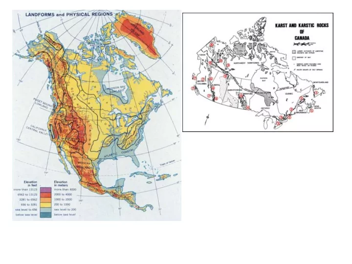
SLIDE 2 The Laurentide Continental Icesheet covered the lowlands, Franklins and eastern edge of the Mackenzie Mtns several times. The western Mackenzies were filled by valley glaciers. A narrow ice- free corridor survived between. There are no glaciers today but the region is cold – see the climate statistics for Ft Norman (Tulita) and Norman Wells (next frame). Frozen ground phenomena are seen
- everywhere. The karsts range from 220 m
to 1900 m asl, straddling a range of permafrost conditions as shown on the right.
SLIDE 3
Karst around Norman Wells.
There are at least 14 geographically distinct areas of karst around Norman Wells. Bob van Everdingen (1981) studied six of them in and east of the Franklin Mountains in varying detail. Jim Hamilton (1995) studied five to the west, following a 1981 reconnaissance by Ford.
26
SLIDE 4 The youngest rocks are unconsolidated deposits
- f gravels, sands, silts and clays laid down by
glaciers, rivers and past lakes during and after the last Quaternary ice age. The Tertiary, Cretaceous and Upper Devonian strata are all consolidated clastic (fragmental) rocks such as sandstones, siltstones and shales (clay rocks) that are insoluble and so will not develop karst features. They re also mechanically weak in most places and so do not support big cliffs. The karst develops in strata of Cambrian to Middle Devonian age. At base, the Saline River Fm is a mixture of salt, anhydrite and red beds (clays). Salt is the most soluble karst rock and so can be attacked by groundwater even deep beneath the surface, generating collapse of overlying rocks upwards. The redbeds are very prominent at the head of Dodo Canyon (above). The Franklin Mountain and Mt. Kindle Fms are varied dolomites separated by an erosion surface displaying paleokarst (e.g. in Dodo Canyon). The Bear Rock Fm consists of interbedded anhydrite and dolomite and minor limestone in deep wells but is always a breccia variably cemented by calcite when seen in outcrop. The Hume Fm is a limestone, often brecciated at the base by collapse into Bear Rock karst. Ramparts Fm is a thinner, less pure limestone, separated from the Hume Fm by the Hare Indian Fm, shaly rocks (insoluble) with minor limestone; it blocks any extension of karst groundwater circulation from the Ramparts to the Hume and vice versa. 29
SLIDE 5
30 Dolomites are the least soluble of the standard karst rocks. Karst landforms and ground water flow are surprisingly well developed in them in this region, especially given the permafrost climate: e.g. superior to those on the famed Niagara dolomites of Ontario. Above - The top of the Mt Kindle dolomite at Dodo Canyon. Below – the contact between the Franklin Mountain dolomite (orange) and the Mt Kindle (grey) dolomite in Dodo Canyon. Both formations are ‘cyclic’ – contain sequences of thicker and thinner beds, the thicker being stronger. East of Norman Wells the Franklin Fm is divided into three ‘members’ – the lowest member (Of2) is impure, the top member (Of4) has prominent nodules of chert (flint – insoluble)
SLIDE 6 31 The Bear Rock Formation is one
- f the two most remarkable
solution breccias I have seen (the
- ther is in Belize). Deep beneath
Norman Wells cores reveal that it consists of sequences of beds of dolomite and gypsum. Nearer the surface the much more soluble gypsum is progressively dissolved, collapsing the dolomite above into broken fragments, termed ‘breccia’. The breccia is now re-cemented by calcite precipitated from the circulating ground waters. The strength of cementation varies considerably, so the Formation displays very variable responses to solution and other erosion processes. Locally, a layer a few metres thick is particularly strongly cemented – the ‘Landry Member’ seen in the lower photo here.
SLIDE 7
Above – the contact between the Mt Kindle dolomite and Bear Rock breccia is usually sharp. Below- details of the Bear Rock breccia, a very remarkable formation. 32
SLIDE 8
Above – the rugged, chaotic karst topography on the Bear Rock breccia in the foreground contrasts with the regular cliff line of the Hume limestone formation seen behind it. Bear Rock itself is in the far background. Right – the Hume Formation is a more conventional, regularly bedded platformal limestone that takes good glacial scour and polish. 33
SLIDE 9 34 In some parts of the study region the sedimentary strata remain horizontal and little disturbed although they have been uplifted thousands of metres from their burial positions. But in the Canyon Ranges and the Norman Range they display tilting
- r anticlinal and synclinal folding (above).
Most important is the overthrusting (above right) by force from the west. On right the surface fault traces of the many thrusts. Thrusting is usually accompanied by some folding of the displaced strata.
SLIDE 10
The Hare Indian eastern plateaus (the Mahony Lake and Tunago Lake ‘domes’) 70
SLIDE 11
71 In his 1981 report R. van Everdingen adopted
the names, Mahony and Tunago Lake ‘domes’ for two shallow plateaus east of the Norman Range. The sketch map on right shows their locations. The two separate features have been created by the deep entrenchment of the Hare Indian River Valley, a major glacial spillway. Geologically, the region lies east of the zone of intensive thrust faulting and folding that created the Franklin Mountains. As shown in the section below (from Van Everdingen) the bedrocks are the Franklin Mtn dolomites, underlain by the Saline River Fm and with some Mt Kindle Fm dolomite possibly preserved on top in down-dropped areas.
SLIDE 12
This very shallow depression east of Bracket Lake drains underground into the small sinkhole seen as a separate small pond on the right. 51
SLIDE 13
In the southeastern foothills of the Range a closed depression occupied by Yakeleva Lake is a fine example of a turlough at a young stage of development such that it retains a (probably) permanent, shallow lake. All drainage is into the sinkhole seen in the upper right quarter of the photo. The feature is in the Of4 cherty Franklin dolomites. 47
SLIDE 14 Yakeleva Turlough is located at 65 10.185 N, 125 42.486 W. Elevation = 1400’ asl. The feature is in the Of4 cherty dolomites. The floor is of flood clays on glacial till. Most erratics noted were small, angular clasts of Hume-type limestone. There were very few true, well-rounded erratics from further away (i.e. from the Shield around Great Bear Lake). The sinking stream was flowing at 1-2 l/s during
- ur visit. Water temperature was 21 C, SpC = 198.
Karst processes are very active in the channel, as shown by fresh collapses 1-2 m in diameter along it.
48
SLIDE 15
77
Ground Stop #2, Mahony Dome. R. van Everdingen’s Sinkhole #142. Location – N 66 00.86’, W 125 52.86’. Elevation at lowest sinkpoint ~300 m asl. The feature is ~3 km in length, 1.5 km maximum width. It is clear that it has a few permanent ponds and an extensive area subject to frequent flooding. Van Everdingen showed that flooding occurred in the Spring thaw and lasted for a few weeks most years. It is the finest example of a mature turlough I have seen in the entire region.
SLIDE 16 79
Aerial views of the downstream
- sinks. There is a main stream into
bedrock at left centre in the upper photo, with an overspill pond on the right that drains to a separate sinkhole. The lower photo shows both sinks and a small permanent pond that is perched on two metres of till above them.
SLIDE 17 82
Turlough # 142, looking upstream from the main sink. This feature floods to the forest trim line in most years. Van Everdingen recorded flooding from mid-May to mid-July in
- 1977. The maximum volume of water sinking (all sinks combined) was estimated at about
three cubic metres per second. #142 is recommended for protection as an outstanding example of a mature turlough.
SLIDE 18 84
Two more overviews of Turlough #110. Above – shallow sinkholes in the central sector of the depression; the forest is encroaching on ground that rarely floods
- today. Right – overhead view of a
cluster of sinks in the north.
SLIDE 19
87
Aerial view of a major upstream (SE) sinkhole where Ground Stop 3(1) was made in 2007. The sink is in the cherty member of the Franklin Mountain Fm. A dry stream channel is seen at bottom right. Location is N 65 51.07’, W 125 23.27’. Elevation is 370 m above sea level.
SLIDE 20 89
There was no water flowing into this sinkhole during
- ur visit on July 31 2007 but the dry channel entering
it from the southern end has a bedload of pebbles, cobblestone-sized boulders and larger, all ‘imbricated’ (wedged together and tipped upwards in the downstream direction) that indicates a flood flow of more than one cubic metre per second.
SLIDE 21
95
The southerly large sinkhole at Ground Stop 3(2). It is about ten metres deep. Dissolution first segregates large blocks along vertical joint faces. The blocks then topple into the sink and disintegrate along bedding planes.
SLIDE 22
97
The northerly large sinkhole at Ground Stop 3(2) is a dramatically narrow shaft that appears to be younger than the others but is now evolving rapidly.
SLIDE 23
100
A second aerial view of the Disappearing River, looking northeast. The overspill Sink, 86A, is in the foreground. The River sinks at the NE end of the central sink and there is a smaller collapse sink behind it along the same joint fracture trend. Beyond it is a permanent pond. Muskeg in the foreground and rear appears to be suffering some desiccation, probably due to the development of karst drainage.
SLIDE 24 99
Ground Stop #4 – “The Disappearing River” of van Everdingen (1981). The location is N 65 58.76’, W 125 35.64’. Elevation of the rim of the sinkhole is 332 metres above sea level. The river sinks into van Everdingen’s Sink 86B, with
- ccasional overspill via a meandering channel into Sink 86A in the foreground.
SLIDE 25
102
The principal sinkhole, #86B, is approximately 100 m in length, 40 m wide and 25-30 m deep from the rim to the water sink. Entering it, the River first drops down a small waterfall (above) and then builds a detrital fan (right) out into the depression.
SLIDE 26
SLIDE 27
104
The Hare Indian River Valley
The valley is a glacial spillway formed by melt waters pouring out of the Laurentide continental ice sheet over Smith Arm. In its eastern parts the valley is a straight-walled entrenchment into the dolomites, 120-150 m deep and 1200-1500 m wide. Its nearly flat floor is an infilling of glacial and proglacial sediments. In the eastern sector these pond up a series of elongated, shallow lakes, shown above looking east towards Smith Arm, Great Bear Lake.
SLIDE 28
106
Van Everdingen (1981) mapped three groups of springs in the Valley. The central group (Nos. 143-5) were the largest and are shown above emerging from the southern wall. Ground Stop #5 was made on the principal stream (on right, #144, viewed upstream and downstream). The Volume of flow on 31 July 2007 was ~1.0 - 1.5 cubic metres per second (or 100-150 times greater than the flow in the Disappearing River that day). Water temperature was 4.1 C. The specific conductivity was 390 microsiemens, suggesting a dissolved load of dolomite of about 150 mg/l.
Location of spring #144 was N 66 0.86’, W 125 26.98’. Elevation was 165 m above sea level.
SLIDE 29
109 Karst features on the Tunago Lake Dome
A view northwest across the Dome, with Tunago Lake in the background.
SLIDE 30
111
On the Tunago Lake dome there are patches of rectilinear corridor terrain reminiscent of the Nahanni karst but much shallower. This suggests that, in contrast to the Mahony Lake dome, this area experienced sub-glacial mega-flood erosion which disrupted the earlier patterns of karst drainage. The deeper sinkholes are scattered widely apart, draining into local cliffs, as seen in these pictures and the upper one on page 110.
SLIDE 31
Lac Belot and its underground river, Lac Belot Ridge, Tunago Ridge and the Belot Karst. 113
Lac Belot Ridge, looking south. The southern end of Lac Belot is seen to the left.
SLIDE 32
116
Above – another view of Lac Belot, seen from above the Ridge. Right – the bathymetry of the lake. It has an area of 300+ km square kms and is estimated to store nearly five billion cubic metres of water. The arrow indicates where, according to the Neyadalin map on page 115, the outflow passes underground via a sinkhole. The water will pass beneath the Ridge or perhaps flow along it underground for some distance.
SLIDE 33
115
The legend of Neyadalin, the underground river. From the Report of the Sahtu Heritage Places and Sites Joint Working Group, pages 56 -7.
SLIDE 34
36 Area A
This Google Earth image shows the Norman Range between Norman Wells and Kelly Lake (to North), extending down to Bear Rock and the mouth of the Great Bear River (southeast). The circular lake on the eastern boundary is Bracket Lake.
SLIDE 35 The differing erodibility of these formations, plus multiple overthrusts, has created lesser escarpments on both the main scarp and dip slopes.
- Above. The eastern, scarp face
- f the Norman Range viewed
from NE across Kelly Lake.
- Right. A view down the dip slope
towards the Mackenzie River on an afternoon when the air is thick with smoke from forest fires.
The Norman Range is formed by an eastwards overthrusting of the carbonate rocks, chiefly the Franklin Mountain
- dolomites. Overall, this creates an
escarpment landform with a steep ‘scarp’ face on the east side and a longer, gentler ‘dip’ slope on the west side. Bear Rock, Hume, Hare Indian and Ramparts strata outcrop on the dip slope. The Mt Kindle dolomites are absent in the Range.
37
SLIDE 36 Effects of glacial scour of the rocks are best seen along the crest of the Range, shown here. Strata are the Franklin Mountain dolomites All parts of the Norman Range were overriden by glacier ice
- f the Laurentide Continental
Ice Sheet flowing from the east and northeast. 38
SLIDE 37
Karst landforms on the strongly ice-scoured upper slopes are composite features, topographically closed depressions created partly by water sinking underground and dissolving the rock along its course, and partly by basal glacier scour. Such ‘glaciokarstic’ landforms pose a chicken and egg problem. Do glaciers enlarge earlier sinkholes, or do groundwaters adapt prior ice scour depressions? Shown above are two superb examples that may overflow seasonally but are drained perenially down dip into bedding plane micro-caves in the rock.
40
SLIDE 38
The scarp face depression (above) is developed on a thrust plane in the Franklin Mountain dolomites. The dip slope feature (right) is at the contact between Hume limestone (cliffs to the left) and Bear Rock breccia (eroding slopes on the right). Lower down on both scarp and dip slopes ice scour was often less intensive. Larger closed depressions that are now drained karstically are common. 41
SLIDE 39
68
Bear Rock towers over voyagers on the Mackenzie River. The tributary flow from Great Bear River is easily distinguished at the foot of the Rock.
SLIDE 40 5 7
In contrast to the main sector of the Range to the north, in the southern Franklins and Bear Rock itself the Bear Rock Fm (Db) and overlying Hume limestone (Dh) are preserved at the crest line on top of the Franklin Mtn Fm (COf). This forms a series
- f east-facing, dissected scarplands at lower elevations than in the main Range. This
scene is north of Bear Rock, which is in the background left.
SLIDE 41
62
In the pinnacle country of northern Bear Rock Right – a ridge descending towards the River. Below – steep dry valleys with fragile pinnacles that somehow endure, and many caves that quickly become impassably small.
SLIDE 42
63
Striking solifluction features such as stone stripes and lobate flows in the talus below a pinnacle ridge on northern Bear Rock.
SLIDE 43
65
The crest of southern Bear Rock. Above – the Long Lake karst depression with the River and Mackay Range behind Right – Long Lake in rear with Round Lake in the foreground. The two lakes are aligned along a depression scoured in the crest of an anticline with Franklin Mtn dolomite in the floor and Db breccia forming the cliffs.
SLIDE 44
67
The Bear Rock Springs Area is the prominent tree-less apron seen above. Ground water emerges at many different points (detail on right). Jim Hamilton estimated summer discharge at around 20 litres/second. T =3.7 C. SpC~1400.Total dissolved solids ~1000 mg/l, indicating that there is much dissolved gypsum in the water. There is some discharge throughout the winter.
SLIDE 45
54 Vermillion Creek Collapse Sinkhole
Photo by R. van Everdingen.
SLIDE 46 55
Vermillion Creek Sinkhole is located at 65 08.217 N, 126 05.5 W. Its rim is at an elevation of approximately 270 m (900 feet) above sea level. It measures 120 x 60 m in plan view and is about 40 m deep to the waterline. The top of the collapse is through shales and shaly limestones of the Canol Fm, with limestones of the upper Ramparts Fm probably being seen in the lower half of the
- cliffs. This collapse will have been triggered by dissolution of gypsum in the Bear Rock
Fm below, or by dissolution of salt in the Saline River Fm, or by both. The world’s shapeliest karst collapse sinkholes are either cylindrical, or elongated along a vertical fracture to create an ellipse such as is seen here. The walls are vertical. Vermillion Creek Sinkhole is the finest example of a fresh collapse that I have seen anywhere in Canada or the United States. It is strongly recommended for protection.
SLIDE 47
BR MR RC BL MP PA CC PL DP GF
PA = Plains of Abraham; MP = Moraine Polje; BL = Bonus Lake; PL = Pyramid Lake; DP = Dodo Pavements; GF = Great Fan; CC = Carcajou Canyon; RC = Ration Creek Sinkhole; MR = Mackay Range; BR = Bear Rock
Norman Range
121
SLIDE 48
SLIDE 49 124
Looking down into the central closed depression from a point on the southeastern ridge. The depression was created by dissolution of Bear Rock breccia, and possibly by underlying solution of salt in the Saline River Fm as suggested by Hamilton. It and all
- ther interior areas of the Range are drained karstically to small springs around the
perimeter of the Range.
SLIDE 50
128
Above – very steeply dipping Bear Rock strata along part of the east face produce these beautiful talus fans with torrential debris flow channels in some of them. Below – accumulation of ground ice in the base of this fan has converted it into a rock glacier.
SLIDE 51
131
Ration Creek Sinkhole
West of the Mackay Range a shallow ridge of steeply dipping Bear Rock and Hume strata rises above the general level of the Mackenzie Valley. It is well rounded by glacial action. A large
SLIDE 52
133
Three further perspectives flying around the sinkhole. We have not visited it on the ground. A small stream flows in at the east end and two possible sink points are seen towards the west end. The ground water probably drains to the Little Bear River valley, which is two km to the west at 360 m asl. In the past geologists have suggested that the collapse was caused by dissolution of the Saline River salt far below but it is considered as likely to be due to the local stream dissolving the Breccia.
SLIDE 53
134
Ration Creek Sinkhole is one of the finest examples known in Canada and offers an excellent morphological contrast to Vermillion Creek Sinkhole. Recommendation - that Ration Creek be considered for protection with Vermillion Creek as a truly spectacular pair of karst depressions.
SLIDE 54
SLIDE 55
160
The Plains of Abraham
The Plains of Abraham are an extensive plateau in the central unglaciated zone, formed of horizontally bedded dolomites of the Mt Kindle and Franklin formations. Elevations are generally between 1500 -1700 m asl, placing the Plains in the arctic tundra biozone. In this view we are approaching them from the south, with Carcajou River at their foot 500 m below them.
SLIDE 56 162
Varieties of patterned ground above an elevation of 1600 m where growth
- f grasses is very limited.
SLIDE 57
163
A superb display of stone stripes
SLIDE 58 167
This is the finest steephead I have seen in any alpine or periglacial region. Water seeps out along the foot of the arcuate cliff in massive, resistant dolomite, sapping it back by a combination of solution and frost
- shattering. The water surfaces from
springs at the base of the talus below, creating an oasis. The Canol Road passes by the crest.
SLIDE 59 168
The oasis is at N 64 33.7’, W 127 18.6’. Its floor is at an elevation of 1450 m. On right – a line of tiny caves can be seen in the prominent bedding plane at the base of the massive dolomite bed. These caves are now abandoned as the groundwater has moved down to another exit plane masked by the top
SLIDE 60
SLIDE 61
146 (B) Moraine Polje
An astonishing feature! – in its furthest incursion into the Keele River valley the Laurentide Glacier front reached the position between the arrows in the rear of the picture and built a terminal moraine there. This blocked surface stream flow out of the valley in the foreground, which has never been glaciated. The valley became partly filled with alluvial debris and the water developed an underground karst exit through the
SLIDE 62
148
Topographic map of the Moraine Polje basin. The grid has one km squares. Contour interval is 20 m. Red = topographic watershed. Yellow = the alluvial floor (infilling). Brown quadrangle = approximate extent of the moraine dam. Northern blue arrow = stream sink. Southern blue arrow = the spring. The area of the basin is ~90 square km.
SLIDE 63
150
Left – the stream sink of Moraine Polje viewed from the crest of the moraine in 1983. Below – viewed in 2007. The sink point and the shallow ponds on the alluvium have been very stable over this time period. The polje has developed in a steep, V-form syncline (downfold). Curiously, the stream has sunk into the rock north of the alluvial flat in the pictures instead of into the same strata on the south side (shown by horizontal arrow), which are much closer to the spring outlet.
SLIDE 64 152
The stream sinks into a cave of enterable dimensions. Top left – the author injecting fluorescein tracer dye
- n the first visit, August 1983. The
water had warmed in the shallow approach channels and was a pleasant 14 C. Top right – the entrance in August 2007. There has been one fall of roof rock in the centre of the entrance arch; otherwise the scene is unchanged from 1983.
SLIDE 65 153
From the entrance the cave opens up into a substantial chamber formed by rockfall (‘breakdown chamber’) and plunges down a small waterfall. Beyond it is the wet and constricted passage shown above. This may be explorable in winter when there is no water flow but I do not believe that it will be enjoyable! The cave is a very raw, young feature formed as a consequence of the Moraine
- blockage. There are no sediments or
speleothems of interest, and no faunal remains were seen.
SLIDE 66 154
The spring is a truly astonishing feature, appearing as if a giant fist had punched
- ut from inside the rock to release the pent-up water.
SLIDE 67
169 The Pyramid Lake Polje
Pyramid Lake is located at N 64 42’, W 127 15’. The lake surface is at 786+/- m above sea level, fluctuating a little seasonally. It occupies an alluvial lowland, is drained underground karstically, and thus functions as a karst polje. This view looks south across it towards the Plains of Abraham. The Canol Road is at the foot of the hills behind the lake.
SLIDE 68 170
Above – Jim Hamilton’s map of Pyramid Lake
- Polje. It has a catchment basin area of 34.4 sq
- kms. Water sinks in the Blue Creek channel bed
upstream of the lake, where it was dye traced to ‘Horseshoe Springs’ (unofficial name) with a flow time of four days or ~1500+ m/day. The underground flow broadly follows a synclinal downfold in Franklin Mountain dolomites, i.e. this is a polje determined chiefly by geological structure.
SLIDE 69
176
The middle section of Dodo Dry Canyon shown looking upstream (south) on left and downstream above. An outstanding feature of the canyon is the manner in which great aprons and fans of dolomite talus sweep in from either side.
SLIDE 70 177
A further feature of the middle canyon is the apparent
- ccurrence of paleokarst depressions and deposits
in the cliffs. After deposition of the Franklin Mountain dolomite there was a long period of surficial erosion before deposition of the Mt Kindle dolomites
- began. Karst sinkholes formed and filled with
terrestrial sediments, the buff, orange and yellow patches shown in these photographs.
SLIDE 71
178
The climax of Dodo Dry Canyon is the northern (downstream) end where it is more than 350 metres deep. The lake is at N 64 49’, W 127 14’, at 600 m asl. Dodo Creek at the head of its canyon is in the background.
SLIDE 72
180 Dodo Creek Canyon
Dodo Creek has entrenched its course across the flank of a major anticline (upfold) in the strata. As a consequence it first passes down through progressively older rocks to the crest of the anticline and then back up through them to its mouth. It is a very colourful journey, as this picture from the southern (upstream) end suggests.
SLIDE 73
183
The start of the lower canyon where strata dip in the downstream direction and the cliffs become higher.Here the top of the redbeds is beautifully exposed. Note that one block has settled below the others, probably due to salt dissolution below. Inset – the ruins of a Canol camp glimpsed in the main picture.
SLIDE 74
184
A further scene in the redbeds sector of Dodo Canyon. Another differentially settled block is seen where a tributary stream enters.
SLIDE 75
186
This is one of the finest scenes in Dodo Canyon. The orange Franklin Mountain dolomites dip into the canyon floor and the more massive, dark grey and steeper cliffs of the Mt Kindle Formation appear behind them. This is the deepest part of the canyon, the walls being more than 400 m in height.
SLIDE 76
187
In Dodo Canyon the Franklin Mountain dolomites display some attractive pinnacles and bright reddish orange patches of paleokarst sinkhole fillings.
SLIDE 77
188
Upper left – the Franklin Mtn dolomites pass below the Canyon floor. Upper right – the Mt Kindle dolomites have also dipped below the floor and a prominent ‘gatepost’ marks entry into Bear Rock breccia sector of the Canyon. Lower right- a surviving remnant of the Canol Road her
SLIDE 78
191 The Dodo West Karst Pavements
These two pictures both show the upper beds of the resistant Mt Kindle dolomites. On left – on the never-glaciated Plains of Abraham, where periglacial frost shatter processes predominate. On right – on Dodo West where the last Laurentide glacier scoured all loose debris away, exposing fresh bedrock to karst solutional attack.
SLIDE 79
193
The Mt Kindle dolomites were ‘cyclic’ deposits of thick and strong beds, succeeded by weak thin beds like meat in a sandwich (above). Glacier ice bulldozed the rock away along the weaker beds, creating a staircase-like topography (upper right). Each strong bed surface that was exposed tends to have slightly different properties with the consequence that the detailed solutional landforms (karren) are never quite alike on any two beds.
SLIDE 80
198
Looking North across the pavements with the Breccia karst beyond and the confluence of Dodo Creek and Carcajou River in the background. The West Dodo dolomite karst pavements are amongst the finest known anywhere in the arctic regions.
SLIDE 81
199 The Dodo Breccia Drape Karst
Between Dodo Canyon and Carcajou Canyon the Bear Rock Breccia is dissected by karst processes into a fantastical landscape unknown in any other part of the world. It was its dramatic appearance on air photos that first drew the author to reconnoitre the regional geomorphology in 1983. Meltwaters from the Laurentide Ice Sheet and then thousands of years of rain and snow melt have scoured corridors and sinkholes into the Breccia, destroying its softer parts and leaving more resistant, hardened surface crusts such as the Landry Member draped on ridges and sliding into the solutional depressions, as shown here.
SLIDE 82
202
Further scenes in the upper belts. Lower photos show an example of hardened breccia crust tipped on end and sliding downslope, and some of the superb patterned ground, both evidences of the vigour of periglacial processes on the Breccia.
SLIDE 83
203
This aerial photograph of a very beautiful sinkhole with its pond perched on permafrost but leaking slowly into the groundwater aquifer underneath has delighted fellow geomorphologists worldwide when they have seen it. It is an ideal example of periglacial karst.
SLIDE 84 206
A general view from east to west along the ‘Carcadodo Valley’. The aircraft is over the steep drop off into Carcajou Canyon. This was an important section of The Great Spillway at the end
- f the last glaciation, when meltwater flowed along it from east to west. Today its stream is fed
by springs from the Drape Karst belts (on left) and flows from west to east until sinking again in left centre.
SLIDE 85 208
Above – the Carcadodo stream flowing east to its sinkpoint (arrow); July 2007. In rear, the Carcajou River flows from the mouth of its
- canyon. On right – a detail from the 1989 field
study season; the sinkhole ponds were very similar in extent to 2007.
SLIDE 86 210
Three views of springs at the mouth of Carcajou Canyon. Above left – the arrow shows the stream sink in Carcadodo Valley. The springs are in the foreground. Above right – the flow from the springs is bright but peaty, readily distinguished from the turbid, silty water of Carcajou River. Below – measuring temperature and conductivity in the springs. They were at 10.7 C and carrying about 4000 mg/l
- f salt, plus dissolved dolomite and
gypsum.
SLIDE 87 Above – Jim Hamilton’s model for the chemistry of karst groundwaters in the
- Breccia. Type (1), intrapermafrost, water is
dissolving chiefly gypsum. Type (2) water reaches the base of the permafrost and dissolves both gypsum and dolomite. It takes 40 – 50 days to travel to the springs in Carcadodo Valley. Type (3) water is warmed by long distance, deep flow into the salt of the Saline River Formation. On right – salt-tolerant lichens and slimes in a young salt spring.
211
SLIDE 88
Nahanni National Park Reserve was established by Prime Minister P.-E. Trudeau in 1971 to protect three river canyons and a great waterfall from proposed hydro-electric dams. That year I was asked to evaluate newly discovered caves in the downstream (First) canyon and enlarged the task to study the geology, geomorphology and hydrology of the Reserve, and explore a major karst area to the north of it. My reports (1974, 1975) provided the basis for the Reserve being one of the first two UNESCO World Heritage natural sites to be declared, in 1978 (Yellowstone National Park in the United States was the other). It was always the intention to enlarge the Park but many political problems have arisen. In June 2009 an incomplete enlargement was announced.
SLIDE 89
SLIDE 90
SLIDE 91
We cannot get into the modern underground river caves but there are plenty of relict ones high and dry in the canyon walls
SLIDE 92
Grotte Valerie, overlooking First Canyon, is the finest
SLIDE 93
Brightly coloured speleothems in the warm cave The cave has three climatic zones – warm, cold and permafrozen
SLIDE 94
In the largest chamber
SLIDE 95
In ‘the cold cave’ – 300 m of skating
SLIDE 96
Hexagonal crystals of hoarfrost in a recess
SLIDE 97
Looking down into ‘the permafrozen cave’
SLIDE 98
The cold cave is an ossuary
SLIDE 99
Twenty-two hundred years old
SLIDE 100
Grotte Valerie, Nahanni; Lat 63 N
Karst Record 6 conference, June 2011
SLIDE 101 120+/-0.6 ka BP
- 356+/-6
- 596+/-12
- 620+/-15
650+/-15
2011 - Bristol Th/U and U/Pb ages
1694 - Valvasor
SLIDE 102
North of Death Lake lies the spectacular Labyrinth Karst, draining via Bubbling Springs into the Ram River basin. To incorporate all of the karst in an expanded Nahanni National Park it is necessary to include the Ram basin to the mouth of Ram Canyon in Ram Plateau.
SLIDE 103
Death Lake Canal Canyon Karst features extend far to the north of the topographic divide on the east flank of First Canyon. Major stream sinks at Death Lake and Canal Canyon have been dye-traced to White Spray Springs in the bottom of First Canyon, >460 m below the stratigraphic top of the dolomites.
The geomorphic case for extending the Park into the Ram River basin
SLIDE 104
SLIDE 105
Third Polje is seen dry on the occasion of my first visit, in June 1972.
There are three small but perfectly formed karst poljes. Some historic pictures.
The high water dissolution notch seen in a cliff on the right bank that day. Third Polje fully flooded after eight days of rain in July 1972 that also filled the other poljes and Raven Lake.
SLIDE 106
‘Bubbling Springs’ (~10 cumecs) are the northern drain of the main karst belt. They are also perennial.
SLIDE 107
Global warming is melting permafrost rapidly in northern Canada. I have noted a big increase between 1971-78 and 2006 -10 in Nahanni.
SLIDE 108
SLIDE 109
Left – Second Polje in August 2007 Right – the same scene in September 2009 after a landslide in glacial silts due to permafrost melting
SLIDE 110
SLIDE 111
SLIDE 112
The End