
SLIDE 1
The Fire and Invasive Annual Grass Assessment Tool (FIAT)
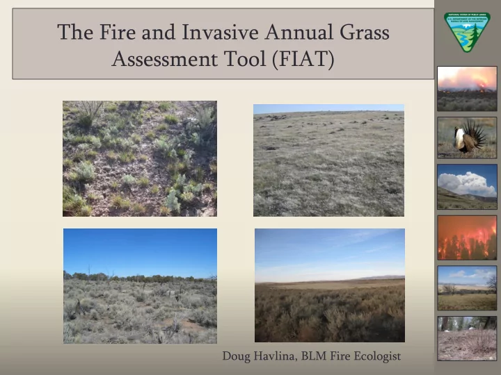
Doug Havlina, BLM Fire Ecologist
The Fire and Invasive Annual Grass Assessment Tool (FIAT) Doug - - PowerPoint PPT Presentation
The Fire and Invasive Annual Grass Assessment Tool (FIAT) Doug Havlina, BLM Fire Ecologist Topics to Cover Background and Development of FIAT FIAT Step 1: The regional context FIAT Step 2: Strategies within priority landscapes
Doug Havlina, BLM Fire Ecologist
Development Team
Mike Pellant* (lead) Dave Pyke* Jeanne Chambers* Jeremy Maestas* Chad Boyd* Lou Ballard Doug Havlina Tim Metzger Todd Hopkins Tom Rinkes Clint McCarthy Joe Tague Steve Knick Mina Wuenschel Mike Gregg * = member of WAFWA resistance and resilience team
Review Team
Laurie Kurth Chris Theisen Lauren Mermejo Glen Stein Jesse Delia Mike Ielimi Tate Fischer Krista Gollnick Waid Ken Collum Chuck Mark Dave Repass Peggy Olwell Don Major Don Kemner
(March 2013 - August 2014)
Priority Areas for Conservation (PACs) from 2013 Conservation Objectives Team (COT) report
(habitat indicator, correlation to persistence)
75% BBD areas in priority PACS with sagebrush
subsets of focal habitats in warm/dry moisture regimes with sagebrush landscape cover greater than 25%
Areas within or near conifer expansion in areas with > 25% sagebrush landscape cover
subsets of focal habitats in the 75% BBD areas
Percent of Breeding Bird Density (75%) Area within PAC 4 Northern Great Basin 13045515 7383442 57% 179551 (2%) 674554 (9%) 1745163 (24%) 3 Southern Great Basin 9461355 3146056 33% 42596 (1%) 792780 (25%) 1062091 (34%) 4 Snake, Salmon, and Beaverhead 5477014 2823205 52% 68107 (2%) 89146 (3%) 95970 (3%) 5 Western Great Basin 3177253 2084626 66% 149399 (7%) 140141 (7%) 202767 (10%) 5 Warm Springs Valley NV/Western Great Basin 3520937 1558166 44% 31458 (2%) 207365 (13%) 741353 (48%) 4 SW Montana 1369076 659475 48% 0 (0%) 0 (0%) 0 (0%) 4 Northern Great Basin/Western Great Basin 1065124 624581 59% 114222 (18%) 85258 (14%) 116513 (19%) 5 Central OR 813699 451755 56% 0 (0%) 6211 (1%) 16463 (4%) 3 Panguitch/Bald Hills 1135785 352258 31% 6883 (2%) 5821 (2%) 0 (0%) 3 Parker Mountain-Emery 1122491 308845 28% 0 (0%) 127 (0%) 0 (0%) 4 Box Elder 1519454 292658 19% 22 (0%) 43325 (15%) 23913 (8%) 4 Baker OR 336540 184813 55% 0 (0%) 46459 (25%) 36214 (20%) 3 NW-Interior NV 371557 108256 29% 576 (1%) 17117 (16%) 25173 (23%) 3 Carbon 355723 97734 27% 255 (0%) 180 (0%) 0 (0%) 3 Strawberry 323219 52635 16% 0 (0%) 0 (0%) 0 (0%) 3 Rich-Morgan-Summit 217033 37005 17% 0 (0%) 0 (0%) 0 (0%) 3 Hamlin Valley 341270 3244 1% 0 (0%) 139 (4%) 3105 (96%) 3 Ibapah 98574 0% 0 (NA) 0 (NA) 0 (NA) 3 Sheeprock Mountains 611374 0% 0 (NA) 0 (NA) 0 (NA) 5 Klamath OR/CA 162667 0% 0 (NA) 0 (NA) 0 (NA) * Numbers in parenthesis indicate the percent of acres relative to total acres of breeding bird density (75%) Sage-grouse Management Zone Sage-grouse Priority Area for Conservation (PAC) Name Total PAC Acres Breeding Bird Density (75%) Acres Warm and Dry Soil Moisture & Temperature Regime within Breeding Bird Density (75%) Acres* 0-25% Sagebrush Landscape Cover 25%-65% Sagebrush Landscape Cover 65%+ Sagebrush Landscape Cover
4 Northern Great Basin 13045515 7383442 57% 95714 (1%) 247250 (3%) 272079 (4%) 3 Southern Great Basin 9461355 3146056 33% 23982 (1%) 229389 (7%) 92756 (3%) 4 Snake, Salmon, and Beaverhead 5477014 2823205 52% 970 (0%) 18367 (1%) 92251 (3%) 5 Western Great Basin 3177253 2084626 66% 57918 (3%) 106130 (5%) 67858 (3%) 5 Warm Springs Valley NV/Western Great Basin 3520937 1558166 44% 9984 (1%) 46846 (3%) 104168 (7%) 4 SW Montana 1369076 659475 48% 90 (0%) 8182 (1%) 21224 (3%) 4 Northern Great Basin/Western Great Basin 1065124 624581 59% 9436 (2%) 1869 (0%) 3587 (1%) 5 Central OR 813699 451755 56% 339 (0%) 27260 (6%) 31765 (7%) 3 Panguitch/Bald Hills 1135785 352258 31% 28515 (8%) 22118 (6%) 0 (0%) 3 Parker Mountain-Emery 1122491 308845 28% 6967 (2%) 15052 (5%) 5980 (2%) 4 Box Elder 1519454 292658 19% 2415 (1%) 22184 (8%) 20316 (7%) 4 Baker OR 336540 184813 55% 1 (0%) 7484 (4%) 195 (0%) 3 NW-Interior NV 371557 108256 29% 4320 (4%) 5718 (5%) 653 (1%) 3 Carbon 355723 97734 27% 3364 (3%) 15832 (16%) 0 (0%) 3 Strawberry 323219 52635 16% 236 (0%) 1007 (2%) 0 (0%) 3 Rich-Morgan-Summit 217033 37005 17% 3913 (11%) 2628 (7%) 0 (0%) 3 Hamlin Valley 341270 3244 1% 0 (0%) 16 (0%) 520 (16%) 3 Ibapah 98574 0% 0 (NA) 0 (NA) 0 (NA) 5 Klamath OR/CA 162667 0% 0 (NA) 0 (NA) 0 (NA) 3 Sheeprock Mountains 611374 0% 0 (NA) 0 (NA) 0 (NA) * Numbers in parenthesis indicate the percent of acres relative to total acres of breeding bird density (75%) Conifer Expansion (Modeled) Acres within Breeding Bird Density (75%) Areas* 0-25% Sagebrush Landscape Cover 25%-65% Sagebrush Landscape Cover 65%+ Sagebrush Landscape Cover Sage-grouse Management Zone Sage-grouse Priority Area for Conservation (PAC) Name Total PAC Acres Breeding Bird Density (75%) Acres Percent Breeding Bird Density (75%) Acres
FIAT Assessment Areas:
Great Basin (7.3 M acres)
(Sept. 2014 – March 2015)
Fuels Management
Habitat Recovery/Restoration
Fire Operations
Post-fire Rehabilitation
(OR/WA Fire Ecologist)
(ID Forestry Lead) (2) Snake/Salmon/Beaverhead
(NV Fuels Lead)
(Eagle Lake Field Office Manager)
wildfire, invasive annual grasses, and conifer expansion
potential treatments, and priority areas (fuels mgmt.,
habitat restoration, fire operations, post-fire rehabilitation)
where management should be applied
General Technical Report, and FIAT Report
Proportion of Landscape Dominated by Sagebrush Resilience to Disturbance & Resistance to Invasive Annual Grasses
Low
< 25% Sagebrush-Dominated Landscape
Medium
25-65% Sagebrush- Dominated Landscape
High
> 65% Sagebrush- Dominated Landscape
High
1A Natural sagebrush recovery possible. Sagebrush restoration potential is high 1B Natural sagebrush recovery is likely to occur, but certain areas may lack connectivity 1C Natural sagebrush recovery is likely to occur.
Moderate
2A Natural sagebrush recovery is possible, but time required for may be too great 2B Natural sagebrush recovery is likely to occur, but certain areas may lack connectivity 2C Natural sagebrush recovery is likely to occur
Low
3A Natural sagebrush recovery
3B Natural sagebrush recovery may occur, but time required will likely be too great 3C Natural sagebrush recovery may occur, but time required will likely be too great Perennial grasses and forbs sufficient to recover Annual invasive risk is low Restoration potential high Recovery from inappropriate grazing high Perennial grasses and forbs inadequate to recover Annual invasive risk is high Restoration potential low; needs multiple interventions Recovery from inappropriate grazing is low
Perennial grasses and forbs usually adequate for recovery Risk of annual invasives is moderately high on warmer and drier sites Seeding-transplanting success depends on site characteristics Recovery following inappropriate livestock use depends on site characteristics
(proactive strategies)
Southern Great Basin FIAT: 20 Project Planning Areas
Habitat restoration potential treatments identified using conifer expansion data and intersection with habitats and sagebrush cover
Identifying potential treatments for (1) conifer expansion and (2) invasive annual grasses
Post-Fire Fire Re Reha habilitatio ilitation Treatme tments nts