
SLIDE 1
1
THAILAND MINE ACTION CENTER THAILAND MINE ACTION CENTER
THAILAND MINE ACTION CENTER THAILAND MINE ACTION CENTER - - PDF document
THAILAND MINE ACTION CENTER THAILAND MINE ACTION CENTER
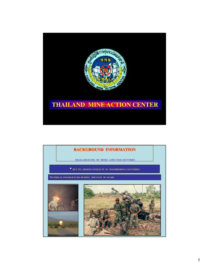
1
THAILAND MINE ACTION CENTER THAILAND MINE ACTION CENTER
2
!"#$% &" !'%()(* &!!#+!&!,&- (.+/"#0,&!#+#&" 1,
3
55.9 SQ.KM.
4
CLUTTER
UNEXPLODED ORDNANCE
ANTI-TANK MINE
ANTI-PERSONAL LANDMINE
& !2,#& "# 34
5
2,557 sq km LIS
Locating Minefield Procedure
Appx.500 sq km
Goal No mines
Mine Clearance
minefields in Thailand
6
Models Development for Locating Mine field procedure
(IMAS will strictly be followed)
Canceling Survey Areas that have been used over confident period of time
such as farm lands, recreation areas, etc. and no evidence
Models Development for Locating Mine field procedure
(IMAS will strictly be followed)
Canceling Survey Areas that have been used over confident period of time
such as farm lands, recreation areas, etc. and no evidence
Releasing Survey for low contaminated area where random check is made
by technical survey, area with negative result will be identified as safe areas
7
Models Development for Locating Mine field procedure
(IMAS will strictly be followed)
Canceling Survey Areas that have been used over confident period of time
such as farm lands, recreation areas, etc. and no evidence
Releasing Survey for low contaminated area where random check is made
by technical survey, area with negative result will be identified as safe areas
Boundary Survey for high contaminated area where majority of the area show
evidence of explosive hazard, will be marked and identified as mine fields
Method & Equipment that could be used together with Locating Minefield Procedure
Deploy de-miner and dog to make new border line of mine fields Install warning signs
Other appropriate Methods:
Machine or other methods will be used for assuring the safety of: Public land, recreation attraction, govt. area currently used
8
EOD Team clear Spot Tasks during Procedure
UXO around living area UXO left near farm land Public forest
Expected Outcome
clearance activities
practicable
9
DA DA-
436 DA DA-
436
10
AREA 10,274,540 SQ.M.
AREA 10,274,540 10,274,540 SQ.M.
REDUCED 8,664,580 8,664,580 SQ.M.
MF 1,609,960 1,609,960 SQ.M.
MF 436 MF 436 -
02
525,894 525,894 SQ.M.
SQ.M. MF 436 MF 436 -
01
1,084,066 SQ.M. 1,084,066 SQ.M.
11
12
13
14
AREA OPERATION : HMAU 1 - 4
PROVINCE PROVINCE
(AREA) (AREA)
AREA AREA SQ.KM SQ.KM . .
PERS PERS . .
SA KAEO (181) SA KAEO (181) KANCHANABU (17.9) KANCHANABU (17.9) RATCHABURI (318) RATCHABURI (318) PEETCHABURI (31.4) PEETCHABURI (31.4) PRACHUAP PRACHUAP KHIRIKHAN KHIRIKHAN (
(18.5)
18.5)
(875 (875 66 66
HMAU 1
15
PROVINCE PROVINCE
(AREA) (AREA)
AREA AREA SQ.KM SQ.KM . .
PERS PERS . .
CHANTHABURI CHANTHABURI (
(99.4
99.4)
)
TRAD (312.8) TRAD (312.8) 412.2 412.2 119 119
HMAU 2
16
PROVINCE PROVINCE
(AREA) (AREA)
AREA AREA SQ.KM SQ.KM . .
PERS PERS . .
BURIRAM (37.5) BURIRAM (37.5) SURIN (260.4) SURIN (260.4) SI SAKET (541.7) SI SAKET (541.7) UBON (510.9) UBON (510.9) NONG KHAI (.000073) NONG KHAI (.000073) NONG BUA LAMPHU NONG BUA LAMPHU (.000019) (.000019) UDONTANI (.000143) UDONTANI (.000143) *97: *97: *66 *66
HMAU 3
17
PROVINCE PROVINCE
(AREA) (AREA)
AREA AREA SQ.KM SQ.KM . .
PERS PERS . .
PHETCHABUN (49.5) PHETCHABUN (49.5) LOEI (15.4) LOEI (15.4) PHITSANULOK (40.3) PHITSANULOK (40.3) UTTARADIT (7.3) UTTARADIT (7.3) NAN (22.7) NAN (22.7) PHAYAO (26.3) PHAYAO (26.3) CHIANG LAI (38.5) CHIANG LAI (38.5) MAE HONG SON (103) MAE HONG SON (103) CHIANG MAI (132) CHIANG MAI (132) TAK (20.4) TAK (20.4) 520.8 520.8 129 129
HMAU 4
18
! "#$$% "#$$%
&'(
) #$$& #$$&* *+#$,% +#$,%
19
THAILAND MINE ACTION CENTER THAILAND MINE ACTION CENTER