
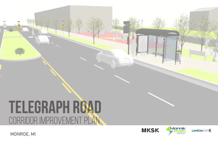
SLIDE 1
Telegraph Road
corridor improvement plan
MONROE, MI
Telegraph Road corridor improvement plan MONROE, MI agenda 1. - - PowerPoint PPT Presentation
Telegraph Road corridor improvement plan MONROE, MI agenda 1. Purpose of the Study 2. Summary of Major Findings 3. Recommended Corridor Improvements 4. Catalytic Sites 5. Implementation 6. Questions and Discussion 2 purpose of the study
MONROE, MI
2
for catalytic sites along the corridor
for all types of users
corridor
3
3
NORTH
4
Multi-Use Path - 10 feet Proposed Sidewalks - 6 feet Median Midblock Crossing with "Active" Device (i.e. Rapid Flashing Beacon) High Priority Sidewalk Neighborhood Connections - 5-6 feet Medium Priority Sidewalk Neighborhood Connections 5-6 feet Enhanced or New Crosswalk Proposed Bus Stop/Shelter
F R E N C H T O W N C H A R T E R T O W N S H I P M O N R O E C H A R T E R T O W N S H I P C I T Y O F M O N R O E
TELEGRAPH RD STEWART RD STEWART RD N CUSTER RD W ELM AVE W FRONT ST S CUSTER RD W 7 T H S T W 7 T H S T LASALLE RD M A L L R D E DUNBAR RD
WALMART AT MALL ROAD FORMER LA-Z-BOY HQ NORTEL LANES MILL RACE PARK BOWL-A-DROME 1200 TELEGRAPH ROAD
Former La-Z-Boy HQ
1 2 3 4 5 6 Nortel Lanes Proposed Access Road Noble Avenue Bowl-a-Drome 1200 Telegraph Rd Enhanced Pedestrian Crossing & Access Potential Realignment for a Crossing Midblock Crossing Midblock Crossing New Pedestrian Crossing
100’
RIGHT OF WAY64’
EDGE OF PAVEMENT17’
DRIVES15’
LAWNFormer La-Z-Boy HQ
64’
EDGE OF PAVEMENT
6’
SIDEWALK
10’
LAWN
10’
LAWN
10’
PATH
100’
RIGHT OF WAY
Hampton Plaza Redevelopment Former La-Z-Boy HQ Redevelopment
5
EXISTING CONDITIONS PROPOSED IMPROVEMENTS*
100’
RIGHT OF WAY63’
EDGE OF PAVEMENT11’
LAWN10’
LAWN5’
WALK5’
WALK2.5’
LAWN4’
LAWNNortel Lanes Parking Lot
100’
RIGHT OF WAY
63’
EDGE OF PAVEMENT
11’
LAWN
4’
LAWN
5’
WALK 2.5’ LAWN
10’
PATH
5’
LAWN
Nortel Lanes Redevelopment Strip Mall
6
EXISTING CONDITIONS PROPOSED IMPROVEMENTS*
NORTH
N C U S T E R R D CUSTER DR N TELEGRAPH RD Veterans Park
Multi-Use Path Connection Green space Improvements* North Custer Road Diet & Bike Lanes Enhanced Pedestrian Crossing Enhanced Pedestrian Crossing Multi-Use Path Median Removed
7
EXISTING CONDITIONS PROPOSED IMPROVEMENTS*
65’
RIGHT OF WAY1’ 1’
RAILING BARRIER RAILING BARRIER12'
LANE12'
LANE12'
LANE12'
LANE6’
WALK9’
WALK46’
EDGE OF PAVEMENT
65’
RIGHT OF WAY
9’ 1’ 1’ 2’ 45’
EDGE OF PAVEMENT
65’
RIGHT OF WAY
6’ 6’ 10’ 1’ 1’ 1’ 1’
DECORATIVE RAILING BARRIER EXISTING RAILING BARRIER DECORATIVE RAILING BARRIER EXISTING RAILING BARRIER CONCRETE BARRIER CONCRETE BARRIER ELEVATED BOLLARDS WALK WALK PATH PATH
12'
LANE
12'
LANE
12'
LANE
12'
LANE
11’
LANE
11’
LANE
11’
LANE
11’
LANE
Sidewalk retains existing elevation Sidewalk retains existing elevation
8
EXISTING CONDITIONS PROPOSED IMPROVEMENTS*
61’
EDGE OF PAVEMENT6’
LAWN6’
WALK8’
WALK18’
LAWN10’
LAWN110-120’
RIGHT OF WAYRiverBend Commons Parking Lot Mill Race Park
9
EXISTING CONDITIONS PROPOSED IMPROVEMENTS*
61’
EDGE OF PAVEMENT
6’
LAWN 6’ WALK
10’
PATH
18’
LAWN
10’
LAWN
110-120’
RIGHT OF WAY
RiverBend Commons Parking Lot Mill Race Park
100’
RIGHT OF WAY63’
EDGE OF PAVEMENT18’
WALK16-18’
LAWN Don Larson’s Bar Parking LaRoy Door Sales & Service100’
RIGHT OF WAY
63’
EDGE OF PAVEMENT
6’
LAWN
10’
PATH
12’
WALK
8’
LAWN
Don Larson’s Bar Parking LaRoy Door Sales & Service
New Plaza Driveway Closure Driveway Closure
10
EXISTING CONDITIONS PROPOSED IMPROVEMENTS*
11
NORTH
TELEGRAPH RD STEWART RD STEWART RD N CUSTER RD W ELM AVE W FRONT ST S CUSTER RD W 7 T H S T W 7 T H S T LASALLE RD M A L L R D E DUNBAR RD
F R E N C H T O W N C H A R T E R T O W N S H I P M O N R O E C H A R T E R T O W N S H I P C I T Y O F M O N R O E Former La-Z-Boy HQ
(separate project in progress)
1
6 Nortel Lanes Proposed Access Road Noble Avenue Bowl-a-Drome 1200 Telegraph Rd
2 3 4 5 6
MARKETABILITY AND POTENTIAL USES
Lifestyle Anchors:
Supporting Uses:
Retail
HUBER DRIVE BENTLEY DRIVE HOLIDAY BOULEVARD EATON DRIVE J O H N L D R I V E NORTH ROESSLER STREET DAZAROW DRIVE S T E W A R T R O A D LAVENDER STREET Cottage and Neo- Traditional Homes Mason Run Open Space Townhomes Townhomes Lofts Lofts Retail Retail 10' Multi-Use Path Proposed Bus Stop HUBER DRIVE BENTLEY DRIVE HOLIDAY BOULEVARD EATON DRIVE J O H N L D R I V E NORTH ROESSLER STREET DAZAROW DRIVE S T E W A R T R O A D LAVENDER STREET Offjce Build-to-Suit Campus Mason Run Open Space Townhomes Townhomes Lofts Lofts Retail Retail 10' Multi-Use PathCONCEPT 1 SITE PLAN CONCEPT 2 SITE PLAN
TELEGRAPH ROAD TELEGRAPH ROAD Proposed Bus Stop12
N TELEGRAPH RD BENTLEY DR JOHN ANDERSON CT
W LORAIN STCommunity-Wide Entertainment and Fun Center 80,663 SF total Neighborhood Connection Outdoor Dining Volleyball Courts Enhanced Pedestrian Access Multi-Use Path Proposed Bus Stop Enhanced Pedestrian Access
FOUR SEASONS ENTERTAINMENT CENTER
ADULTS - INDOORS
ADULTS - OUTDOORS
FAMILIES - INDOORS
13
Multi-Use Path Proposed Bus Stop Enhanced Entrance Drive and Pedestrian Access
N TELEGRAPH RD BENTLEY DR W NOBLE AVENUE
C U S T E R D R N CUSTER RD
Existing Building 14,350 SF Proposed Outparcel
7,000 SF
Proposed Outparcel
7,000 SF
Existing Building 78,700 SF
MARKETABILITY AND POTENTIAL USES
14
Existing Buildings 20,000 SF Enhanced Pedestrian Crossing Driveway Closure Driveway Closure Public Plaza & Outdoor Dining Proposed Bus Stop
PROSPECTIVE TENANTS
15
regulations should be created for Telegraph Road for the number, size, and types of signs as well as the general materiality and design of those signs.
distance, limit the total number of driveways per site, encourage/require shared driveways, spacing and design standards, and pedestrian and bicycle considerations.
permit some additional uses along the corridor to allow for proposed uses that are marketable within the catalytic sites.
section of the overlay could include standards such as: stricter front yard setbacks, require at least one main entrance that faces the street.
Existing conditions along Telegraph Road Zoning Overlay recommendations could help transform the corridor
16
standards could lead to transformative changes along the corridor. Standards that could be adopted include: limit parking to the side and rear yards, create a maximum ratio or percentage of parking spaces to a site, permit parking reductions and allow for shared parking.
Landscaping within the overlay should include uniformly planted canopy trees, permit sidewalk cafes, and native vegetation of bushes and fmowers should be planted along foundation walls and fences.
The Zoning Overlay should limit parking to the rear and/or side yards. Amenity outdoor space with plentiful and lush landscaping creates an inviting and pleasant experience.
17
to implement capital improvements within the corridor
communities to use tax dollars from difgerent sources for economic development purposes
development through a TIF (requires approval of all taxing jurisdictions, including schools and counties)
all of the criteria to become a CIA (except for the requirement for areas to be zoned for mixed-use development which would require a zoning change)
the corridor
18
Provides funding for projects that enhance the multi-modal transportation system and provide safe alternatives to vehicular travel.
funding to non-attainment counties to help meet the requirements of the Clean Air Act. Projects that are selected are those that are the most efgective in reducing congestion and transportation related emissions.
Program: Meant to be complmentary to other private and public funding resources, this program reduces borrowing costs for transportation projects.
19
SHORT-TERM TASKS 1-2 YEARS Traffjc Conduct a study on intersection signalization optimization of Telegraph Road to increase progression and decrease congestion along the corridor City, Townships, MDOT, County Road Commission Traffjc Further investigate and implement recommended roadway and geometry mitigation measures at key intersections per the Traffjc Analysis section of this plan City, Townships, MDOT, County Road Commission Transit Coordinate with Lake Erie Transit to confjrm priority locations for future bus stops and enhancements based on their existing and projected ridership numbers. Use bus stop locations to help support approval for mid-block crossings. City, Townships, Lake Erie Transit, MDOT Zoning Create a zoning overlay district that can be adopted by all three communities to maximize pedestrian-oriented development opportunities City, Townships CIA Begin the Corridor Improvement Authority application process and coordinate with the necessary partners; ensure that the corridor meets all necessary eligibility requirements City, Townships, County, Schools Funding Further investigate funding resources for implementing the components of the plan and determine priority resources City, Townships, SEMCOG, MDOT Non-motorized Conduct an engineering and design study of the mulit-use pathway to determine cost estimates, acquisition needs, and phases of construction City, Townships, County Road Commission, MDOT, SEMCOG Streetscaping Create a corridor-wide streetscape plan to determine cost estimates, plant types, proper spacing, lighting, and seating details City, Townships, County Road Commission, MDOT Adoption Adopt the Telegraph Road Corridor Improvement Plan as part of each community Master Plan City, Townships, Telegraph Corridor Task Force Traffjc Require Traffjc Impact Studies for new developments to address access management, safety, non motorized travel, and transit. City, Townships, MDOT Access Management and Adoption Adopt the 2005 Access Management Study and amendments to each community’s Zoning Ordinance. Ensure that MDOT is included in future site plan reviews. City, Townships, MDOT
CATEGORIES TASKS PARTNERS
20
21
DISCUSSION & QUESTIONS